
Petra: The Rose-Red City and 7th Wonder of the World
UNESCO World Heritage Site
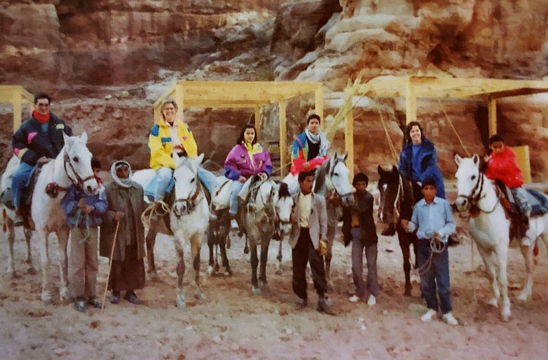
In 1992 we moved to Amman, Jordan. Shortly after arriving, friends loaded us into their car and drove us to Petra. We had no idea what a spectacular visit it would be.
Petra, called the Rose-Red City, is carved out of beautiful sandstone cliffs. It was declared a UNESCO World Heritage Site in 1985. It is now considered to be one of the New 7 Wonders of the World. UNESCO has described Petra as “one of the most precious cultural properties of man’s cultural heritage”. Archeological digs indicate that the area has been inhabited since 7000 BC. The Nabateans, a nomadic Arabic group, arrived in about the 4th century BC. and had made Petra their capital.
Although surrounded by arid regions, Petra had a perpetual water source so people could live there and could attract and conduct business with the traders traveling through with their camel caravans. Trading became the source of the Nabatean wealth.
Petra was a crossroads between Arabia, Egypt, and Syria-Phoenicia. It was an important stop on the Incense Route which included the trade of frankincense and myrrh. The Incense Route flourished from the Arabian peninsula to the Mediterranean Sea, putting Petra in an excellent location on the route. It was also a southern connection to the Silk Route that ran through Damascus and Palmyra.
Petra is in a basin surrounded by mountains running from the Dead Sea to the Gulf of Aqaba. The main entrance to Petra is through a narrow 1.2 km passage called the Siq, a natural break in the mountains around Petra.
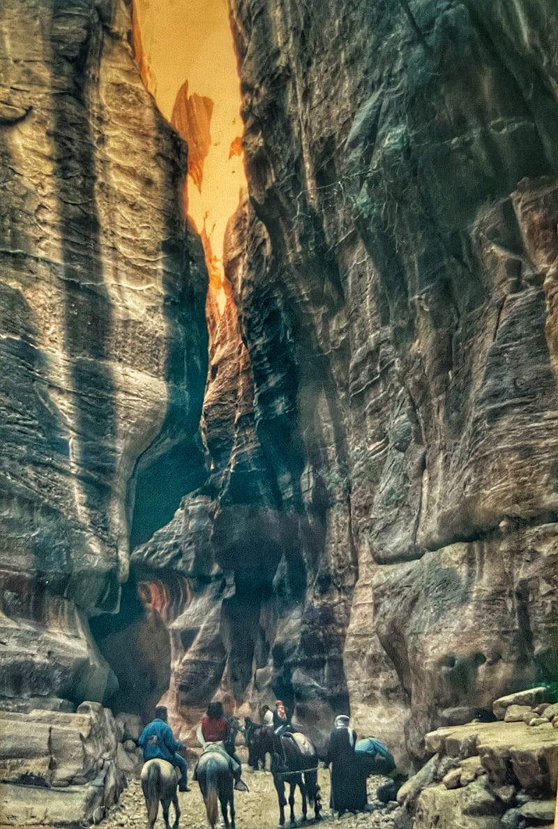
The Nabateans were very skilled in water management. The Siq begins at the ancient dam built to hold and control the water flow into Petra, so Petra wouldn’t flood during the rains. As you go through the Siq you see evidence of the canals that were carved and dug in the stone walls to control the movement of water. The canals and pipes used to control the flow of water into the city could maintain the water pressure. They also build cisterns to hold and manage the water supply.
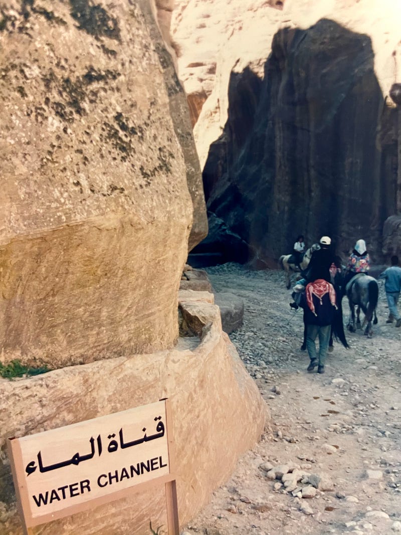
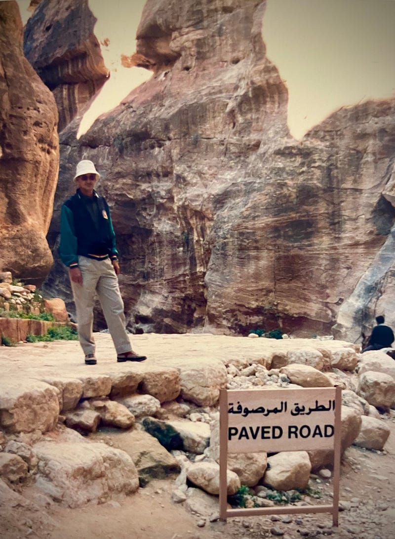
The road through the Siq was built around 30 to 20 BC. When we were there it was mostly covered in sand and rocks as you can see in the photo above, although part of the way in we could see the exposed paved road. It has since been cleared down to the paved road built by the Nabateans.
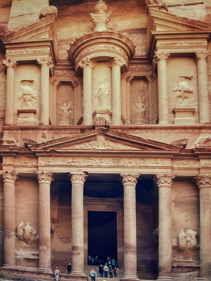
As you exit the Siq, the view in the photo below is what you see. This is the Treasury. It is rose-red because it is carved out of the sandstone cliff. Spectacular. The Treasury facade is 25 meters wide x 39 meters high. We don’t know when it was built but it is possibly a tomb for one of the Nabatean kings, possibly King Aretas IV who reigned from 9 B.C.E. — 40 C.E.
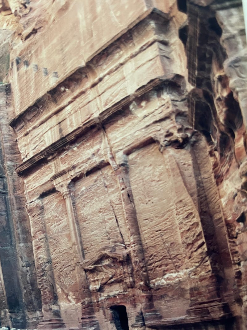
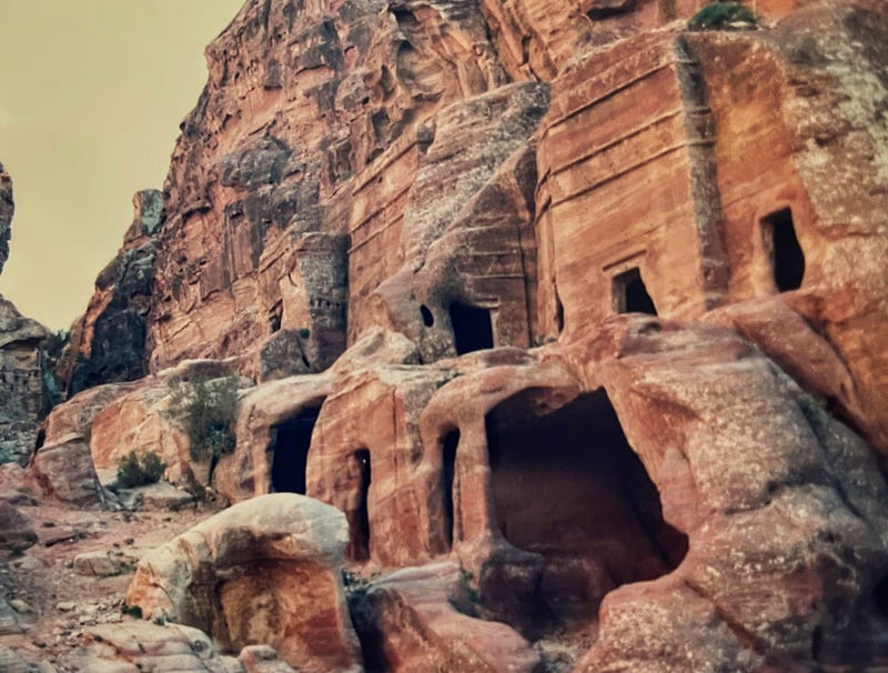
How many people lived in Petra and where and how did they live remains a topic for discussion. Several of the other openings carved in the stone walls seem to be used as temples but are often tomb sites too. The Nabateans were nomadic people, so possibly they mainly lived in portable tents with only a few people, the wealthy and the royals, living full-time within the carved openings in the sandstone walls.
The Nabateans may have been nomadic but they knew how to party. Within the city area of Petra is a large theater that could hold around 8,500 people. There is also evidence of a pool and garden complex in the city center. These support the idea that Petra was a center for festivals and celebrations.
The Romans did not capture Petra, but in 106 AD Petra and the surrounding area became part of the Roman Empire with Petra remaining the capital of the region. Petra continued to flourish for another century.
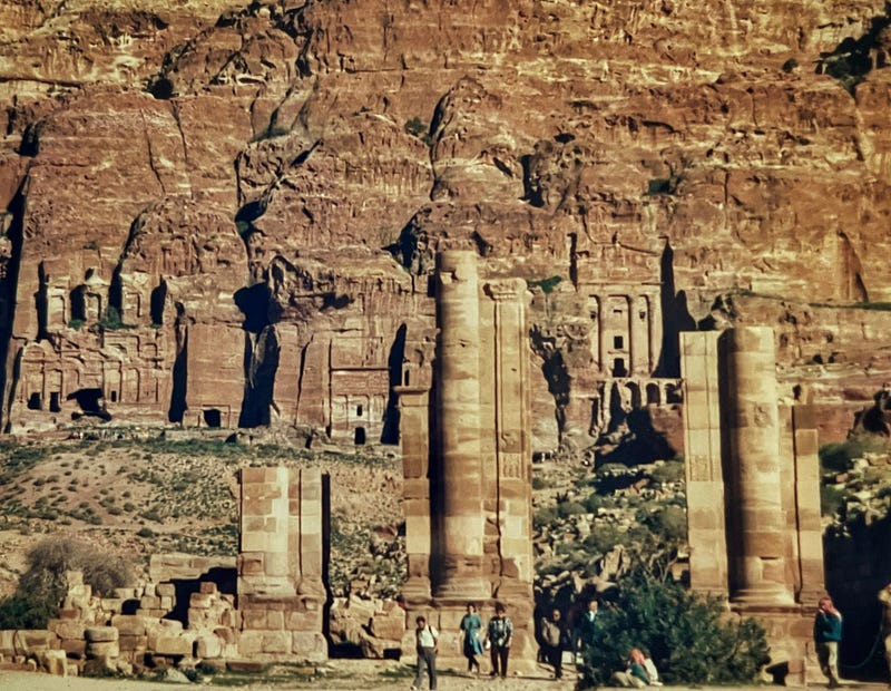
The paved street shown in the photo above was originally a Nabatean design. When the Romans arrived, the street was narrowed to add a sidewalk, and columns were added on each side.
Little Petra, a suburb of Petra, is north of the main Petra area. It is less well known and has fewer visitors so is less crowded. It is a smaller area but is still in the Petra Archeological Park and is included in the UNESCO World Heritage Site.
It might be where wealthier Nabateans lived or where visiting traders stayed. There is evidence of vineyards and wine-making along with grains and olives in the area surrounding Little Petra. In 2010 a dining room was discovered in one of the caves with art showing vines and grapes. The 2000-year-old frescoes have been restored. If you get to Petra, try to visit Little Petra also to view the frescoes.
Petra’s influence gradually declined as the sea-based trade route became more commonly used. Then in 363 AD an earthquake destroyed many of the buildings and more importantly, the water management system.
Why would you visit? My few photos do not show the beauty of the vast area. We visited often. There always seemed to be another area to explore. Another set of stairs to climb. Another marvel to wonder about.
Additional Good Reads about Petra — Medium.com
Petra — Lost City of Jordan by Peter Preskar
Petra: Jordan’s History Cave City by Darren Weir
Petra still manages to surprise. There was a large object buried in the sand by Dark Energy Articles
The Lost City of Petra by Adelia Ritchie
Jordan’s Petra, City of Stone by Dawn Bradnick Jorgensen
Additional Sources of Information
My Additional stories of Jordan and Syria here on Medium:
Palmyra: A Greco-Roman City (Syria)
Ebla, Syria — An Ancient City And Early Dictionaries (Syria)
Mount Nebo, Memorial to Moses (Jordan)