
THE MEGADROUGHT SERIES, PART 21C
What We Lose If We Lose The Colorado River: A Travelogue
“This river can’t sustain 40 million people. And that’s the problem.”
“Westerners call what they have established out here a civilization, but it would be accurate to call it a beachhead. And if history is any guide, the odds that we can sustain it would have be regarded as low.” ~Marc Reisner, Cadillac Ranch
Authors note: “The Megadrought Series” has always been about how climate change affects the Colorado River Basin states, where growth is outstripping water availability. With this mini-series within a series, we’ll take a closer look at the six most problematic areas of the megadrought. Those are Lake Powell, the Colorado River, Arizona, California, Nevada, and Lake Mead, and finally, a piece on other notably troubled areas west of the 100th Meridian. Today we focus on the river itself.
As a child, I spent all my summers at my grandpa’s small ranch in Southwestern Colorado. I was a nature lover then, so it was the perfect place. We had horses to ride on. A garden that produced things we’d eat every day. There were plants and birds and rocks and things.
An irrigation ditch ran through it. That particular ditch was routed off the Los Piños River, or the Pine River as the locals call it. It is a tributary of the San Juan River, which flows into Navajo Reservoir in New Mexico, then out of the lake on its journey westward to join the Colorado River at Lake Powell.
Pop, as we called him, didn’t have water rights on the ditch. He just did it. He used it to water the yard and garden. I wonder how many hundreds or thousands of people are doing that up and down the Colorado watershed. I wonder what measurable effect it has.
According to the American Rivers Organization, the Colorado is the most endangered river in the country.
Geography of the Colorado River
I’d love to take a road trip to the Colorado River headwaters, and apparently, it is accessible, even in my Hyundai Sonata! An unpaved forest road (156, also known as Long Draw Road) off CO 14 will take you there.
The trip begins in Colorado at LaPoudre Pass Lake, elevation 10,174 feet, within Rocky Mountain National Park. From this point, the “river” (more of a creek) flows southwest to the famed Grand Lake off US 34. Shortly after that, it arrives at Lake Granby.
Water from Lake Granby is fed back over (and under through tunnels) the Continental Divide and the Front Range until it reaches the thriving Denver metropolitan area. Denver gets about half of its water from this source. Cities like Boulder and Colorado Springs get much of their water from the river as well.
Lake Granby has the first of the river’s dams, and there will be around a dozen more, large and small, making it one of the most controlled rivers in the world. And that number doesn’t include the tributaries.
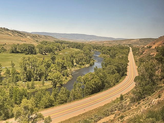
The river skirts highways US 40 and I-70 until it tumbles through the red rock canyons that lead into the Grand Valley. This is a prime fruit-growing area, and if you’ve never eaten a peach from the Palisade area, you’ve never eaten a peach! They are sweet and juicy as all get out.
With a population of 155,703, Grand Junction is the second largest city through which the river will travel. This is also where it meets one of its first significant tributaries, the Gunnison River. Shortly after reaching Utah, the Dolores River joins. Forming the southern border of Arches National Park, the river flows through Moab and then through Canyonlands National Park, where it is met by the Colorado’s major tributary, the Green River.
It’s important to note that upstream on the Green, on the Utah/Wyoming border, lies the Flaming Gorge Reservoir, which holds nearly four million acre-feet of water. The Bureau of Reclamation had 500,000 acre-feet of it drained in 2022 to help boost the level of Lake Powell. In fact, the primary purpose of Flaming Gorge is to backfill Lake Powell when needed.
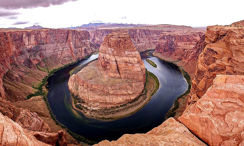
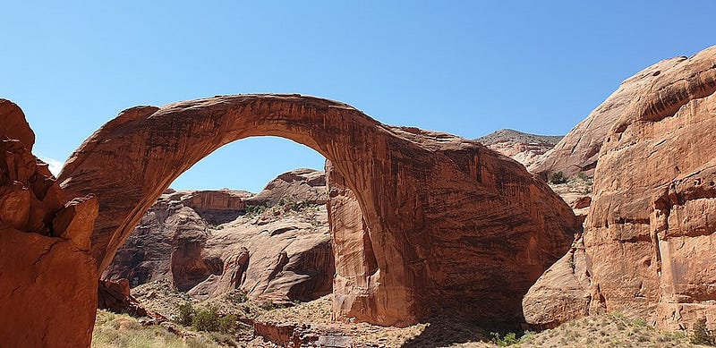
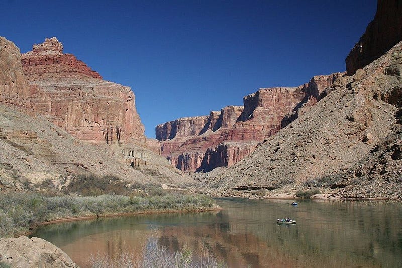
Hite, Utah, is where Lake Powell unofficially begins, but you wouldn’t know it because the lake’s level is so low. It’s just the river at this point. The marina at Hite is closed indefinitely, as are several others downstream. Glen Canyon begins to reveal itself, with its red rock stone faces and hundreds of side canyons — which are now dry due to the lake’s only being 24% full. You once could boat to Rainbow Bridge National Monument, one of the world’s largest natural arches. It is now quite a hike from the lake.
One of the few remaining tributaries is the San Juan River. It flows from southwestern Colorado to New Mexico, where the Navajo Reservoir dams it. From there, it flows westward to meet the Colorado at Lake Powell. It is the main reason New Mexico has a claim to Colorado River water.
The lack of water in the lake has revealed a significant amount of sediment from the rivers. In some places, the piles of silt tower over the lake. It has displaced about 7% of the capacity of Lake Powell. The sediment needs to go, but that has yet to be discussed. It would be a multi-million dollar project and a mammoth job.
Lake Powell ends at the Glen Canyon Dam just outside Page, Arizona. The vertical red sandstone walls near the dam are spectacular, and its hard to imagine how they were scraped with huge machinery to make room for the dam and its components. There is a good highway (US 89) that crosses the river. You can walk across this very high bridge for a spectacular view of the dam, the canyon, and the river.
But this is where things get dicey.
Imagine, if you will, no river flowing through the Grand Canyon. That’s one of the possible outcomes without more water in Lake Powell. Years of above-average runoff from the Rockies is needed to lift the lake out of danger. The alternative is to drain it. You can read about that in my last installment here.
I don’t need to linger on the Grand Canyon. We’re all aware of it’s majesty. An overcrowded one at that. Try the North Rim next time! You’ll find a bit more solitude there.
Lake Mead begins to take shape in western Arizona, and one of the last few tributaries, the Virgin River, ends in one of its arms.
As the water passes through Hoover Dam, it flows through steep mountain canyons devoid of vegetation, eventually forming the next reservoir, Lake Mohave, held back by the Davis Dam near Laughlin. In the flat river valley it flows, separating Arizona from California. The river becomes placid from reservoir to reservoir.
The next dam in the desert is Parker Dam, which contains Lake Havasu. It is from this body of water that much of what California uses is pumped. The Colorado River Aqueduct begins here and features several pumping stations before it reaches Southern California and the Los Angeles area. Further south in the lake marks the beginning of the Central Arizona Project (CAP), funneling water to the thirsty cities of Phoenix and Tucson and providing water for agricultural purposes along the way.
The Gila River is the last tributary on the Colorado, and they meet at Yuma, Arizona. The Gila is a tiny piece New Mexico contributes to the Colorado, beginning in that state’s southwestern mountains. But by the time it reaches the Colorado, it is often just a trickle, if not altogether dry. As a result, it only contributes about 180,000 square feet of water annually.
With a population of 203,247, Yuma is the largest city on the CHeolorado. It sure would have been cheaper and more convenient for cities like Los Angeles, Phoenix, and Tucson to have located closer to the river!
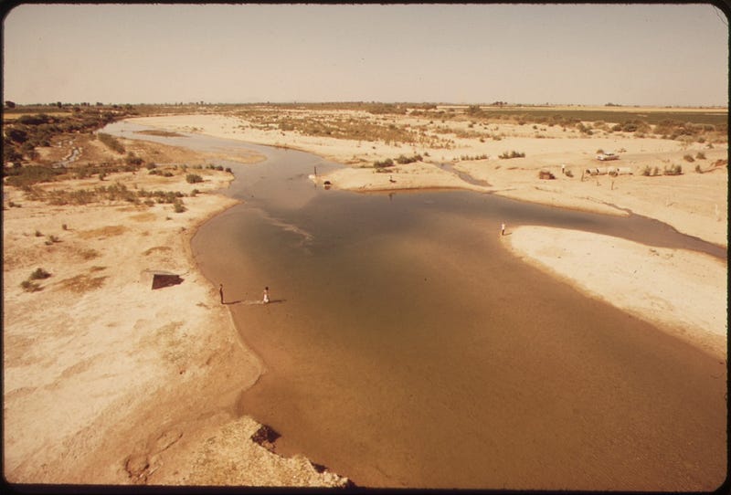
After passing the Morelos Dam and various irrigation diversions, what’s left of the river tries to make it to the Sea of Cortez. The ecosystem in this area, which was once lush with vegetation, has already been destroyed. Its resurrection depends on us.
The Colorado River and the lands around it are national treasures. Even though agriculture accounts for 75–80% of its use, we must do what’s possible to preserve the other 20% for ourselves and future generations.
All seven articles of this series are inextricably tied to the river. But a holistic approach is just too overwhelming. Even I can’t understand it without breaking it down. And so many entities are involved: individuals, legislative bodies, and the like. Some are devious, looking for ways to undermine their neighbors. Others are staunch supporters of the environment. If you have the time and interest, I encourage you to read Cadillac Desert. In the meantime, I’ll do my best to weave each part together so it makes sense if sense can be made of it.
Next up: “The Population of Phoenix Keeps Rising While the Water Table Keeps Falling” — the Arizona story.
Sources:
- “A River Guide’s View of Lake Powell’s Decline and the Depths of the Colorado River Crisis” by Ian James in the Los Angeles Times, 1/26/2023.
- “Why More Water Could Make Fixing the Colorado River Even More Difficult” by Joanna Allhands in the Arizona Republic, 1/21/2023
- “Cadillac Desert” by Marc Reisner
- State-issued road maps for each of the seven Colorado Basin states
- Wikipedia
More about the Megadrought by Arthur Keith in Illumination:
For just pennies a day, you could save talented and creative writers like me and all the other writers from future homelessness! In addition, you’ll get to read every single article on Medium.com. Please, won’t you help?


