
Water Crisis In The West, v5.0 — The Colorado River Story
It’s happening faster than I can write about it
Well, folks, it happened, but it comes as no surprise.
The Federal Government has officially declared a water shortage on the Colorado River for the first time in history.
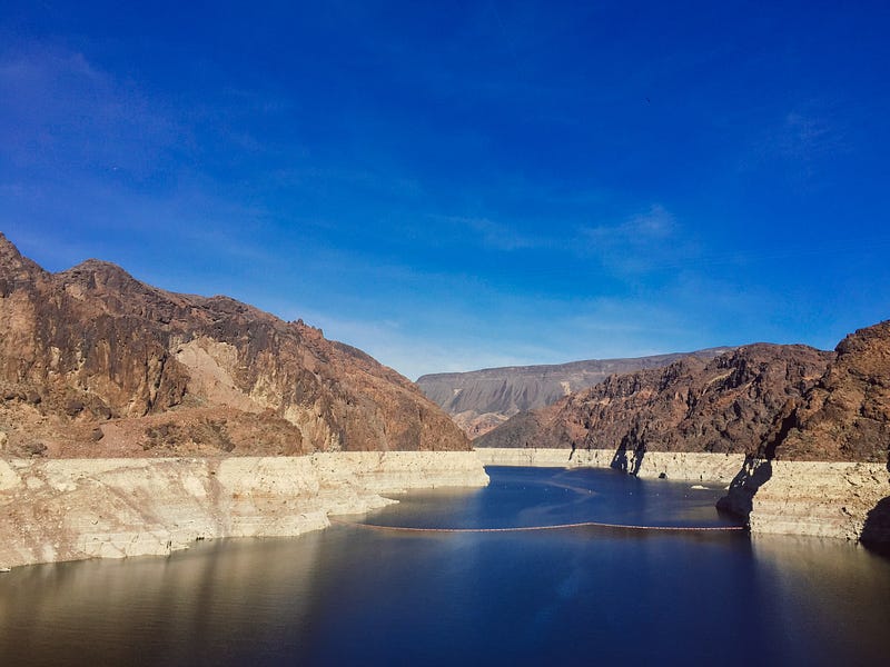
Lake Mead has fallen below a major threshold: 1,075 feet above sea level. At just 35% full, it is at its lowest point since it was filled in the 1930s. This is the first tier at which water cuts begin.
Who takes the first hit? Well, it’s a bit convoluted.
Many of the rules from the Colorado River Compact of 1922 still apply. No one ever thought of shortages in 1922! The River was flush with water after several exceptionally wet years. Seven states were involved in the Compact, and all would ratify it — except one.
By the 1940s, Arizona was growing exponentially. They realized they would need to build a reclamation project from the Colorado to feed its growing population and agribusiness. But first, they would need to ratify the Compact, which they finally did in 1944. After that, Arizona began to envision a canal.
Since Arizona and California couldn’t agree on how much of the Colorado each state would get, Arizona took the case to the Supreme Court, which lasted 11 years (Arizona v. California, 1952–1963). The decision determined the basic apportionment Nevada, California, and Arizona would receive annually.
There are more water rights on paper than there is water in the river. ~Robert Glennon, marketwatch.com
California fought hard against the Central Arizona Project, or CAP, which was to be federally funded. Finally, Arizona capitulated that California would get its full apportionment of water in the event of shortages. California thus withdrew its opposition to the CAP, and construction began in 1973.
Arizona got the short end of the stick.
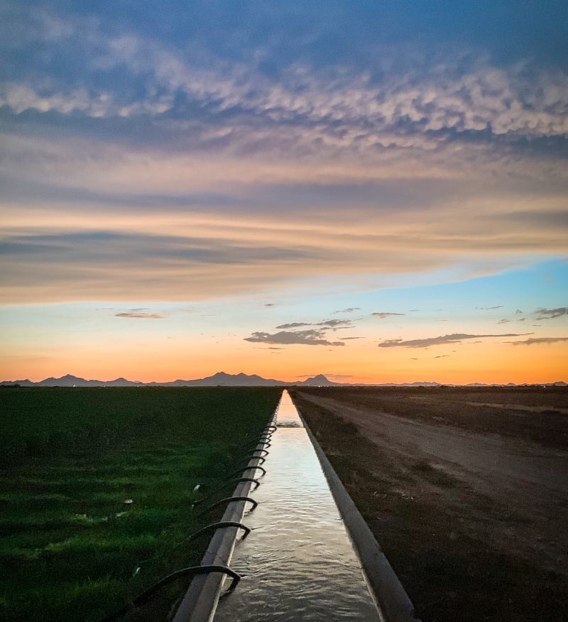
Their cut will be 18% as of January 1. Since 70% of Colorado River water is used for agriculture in Arizona, that is the sector to be hardest hit. Production of cotton, their biggest cash crop, will decrease, and farm fields will become fallow. Some farmers may sell out to developers who, in turn, will drill ever deeper for dwindling groundwater reserves. Or maybe the land will be used as solar fields.
The current Megadrought the Colorado River Basin is facing began about 20 years ago. By 2007 an amendment to the Compact was drawn up among the Lower Basin states of Nevada, Arizona, and California.
The agreement stipulated how much water each state would reduce its usage, depending on the elevation of Lake Mead. These guidelines will expire in 2026, at which time it’s back to the drawing board.
Still with me?
As simple as I’m trying to make it, it’s extremely complicated. We’re working with science and with benchmarks, but Mother Nature has a way of tricking us.
One thing is for sure: man is largely responsible for climate change. What we still don’t know is what the weather is going to be like tomorrow. For instance, there was a 2 in 3 chance that it would rain in Albuquerque today. Didn’t happen.
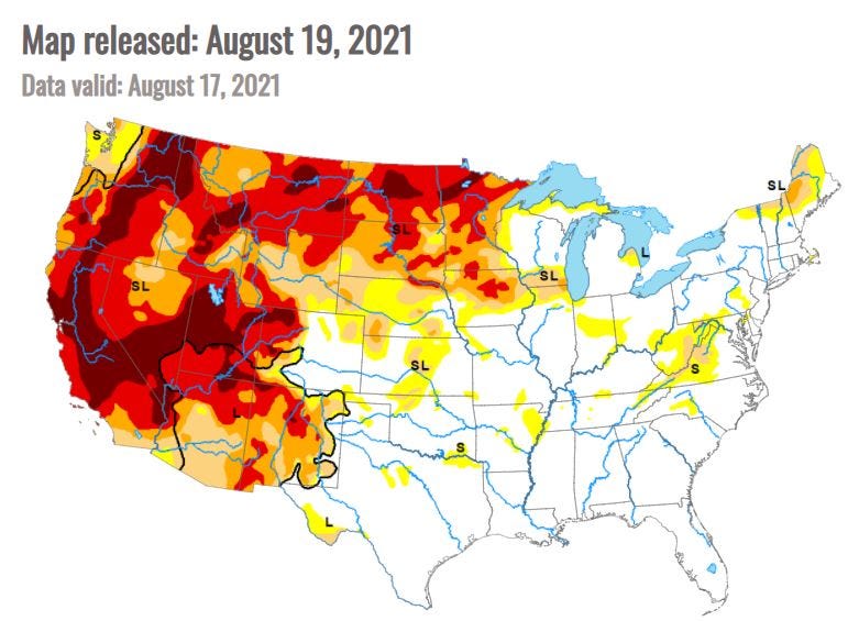
Last spring, it was predicted that this was going to be a weak monsoon season. Have you seen the pictures of the flooding that just happened in Phoenix and Flagstaff? Tucson has had 11.86 inches of rain this year, most of it being monsoonal. Their yearly average? 12.17 inches, with monsoon running until September 30. Last year they received only 4.17 inches.
So Lake Mead is now at 1,068 feet, and Tier 1 reductions go into effect on January 1, 2022. Further cuts will be mandated at various thresholds: 1,050, 1,045, and 1,025 feet. California is not expected to take a hit until 2023. Unless the situation gets worse. If Lake Mead should fall below 950 feet, it will no longer be able to generate power.
That‘ll be the night when the lights go out in Vegas.
Further upstream, The Colorado River Compact requires that Lake Powell release 8.23 million acre-feet of water annually, sending water to Lake Mead. But Lake Powell is so low that the Upper Colorado Basin states will have to release more of their water to Lake Powell to make up for the shortfall, again putting pressure on farmers. This includes Flaming Gorge Reservoir in Utah, Blue Mesa Reservoir in Colorado, and Navajo Reservoir in New Mexico.
The South and East are being pounded by flooding and rain, just what they don’t need, but we’re envious of the water. Two-thirds of the West is in extreme or exceptional drought, the most since the U.S. Drought Monitor began 20 years ago. Seven states are entirely in drought. South Dakota has recently begun a project to divert some Missouri River water to North Dakota.
In the end, people will conserve even more than they have because water will become a precious commodity. It will become costly. Food prices could skyrocket under the current scenario. The Colorado River is at its breaking point.
Go East, Young Man.
Sources for this story include CNN, Associated Press, MarketWatch.com-The Conversation, Bloomberg-Green + City Lab, WaterEducation.org, and the Bureau of Reclamation.
Read the whole series!