
The Many Terrains of Big Bend National Park
February Monthly Globetrotter Challenge
Anne Bonfert challenged writers to write about the diversity of landscapes found around us. You can read her article here.
I plan most of our monthly locations by searching for National Parks in the area. Then I use the National Park Service website to further research the park. www.nps.gov is a great place to find out the current conditions including warnings and alerts. Know before you go.
We have been exploring Big Bend National Park in southern Texas on the Rio Grande and have seen many fascinating landscapes and geographical contrasts all in one place. The terrain can change as quickly as you drive around a curve.
According to www.nationalparks.org —
“The park is comprised of 1,252 square miles of land, making it larger than the state of Rhode Island. Within Big Bend National Park are numerous geographical contrasts. These include the vegetation belts along the Rio Grande, the sparseness of the Chihuahuan Desert, the peaks of the Chisos Mountains, and the limestone outcrops of Persimmon Gap and Boquillas Canyon.”
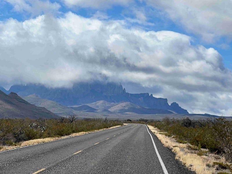
As we enter Big Bend at the northern entrance the vast open features of a desert greet us, but sandstone hills are visible as are the mountains further in the distance. The only thing you cannot see in the photo above is the river. I can’t wait to explore it all.
Big Bend National Park is a complex natural system of varying landscapes.
The Chisos Mountain Range is the volcanic heart of Big Bend. These mountains were created by volcanic activity millions of years ago, and are still changing regularly today. The mountain range is located entirely in the National Park making it the only mountain range in America fully contained in a National Park.
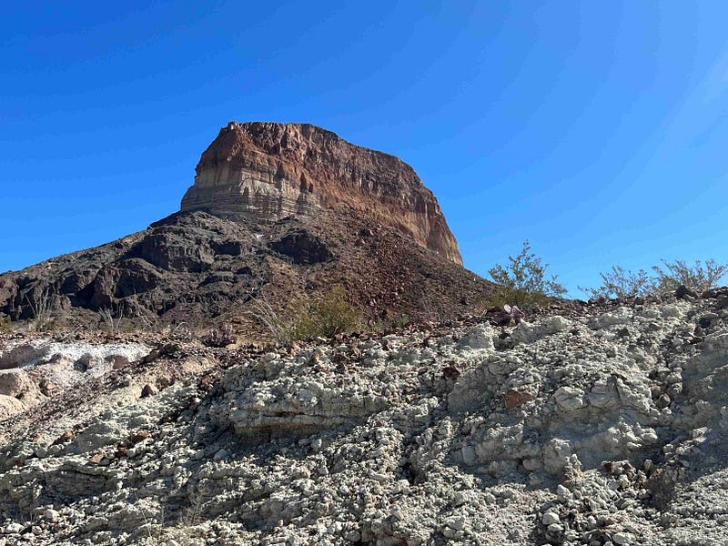
The tallest peak is Emory Peak at 7,835 feet. When these mountain peaks are formed, canyons develop as part of the process. Boquillas Canyon marks the Rio Grande in the east while the Santa Elena Canyon marks the west.
The tree zone separates the climates of the mountains. The climate above the tree zone is called an alpine climate and the terrain is described as an alpine tundra.
Anne Bonfert wrote an article about a hike to the high alpine terrain. You can read it here.
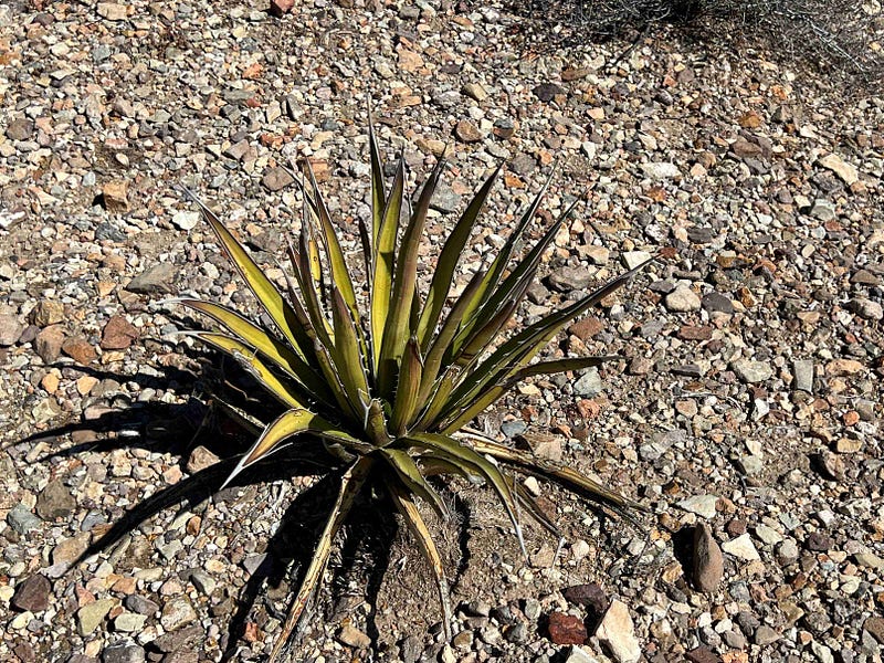
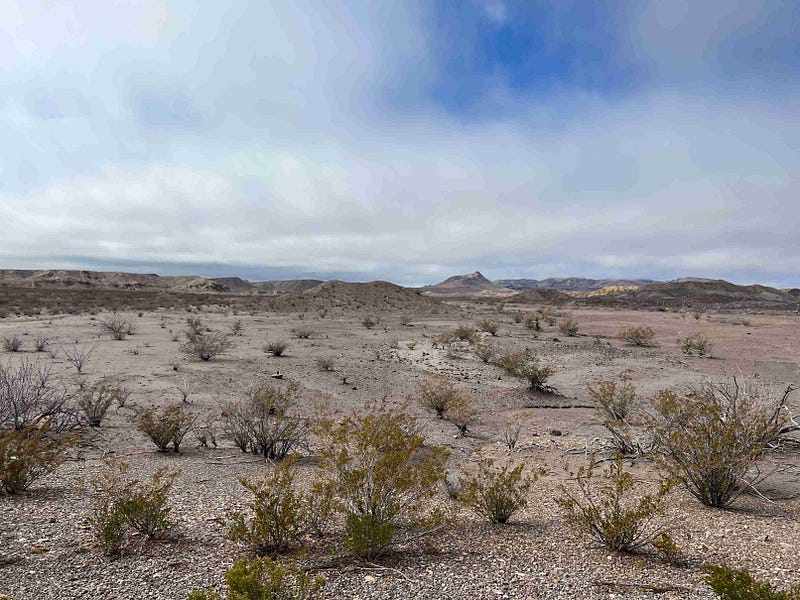
The mountains are surrounded by smaller sandstone hills and then the Chihuahuan Desert. The desert is filled with spiny plants, barren ground, and a variety of reptiles. The agave lechuguilla is only found in this desert. This ornamental small green succulent plant flowers once in its lifetime and then dies. This plant has been used for food, drink, and medicine for thousands of years.
Within the desert, we found an oasis at Dug Out Wells.
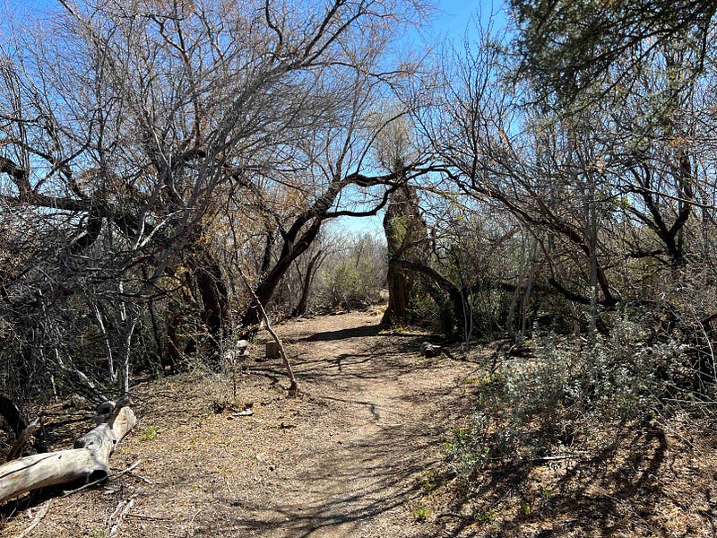
Tall trees in the middle of a desert are a sure sign of water. The moisture here seeps from a bed of gravel in the Chisos Mountains east range. Entering the grove reveals an instant change in the climate. The vegetation was dense and filled with life. We saw butterflies, rabbits, and beetles.
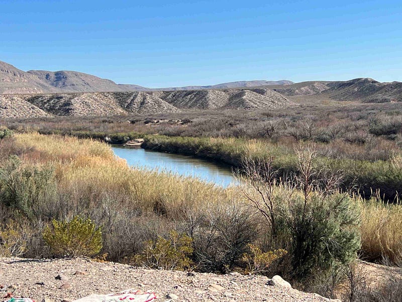
Finally, is the river terrain and landscape. Shaping its way through the mountains and hills, along the desert plains, the river flows strong feeding vegetation and trees along the bank and supporting life in the water.
The geographical features are different in each of these fascinating terrains. Big Bend is filled with tremendous diversity in its terrains. Rivers, canyons, mountains, valleys, deserts, and oases are all found in Big Bend National Park in southern Texas in the United States of America.
Aarti Tailor wrote an impressive article about the different terrains of Mother Earth. She said, “There are many more terrains I have yet to explore and it is so exhilarating to know that our planet is bursting with so much variety.” I want to explore all the different types of terrains also.
Works Cited


