
TRAVEL TALES
Where the Hiking Trail Dropped into a Deep Gorge and a Glacier-fed Lake was Shining Between the Mountains
More beauty was found in the Southern Alps near New Zealand’s tallest
All of a sudden this wall next to us ended and the trail just stopped. Well, it didn’t stop, it dropped off a hundred-meter steep cliff filled with loose rock. But behind it was this beautiful glacier-fed lake with icebergs inside tumbling around.
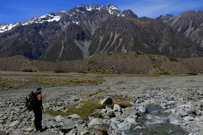
Just after walking the popular Hooker Trail toward the base of Mt. Cook, New Zealand’s tallest, David and I were still flashed by the beauty of turquoise-blue glacier lakes, snow-covered peaks and lush green valleys and certainly wanted to get more of it.
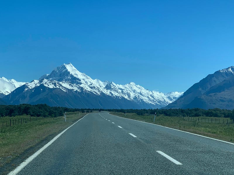
After a good night’s rest and a strengthening breakfast, we hit the road again toward this beautiful mountain. But instead of turning left into the Hooker Valley, we turned right into the less visited Tasman Valley.
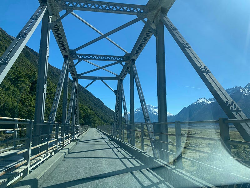
A spectacular steel bridge brought us across the roaring river and a winding road led at the base of the in trees covered mountain slope from the open Mackenzie Basin into glacier land.
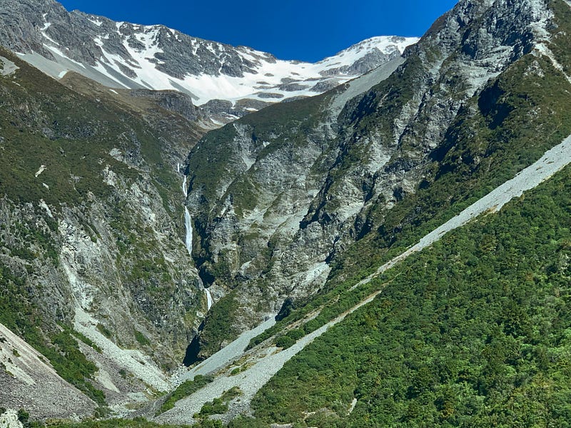
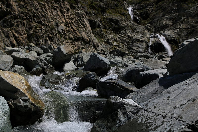
We passed a beautiful waterfall cascading in several levels from the snow-high alpine lands through rough cliffs cutting deep into the mountain creating a narrow but spectacular gorge.
Arriving at the car park we noticed a lot fewer vehicles than the day before where we stopped in a lot with space for around 200 vehicles which was full during peak time.
But while there was another touristy trail leading in just a few minutes to another glacier-fed lake offering another view of Mt. Cook, we opted for the less traveled path.
After returning yesterday from our hike, I was curious and did a little more research on the last part of the hike where we followed some random trail. It turned out that path was part of the Ball-Pass crossing, a high alpine and difficult multiple-day route crossing the mountain range of Mt. Cook via glaciers and scree fields.
This trail was non-marked and not maintained and its other end lies in the Tasman Valley. Where we were now. So why not do the same as yesterday we thought, and walk as far as we feel like on this trail?
The trail began with an avalanche warning board, lots of information and a danger assessment. As most of the snow had melted off the slope we would be walking along below and we weren't intending on climbing higher up in altitude, the avalanche risk was said to be 'low'.
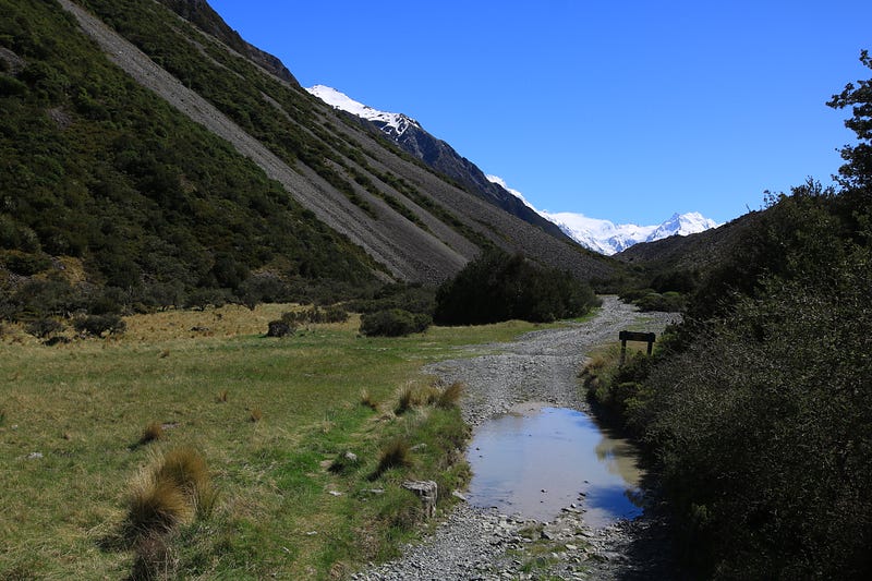
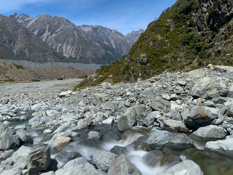
Following an old 4x4 trail along a mountain stream for a few hundred meters, we talked about what we were hoping to get from this hike while barely noticing the altitude we were gaining.
The stream soon disappeared but our trail continued rather flat and monotonously further along the mountain slope to our left and a high ridge of a moraine to our right blocking the view of Tasman Lake which should be right there. Just meters from us.
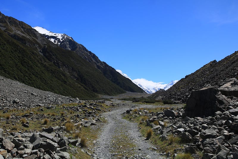
It was like a never-ending road as we always thought 'just around the next corner we'll get a view' but upon reaching that point we only noticed how much further the rock wall to our right was stretching blocking the lake.
David was getting a bit over this monotonous trail saying then he'd rather go back and take the touristy path while I was hanging on a string of hopes the view would eventually come seeing the snow-covered mountain range in front of us in the distance.
Yeah, we did continue.
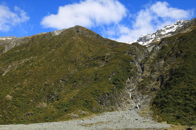
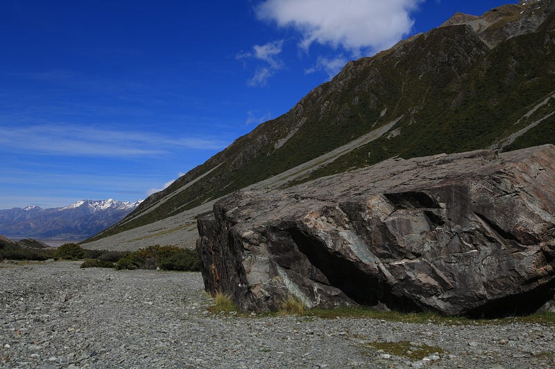
We passed another waterfall I selected for a stop. David pushed for the return journey and walked along this massive boulder possibly being a great lunch spot as it was blocking a lot of the wind.
Yes, it was windy again but not as much as the day before which one could notice by the sudden sound of propellers. Helicopters offering scenic flights around Mt. Cook were buzzing above our heads. The sound we didn't miss the day before.
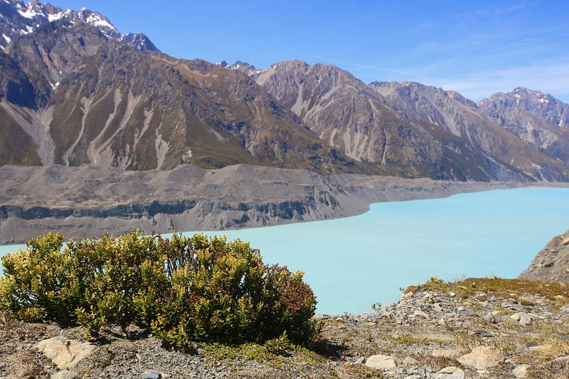
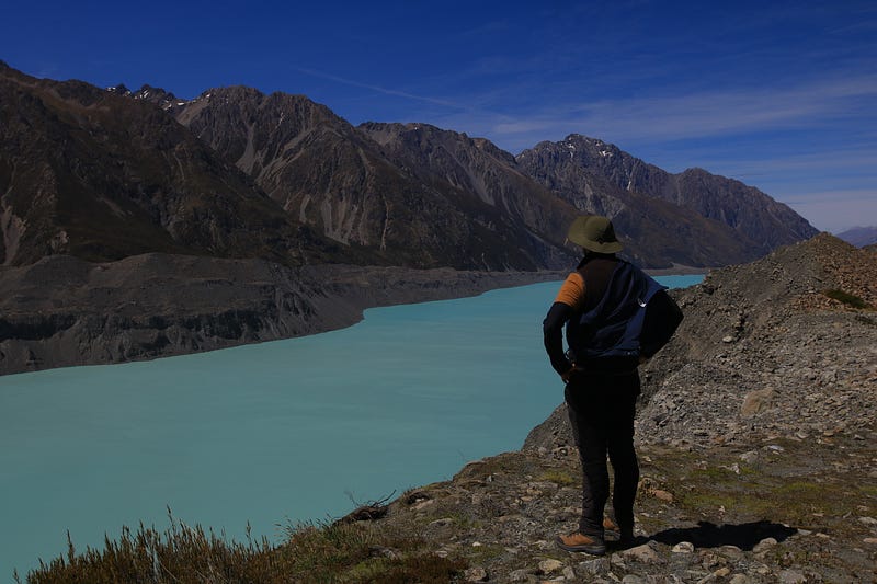
And just when we wanted to lose hope, that wall to our right didn't just stop but the trail we were walking on, the old 4x4 track, just vanished. It dropped off into the lake below.
The cliff was unstable and built of loose rock being washed down the Husky Gorge over the years. I assume it is happening as the glacier used to keep the base of the mountain in place but upon melting more and more of the slope got exposed and being unstable terrain with every rain or melting snow water, more of the terrain gets washed away.
Reading up on the Ball Pass route, this 4x4 track was washed away in 2019, up until then one could go on motorized tours up the Tasman Valley. Also, the place where we were standing used to be called Husky Flats, referring to the wide and broad flatlands at the bottom of the mountain.
Well, there is no such thing left and they renamed the Husky Flats into Husky Gorge. And since this Gorge is getting deeper and deeper every year, it creates a more challenging task for hikers on this trail who need to get across.
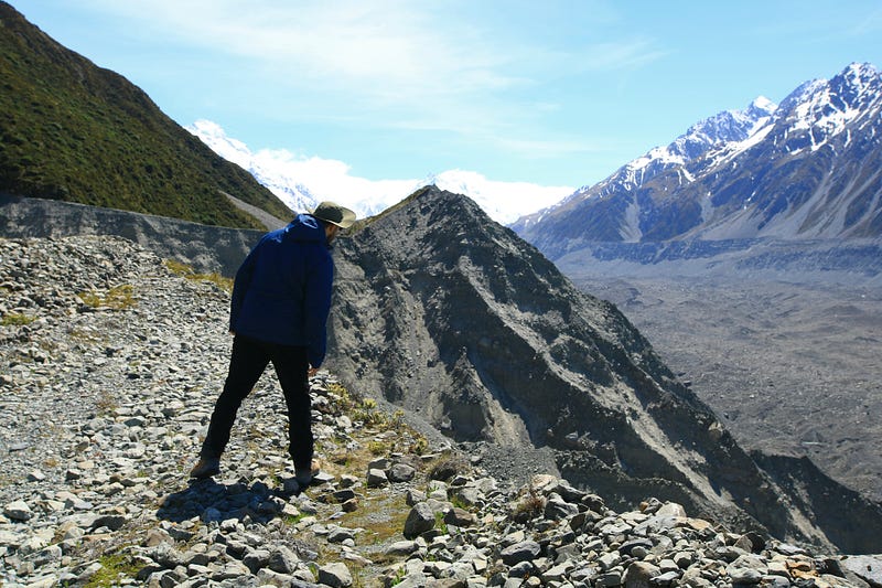
While that wasn't going to bother us except for our curiosity as we would have loved seeing someone crossing the gorge, we did know we reached our destination looking to the right.
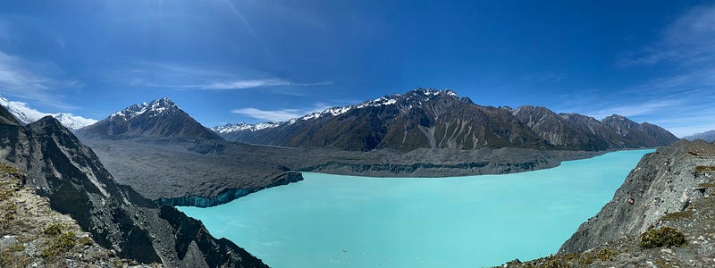
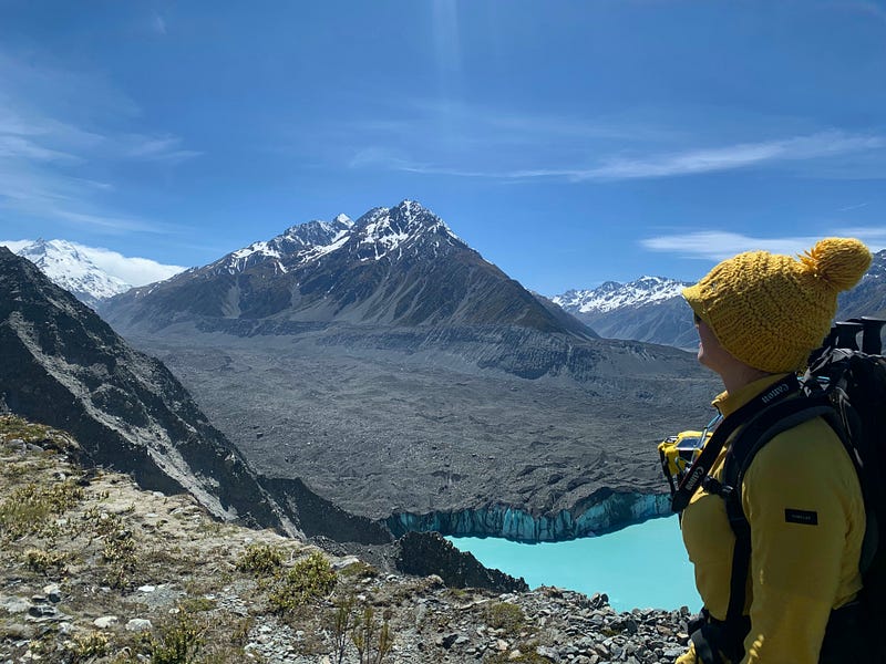
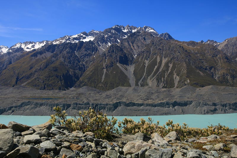
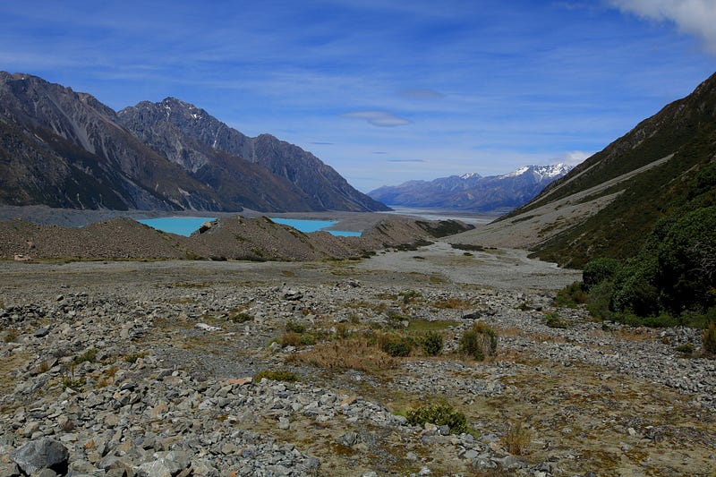
The Tasman Lake lay far below but was shining in turquoise blue below the barren mountain slopes surrounding it. And this lake lives out of the glacier one can see on the left. Yes, this glacier isn't white atop but gray from all the gravel getting washed down the mountains but, on its side, one can still see the deep blue of the ice.
The sky was blue and the sun was shining but thanks to the wind there was a chill in the air. Wearing my beanie over my sun hat I had learned from the day before and combined both for maximum UV protection and warmth.
Staring into the distance I was wondering for how much further this glacier stretched up in the valley. I do get those taking a scenic flight up this way. But then again, it wouldn't be the same as walking toward something so spectacular.
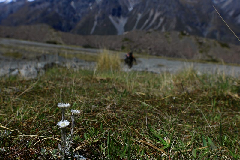
While David was scouting out the edge of the cliff telling me where I could step a little closer or where I should stay far away due to an overhang and loose rock, I bent down to capture some vegetation growing right there where possibly no more land will be left in a week or two from now.
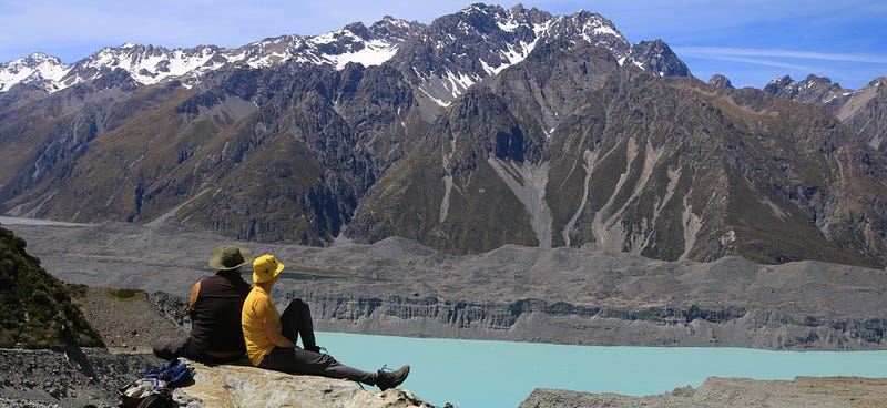
Then we both just stood there staring into the distance while admiring the view.
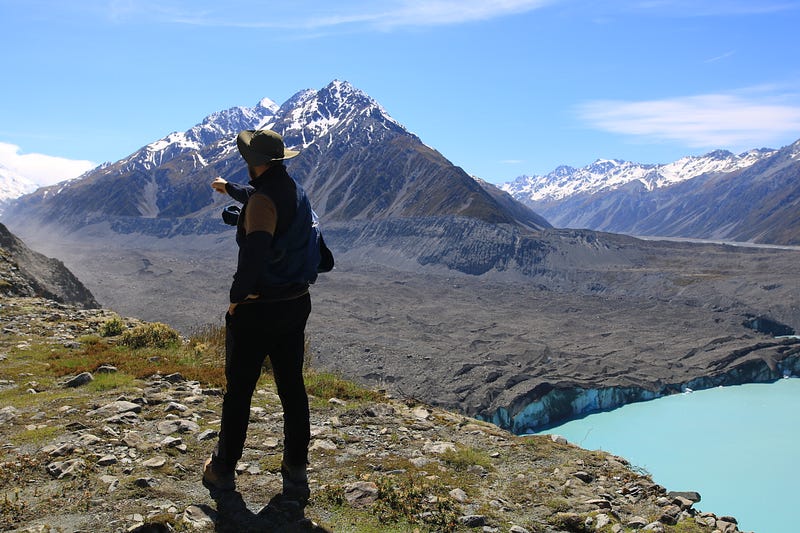
Looking at the picture below I captured so much in just one single shot.
Of course, you can see the mountains on the horizon, covered in snow atop. You can see part of the deep blue lake below and some ice sticking out of the glacier sliding into the water.
But then there is David as well who is pointing not toward nothingness but the sudden dust cloud appearing on the steep cliff ahead which has either been caused by an avalanche or a strong gust of wind. We will never know.
We then turned our backs toward the lake and made our way up the gorge scrambling across boulders and rocks. We stayed far off the cliff on the side but were curious about where brave climbers would be hiking to get to the other side.
Eventually, the gorge leveled out and we could see a faint trail leading across just below a snowfield. While I wanted to reach the snow especially since we were so close, I knew we had reached our limit.
We had walked past our set turnaround point already and will return later to our car than planned and still have quite a drive ahead.
Instead of trying to run for the snowfield, we looked for a flat boulder, pulled out our snacks packed for lunch and simply enjoyed the stunning view across Lake Tasman.
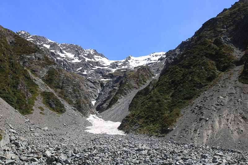
After soaking in some sunshine and filling up our stomachs, we were ready to turn back but I didn’t forget David’s promise, I could still walk past the waterfall.
This waterfall was completely off-trail and we had to scramble across even more boulders, loose rock and gravel but the effort was worth it. The water was so clear and the small waterfall was pristine and serene.
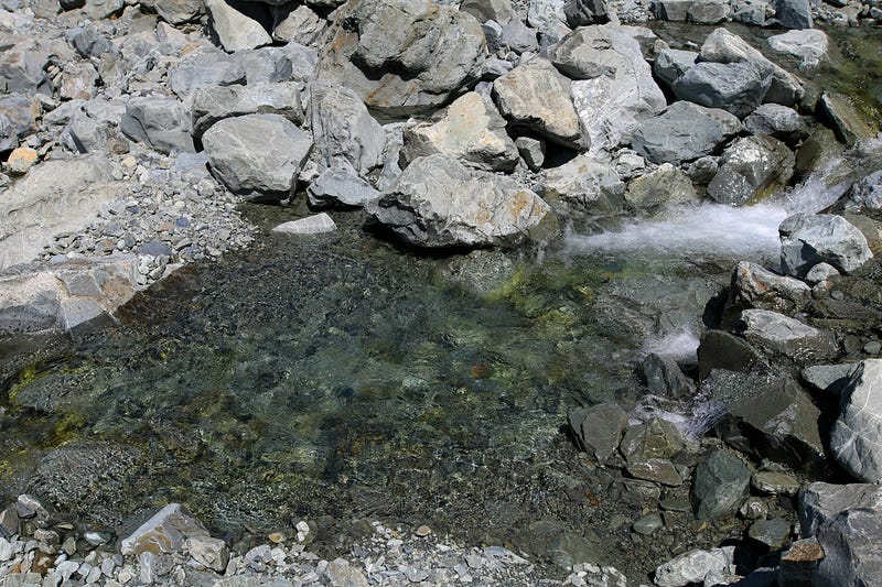
I walked a bit ahead just to have more time at the waterfall and as soon as David arrived, he said “I give you five minutes”. While I really wanted to jump into the crystal clear water I knew how freezing cold it would be and since we didn’t have towels to dry us off afterward, we decided to leave it at just sitting there and admiring the natural beauty.

So we moved on again following the flow of the stream as we were curious where this beautiful body of water would disappear in the rocks.
Scrambling our way further down across boulders and getting a fright when David stepped on a loose rock and slipped falling on his butt, we kept on aiming to reach the easy trail of the old 4x4 track again.
I did fall behind.
Of course, I did.
Look at this beauty. How could I walk past this landscape without stopping every few meters to take another photograph?
And all of a sudden the water of the stream was gone and we were back on the trail passing two other couples who also just wandered up this valley in search of some afternoon fun in the mountains.
We were back on the monotonous but certainly not boring trail and reached our car two hours later. Still early enough for us to drive home in daylight and go to sleep before returning to work the next day.
If you’re interested in my New Zealand adventures, subscribe to my newsletter to stay updated or check in on my new list regularly. Join my email list here if you would like to read more photo essays.
Shutterstock | Instagram | YouTube | Mailchimp | Amazon | Redbubble