
What a Fantastic Mountain Hike: Romsdalseggen, Norway
Happy peak ride in magnificent scenery
The hike over the Romsdalseggen is among the finest I know. It’s about 10.3 km and a 5 to 8 hours long trip, a little demanding, because of the mass of stone. If you have the time (1–1.5 additiononal hour) it is definitely worth taking this extra hike at the start of the trip, up at Blånebba, 1320 m.
The return trip follows the top back all the way forth and back.
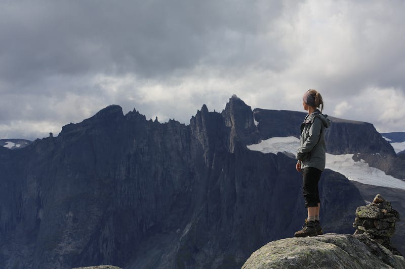
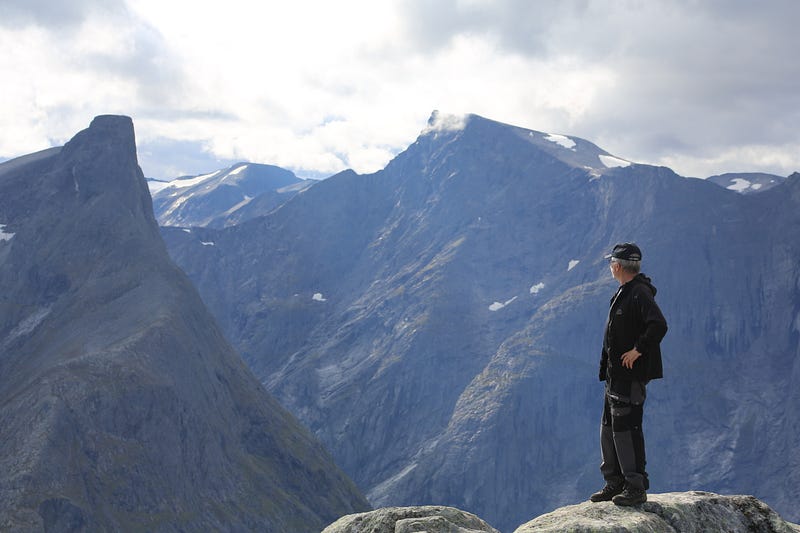
From Blånebba there is a great view towards Romsdalshorn and Trollveggen.
The trip can be divided into four parts:
1. A rise to Steinfjellet 1168 m above sea level. 2. A walk up at the top of Blånebba, 1320 m 3. Hiking over the Romsdalseggen 4. Descent to Åndalsnes
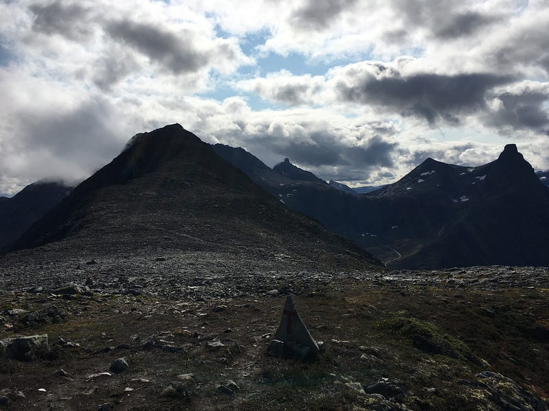
The trip is well marked all along the path with red painted T-s.
1. Climbing Steinfjellet 1168 m above sea level
Up the hill, a good path with a view to the Store Venjetind 1852 m and the Romsdalshorn further west. After about half an hour, the terrain is flat and we walk about 15–20 minutes in the slope towards the plateau.
Then there is steep and relatively easy climb on the rock upwards towards the top of 1168 m above sea level. Now the worst of the climb is behind me!
2. A walk up at the top of Blånebba, 1320 m
Here it is easy to walk over the mountain ridge.
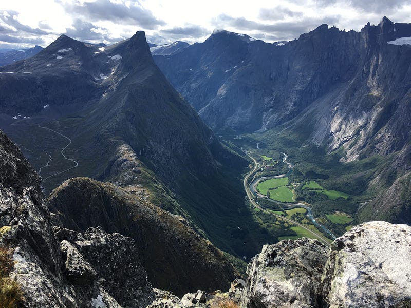
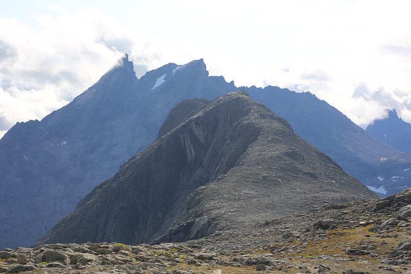
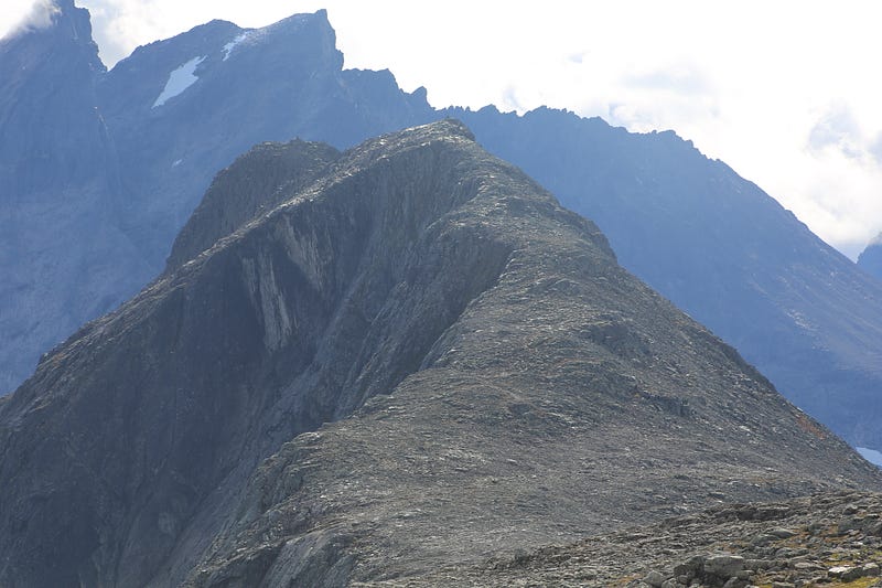
Great views to the west and south: Romsdalshorn and Trollveggen, and the Raumadal between the two.
A lot of stone.
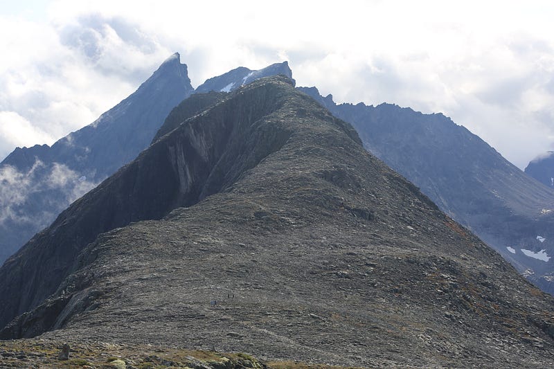
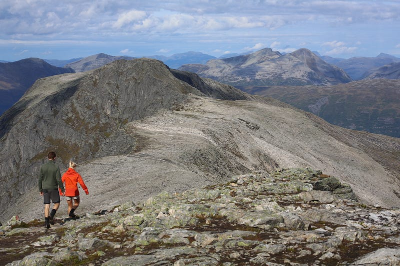
3. Hiking over Romsdalseggen
After the blower to Blånebba, the next leg is to take the ride over Romsdalseggen.
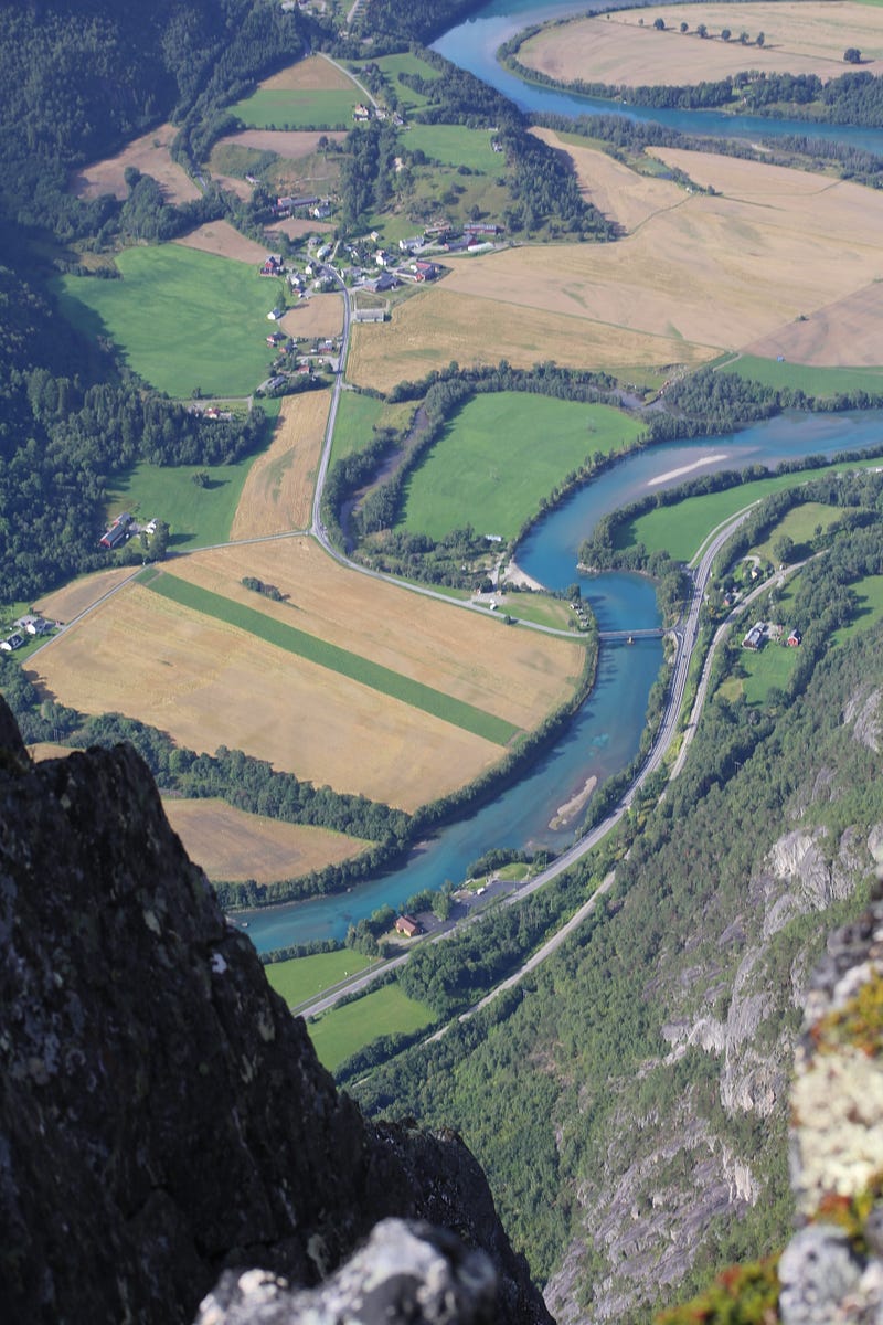
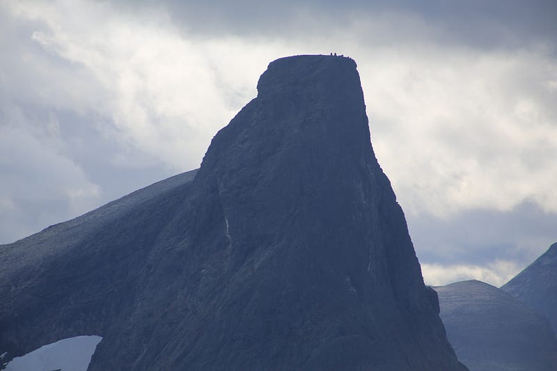
It is steep down to both sides, and the view down to the Rauma valley can take your breath away.
The ride over the Romsdalseggen is airy, but not dangerous if one shows a common sense and does not take chances.
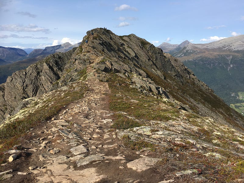
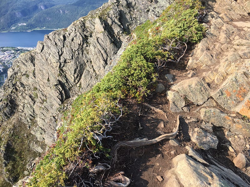
Part of the trip goes on narrow parts of the mountain tops.
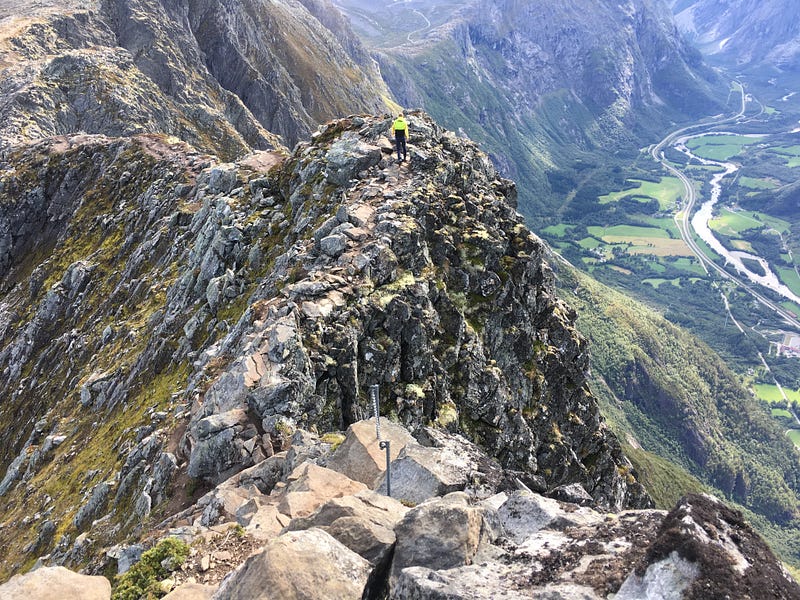
Some parties go steep up and down, and there’s iron and chains to hold.
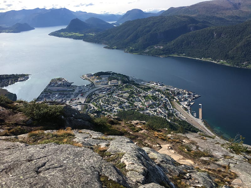
4. Downhill to Åndalsnes
Much stone and important to keep safe here!
The trip gives a lot of great views and photo opportunities, and I recommend the trip to everyone.
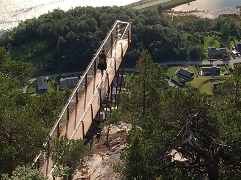
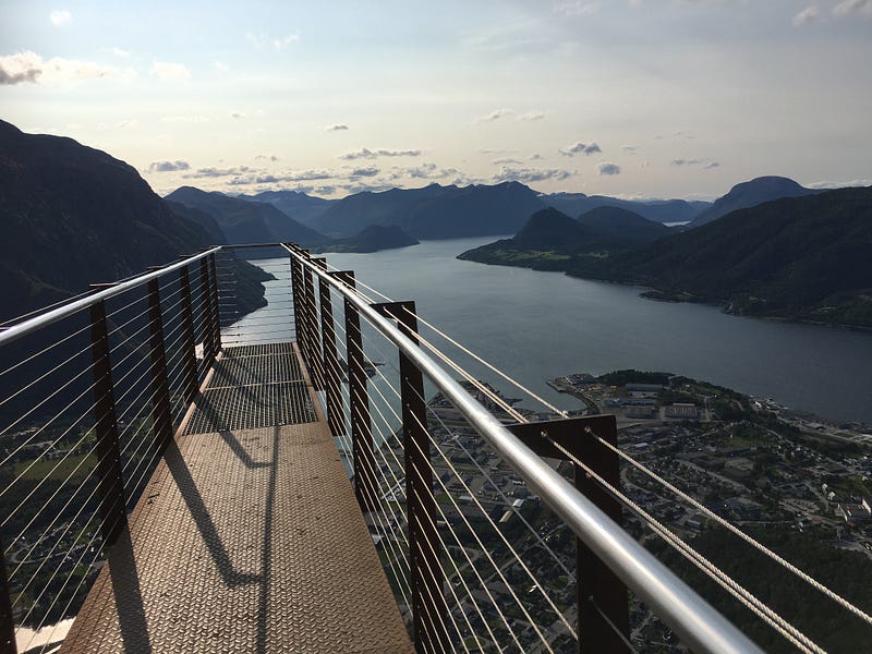
At the downturn you can walk out onto this bridge and experience air under your feet!
My trip took 8 hours, and then I walked very carefully on the stone floor because of a minor accident. Normally, the trip including Blånebba would have taken me between 6 and 7 hours, including breaks.
A good schedule has been established with a bus at 9.30 am from the center of Åndalsnes to the starting point at the parking lot at Venjedalssetra. The path ends in the center of the city where there are car parking spaces. The path over the Romsdalseggen thus ends close to where I parked to go on the bus.
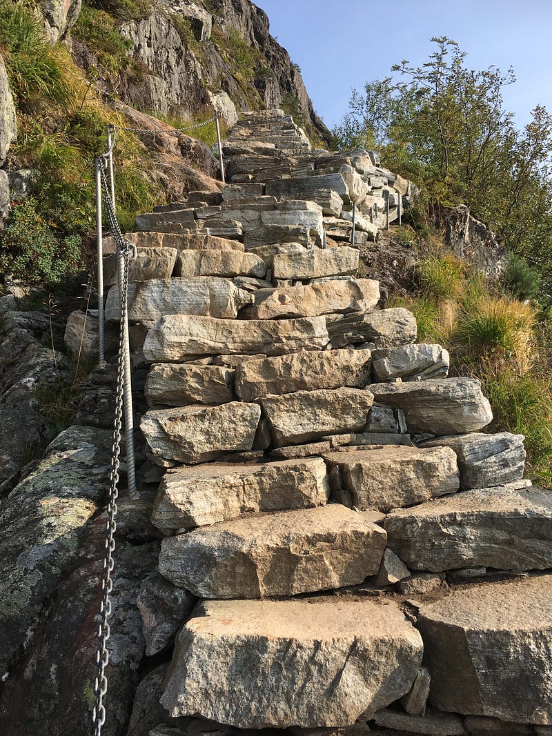
Stone steps down the last part of the trip.
On ut.no you will find good information about the trip, including this:
Demanding route with airy parties. Exposed and difficult in bad weather and wind. This path is called Romsdalseggen normal and is more demanding than the Romsdalseggen family over Høgnosa, and takes 7 hours according to the usual DNT standard. With a lightweight topsack, the ride is faster. The trip is suitable for some older children with mountain experience.
It is some places very steep down on both sides and a little scary, so children should probably be older than 7–8 years.
Thank you for reading!
More from the author:


