
The most lovely beach in Switzerland, its underwater treasures and the beautiful towns nearby
PART OF MY SERIES Natural wonders of Switzerland’s canton Vaud
Get to know this beautiful beach, lake Geneva above and below the water surface, the main river of canton Vaud, an iconic corner in Saint-Sulpice, and the tulips festival in Morges. Check the selection of own photos!
Switzerland is a land-locked country, but this does not mean you cannot sunbathe and swim! The country in fact features a large number of beautiful beaches in the shores of its lakes and rivers. At various altitudes, of varied colors, and with different attractions around. Over various posts I will slowly take you through some of the most beautiful water places in the country, starting here with my favorite beach, located along the north shore of lake Geneva (Léman) in the French-speaking canton of Vaud.
My favorite beach in Switzerland -where and why
For the last 9.5 years I have traveled a lot around Switzerland, and thus got to know beautiful lakes, rivers, cascades and other watery natural places all over. Through different posts in this Medium account you will get to know all my favorite water places in the country. But let’s begin here with my top pick.
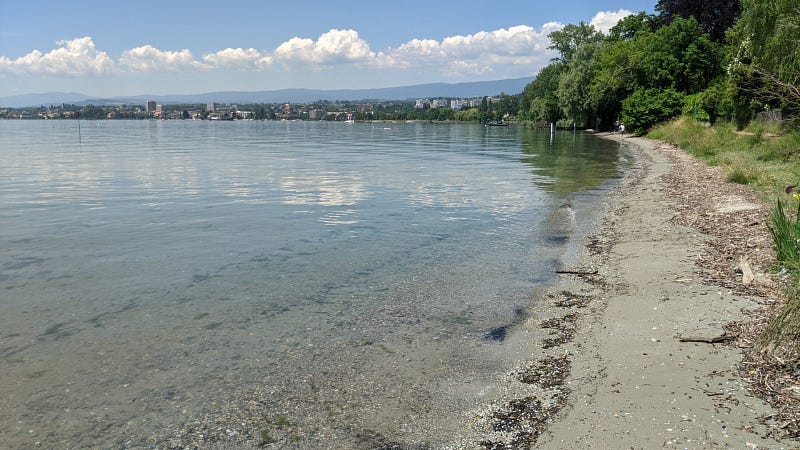
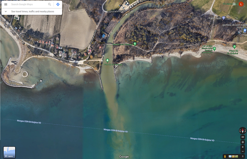
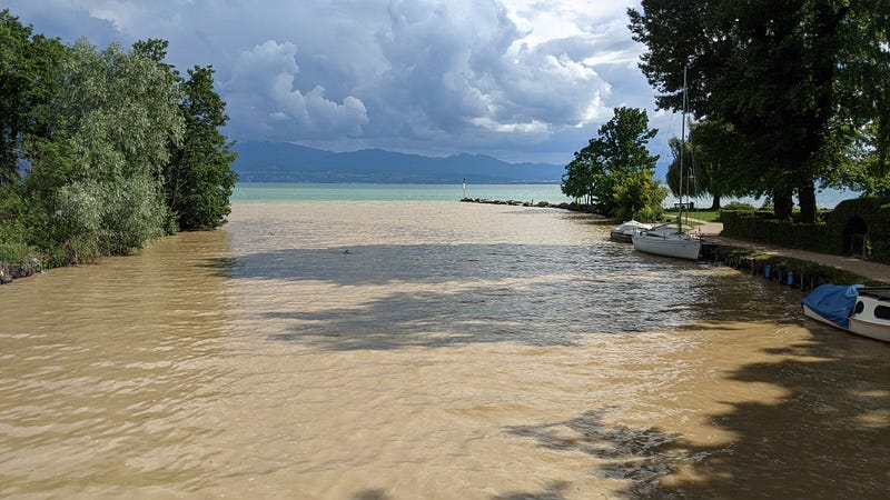
My favorite beach in Switzerland is a short strip of shore (well… actually long compared to most other beaches in the country) on the north side of lake Geneva, in the French-speaking canton Vaud. More precisely, this beach spans from the town of Préverenges in the east up to somewhere in-between this town and the larger town of Morges in the west. I say “somewhere” because the beach has a clear starting point in the east, defined by the Vaud-famous Venoge river (it is an emblem of the canton and even has its own poem, see at the end of the story), but on the west side it slowly fades into forest, a park and then the city of Morges.
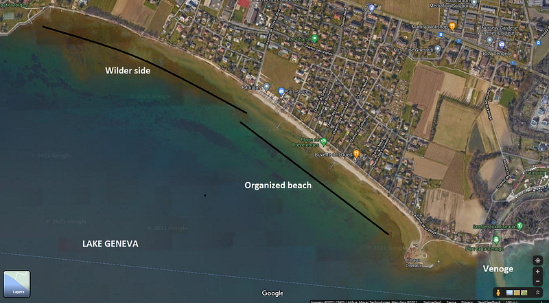
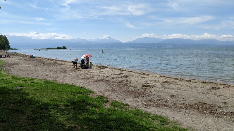
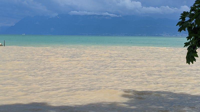
This beach, around 1.5 km long of which aprox. 1 km is a continuous stretch, spans the whole front of the town of Préverenges in the east and extends into the less populated space that connects this town to that of Morges, on the west. The shores are ample, especially in what I call the “organized beach” as in the map above, filled with sand at the coast and also well into the water. In fact the water remains quite shallow for around 50 meters and even then its keeps going deep very slowly. All this makes for a nice effect on full sun days with no wind in which the lake looks deep blue, turning grey on cloudy days and turquoise when it is sunny but also windy. In the photos by the end of the post you can see some of these colors. And most importantly, right there the water is super-transparent, and of such high quality that most of the year you could probably drink it with no bad consequences (disclaimer: not saying you should drink it!).
The fact that the first meters are so shallow and have a comfy sandy basin make it easy and very enjoyable to play in the water, swim or just sunbathe more freshly. Besides, the water gets quite warm, although this has the downside of fostering the growth of some pests, most notably the “duck flee” (not really a flee but annoying!). But ok this is quite controlled and you normally get to know when you rather wash yourself after swimming.
The space in this beach is ample, so except for very hot Saturdays and Sundays in the afternoon, most of the time you can find good space for you and your things. Thus we comfortably play with water-volley, badminton, etc. sometimes right in the sand, sometimes right in the water.
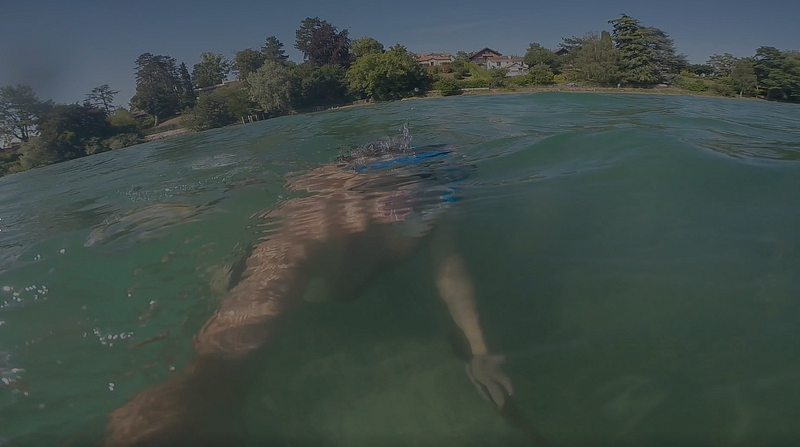
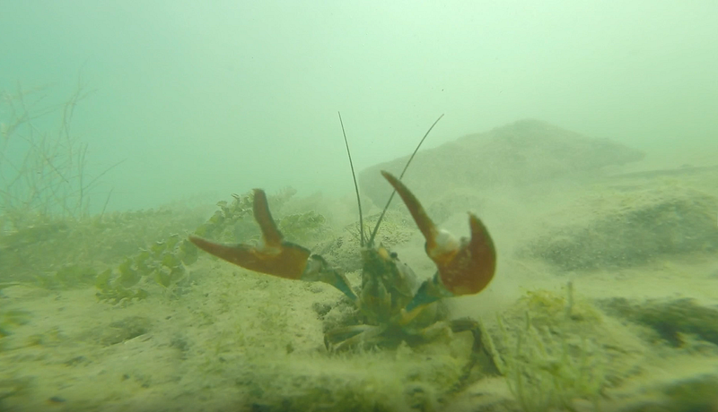
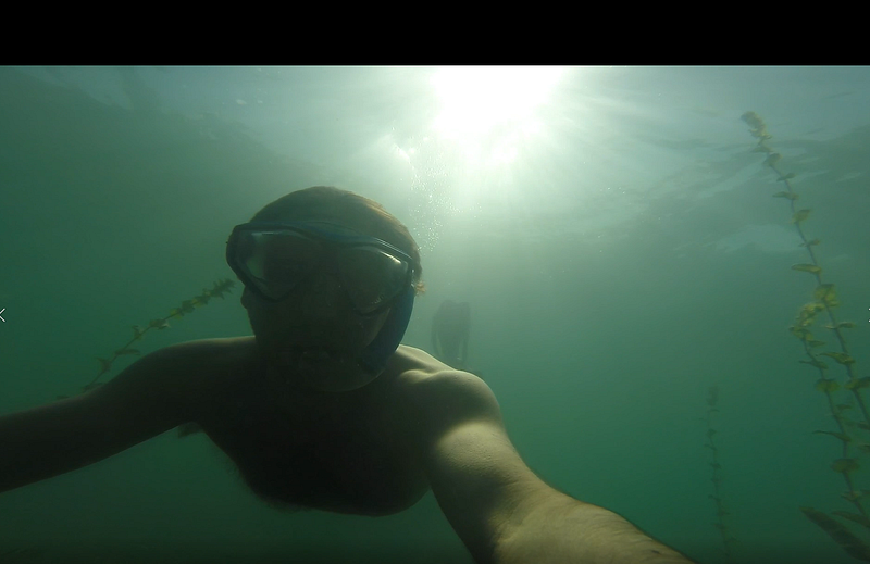
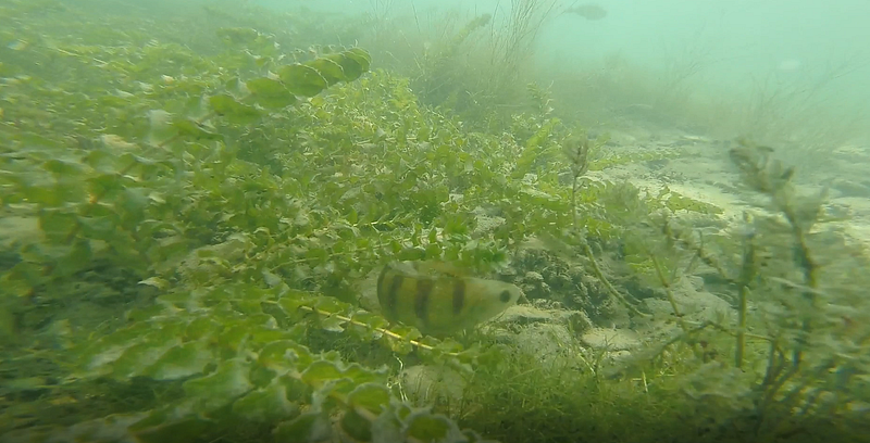
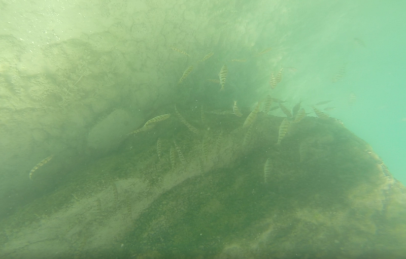
As most of the country, this is a quite safe place, so you can leave your stuff and go enjoy the water. I do not go to extremes, but I see often people who just leave their things and go swimming for hundreds of meters. When the water is calm, which is I‘d estimate like 80% of the summer, you can even snorkel (yes, I take my fins, snorkel and mask with me when I go to this beach) to discover the many tiger fish, crayfish, the rocky bottoms that shows up once you’ve passed the sand part, and the many kinds of algae. Around 50–100 meters away from the coast the depth may already be around 3 meters or so, but from time to time you will spot huge rocks on which you can stand and relax.
At the main “organized” beach you can rent pedal boats and paddle surf boards, although for this latter, each year more and more people but their own. So you can see and experience moving quite efficiently above the water surface, with a deep vertical view to the bottom of the lake.
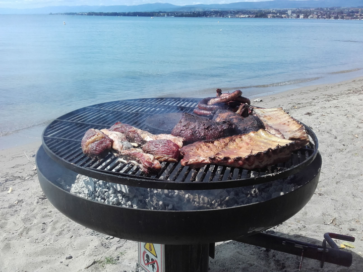
The “organized” beach also features a public bathroom, a couple of places to eat or take away meals, showers to rinse yourself after swimming in the lake (not much needed, except when the lake water is too warm) and in summer even grills where to cook barbeques like the one you saw at the top.
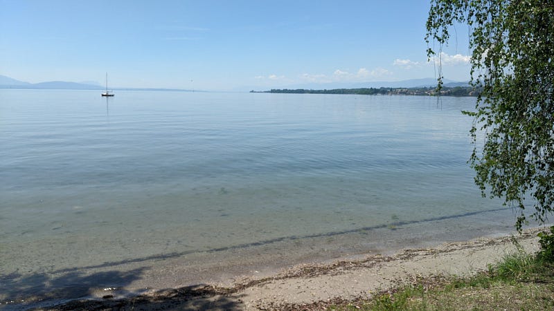
The “wild” side of the beach has a bit less sand, I mean, the beach itself is smaller, but it looks much more natural, with many plants and trees leaning towards the water. This part of the beach follows next to the “trail of birds” (“Sentier aux Oiseaux”), note you cannot ride your bike there but you can walk with it and drop it next to you. I particularly love this part of the beach because in windy days the hilly terrain behind you protects you from the wind. Oh and talking about those hills, feel free to envy the locals who have their houses right there, “pie dans l’eau” (“feet in the water”) as the Swiss like to say.
After reading in the next section some global and curious facts about the lake that holds this gem of beach, read down to know more about the beach itself (towns, attractions, history, water activities, …) and see more of my photos selected from a huge selection I took over years.
Welcome to Lac Léman
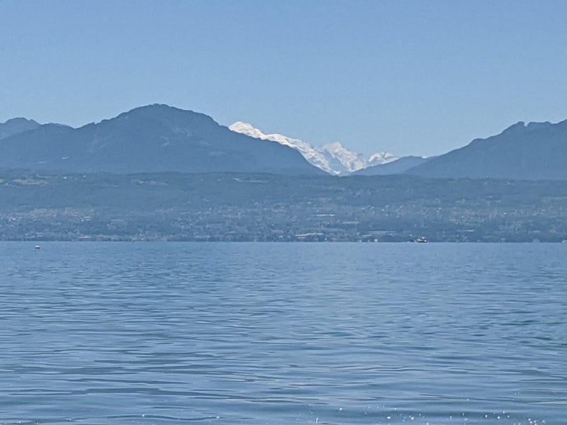
“Lake Geneva” is the official English name for a lake called by the locals by the names of Lac Léman in French or also Lago Lemano in Italian and Genfersee in German. Being Genf the German for Geneva (Genève in French), Genfersee literally means “Lake of Geneva” so it is very close to the English name. The name of this lake in the fourth national language, Romansh, also refers to the city: Lai da Genevra. The reference to Geneva in all these languages stems from the fact that this city is at the exit of the lake. In fact the lake resembles a broadening of the Rhône river, running from east to west between the Alps in the south and the Jura mountains in the north. On the west side, before the city of Geneva, the lake gets thin enough to become a river again, keeping its name. The Rhône then sneaks through the city into France and continues its way towards the Mediterranean. It is around Geneva where the lake holds Geneva’s symbol, the jet d’eau.
After rising in the homonymous glacier, the Rhône river rides down the Alps flowing first through the neighboring canton of Valais (Wallis in German) and then into canton Vaud. On its east side, as it is flowing to the west, the river suddenly opens wide to form Lake Geneva. This start is not far from a frontier with France at the split town of Saint Gingolph (split by a small river into a Swiss and a French town, both with the same name) and also not far from the city of Montreux where the famous Jazz festival takes place.
A whole museum is dedicated to the lake in the picturesque city of Nyon, but let me give you some highlights and curious facts:
- It reaches a maximum depth of around 300 m, and is the largest in area and volume in the country.
- It keeps many interesting animals, such as giant catfish, trouts, crayfish like the one you saw above, perches, etc. I will make a separate post with all my photos and videos of living creatures in the lake and its shores.
- Its surface temperature varies a lot from around 5 degrees in winter to as much as 25 degrees in summer, making it perfect for swimming from late April-May until September or even early October.
- However this is only at the surface, because after a few meters the water remains very cold the whole year round. The water stands relatively still, not mixing much. On very hot days you can even see thermoclines 1 or 2 meters under you while swimming (thermoclines are those changes in light diffraction that happen when two layers miscible liquids do not mix, like for example at the interface between syrup and water).
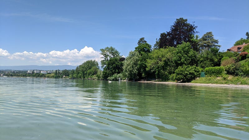
- In the Swiss side the coasts are shallow and rich in sand towards the west, but more steep and rocky towards the east; in fact, in the (UNESCO-awarded, sun-rich) region of the Lavaux terrace vineyards the coast is very sharp with slopes that remain sharp well into the water, allowing quite deep scuba dives right there close to the coast.
- Around year 563, a massive rock fall probably originated at Le Grammont mountain (which I will feature some day in another post about my favorite Swiss mountain lake!) where Lake Geneva begins resulted in a tsunami-like event that was mild in the east but devastated the frontline of Geneva and other towns at the west end of the lake, with waves reaching around 8 meters in height. Research suggests that the mild but ample waves created by the rock fall travelled through the lake being barely noticeable, but then added up together as the lake shrinks before arriving at Geneva.
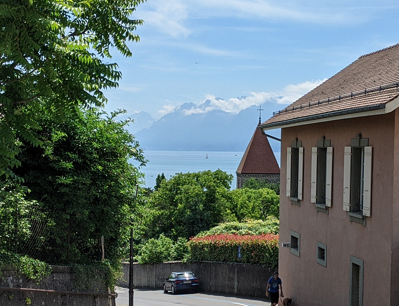
- Some must-visit places around the lake: the cities of Lausanne, Geneva, Nyon, Morges, Vevey, Montreux, and small towns of the Lavaux (esp. Saint Saphorin) in Switzerland, plus Evian-les-Bains and Yvoire in France; the castle of Chillon next to Montreux; the Rochers-de-Naye mountain which you can ride up by train from Montreux (and don’t forget to visit its alpine garden); and the vineyards of Lavaux (and take some glasses of wine at one of the many open cellars).
Towns nearby the beach
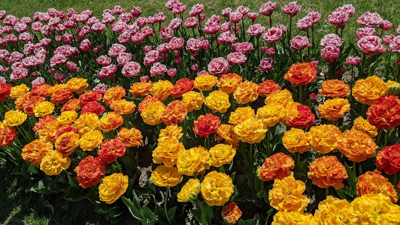
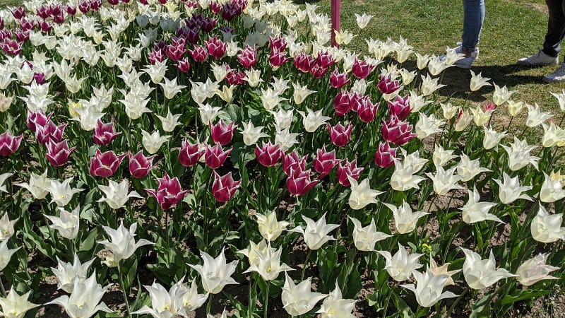
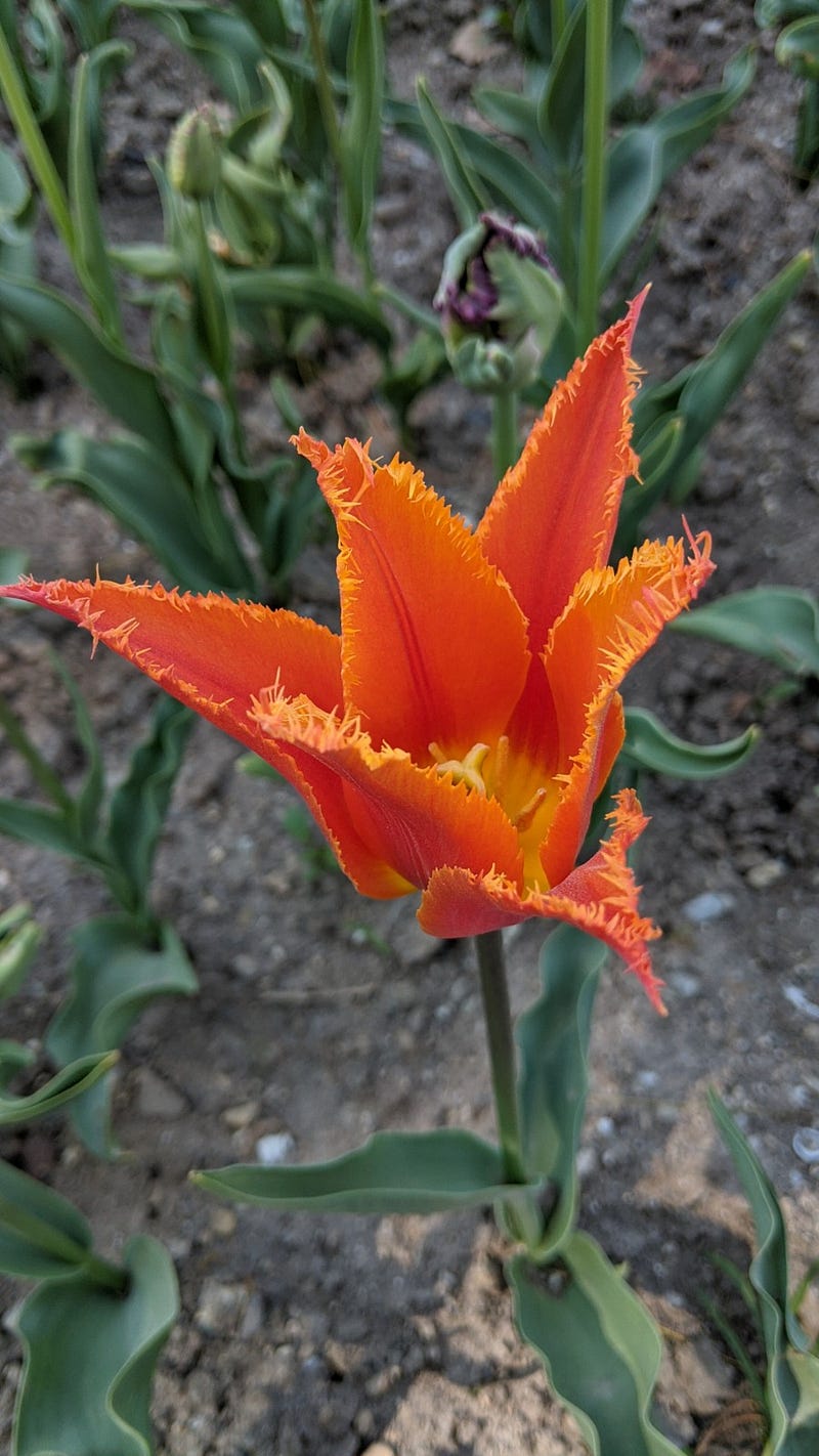
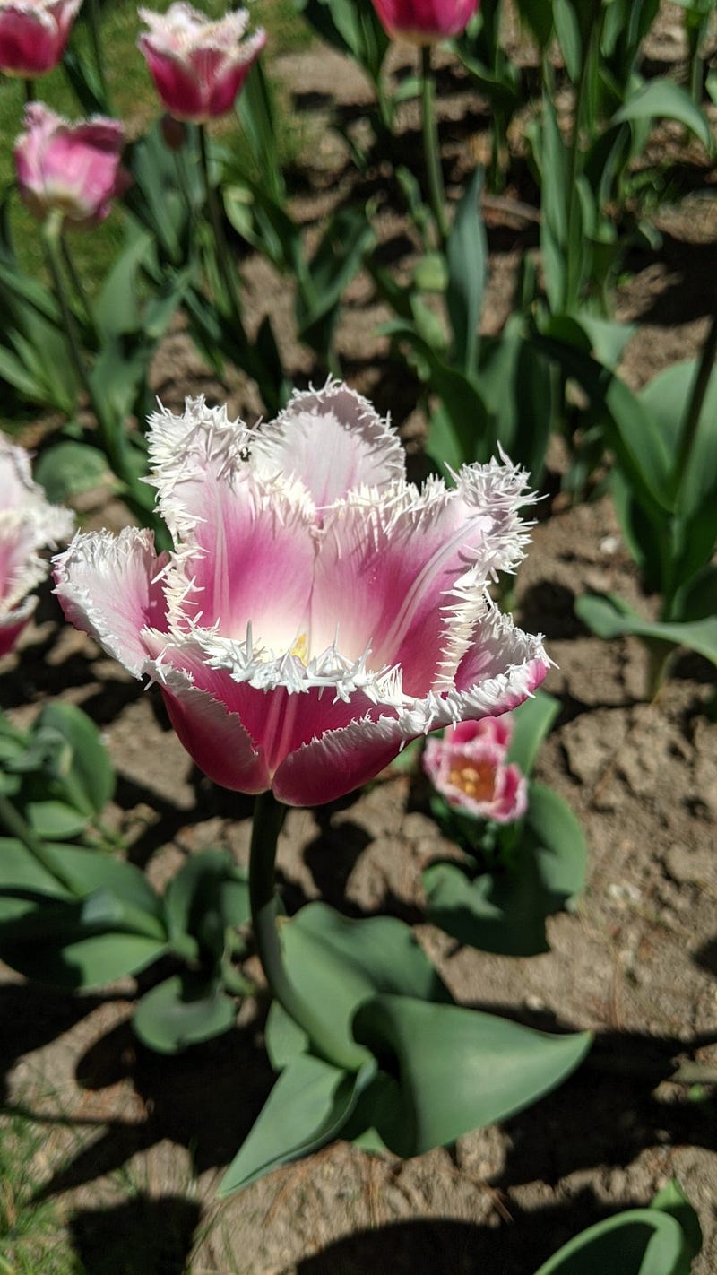
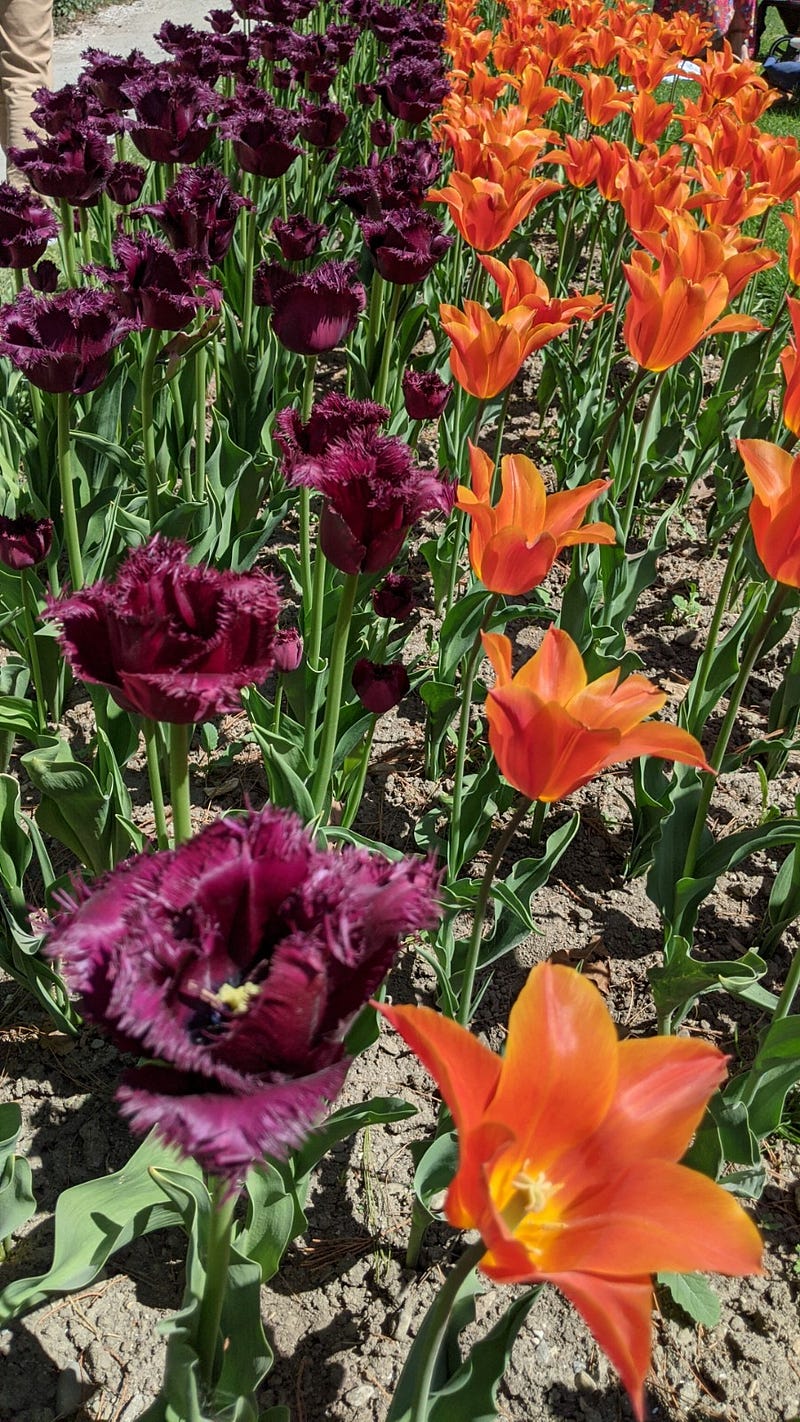
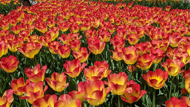
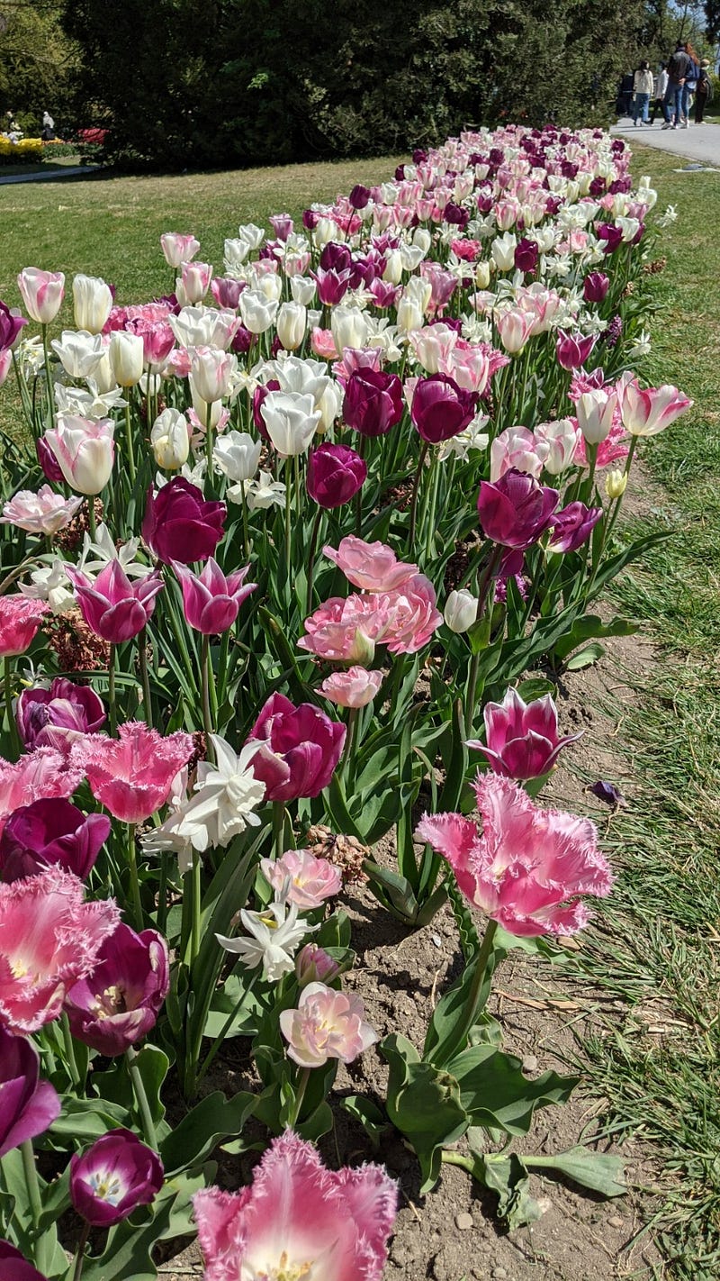
The main town associated to this beach is Préverenges as we saw on one side, and Morges on the other. Morges deserves a good visit, with a promenade full of flowers and plants by the lake (especially full of tulips in April and full of dahlias from July to October), a small but nice city center, and a castle turned into the army museum well worth a visit. In April, the garden behind this castle holds a yearly festival on tulips that presents a large exposition of this flowers for over a month, well worth one or more visits (as not all tulips open up at the same time). See at the end of the post a selection of photos of tulips in Morges.
Closeby, there is also the town of Saint Sulpice, separated from Préverenges by a river called Venoge (see below) and a small but dense forest around it. It is a small town with a nice promenade around the lake and some small beaches, much more densely populated as we approach Lausanne on this side. One particular beach in Saint Sulpice, Laviaux, is an entry point for those doing kite surf and similar sports, so you will see full of flying sails on windy days.
Palafittes (“in-the-water houses”) of ancient times
The palafittes of the Alpine region are among the most important archaeological assets in Europe. Many of these sites are registered as UNESCO World Heritage assets, which fostered the implementation of measures to make the general public aware of the exceptional character of this cultural heritage. Right at what I call here the “organized beach” but several meters into the water, Préverenges keeps some quite “well” preserved archeological sites, with vestiges of palafittes dating back by around 3800 years. They are at depths that vary from 2 to 6 m, probably because the lake was lower at that time. It’s so cool to think that people were living almost right there 4 millennia ago in the same place where you now go to have fun and relax.
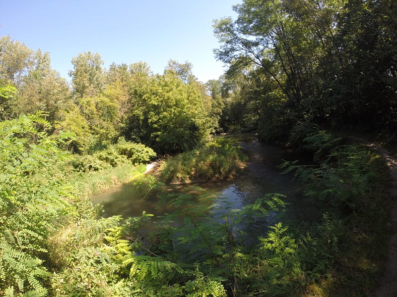
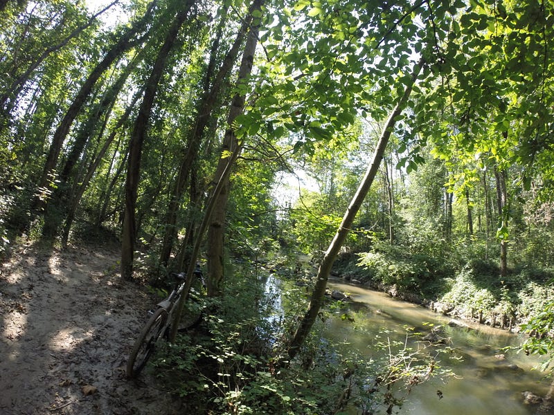
La Venoge
I have referenced above this river a few times. But it’s not just a reference point. La Venoge is one of the most important rivers in the canton of Vaud. This river emerges from underground near the town of L’Isle at the foot of the Jura Mountains. It is a rather quite river except when it rains heavily, as it collects all the water from the surrounding basins and becomes quite powerful causing strong erosion of its edges. That’s why its shape changes quite notably. I have seen it change within less than 10 years.
What I like most about this river is that the Swiss have left a quite dense forest around it, where you can find all kinds of native plants all year round. Already in March after the winter you see small sprouts with flowers, followed by the “wild garlic” (“ail des ours”, literally “garlic of the bears”) that we use to make pesto, and then increasingly bigger plants, bushes and trees that remained dormant during the winter. By May you see all shades of green together with wild flowers of all colors coming up. And the best is that there is a hiking trail that follows most of the Venoge in its run up to the lake. A trail intended for walking but that I love doing by bike.
I will post more about the Venoge some day in a dedicated story. For the moment I leave you with this poem (in French) by Jean Villard-Gilles, which sings to the river and actually to the whole identity of the canton of Vaud.
Selection of own photos: the “wild” beach
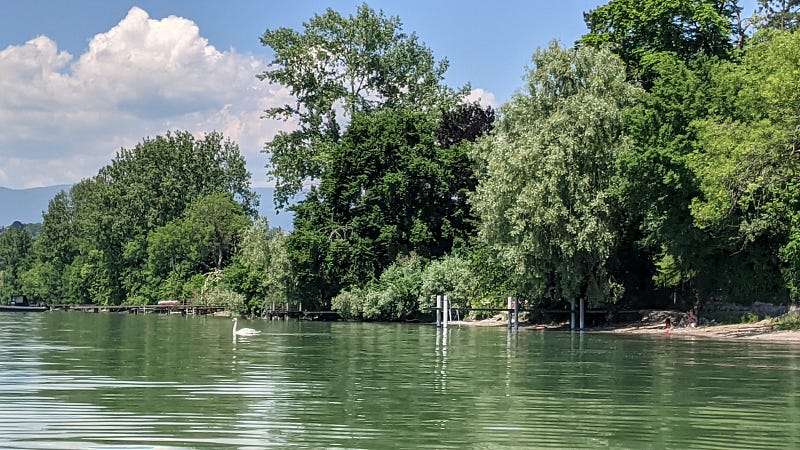
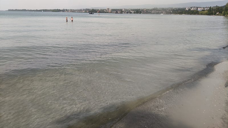
Selection of own photos: La Venoge meets Lac Léman
Selection of own photos: Some underwater shots
Selection of own photos: April tulip celebrations in Morges
And in september, Dahlias. But that’s another story…
I am a nature, science, technology, programming, and DIY enthusiast. Biotechnologist and chemist, in the wet lab and in computers. I write about everything that lies within my broad sphere of interests. Check out my lists for more stories. Become a Medium member to access all stories by me and other writers, and subscribe to get my new stories by email (original affiliate links of the platform).


