
OUTDOORS
Take a Hike: These 8 Long-Distance European Trails Await
Including France’s new challenger to the world’s longest trails
Following on from my ‘Take a Hike: It Changes Everything’ piece, I’ve compiled a number of multi-day / multi-week hikes from around Europe. This list isn’t exhaustive, nor is it studded with entirely unique information. Rather, consider it a ‘dip your toe’ moment if a longer hike has tickled your fancy and you just needed a gentle push to take the next step — the first of many, perhaps. This is an opportunity to plant the seed for an idea that could well blossom into an adventure. It’s a chance for both of us to dream up ideas and then stretch our legs after too long a time confined to our bedroom’s 4 walls.
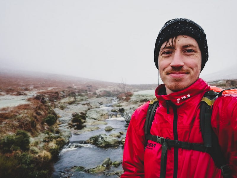
A disclaimer straight off the bat. The majority of these hikes are well known, and to those more experienced than me (i.e. so, so many), you’ll likely bat your eyes and swiftly move on. At some point in time, I’ll jot down a few lesser-known journeys if that’s your thing. Some of the trails featured here I have done, and others I wish to do. So, without further ado, if you are a randomer looking to break into accessible and longer hikes — hello. It’s time to become a randonneur. If the pay-off of my 2 years in France was to remember the word for hiker, so be it. Time well spent, I think. Speaking of having a nice time in France, let’s start:
Note: I haven’t calculated rough costs as it depends on where you’re flying from, what gear you already have, and how much of the trail you wish to do. However, send me a message if you’re keen and I’ll give you my tuppence.
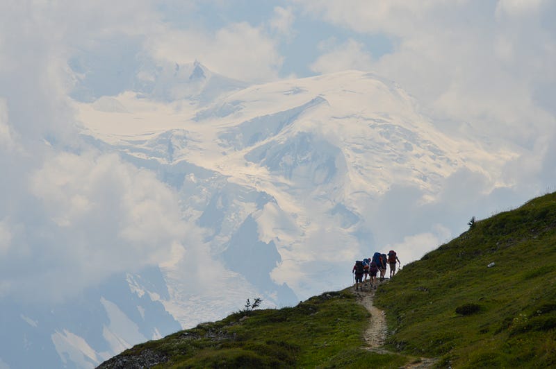
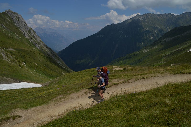
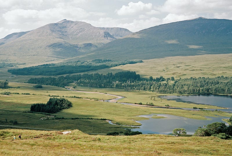
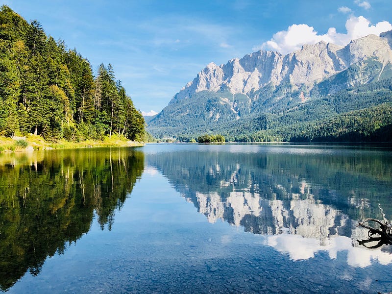
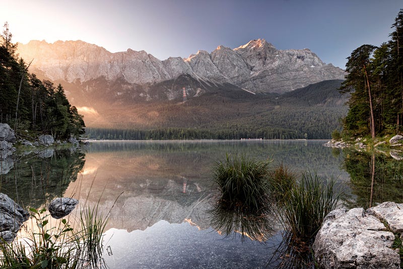
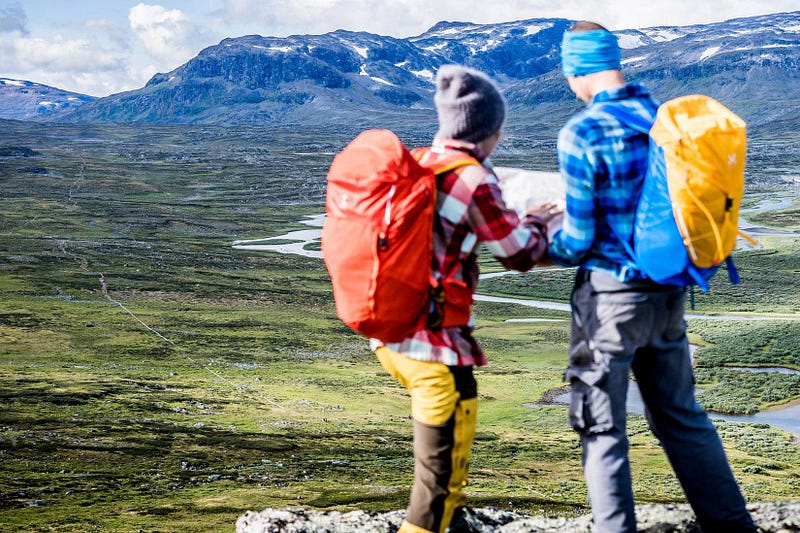
Tour du Mont Blanc (France, Italy, Switzerland)
Distance: 170 km / 106 miles
Total ascent: 8,900 m / 29,200 ft
Total descent: 9,100 m / 29,855 ft
Duration: 10 +/- days
Accommodation: Refugios / Camping
Closest Airport: Geneva
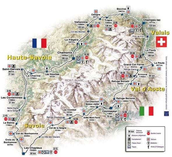
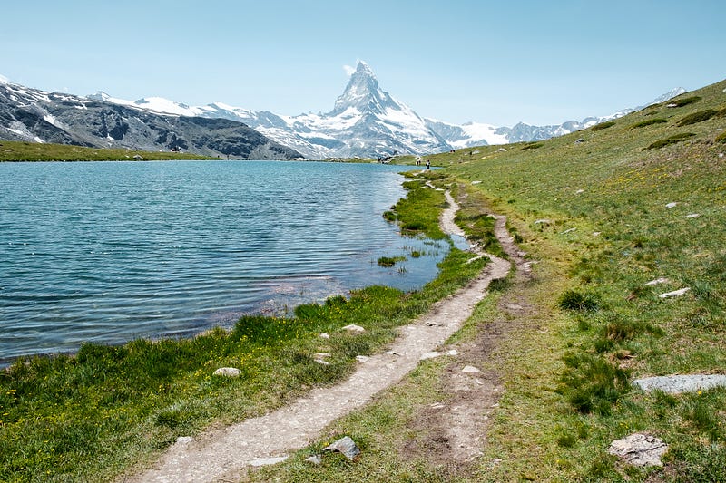
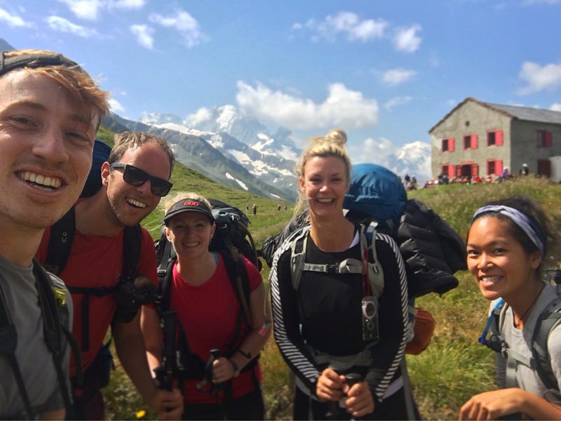
You’ll find the Tour du Mont Blanc in nearly every list, but with good reason. Sure, it can be busy at peak times (July-August), but the trail weaves you through sprawling, picture-postcard landscapes that you’ll yearn for many months and years later. You’ll wander through the French, Italian and Swiss Alps as you slowly circumnavigate the towering pivoting point — Mt. Blanc. While busy, there’s plenty of room for you and others. In 2018, I befriended a great rag-tag group of friends that made the experience all the more memorable. While nature is often the draw, people have their perks too.
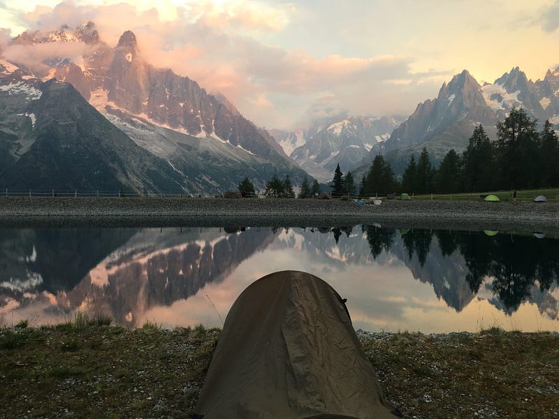
On trail, you’ll encounter endless mountain lakes, alpine hamlets and lush mountain meadows. Furthermore, the glistening towns and villages a few thousand feet below offer both a disconnect and a sense of reassurance should you need it. When it comes to sleeping, refugios dot the trail but be warned, it’s advised to book ahead in peak months. In these toasty abodes, you’ll devour hearty food, shower clean and rest up in the company of others. Your wallet, however, will yearn for the spending to stop. Wild camping (i.e. pitching your tent in a non-designated site) is largely prohibited but for above certain altitudes. This varies from country to country to make things a bit more complicated. There are plenty of campsites spaced out along the journey allowing you to rest up and save your cash for ice cream instead. Lastly, you do not need a guide.
Find out more here or ask me!
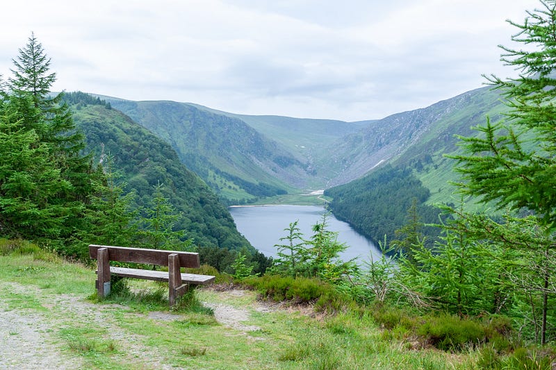
The Wicklow Way (Ireland)
Distance: 131 km / 82 miles
Total ascent: 3,200 m / 10,500 ft
Total descent: N/A
Duration: 6 +/- days
Accommodation: B&Bs / Hostels / Camping
Closest Airport: Dublin
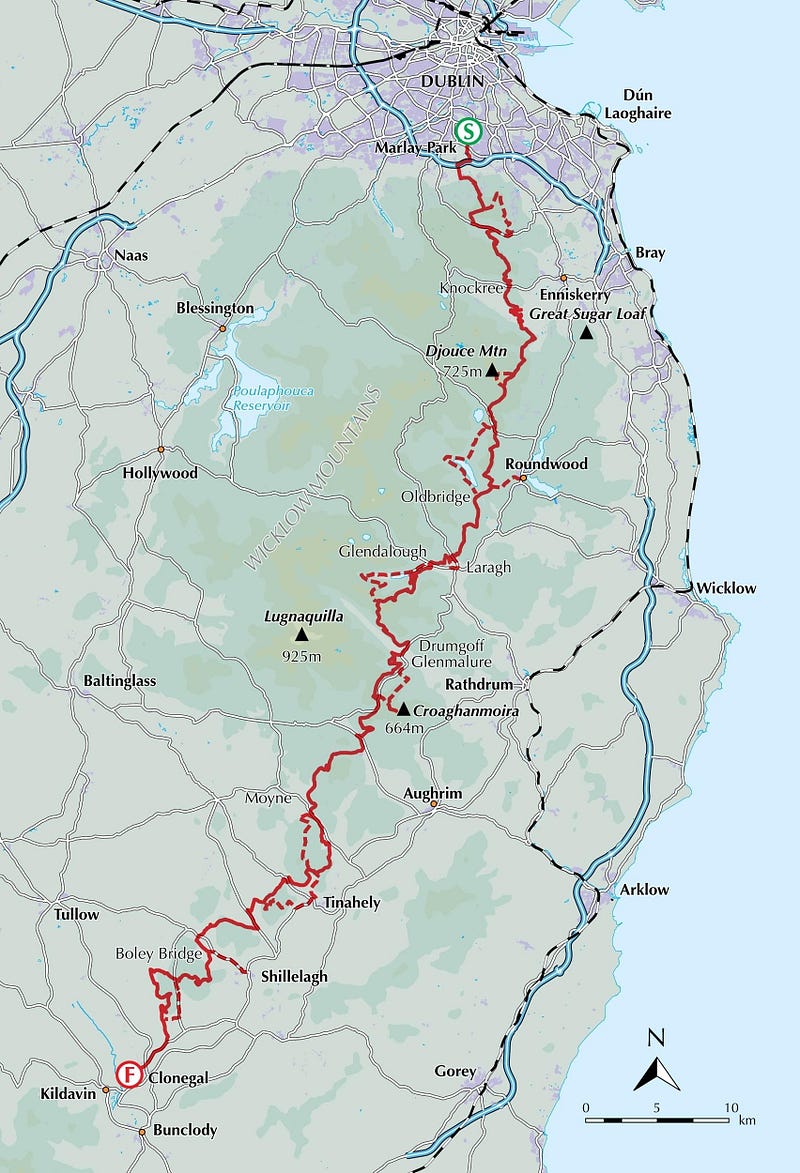
Hands up. I’m pretty bad for overlooking the beauty that lies on our doorstep. It peers in like a hapless dog and I ignore it like a soulless person. In March 2019, while preparing my knee for the Pacific Crest Trail, I hiked along The Wicklow Way. My dad dropped me off at Marlay Park and 4 days later, he picked me up in Shillelagh. If you’re seeking a gradual introduction to longer hikes, this works. You can do it in one go, or break it into sections over a few weekends. Each stage conveniently ends in a (relatively) accessible town or village meaning you can reward yourself with a pint in the company of friends. The overall ascent is helpfully unhurried and never too taxing, while the sequential pattern of rolling green hills and thick pine forests keeps the mind engaged. With the proximity of small towns and villages along the trail, you’re guaranteed a helping hand should a problem arise. As I was still in holiday mode, I stayed in B&Bs and enjoyed a Guinness or two. I apologise to no one. You could wild camp but be wary of farm animals and please ask the landowner if possible.
Find out more or ask me!
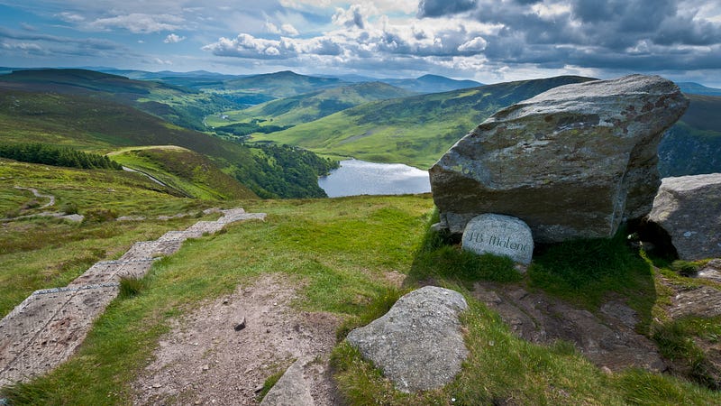
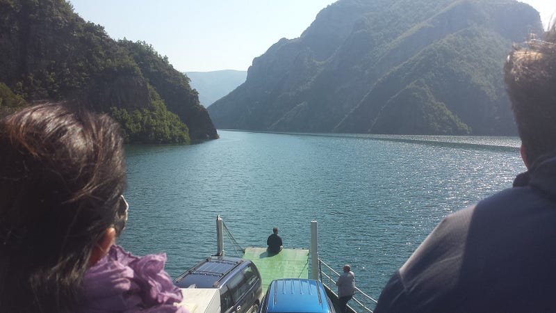
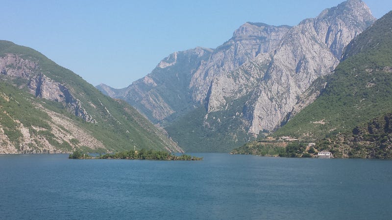
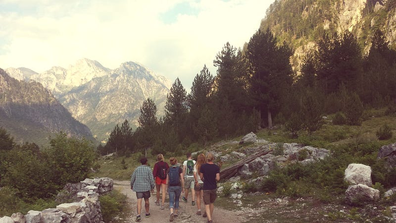
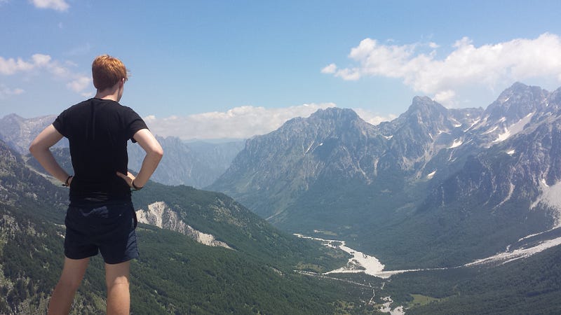
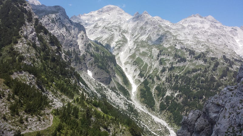
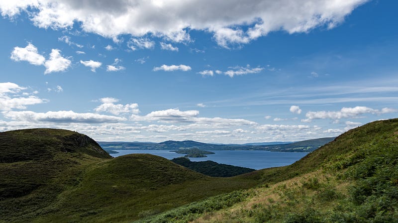
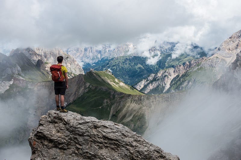
Peaks of the Balkans (Albania, Kosovo, Montenegro)
Distance: 192 km / 120 miles
Total ascent: 9,800 m / 32,150 ft
Total descent: 9,900 m / 32,470 ft
Duration: 12+/- days
Accommodation: Guesthouses & Camping
Closest Airport: Pristina, Tirana or Podgorica.
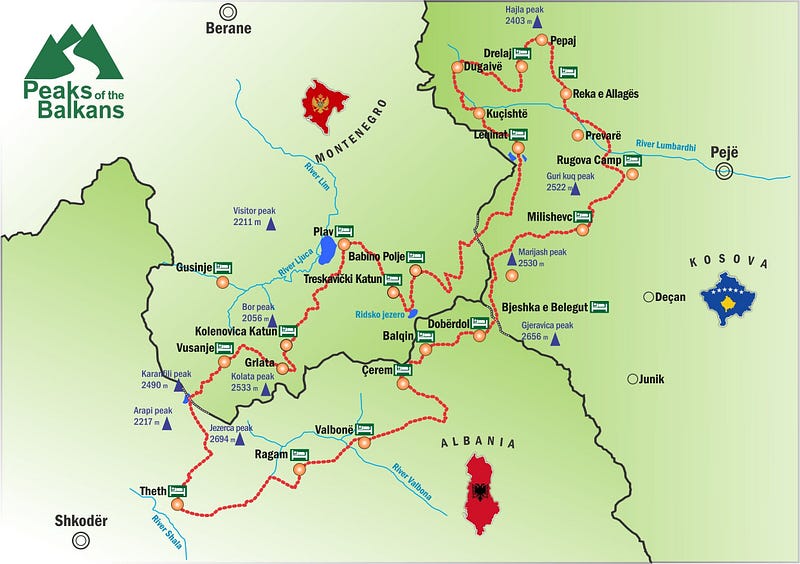
In 2015 I unknowingly hiked the first section of this trail and I was bowled over by the natural beauty of the Accursed Mountains. Judging by photos and reviews, it’s abundantly clear that the stunning views spill well beyond Albania’s borders. Supported by Germany’s Deutsche Alpen Verein, this new 192-km transnational trail gives you a wide-eyed glimpse at the relatively untouched and uninhabited region of the southern Dinaric Alps. By all accounts, it’s a highlight reel of Albania, Kosovo and Montenegro’s finest natural wonders. Local villages have built up a network of comfortable guest houses, but as the popularity of the trail continues to grow, space may be at a premium. Fortunately, there appears to be a whole host of beautifully perched wild camping spots as well as designated campgrounds. While flying to these countries can be a bit of a hassle, it’s 100% worth the trip. The Balkan states are filled with rich history and home to both beautiful nature and warm people alike.
Find out more or ask me!
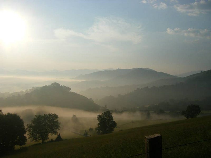
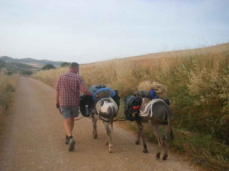
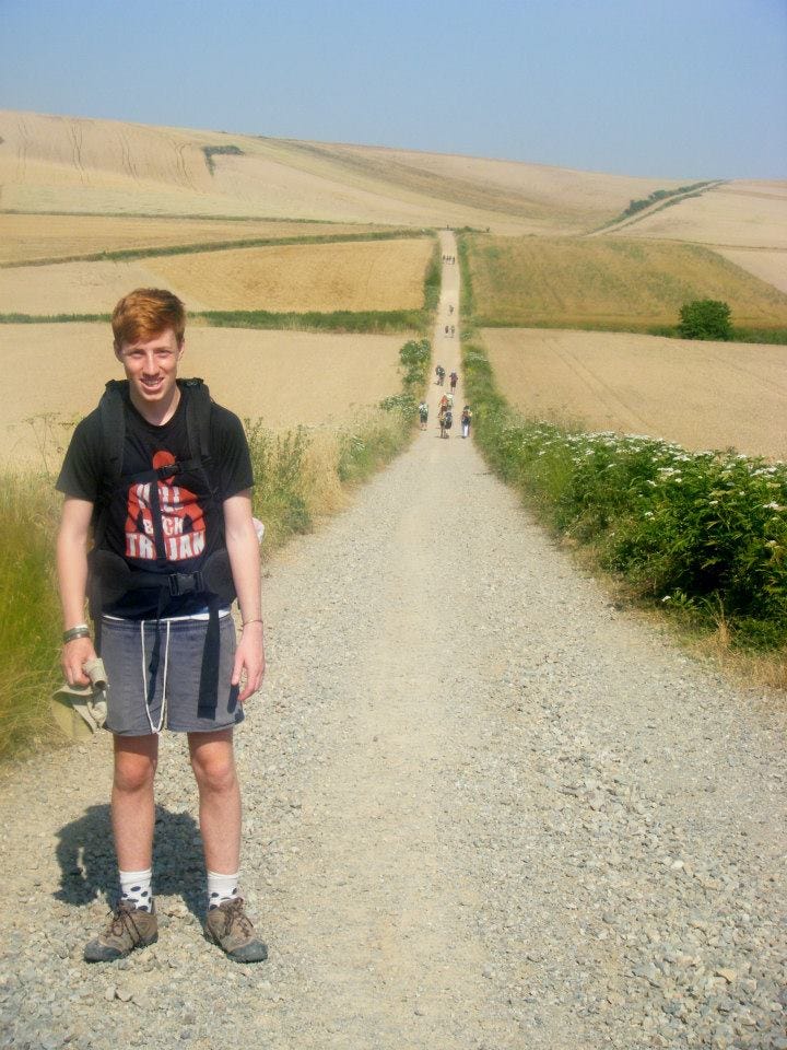
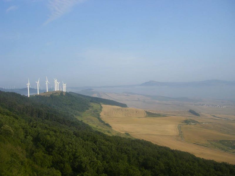
Camino de Santiago (Camino Francés) (France & Spain)
Distance: 937 km / 582 miles
Total ascent: 18,600 m / 61,300 ft
Total descent: 17,700 m / 58,070 ft
Duration: 35+/- days
Accommodation: Albergues
Closest Airport: Biarritz
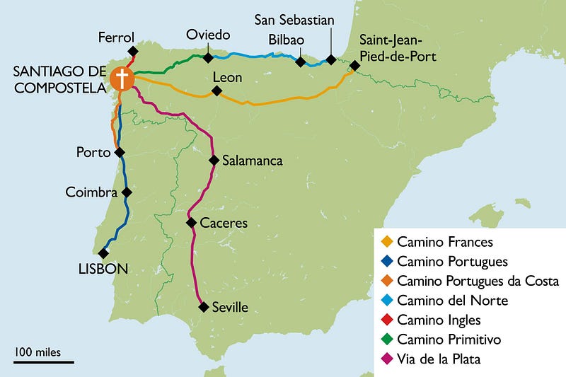
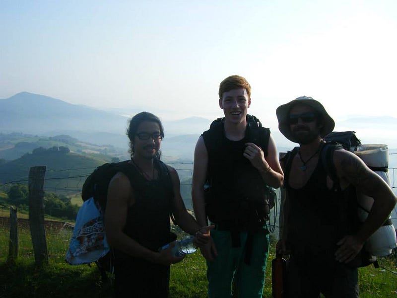
People sometimes scoff at the thought of the Camino being considered a ‘hike’ given its more ‘mature’ audience, perceived busyness, and endless albergues eager for your custom. Yet you’ll discover a whole lot in this part of the world: tough climbs, contentment and tranquility in the quaint, picturesque villages and roaming countryside that surrounds you. You’re on a real journey here — one that’s far-reaching — and you get to experience and enjoy local hospitality along the way. That’s pretty good in my books. The world-famous pilgrimage first brings you up and over the French Pyrenees before then guiding you across Spain to the wild Atlantic, should you decide to continue to Finisterre.
In 2013, I only had time to complete 240 km and I’ve often considered going back and finishing it off. It’s so easy to get to, it’s affordable and it offers a rolling tapestry of the Spanish countryside as you amble along. I have extremely fond memories of my daily routine: 1) Wake up in my Albergue (basically a hostel) 2) Walk until a mid-morning pitstop in a small Spanish village for a Bocadillo el Camino 3) Continue walking before then stopping for lunch when the sun shines strongest 4) Find an Albergue, take off my boots and crack open a beer. Should the foot traffic deter you, there are 12 more Camino routes to choose from, all of which offer varying views, fewer people, and different experiences.
Oh, by the way, it may be a pilgrimage but that doesn’t mean it’s a religious indoctrination. I’m not spiritual nor was the topic ever broached on my trip. However, if that’s your thing or you simply want a sabbatical of sorts, the Camino Francés says hello.
Find out more or ask me!
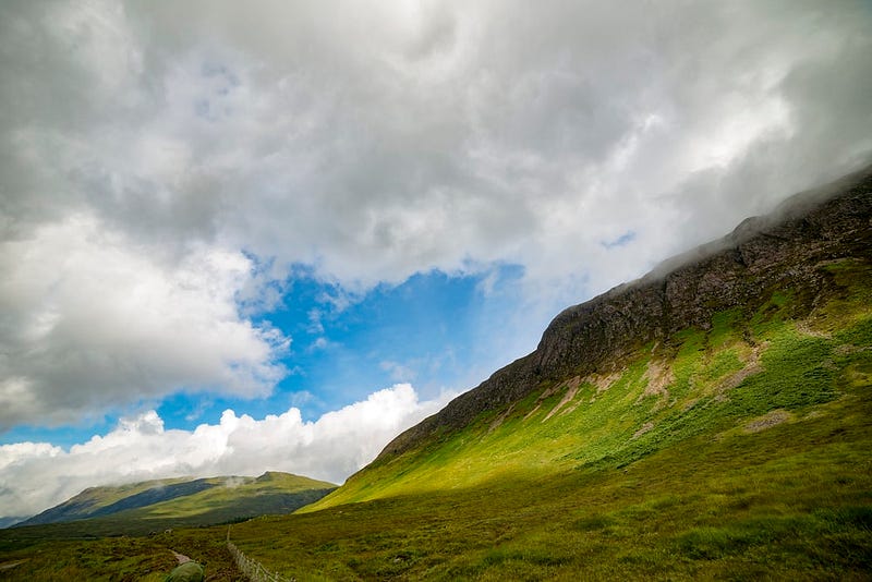
The West Highland Way (Scotland)
Distance: 154 km / 96 miles
Total ascent: 3,155 m / 10,351 ft
Total descent: 1,400 m / 4,593 ft
Duration: 6 +/- days
Accommodation: Camping / B&Bs
Closest Airport: Glasgow
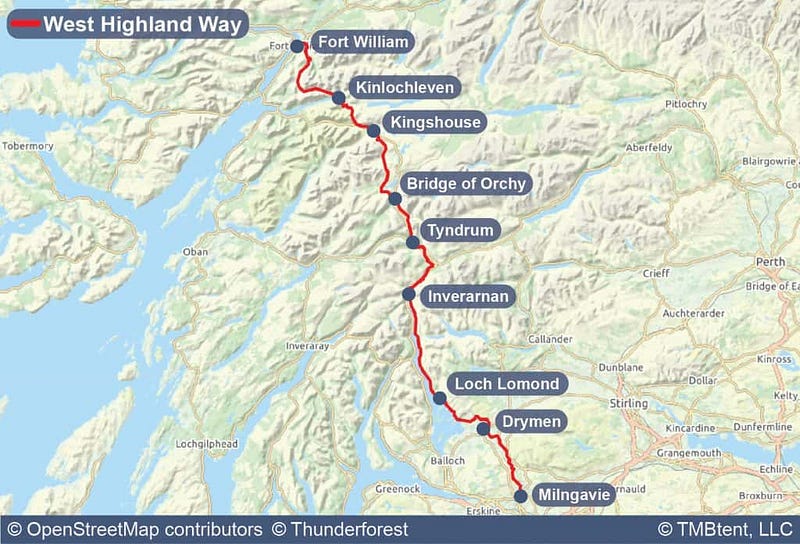
Just across the Irish Sea you’ll find Scotland’s famous West Highland Way. Normally trekked south to north, it’ll give you a good insight to why our neighbours have seen their nation crowned the most beautiful of anywhere on our planet. Starting south, the drawn-out elevation profile allows you to ease into things while the occasional (and tempting) option of a hot meal and warm B&B bed means the WHW positions itself as a perfect place to start stretching your legs. Though, be warned, the notorious and villainous highland midge may cause you problems. The Californian mosquitos nearly drove me insane 2 years ago and while I had planned to undertake the WHW in Spring 2020 (pre-Covid), the thought of them sends chills down my spine.
Find out more or ask me!
Traumpfad (Germany, Italy)
Distance: 554 km
Total ascent: 19,990 m / 65,300 ft
Total descent: 20,430 m / 67,030 ft
Duration: 30 +/- days
Accomodation: Camping / Refugios / Hostels
Closest Airport: Munich
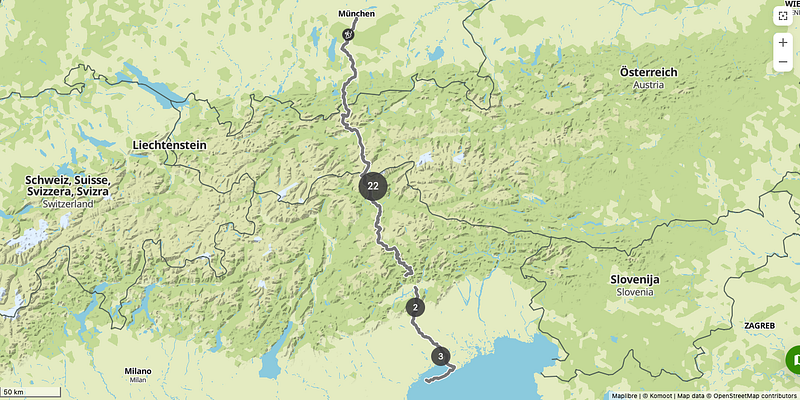
‘The Dream Trail’. Need I say more? Once you see the photos, you’ll agree. Whatever about hiking in the pursuit of inner enlightenment, this is a path that’ll immerse you into an expansive, bewitching world and serve up some of the best pinch me moments this planet has to offer. Munich is your start point and a pizza in Venice will prove a fitting finale. En route, you’ll sample some of Europe’s finest natural delights from the Bavarian foothills to the glorious Italian Dolomites. I adore the idea of point-to-point transnational hikes so the Traumpfad is very high on my list, and now that I have my hiking gear here in Berlin, I’m struggling to resist the temptation. The diligently prepared guide below will tell you all you need to know. If you’re interested in a shorter jaunt along the same wavelengths, check out the E5 trail.
Find out more or ask me!
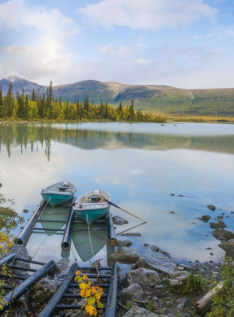
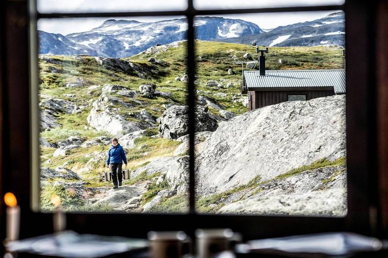
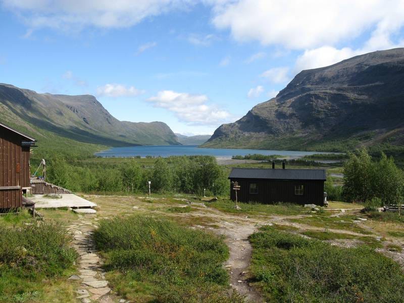
Kungsleden (Sweden)
Distance: 440 km / 273 miles
Total ascent: N/A
Duration: 23 +/- days
Accommodation: Camping / Mountain Huts
Closest Airport: Kiruna
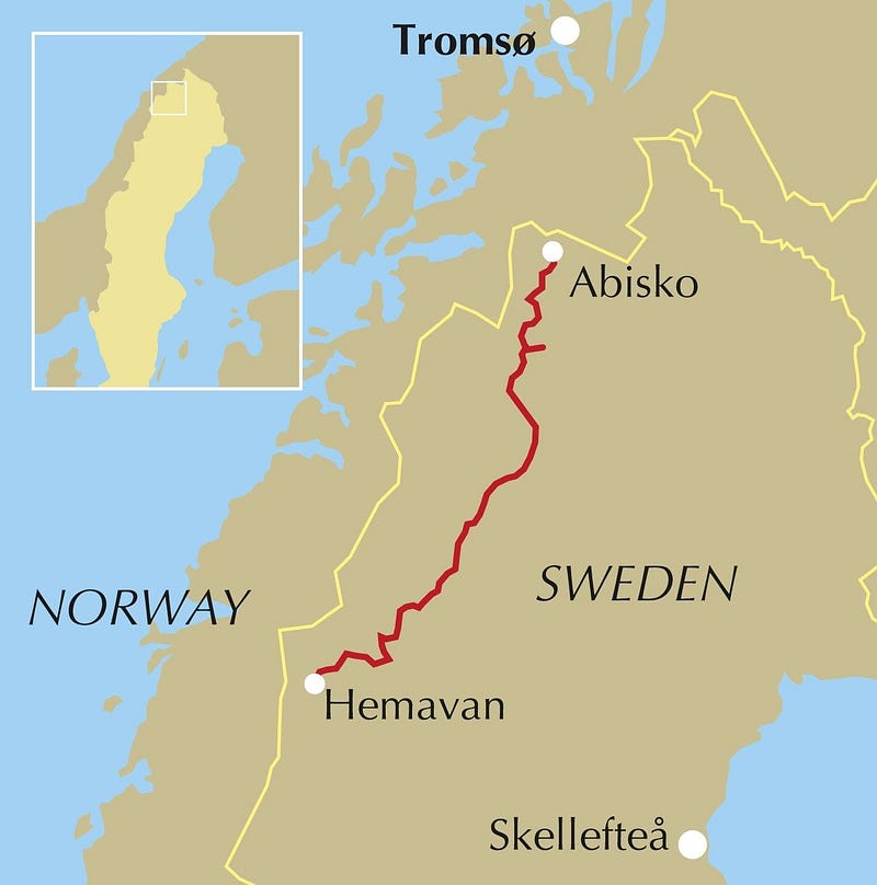
This is another trek that tempts me every summer. With Swedish Lapland being one of the least densely populated regions in Europe, you’ll have endless beauty at your feet as well as the friendly company of like-minded hikers from time to time. The King’s Trail passes north of the Arctic Circle so in summer you can expect long, bright days and who knows, the northern lights might even say hi during the moon’s brief night shift. In winter, you don’t want to be hiking here. Huts spring up every 20–30 km and while they offer near irresistible luxuries, your wallet will wane at the sight of €30+ per night. My approach would be to enjoy the beauty of wild camping in such a remote location and if a bad day arose — whether inflicted mentally or because of the weather — then I’d splash out for a bed.
Find out more or ask me!
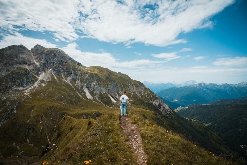
Hexa Trek (France)
Distance: 2,500 km / 1553 miles
Total ascent: N/A
Duration: 90 +/- days
Accommodation: Camping / Refuges
Closest Airport: Stuttgart
Fancy going that bit further? In 2022, Hexatrek will officially launch. This is a long-distance thru-hike blessing you with the best France has to offer as it meanders its way through 2,500 km of national parks. Not much is known given its distant launch date but with America’s Triple Crown (Appalachian Trail, Continental Divide Trail and Pacific Crest Trail) having dominated the thru-hiking conversation for decades, it’s refreshing and exciting to see a European country try to stake its claim.
Find out more. Or, watch the film below. Trust me, it’s worth it.
Thank you for reading! That’s all for now but should you be interested, I can compile a list of lesser-known trails from Europe and beyond. Perhaps a brief rundown of gear could also provide some value? In any case, feel free to share any hiking aspirations, complaints or questions with me in the comments below.
Cheers!


