
Some Special Spanish Structures
Stunning, but scary
I expect that most people who visit the Malaga area in Andalusia, Spain, don’t have bridges in mind when they go there. “Beaches” on the Costa del Sol might be a more popular target than “bridges” for those aiming in that direction.
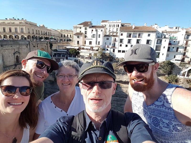
We visited the area back in October 2017, along with two of our sons and one girlfriend. To be entirely honest with you, we were also just trying to spend a week in a warm destination.
But during October the Mediterranean Sea was just a bit too chilly for us to spend all day in. Instead, we decided to do some cultural-historical-geographical exploring, away from the sea.
So we’d rented a little car that we would just about fit into, and headed inland. I seem to remember a VW Golf or something similar. Since it was Spain, it might have been a Seat.
But I digress.
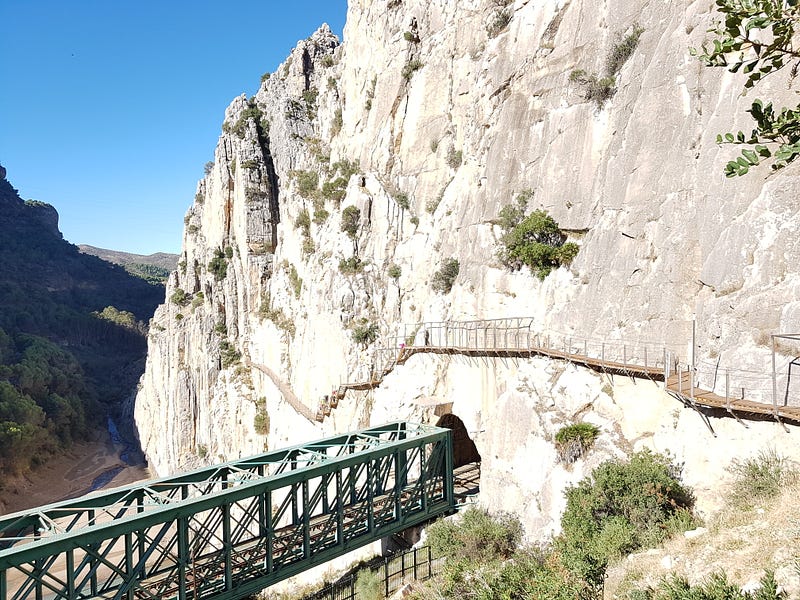
On one day, our travels brought us along some winding roads to the gorgeous gorge of the Guadalhorce River, near El Chorro. Approximately 100 metres deep, with vertical or near-vertical limestone cliffs towering over the river far below, it’s an impressive sight.
The limestone beds had been deposited horizontally during mesozoic times, but were tilted due to the folding that accompanied the formation of the Alps. As a result, we now see vertical layers of limestone.
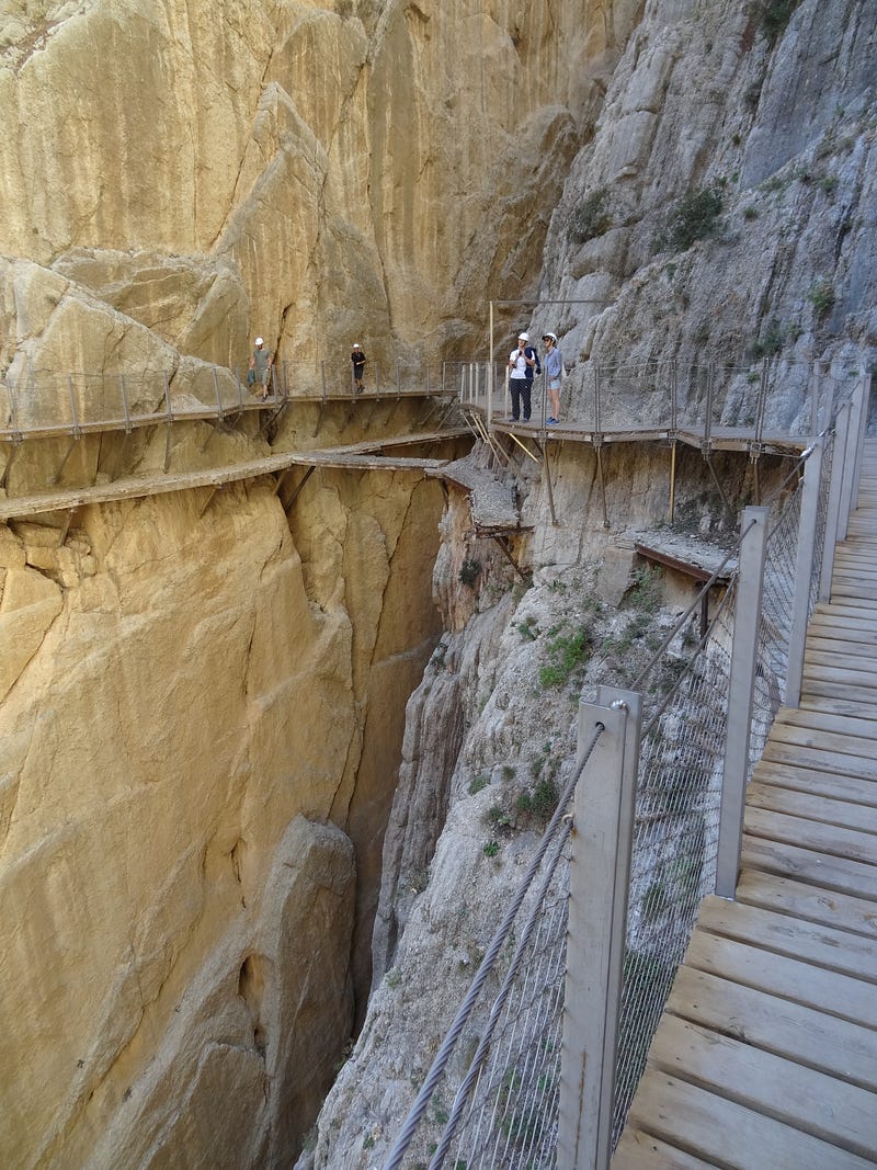
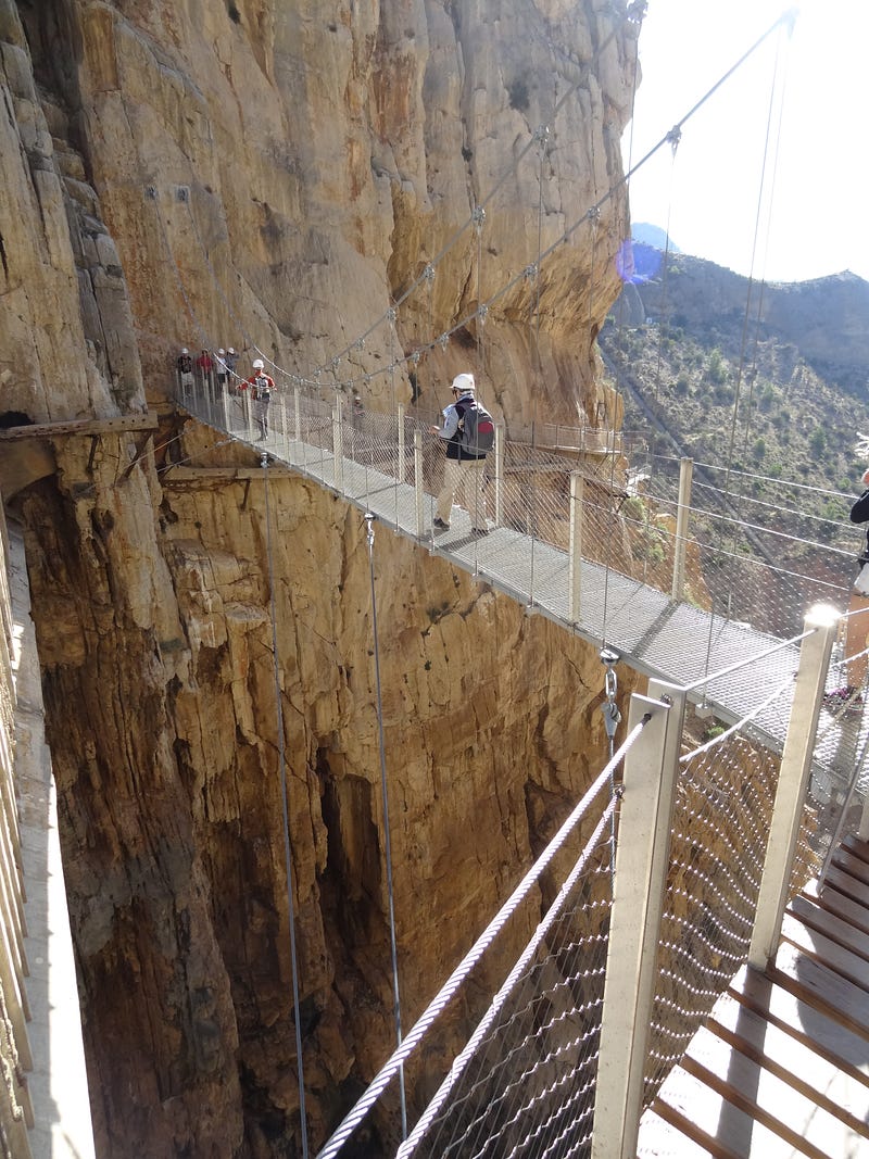
Almost as impressive, though, is the walkway that clings to those vertical faces. This is the Caminito del Rey. It was originally built for maintenance workers to access a hydroelectric dam, construction of which started in 1901. However, after King Alfonso XIII opened the path in 1921, it earned this title of the “king’s little path”.
This must be one of the worst understatements of the last century.
If it had been up to me, I would have found the Spanish words for “the king’s hair-raising, death-defying, vertigo-inducing suggestion for an adventure”. I find it difficult to imagine his Majesty taking “little walks” along the 7,7 kilometres of the original version of that structure!
On the picture below, you can see a section of this walk, with remnants of an earlier version, and a tiny “bridge”, below.
Leaving behind that rather exciting adventure, we also visited Ronda, a town located on very high ground and on two sides of the Guadalevin River. This river flows through the El Tajo gorge, creating a gap of some 120 metres deep between the two parts of town.
I can imagine how this would have been a problem for normal town life.
And so, a number of bridges were built across the chasm. The newest of these, the Puente Nuevo, was completed in 1793, after 34 years of work. If you wonder why it takes so long to build a bridge, take a look at this structure:
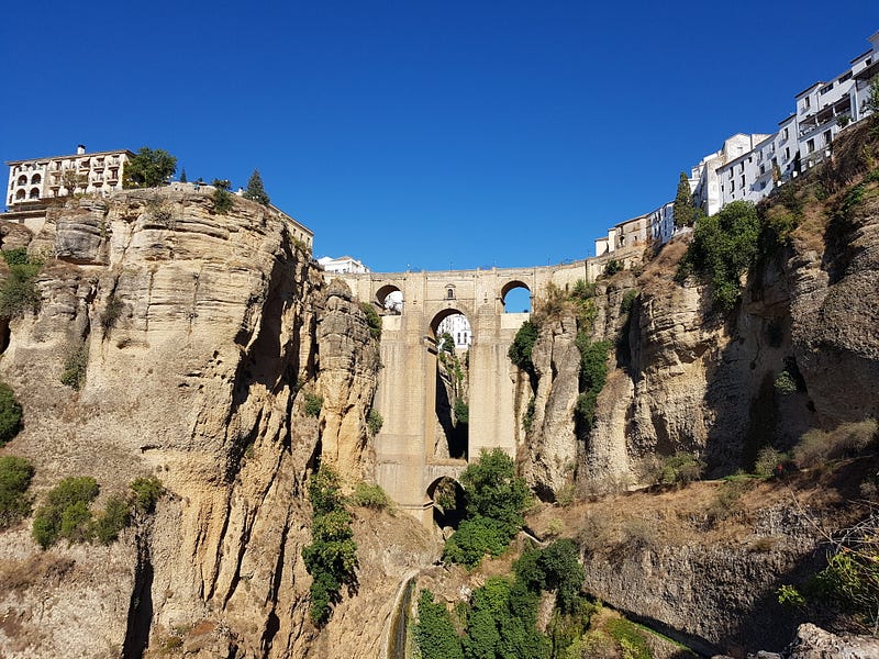
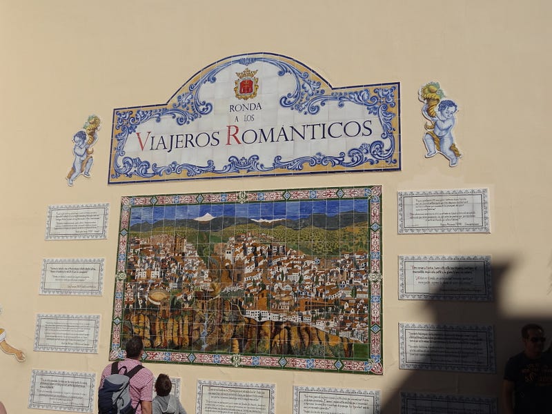
This rather majestic structure clearly provides the town’s major claim to fame. It therefore also features in some artwork seen on a town wall, accompanied by quotations from various famous visitors, in years gone by.
However, not all visitors were so romantic, we heard.
My next image shows a chamber above the main central arch of the bridge. The story goes that during the Spanish Civil War (1936–1939), both sides used this chamber to torture opponents, presumably at different times. Some survivors were apparently ejected to their deaths, below.
Not a very romantic trip, for them.
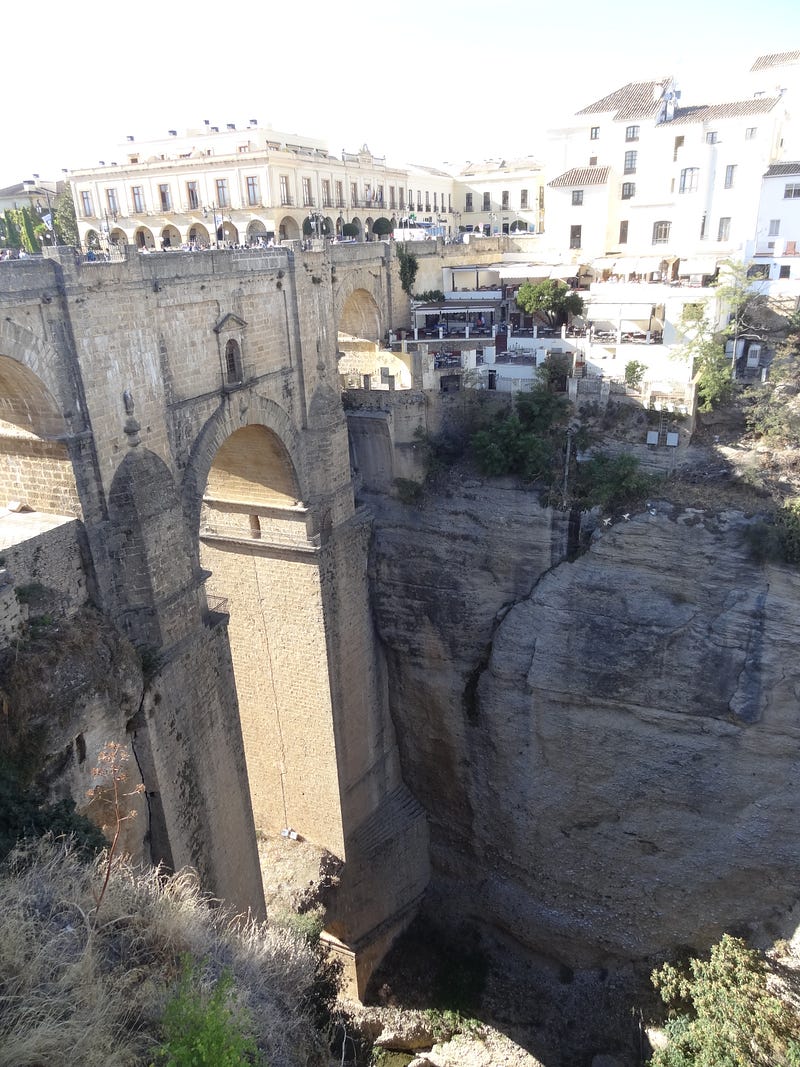
Looking at that massive structure again, I can see why it wasn’t finished over a weekend. But 34 years does seem a bit long. However, we were there in October, hypothetically edging from Autumn towards Winter, and it was hot up there. Perhaps siestas are to blame for slow building progress?
I hope that you’ve enjoyed sharing our visits to a couple of Spanish bridges. Please also have a look at a few more bridge stories and images from the other side of the world, shared by others:
Joe Guay - Dispatches From the Guay Life! writes about various bridges, under cosntruction and completed, with gratitude that the designers were good at mathematics:
Sandy Maximus shares her thoughts of metaphoric bridge crossings, along with images of actual bridges: