GIS
What Is Geographic Information System (GIS)
Everything you need to know about GIS, it's basic working, role in engineering and its applications.
Geographic Information System is nothing but a computer application that captures, stores and displays the various physical and manmade features on the Earth. Starting from mountains to buildings, GIS can map everything and store it in a database(DB). White House defines GIS as “the technology, policies, standards, human resources, and related activities necessary to acquire, process, distribute, use, maintain, and preserve spatial data.”
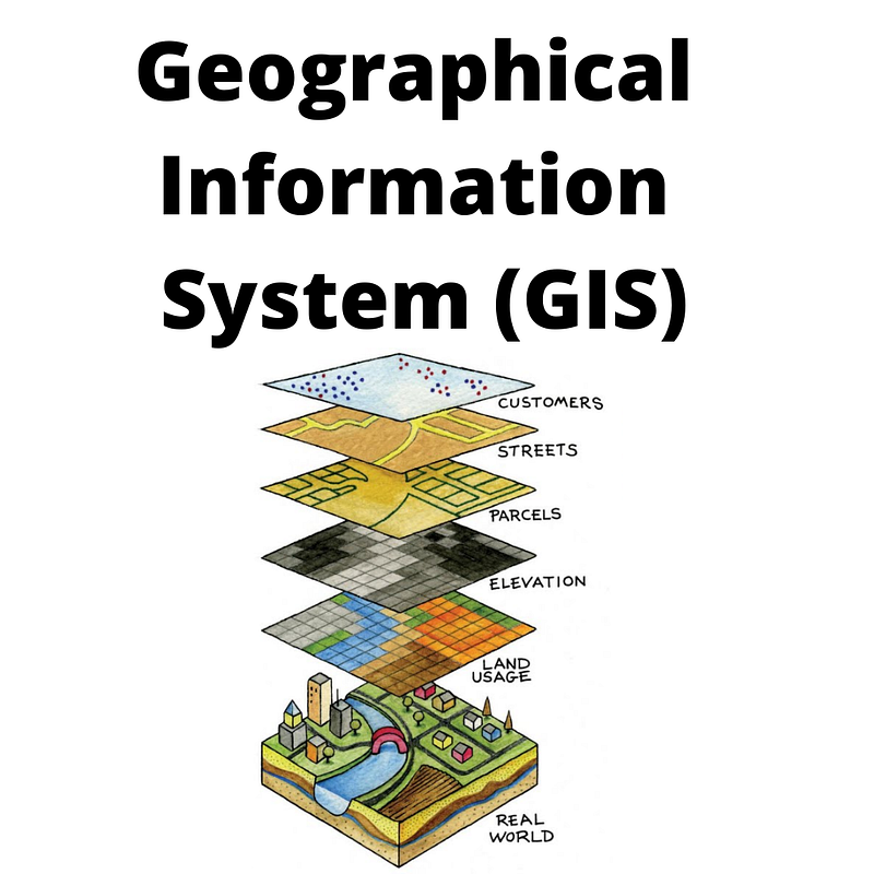
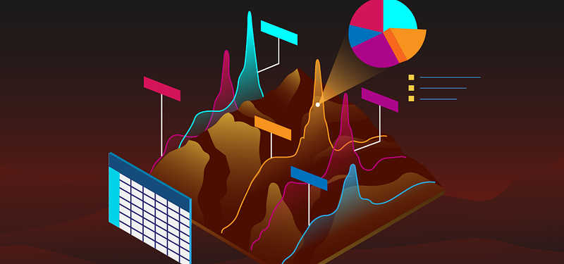
GIS is an integrated system, which utilizes more than one feature at a time. Following is an image for understanding how GIS works.
How does it work?
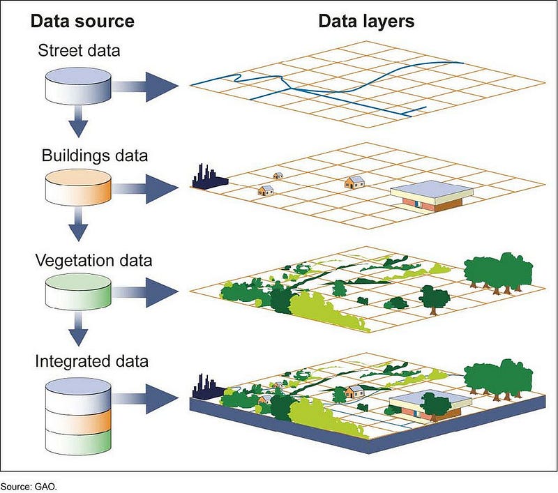
GIS being a Database System can store an enormous amount of data. This includes longitude, latitude, zip code, address for a given location. In addition to those, it can also have the name of the place, population, landscape, types of buildings localities etc. GIS data can be stored either as Cartographic data like maps or as Spreadsheets like MS Excel or even Photographic data. It is the job of Database engineers to fill the GIS with appropriate data.
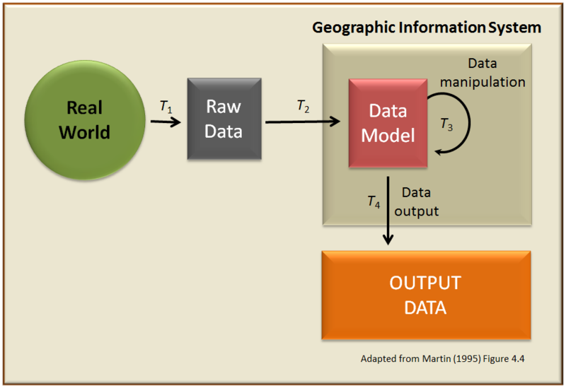
The cartographic data are basically maps. They can be directly entered into the systems. Photographic data requires ariel surveys or ariel photo shoots to be entered carefully. Digital data can be basically more detailed on land use, population, factories etc.
Geoprocessing is the operation known for manipulating GIS data. The input is processed by the system and presented as a useful application for everyone to use. The spatial analysis uses Space-Time of the location and maps it to digital data using a key.
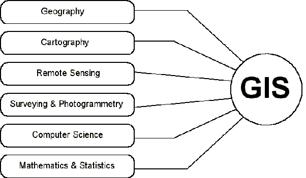
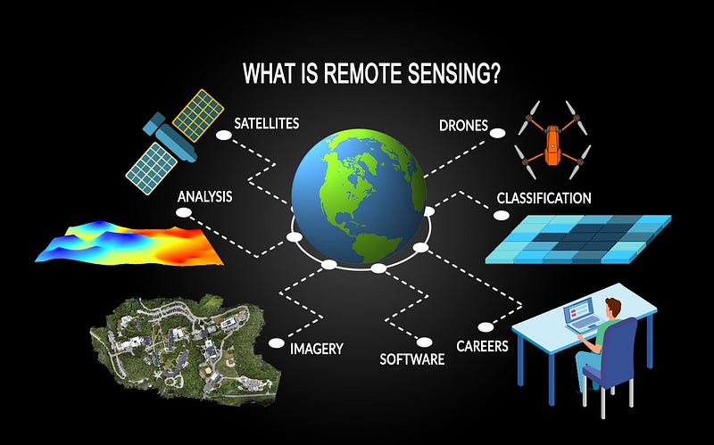
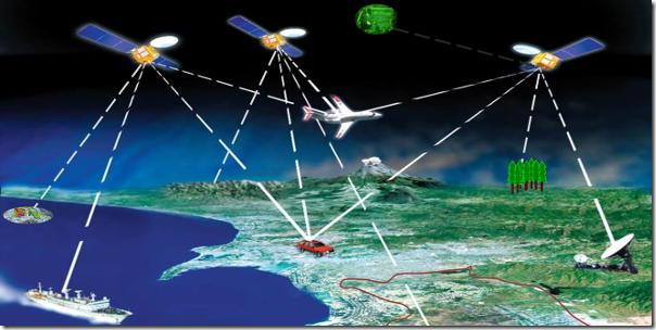
Remote Sensing is a science that is closely aligned with GIS. Remote sensing is the science of collecting data from various sources without any physical contact with the object. A remote sensing satellite is a primary way of capturing data from various locations. Remote sensing is utilised in GIS for obtaining data to be fed to the system. INSAT is India’s first remote sensing satellite.
History of GIS
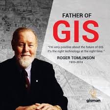
GIS was born when Dr Roger Tomlinson, who is also known as the father of GIS, and a Geographer himself, wanted to make Urban and Rural Planning easier. Spatial analysis is considered to be the major principle behind GIS technology. Later on Wars, the Epidemic prompted technology to be used for various aspects like Nuclear Weapon Research. The first model of GIS was called Canada GIS designed by Dr Roger Tomnilson in 1960. Canada used it for mapping and utilising the resources of Rural Canada ie Soil, agriculture, forests etc at a scale of 1:50,000. With the rise of WWW, GIS became more prominent in many developed countries and now in developing countries.
Difference between GPS and GIS
We often tend to mix up both these terms or may take them as the same. That’s not true. GPS stands for Global Positioning System, which gives the live position of an object on Earth. On the other hand, GIS Software can use the data from GPS and presents you with useful information which you can comprehend and understand. GPS is fully controlled by the Dept of Defence of the United States. It uses the Global Navigation Satellite System (GNSS) for locating your position, especially when you are in a car.
A popular example which we all will be familiar with is Google maps, which utilises GPS data processed using GIS and gives 2D/3D maps which are geographic presentation which we can understand (than longitude, and latitude).
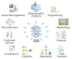
Applications
- Digitalising- In this era, where information is overflowing, we can’t rely upon hard data like book and files. Even the need and requirements for information across the globe is high, so we need a system that stores data and process which everyone can access. It also reduces space and ensures speedy access to data.
- Mapping- To present maps of cities, villages, mountains, factories, buildings etc. This can be used in the time of emergencies like epidemics, wars, natural disasters etc for locating and rescuing people. Urban planning can be effective with help of GIS.
- Borders- For getting an accurate drawing of borders between two countries and establishing border checkpoints and security.
- Pollution and Climate Change- The most affected areas like rivers, factories, cities with bad air quality, can easily be mapped and utilised for analysis. Even places where Humans can physically travel like Polar Icecaps and the middle of Oceans can utilise GIS for mapping and planning future actions. Also, change in temperature and feature fluctuations can easily be monitored.
- Ecology and environment- Forests, deforestation, migratory birds, endangered species, etc can easily be observed and tracked by Organisations and Governments.
- Farming- For precision farming, observing weather patterns, irrigation of crops etc can easily be done using GIS.
- Geology and Astronomy- Nothing in science and technology is confined to the Earth, so GIS can be ultimately used in any celestial object like the Moon, Mars, Venus or Sun. NASA uses image processing technology for the same.
- Military- Militaries across the globe, can use GIS for mapping their bases, warships, aircraft stations, enemy bases, border controls, anti-terrorism, 3D modelling, rescuing civilians, etc.
- Criminology- Crime patterns, Crime statistics in a region, tracking criminals, law enforcement etc can be done using GIS.
- Services- GIS is very much useful for governments in planning services like public health, education, traffic monitoring, transportation etc.
Conclusion
GIS is a binding of technology and geography for the betterment of humanity. It accepts inputs in various forms and gives an appropriate output for us. It has a wide range of applications touching us at every moment. Despite that GIS is not widely known to many. GIS is still an untapped technology and we need to maximise the use of GIS to optimise its applications and make it more beneficial for the world community.