
Mosi-oa-Tunya
Why, how and when the smoke thunders there
When David Livingstone, during his travels across Africa, first saw this waterfall in 1855, he was so impressed that he named it the Victoria Falls, after his queen.
A bit arrogant, really, the waterfall already had a name: Mosi-oa-Tunya, meaning “the smoke that thunders” in the local Lozi and Tswana/Sotho languages. It’s also called Shungu Namutitima or “boiling water” in the language of the Tonga people. Both these names are descriptive and powerful. It’s the former that is more in use, although foreigners and visitors to Zambia usually call it the Victoria Falls.
Pity.
When I read that the Globetrotters monthly challenge for March would be on waterfalls, it was inevitable that I had to write something about these, arguably the world’s most dramatic, and changing waterfalls.
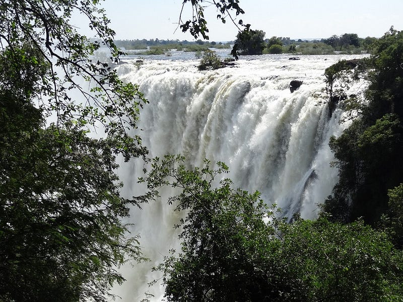
Why dramatic? Well, with a height of more than 100 metres, they do mark the spot where the river, over a width of some 1,700 metres, pours into a narrow gorge and then transforms itself into a narrow torrent that rushes down a series of zig-zagging fissures in the earth. More about that later.
When “Fall” has a different seasonal meaning
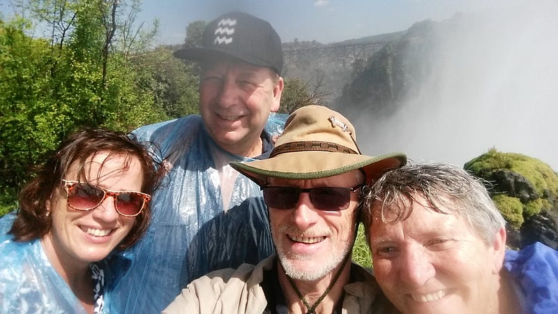
Over the course of the last few years, I’ve been fortunate to visit these waterfalls a few times, at different times of the year. And so I was able to witness the changing character of the river, along with the changing of the seasons.
The main rainfall season in Zambia is between November and April, with the major rains usually starting in the Northwest of the country. Much of these waters slowly flow into the catchment of the Zambezi River. This flows through Angola, back into Zambia, southwards through western parts of the country, turns eastwards where it forms the border with Namibia’s Caprivi Strip, continues to become the border with Zimbabwe and finally reaches the location where smoke and thunder is created. This process takes a couple of months, and peak flow over the Falls is therefore well after the peak of the rainy season.
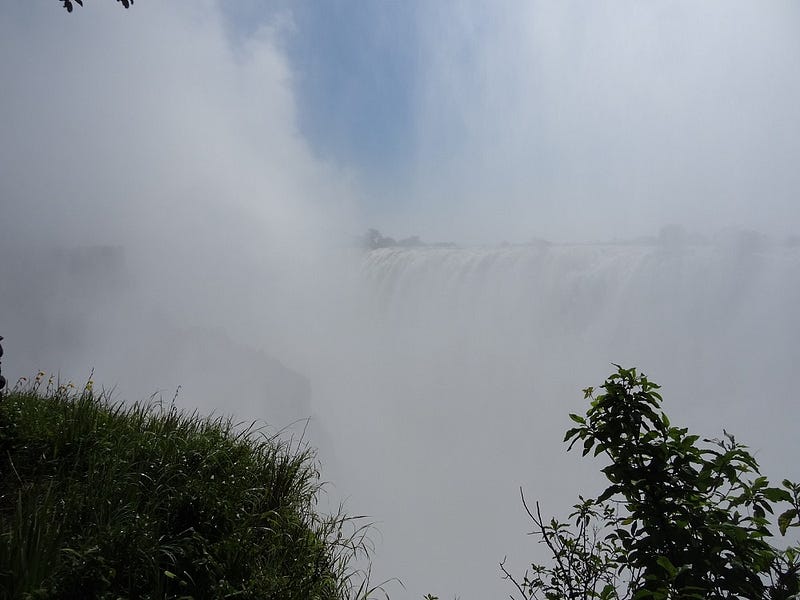
Making a photograph of the waterfall itself, on that date in April, was difficult because it would have been like trying to photograph the inside of a cloud. At that time, the thunder of the falling water and the smoke (spray) shooting up out of the gorge, were all around us. Anyway, the next image shows an attempt.
I’ve also been to the waterfall in drier times, when the wall of basalt rock was clearly visible, only interrupted here and there by streams of water.
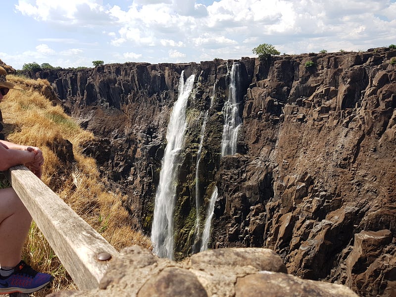
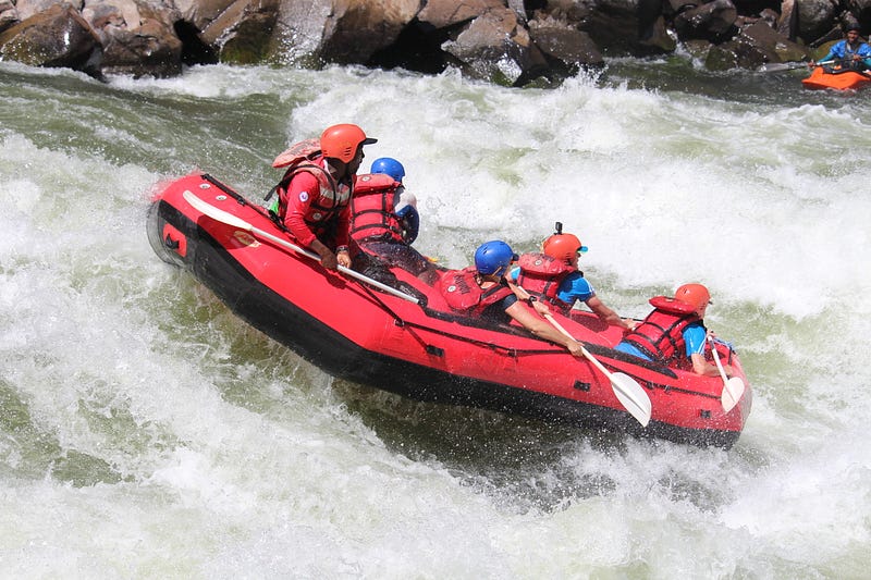
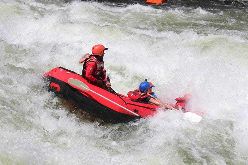
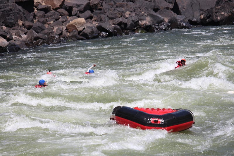
On that particular occasion in December 2018, we were even able to swim in the pool below the waterfall, just before setting off on a rafting expedition through the gorges that the river rushes through, downstream from the Falls.
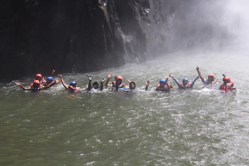
Even in such low-water conditions, the rafting is extremely thrilling. In fact, it’s possible to raft in sections where it would otherwise not be possible.
But I’ve been digressing. What’s the connection between that waterfall and the gorge that provides such thrilling adventures?
Geology determines the location of the river
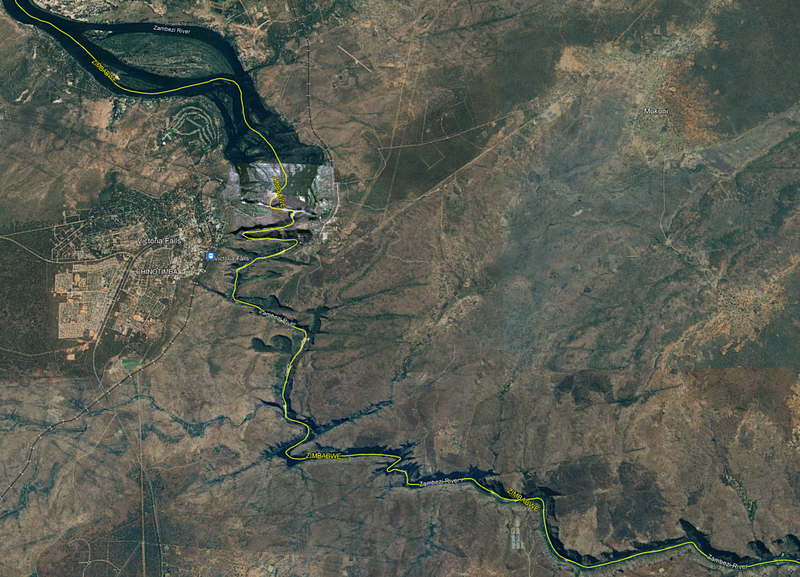
The following two images, screenshots from my laptop, show how the Zambezi pours across a cliff over a very wide front and then disappears into a narrow, zig-zagging gorge. It’s in those gorges that the rafting is done.
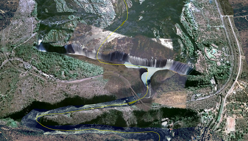
I’ll use the next image, zoomed out from the previous one, to discuss how the waterfall has evolved, why it is where it is and why it looks like it does.
It is clear from those images that the Zambezi River is guided along its erratic way by a series of intersecting fissures in the earth. Rivers in this part of the world have had an interesting history. Some have changed direction, one even flows into an inland delta and disappears into the sand. The flow of the Zambezi has also been affected. It used to flow through today’s Botswana to join the Limpopo River, which is currently the border between South Africa and Zimbabwe.
However, about 2 million years ago, an upward bulge developed in the crust, forcing the river to change direction and cutting off that route to the Limpopo and the Indian Ocean. A large inland lake formed (Lake Makgadikgadi), which had no natural outlet. Eventually, during a much wetter climate, this overflowed to the East, cutting a gorge into the basalts of the Batoka plateau.
Hard rocks acting like toffee
Now, imagine a slab of quite dry toffee, and imagine bending this. (No, not towards your mouth, I want you to imagine what the toffee will look like as you bend the edges downwards.) No doubt, cracks will form on the top of the toffee, and the orientation of these cracks will depend on where you’re holding the toffee and in which direction you’re bending or stretching it.
While you’re now licking the virtual toffee from your fingers, have another look at the previous image. Those diagonal slashes across the countryside are the fissures that resulted when the land was uplifted, with the directions depending on the local direction of the stresses in the Earth’s crust.
The river has been exploiting those fissures, cutting through the layers of hard basalt rock, to create those dramatic narrow gorges. And some smaller tributary rivers have also used those relatively weaker areas, so that the fissures are now marked by greenery.
But that is not the full story.
Wandering waterfalls
Today, we are looking at the thundering smoke of the Victoria Falls during a tiny window in geological time. As those waters roar over the edge and into the pool below, they are slowly carving away at the edge of the waterfall. Looking into that pool, we saw a collection of large and smaller basalt rocks, all of which have tumbled from the edge at some point in time. As a result, the waterfall is very slowly retreating upstream, something called “headward erosion”, a common feature of all waterfalls.
In this particular case, however, we have those intersecting diagonal fissures to complicate the story.
Whenever the retreating waterfall reaches the intersection with the next upstream fissure, the river starts to erode that weaker part of the crust, deepening the channel there. And then, at some point in the future, the waterfall will have moved upstream into a new position and the current location of the waterfall will become the first downstream gorge.
In fact, looking back at those satellite images, we now know that the falls were located in those various gorges during past millenia, and have slowly marched upstream, generally northwards, to their current position.
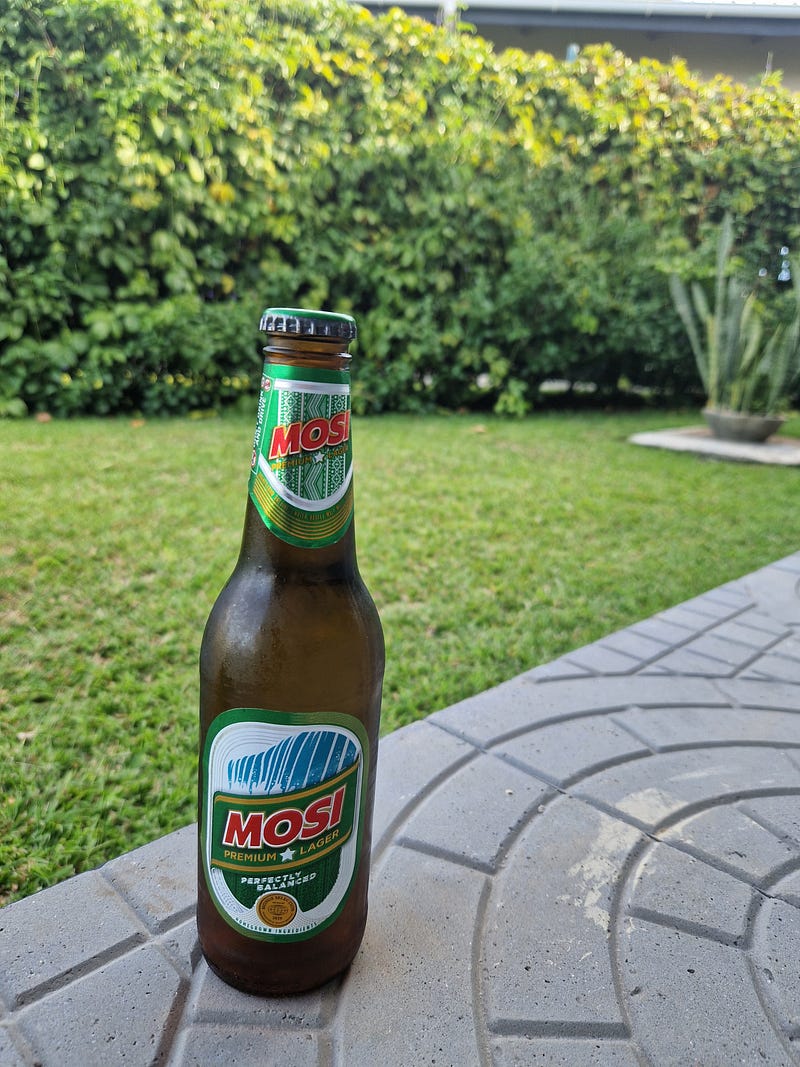
If you’re still with me, and have survived the geomorphological lesson, then you’ve earned a drink! And what could be more appropriate than a cold Mosi?
We humans, rapidly spreading across our planet, should remember that we are fortunate to experience sights like these during our own little time on Earth. Thousands of years into the future, the planet’s landscape will have changed everywhere. Not only due to geological processes, but also since we are driving climate change ourselves. Our descendants, whoever they might be, one day, will not have the same sights to enjoy.
The time is exactly right to plan your own trip to Zambia, where you can enjoy the smoke and thunder (if you time it right!) along with many other waterfalls, National Parks and wildlife, accompanied by cold Mosi, or whatever else you prefer.
Please do have a look at other stories about waterfalls, in different parts of the world! Erie Astin shows us some beautiful falls (and tourists antics) from Montana, USA:
Adrienne Beaumont clearly enjoys swimming below waterfalls! Read all about it here:
To all your other waterfall-lovers, do have a look at the Globetrotters challenge this month, and send us your own stories and pictures:


