
In the Swiss canton of Valais/Wallis
Early winter hike to the Zinal glacier
Short chronicle of a recent hike through rocks, snow, and ice up to the ice cave at the downstream end of this glacier that is quite easily accessible right on foot from a town.
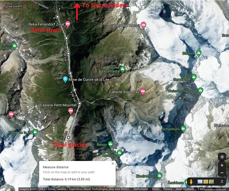
We started this hike from the town of Zinal, above the city of Sierre/Siders where the boundary between the German- and French-speaking regions of this canton stands. In the Zinal area, the language is French. Right on the other side of the mountains the language is German, or rather a (very) local dialect of it. That German valley holds the world-reknown ski resort of Zermatt, with priviliged views of the Matterhorn.
But Zermatt and the Matterhorn are for other (future?) stories. We are here to discover the hike from the town of Zinal, all along the Zinal valley up the Zinal glacier. Once you get to Zinal (one train and two buses from Lausanne, around 2hs and half) you are faced with a hike in this beautiful region, from Zinal town towards the South to the Zinal glacier:
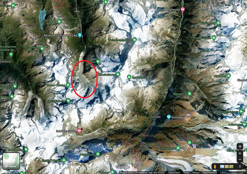
A zoom-out reveals more wonders in the area, where I circled our target:
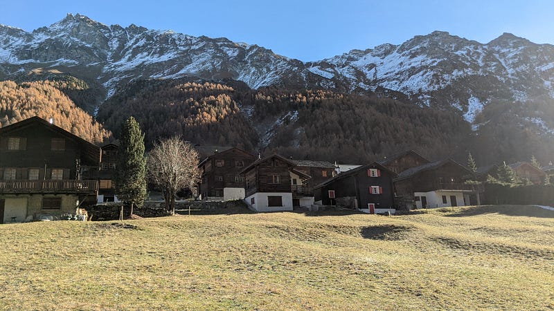
We started walking on a very easy path, just next to a street with a very gentle slope… Here we are leaving the town early in the morning:
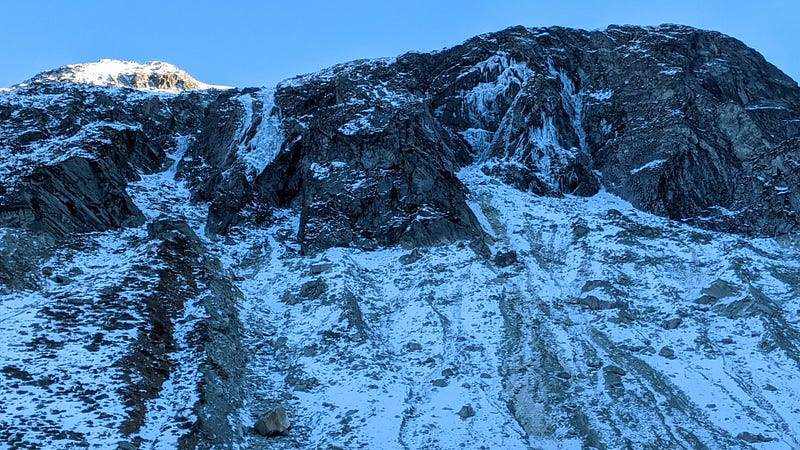
But within just over a km or so we reach the first vestiges of the first snows of the season. Nature looks already cold-dead, and the temperature is very low here where the sun hasn’t yet shined today, but we get these views of the Alps behind:
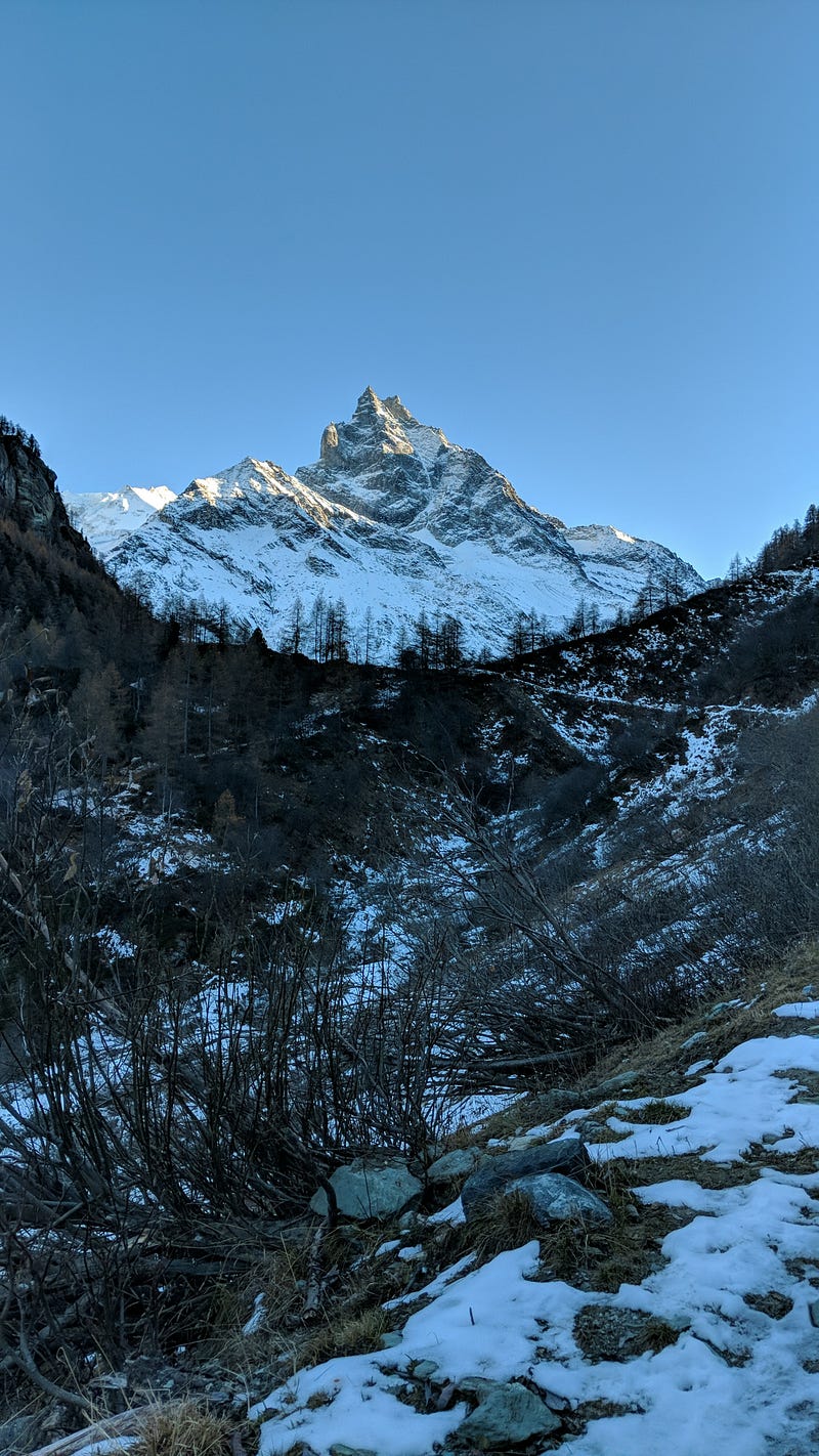
And no, although we are very close to the iconic Matterhorn peak, that’s not it. But this mountain also has a respectable height of around 4000 m.
The walk was still easy by the previous photo, but we quickly needed our snowshoes. Not much because of the snow, but rather because of the ice! Much of it was actually snow that had melted partially and then frozen again tens of times. Whatever, the terrain was very slippery without snowshoes!
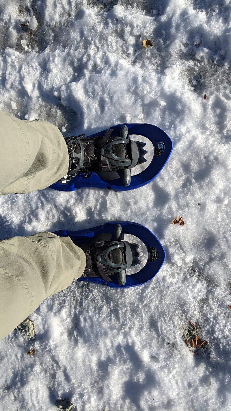
Especially the parts of snow left under the snow are very slippery.
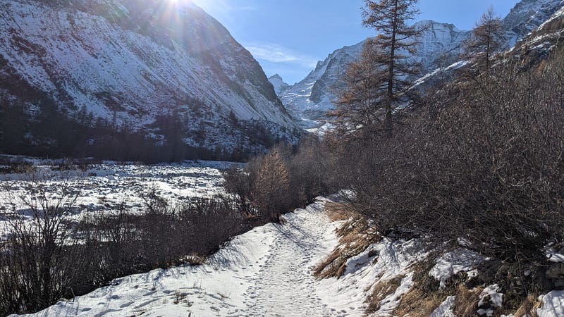
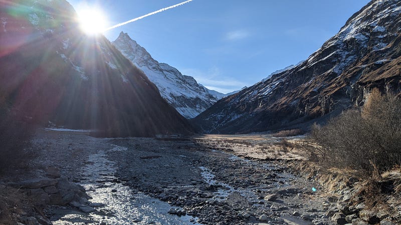
As we walk we get stunning early-winter views:
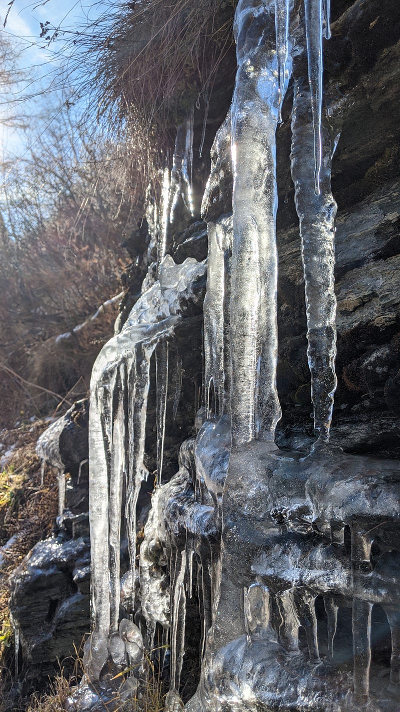
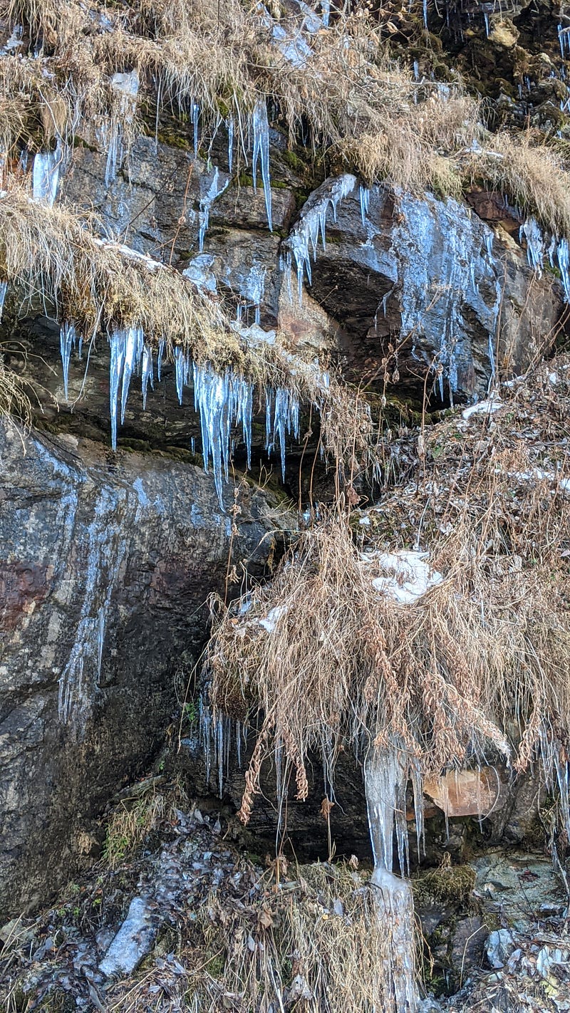
The slope smoothly increases from almost none to some important number of degrees, not too steep but enough to warm us up thus also increasing some degrees in our temperature real feel. However, the stalactites and semi-frozen cascades on the sides of the path remind us that the actual temperature is still below or barely above 0 Celsius:
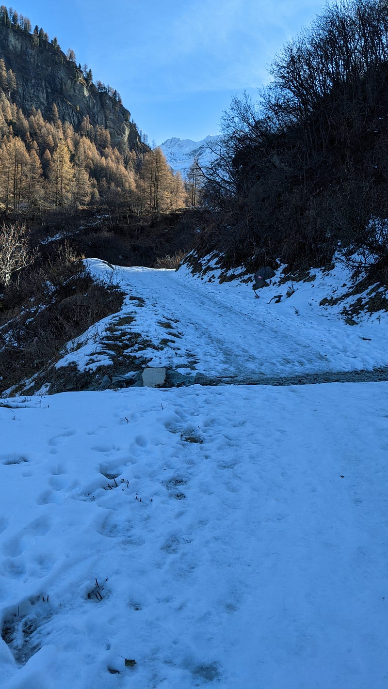
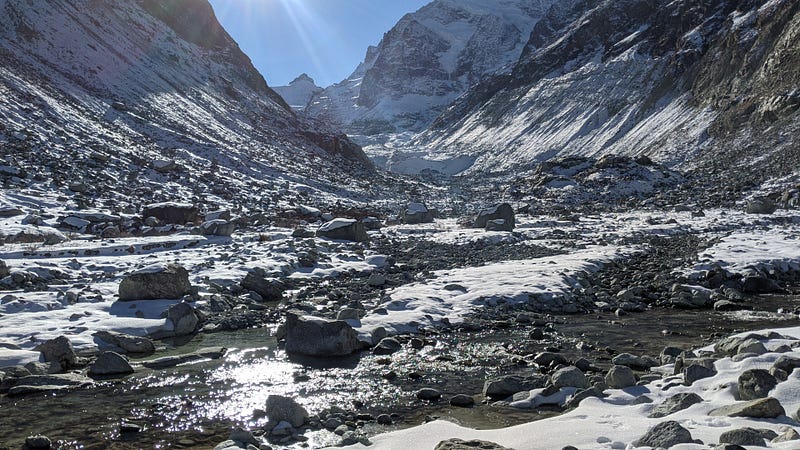
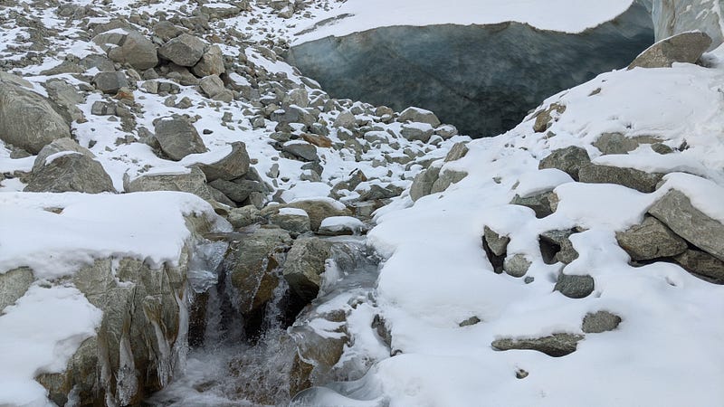
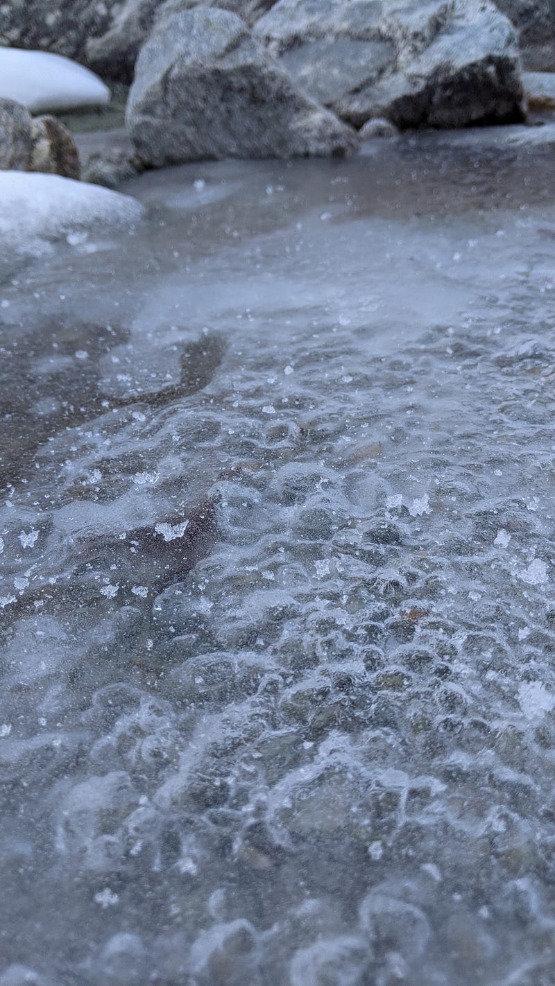
After a few km the hiking trail finishes and we have to keep going along the river, opening our own path through rocks, stones, ice, and snow… The easiest way to keep track of our position is to simply follow the river. It will surely take us to the glacier, because it is actually coming down from it!
Here’s one of the many crosses of the small river:
And here again later on up the valley, with more snow:
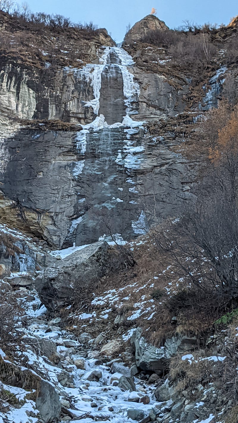
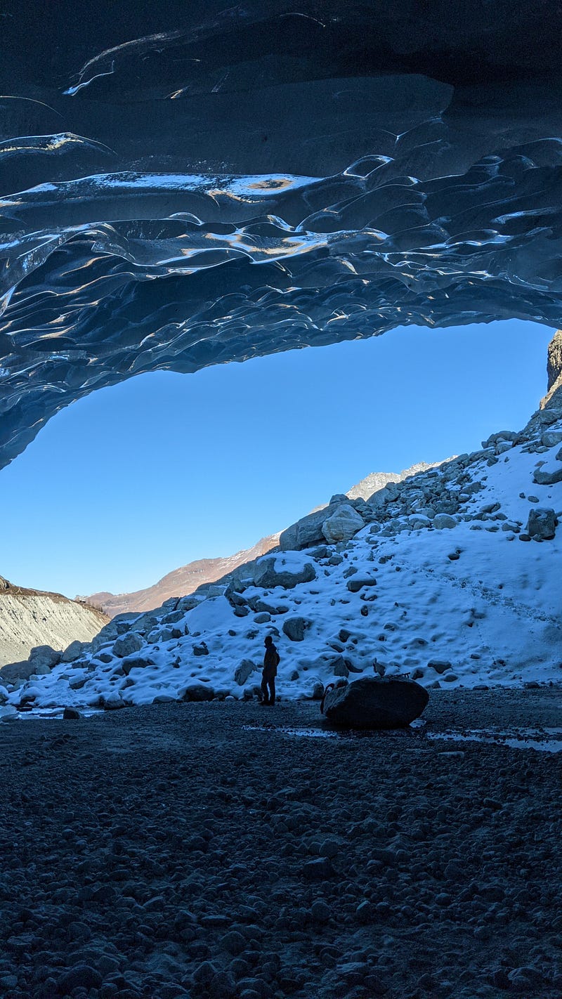
After a small break for a quick lunch, we keep going 20 more minutes and we see it. The ice cave that defines the end of the glacier is just 100 m away:
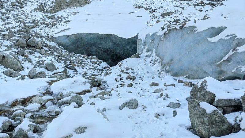
Let’s go in and see what we find…
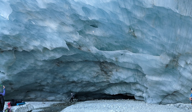
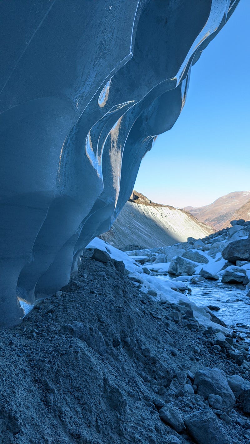
See those lines? They follow the direction of glacier flow. Indeed, glaciers are not static; rather, they are in constant flow as the snow that accumulates at the top pushes the rest of the ice downstream along the valley.
Let’s give a closer look at the end of the cave, where the river emerges:
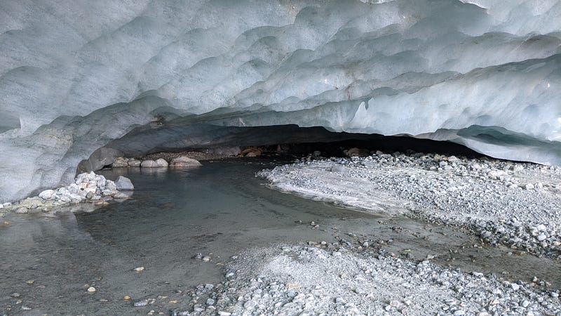
And let’s turn around right there to look towards the exterior:
Wonderful reflections, hues of blues, shapes, and other quite interesting -and beautiful- features that I discussed in this related article, more centered on my photos of the glacier:
Enjoy here some other shots of the glacier, with no words…
Look at these hues of blue, which as I discussed recently is my favorite color:

Time to return. It took us 3 hs to walk up to the glacier, and we barely have 2 hs to come back before the sun hides. We started walking steadily, again through the rocks and snow.
In the hours of maximum temperature, which reached under the sun around 8 Celsius at around 13–14 hs, the snow and ice had melted; however, by 16 hs it is already very cold in the shadow so many parts of the floor are covered in freshly formed ice:
On the sides, the mountains also have no sun by this time of the day. Cascades are frozen, for real but also “in time”. A good part of that ice will remain there for a few months until it melts the next spring. These peaks reach from 3000 to 4000 m, so the temperature is quite low up there:
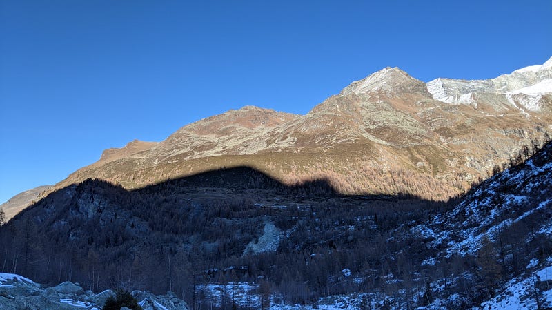
We rush against the sun. The highest mountains of the Alps have already hidden the sun until tomorrow inside the valley, and every time we look at the projections of the shadows on the nearby mountains it is obvious that the sun is lower and lower.
Want to see photos only? Oh, and also other nice photos I shot in previous winters? Check these out:
I am a nature, science, technology, programming, and DIY enthusiast. Biotechnologist and chemist, in the wet lab and with computers. I write about everything that lies within my broad sphere of interests -the @lucianosphere. Check out my lists for more stories. Become a Medium member to access all its stories and subscribe to get my new stories by email (original affiliate links of the platform for which I get small revenues without special costs to you).
For inquiries of all types, contact me here. For small jobs (on programming, data analysis, cryptocurrencies, biotech + bioinf project evaluations, science outreach + communication, molecular data analysis and design, molecular graphics, photography, moleculARweb tutorials, science teaching and tutoring, etc.) check my services page here.


