
A Vertical Road Trip of America — The Great Plains
Part 2 — New Mexico and Oklahoma
We all know a transcontinental trip is going across the country. But what’s the opposite of that? There is none! I chose vertical because no other word came close.
This road trip started in Albuquerque, then went east to the Oklahoma Panhandle, then up the Great Plains to near Canada. After that, I went through Montana, Wyoming, Colorado, and back home on the return.
I wanted to avoid interstate highways as well. But, of course, the good stuff is always on roads less traveled. It’s impossible to avoid them, such as my start on I-25 out of Albuquerque. But it was only 190 miles to my exit in Springer, NM.
As described in Part 1, I wanted to avoid people and crowds. However, if you are interested in geography, geology, flora, and fauna, this is a good trip for you. So come on, let’s go!
New Mexico
Once you exit onto US 56 east from Springer, say goodbye to the mountains. You are now on the high plains. The Great Plains. For the next 82 miles (or thousand, depending on how you look at it), you’re amid undulating hills of short and mixed grass prairie. There are no trees except for scattered juniper and pinon around the slightest elevation changes. If you look closely, you’ll spot the occasional pronghorn antelope near the highway. However, don’t expect to see herds, as that behavior only occurs in the winter.
There’s little oncoming traffic except for the trailers and RVs from Texas in search of cooler weather in the mountains. The only places this road goes are the Oklahoma and Texas Panhandles. I often like to listen to NPR on the road, but there is nothing to hear on either band.
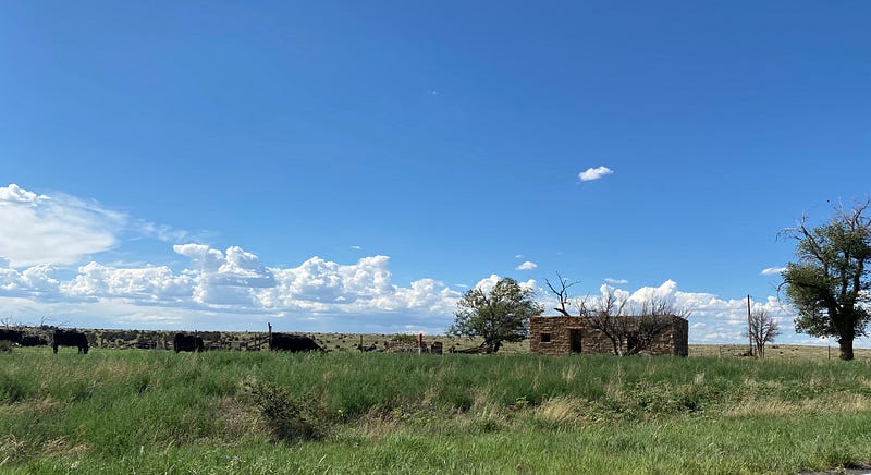
And if you thought that was a lonely drive, the next segment will seem like you’re the only person alive! Grab any last-minute supplies you might need in Clayton, as there are no services from there. After you pass Clayton, you’ll turn left onto State Route 406. On this portion, The Santa Fe Trail makes many crossings. Then, suddenly, you’ll be in an area of canyons and mesas. And I almost guarantee you that you will see no oncoming traffic.
When the road comes to a T, turn right, and you’ll be in Oklahoma in one mile. “This doesn’t look like Oklahoma,” you’ll be thinking, because it doesn’t.
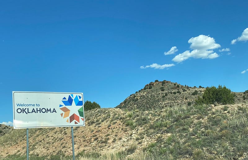
Oklahoma
All I’ve seen of Oklahoma constitutes Route 66 from the Kansas line to Tulsa, I-44 from the Missouri line to Oklahoma City, and I-40 from there to the Texas line. I once had to overnight in Weatherford because of an ice storm. My ex-wife and I were caravanning with my in-laws. Imagine my delight when I saw them spin out in my rearview mirror!
Kidding. I did like them. I think they liked me better than their daughter.
The Oklahoma Panhandle, a bunch of nothingness, is 166 miles long and just 34 miles top to bottom. Originally part of Texas territory, the Missouri Compromise of 1820 stated there to be no slavery north of 36°30’ latitude, which is the Panhandle’s southern border.
Even the Oklahoma Tourism and Recreation Department calls the Panhandle “No Man’s Land,” and there is a museum of the same name in Goodwell.
How many times have you been to a state’s highest point? Yeah, me neither. So I decided to “conquer” Black Mesa, Oklahoma’s highest at 4,973 feet.
But it was nearing the end of the day, so I set up camp at Black Mesa State Park, just a few miles from the mesa. I highly recommend this campground, as it was spread among rock formations and shady trees. It had a little store stocked with the essentials of life and brand new, real toilets and showers! The fly factor was high, but they went to bed at sunset. I didn’t detect any mosquitos, and the ant factor was relatively high, but they weren’t bothersome.
Like most campers, I woke up at about 10:00 am! So much for a cool-of-the-morning hike. The forecast high was 93°. I set out at noon for the 8.4-mile in-and-out trek with three 24 oz. bottles of water. It was a guess.
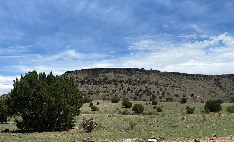
This hike is generally noted as moderate and takes 4–6 hours. For who? This mesa became a monster! There were a couple of ascents that were very steep and rocky. I almost gave up on the second one until I could see flat land at the top. I was on the mesa! But it would be a good mile further until I reached the “summit.” There, an obelisk marks the high point. Each side points in the direction of the four nearby states. The side that points west says that New Mexico is only 1,299 feet away! I’ve gone nowhere.
I sat there for a good 45 minutes until I found the energy to walk down. Everything was sore, I was tired, it was hot, and the water was dwindling. But I’ve been the subject of a search-and-rescue before, and I was not going to let it happen again!
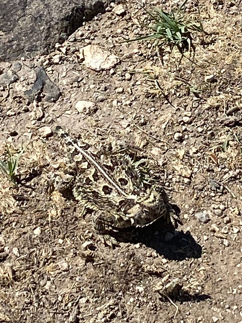
The high point, pun intended, was seeing a horny toad. I loved catching those reptiles as a kid; they’ve become so rare. I wanted to catch it, but I just stared at it for a while and continued on my way. I stopped and rested when I’d pass a juniper with some shade and was becoming delirious by the time I got to my car, gulping down a good half-gallon of water. Four bottles next time. That hike took seven hours.
Once a few miles east of the Black Mesa area, you meet the real Panhandle, in all its flatness. The road from Boise City to Guymon (at a population of 11,442, the largest town in the Panhandle) is straight as an arrow. Once in Guymon, I stopped at an Allsup’s to get one of their beef and bean burritos. Ever had one? They say they’re world famous! Next, I stopped at a little boutique and bought some stupid tchotchkes for some people I know from Oklahoma.
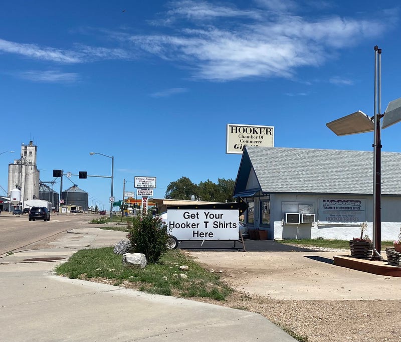
From there, I proceeded northeast to Kansas. But not before I passed Hooker! I would have taken a picture of the sign at the city limits, but there was none. It’s probably been stolen a few too many times. I didn’t even buy a t-shirt. I probably have one hundred t-shirts, and I didn’t feel like wearing one that said “Hooker.” I’m a dignified gay!
Next time we go up, up, and up, almost to Canada!
More in travel by Arthur Keith:
Like what you’re reading? Consider subscribing to Medium. For the price of a monthly magazine ($5/month), you’ll have access to all of my stories and thousands of other writers. And I’ll get a wee bit! Just click the link below.