
Travel. Adventure. Wilderness. Nature Photography.
A Wilderness Canoe Trip in the Boundary Waters
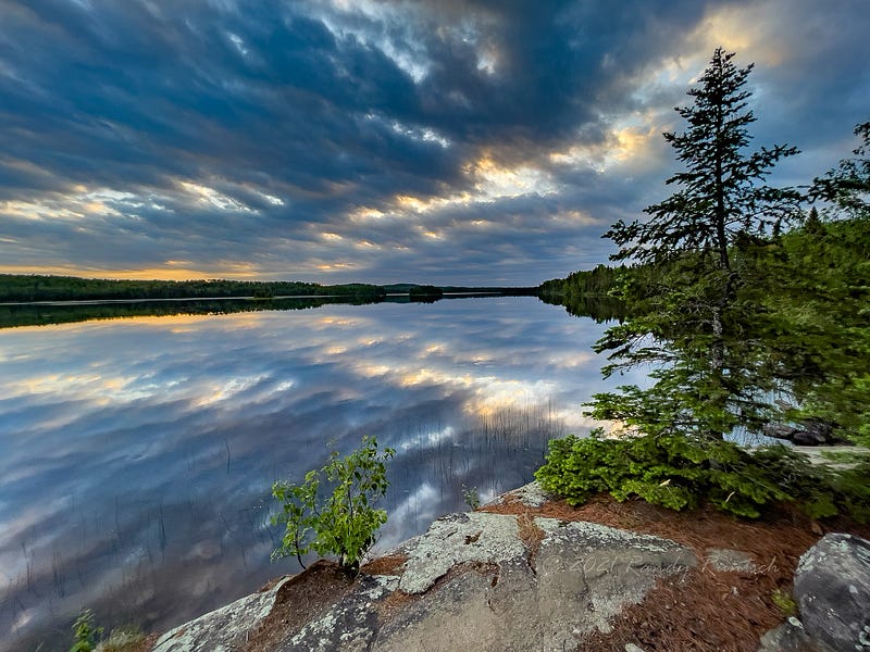
The Boundary Waters Canoe Area in northern Minnesota features over 1,100 lakes to explore by canoe.
“A wilderness, in contrast with those areas where man and his own works dominate the landscape, is hereby recognized as an area where the earth and its community of life are untrammeled by man, where man himself is a visitor who does not remain.” — Howard Zahniser
In Northern Minnesota, along 150 miles (241 km) of the United States’ border with Canada, lies the Boundary Waters Canoe Area Wilderness (BWCAW). The BWCAW, better known as the BWCA or the Boundary Waters, features over 1,100 lakes in its 1,090,000 acres (4,400 km2). More than 150,000 people visit this pristine world-class wilderness area each year for recreation and adventure. Most travel by canoe.
The land of the BWCA was shaped by sheets of ice that repeatedly scoured the ground over the past two million years. When the last glaciers retreated about 17,000 years ago, they left depressions that later filled with water to form lakes.
In the 1900s, various forces, including conservationists, locals, politicians, and logging and mining companies, struggled to define the permissible uses of the area. Finally, in 1978, the U.S. Congress passed the Boundary Waters Canoe Area Wilderness bill. The regulations limit motorboat and snowmobile use, recreational access by a permit-based quota system, and logging and mining within the area.
Almost 20% of the BWCAW’s area is water surrounded by forests. The boreal forest of the region, sometimes called the “North Woods,” consists of various coniferous trees, including red pine, jack pine, white pine, balsam fir, white spruce, black spruce, and white cedar, and deciduous trees, including birch, aspen, maple, and ash.
Paleo Indians occupied the north country in about 8,000 BC. Archeologists have found pottery and clay pipes made by Later Woodland Indians in the area. Later, Sioux Indians sparsely populated the area. They moved west when the Ojibwe displaced them. The area became part of the homeland of the Ojibwe, who traveled in birchbark canoes.
The first Europeans traveled through the BWCAW area in the late seventeenth century. As the fur trade developed, voyageurs started to paddle their long canoes through the area a century later. They mostly hauled beaver pelts for the North West or Hudson’s Bay companies. The furs were destined for garments and hats in Europe.
The BWCAW is home to various wildlife, including black bears, deer, moose, beaver, muskrats, bobcats, timber wolves, weasels, river otters, bald eagles, and peregrine falcons. In addition, wilderness travelers often hear calls of the common loon, Minnesota’s state bird.
Today, wilderness travelers must obtain a permit to enter the BWCAW. There, they can paddle on some of the 1,200 miles (1,900 km) of canoe routes and camp in any of the 2,000 designated campsites.
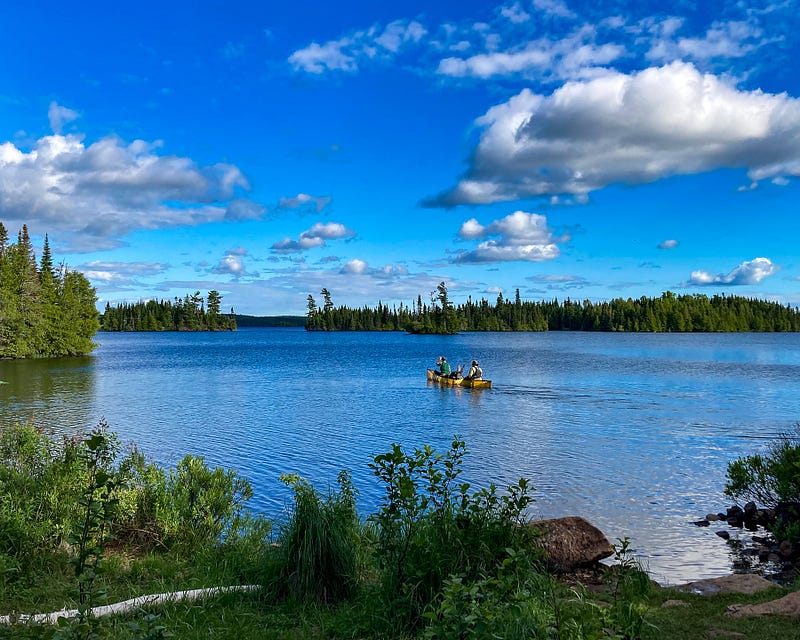
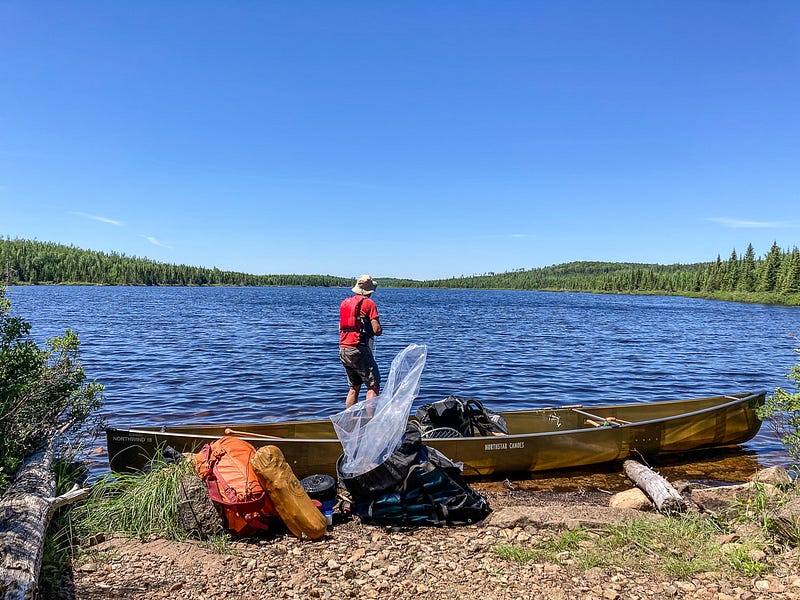
For our most recent five-day trip to the Boundary Waters, my oldest son Nick and I entered the wilderness on Brule Lake. Unlike most entry points, there was no portage from the beginning. Instead, we simply set the canoe in the water and loaded it with our packs, fishing gear, and paddles. Then, we paddled across the sky blue waters to our desired campsite, situated on a rocky point on the east end of an island.
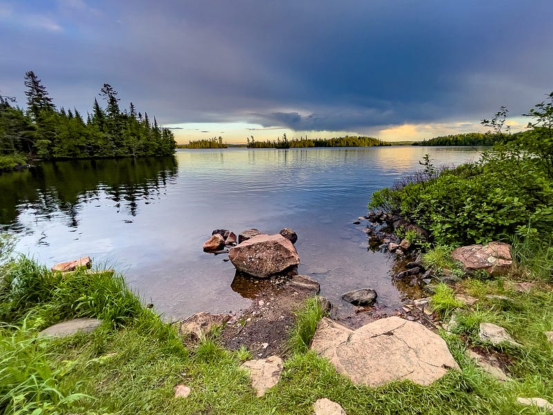
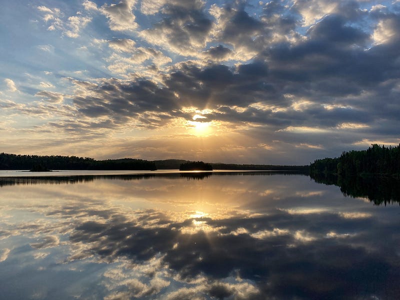
At about 2 x 8 miles, Brule Lake is considered big water in the BWCA. As a result, even a light breeze raise whitecaps waves. Heavy winds can make the crossing risky. But today was calm and the paddling trouble-free.
After an hour of paddling, we discovered that the chosen island campsite was occupied. Fortunately, the map showed four sites in Cone Bay, all within a mile of the island.
As we paddled along the bay’s shore from east to west, we saw that the first site was taken. Moving on, we noticed that the third and fourth sites were occupied as well. Since it was supper-time, and the following site was several miles west, we landed at the open site and set up camp.
We slept well that night. Then, as we paddled and fished in Cone Bay in the morning, we observed a loon as it swam with four chicks riding on its back.
That afternoon, two rangers landed their canoe at our site. They told us they traveled on a planned route during an eight-day maintenance trip to travel to clean and repair campsites. After we chatted, they paddled away to their camp for the night.
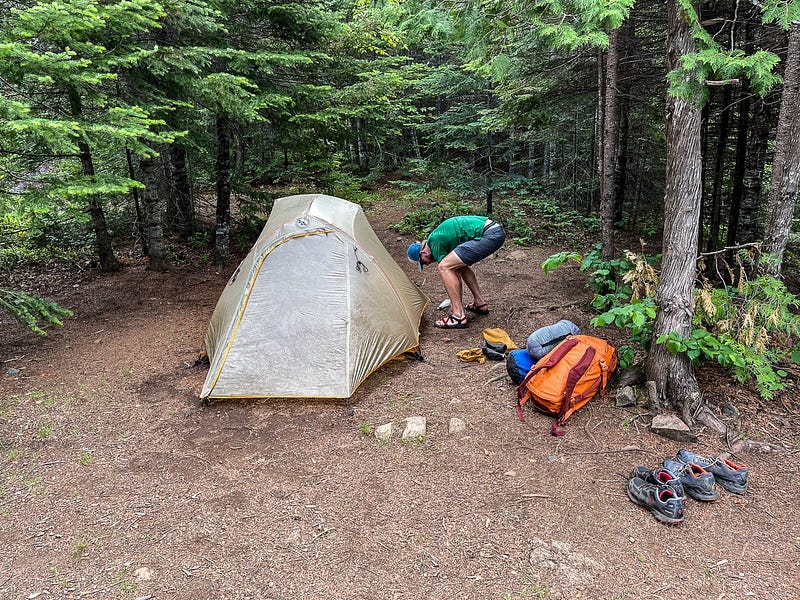
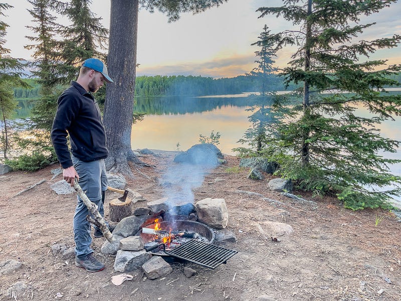
Nick and I naturally divided up camp chores each day. He insisted on setting up the tent and starting and tending the campfire. My main jobs were to cook, clean fish, and wash dishes. We kept the camp neat and clean at all times.
For supper on our first night, I had seasoned and wrapped pork chops, sliced potatoes, and sliced onions in many layers of aluminum foil. While the firewood was soaked from a morning rainfall, Nick eventually started a hot fire to cook the meal. We enjoyed the hearty meal on the log benches placed around the fire ring.
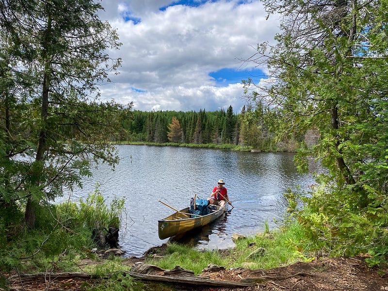
After two nights of camping and fishing on Brule Lake, we paddled west several miles to the portage that leads to South Temperance Lake. The portage route was marked as 10 rods (one rod = 16–½ feet) in length on the map. Instead, it was a short walk of 5 or 6 rods.
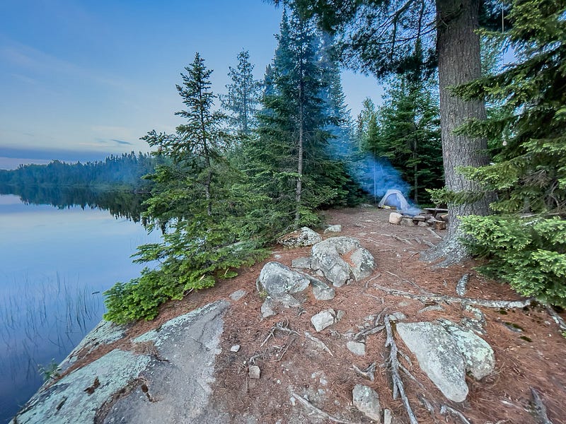
Unlike the 27 campsites on Brule, smaller South Temperance featured only three. I had read positive reviews of a campsite that overlooked the lake from a low cliff on its southern shore. But as we approached the site, we spotted a tent and canoe. Unfortunately, the camping sport on the north shore was occupied, too. Nevertheless, we were relieved that the excellent site near the portage was available. It had views of the water on three sides.
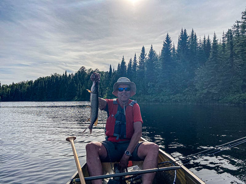
Fishing was slower than on previous canoe trips. Over our five days in the BWCA, I caught seven fish, including three bass, three northern pike, and a walleye. Sadly, Nick caught none but lost a couple of nice fish when his line broke. Still, we enjoyed a couple of meals that featured fresh fried fish.
While we enjoyed our trip into the BWCA, we craved adventure. We planned the short paddling routes assuming that fishing would be better. We agreed that our next trip would involve longer distances, which would mean more exercise, varied scenery and portages, and less quiet time in camp.
On our last full day in the Boundary Waters, we paddled 12 miles on South Temperance Lake, Brule Lake, Juno Lake, and Vern Lake. We planned to camp on Vern, but all campsites were taken. So, we continued to Homer Lake and set up camp at the site where we had camped on our last trip three years earlier.
While still located within Superior National Forest, our campsite on Homer was about a mile outside of the BWCA boundary. So, unlike those in the Boundary Waters, it featured a little picnic table. This feature added comfort to our otherwise primitive campsite.
In the morning, we broke camp and paddled to the Homer Lake entry point. I waited with the canoe and gear while Nick ran 1.7 miles to the car parked at the Brule Lake entry point. After he returned with the car, we loaded it up and made our way home.
Nick and I hope to return to the Boundary Waters soon. While we enjoyed this trip, we will liven up the next one with more time paddling from lake to lake and camp to camp.