
What’s at the Top of a Mountain?
You, a whole lot of air, and maybe some realizations
In the northeast corner of Utah, rising out of the Uinta Mountain Range, sits a special mountain named King’s Peak. The mountain is named after Clarence King, a surveyor and the first director of the United States Geological Survey. This mountain’s peak brings hordes of backpackers, hikers, and trail runners to its summit every year, despite its trailhead being 40 miles down a bumpy dirt road, remotely nestled at the north edge of the Uinta mountain range. It’s not particularly easy to get to, especially for those who live in Utah, so what is it about this summit that attracts so many people?
The answer may partly lie in its elevation. At 13,530 feet, King’s Peak is the highest point in the entire state of Utah, even if only by a mere 20 feet. Of all the places one could stand in Utah, this one would be the closest to the sky.
The trail to climb King’s Peak is not short. From the popular Henry’s Fork trailhead, it’s 14 miles of hiking to the summit, making a roundtrip from the trailhead to the summit and back about 28 miles. Tackling this distance and elevation in a single day is certainly doable, but hardly enjoyable. A two-day trip sounds much better, with camping either at Dollar Lake, surrounded by the silent swaying pine trees, or closer to the summit in Painter Basin, where the sunsets and sunrises slowly reveal the vibrant colors of the basin with a sprawling yawn of light.
Day 1
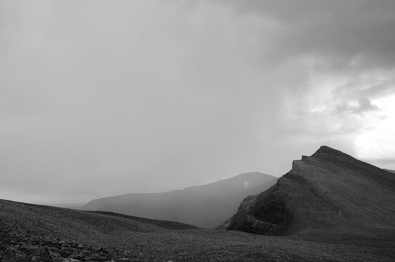
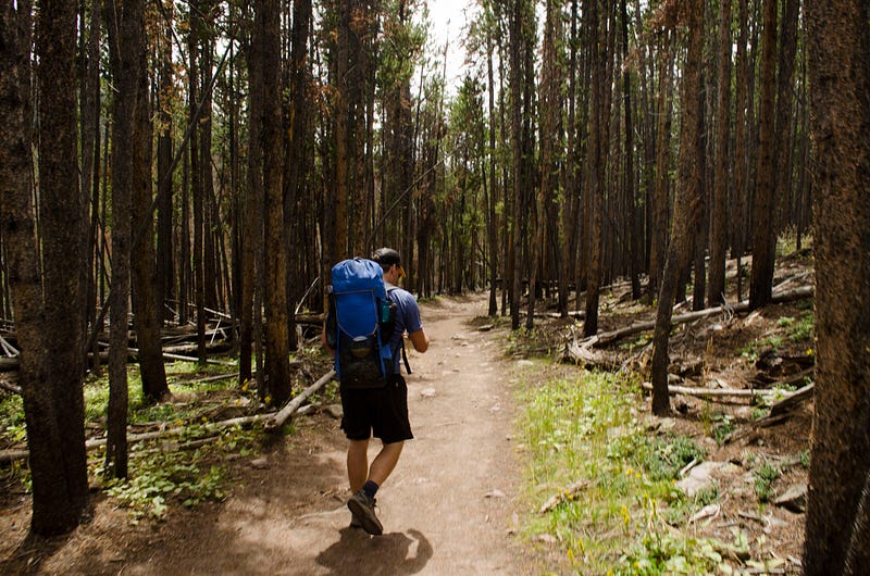
Hiking from the trailhead starts with a somber walk through a dying forest. Western Bark Beetles are eating the souls of these ancient pines, leaving lifeless timbers that bleed orange sap. Eventually, a river crossing or two marks an emergence from the tree cover where you’ll be able to see the mountain ridges that form this long but thin basin. You’ll have to keep an eye on the sky from here on out, as you will have very little tree cover and sudden thunderstorms frequent this end of the Uinta Range.
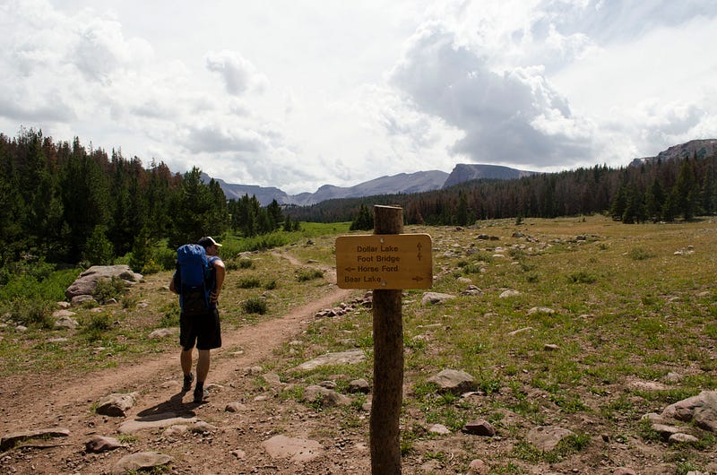
On your way south, you will walk by many dense, secretive groupings of pine trees, and wonder what they are concealing amongst themselves. Within one of these tight groups of timber is Dollar Lake where you could choose to camp if you could find a site. But, beware, camping here leaves you with a long day of hiking tomorrow.
You’ll continue your journey towards Painter Basin, starting with climbing Gunsight Pass. A steep collection of switchbacks leads slowly to the top of the pass. From here, the views of Painter Basin ahead and Henry’s Fork Basin behind show you how far you’ve already come, and how far you have yet to go.
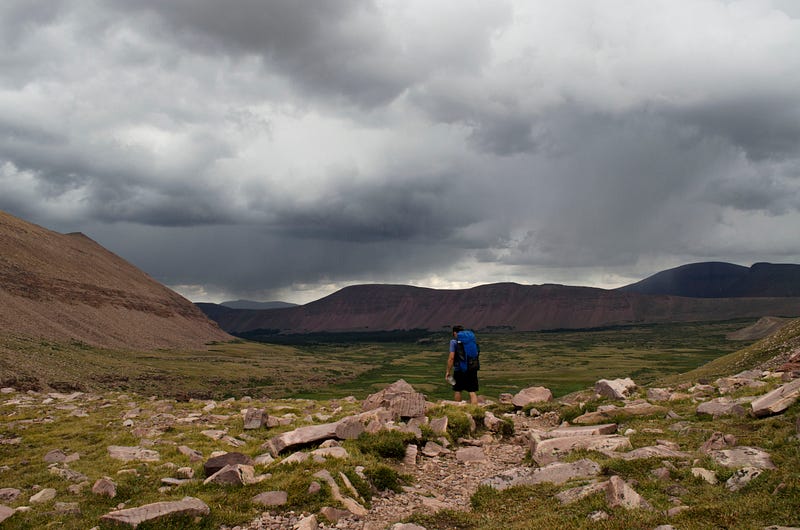
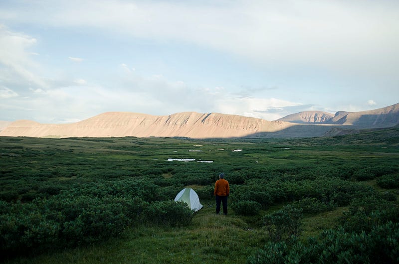
You’ll descend the pass into Painter Basin, keeping an eye on that dark mass of clouds in the sky. A handful of miles into the basin you’ll find a branching creek and your choice of campsites to set up a tent and prepare for the hail that is coming your way. Hunker down in your nylon shelter, maybe even cook a meal, you’ll be sleeping here tonight. The sunsets in this basin are unforgettable, so be sure to grab a good seat in the grass once the storm passes.
Day 2
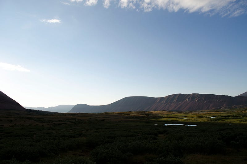
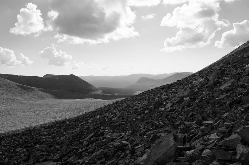
You’ll want to be out of the tent early for the sunrise as it paints the basin in bright orange light. Sip your coffee and break down camp while you watch the basin wake up with the warmth of the rising sun. You’ll have to decide whether you want to stash your pack somewhere while you hike to the summit, otherwise, you’ll be carrying that weight up to the peak. Rejoin the trail and march west towards Anderson Pass. After a mile or so you will start climbing the pass to the saddle. Watch your step from here on up, you’re entering an area of scree and loose rock. Your ankles will be vulnerable all the way up and down this mountain.
Once you’ve conquered the pass, you’ll head up the ridge to the south, rock hopping your way to the peak. As you scramble over the rock, it’ll occur to you that this entire mountain is just a massive pile of loose boulders. On your way up the side of the mountain, you will encounter several false summits. Don’t let your motivation crumble when you discover you’ve got further to go. You’re closer now than you’ve ever been, and you can repeat that mantra with every step.
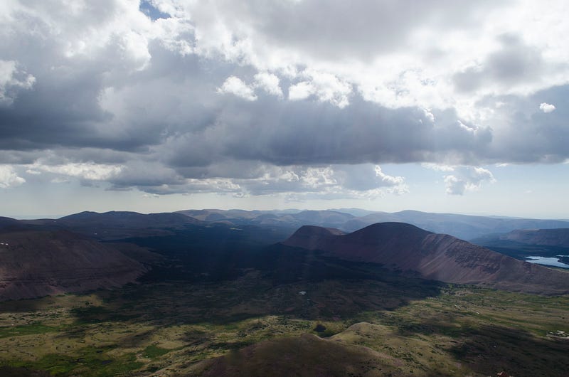
Eventually, you will step up onto the summit of this mountain, along with many others, and you will discover why people climb this peak. In fact, you’ve been discovering why since you first stepped foot on the trail. You’ve reached the end. There is nowhere left to go that you haven’t already been. The adventure started with a question and has ended with this open-air answer that surrounds you with an entire state below your feet.
R.W. Emerson once wrote “It needs the doing hand to make the seeing eye..” in a journal log when visiting Thoreau in the wilderness near Walden Pond. Both of these writers knew something that you now know too. The view at the top of a mountain is only worth as much as the effort you put into getting there. Seeing is given meaning by doing.