
What is Lidar Point Cloud Data?
Learn LiDAR Point Cloud Data, its applications and Sources.

LiDAR Point Cloud data is widely used in Geospatial and Earth observation applications. This blog post will look into what Lidar data is, where and how to access it freely, and the open-source tools you can use to work with point cloud data.
In the next blog post, I will post a Python tutorial on Lidar Point ingestion, manipulation and visualisation.
What is LiDAR?
Light Detection and Ranging (LiDAR) is a remote sensing technique that light from a laser to measure out the Elevation like buildings, ground and forest. LiDAR uses ultraviolet, visible or near-infrared sources to sense objects.
LiDAR calculates how long it takes a pulse — Light Energy emitted by Lidar — to return to the sensor to measure the distance. The result is a variable distance of objects on the ground, giving us an accurate 3D representation of Earth's surface. It allows us to examine natural and artificial features with accuracy and precision.
Lidar is widely used in different applications, including agriculture and forest management, architecture, transport and urban planning, surveying, geology, mining and heritage mapping.
LiDAR Point Cloud Data
A typical LiDAR data product is an extensive collection of point cloud data (millions to billions) of accurate 3-dimensional (X, Y, Z) points with other attributes like intensity, classification of features and GPS time. These additional attributes are essential and supplemental information when creating raster products like terrain and canopy height models.
There are two standard and commonly used types of LiDAR data format: .LAS and .LAZ. The LAS file format is a standard binary file format to store and interchange 3-d point cloud data. The .LAZ file format is a compressed version of .LAS.
Other file formats for point data include ASCII, XYZ, PLY, and text files. The .LAS files are more effective than these non-binary file formats and contain more information.
The latest LAS specification is LAS 1.4. This version is compatible with standard point formats from 0 to 10. Point Format 6 is the new base point format (6, 7, 8, 9, 10) introduced in the LAS specification 1.4.
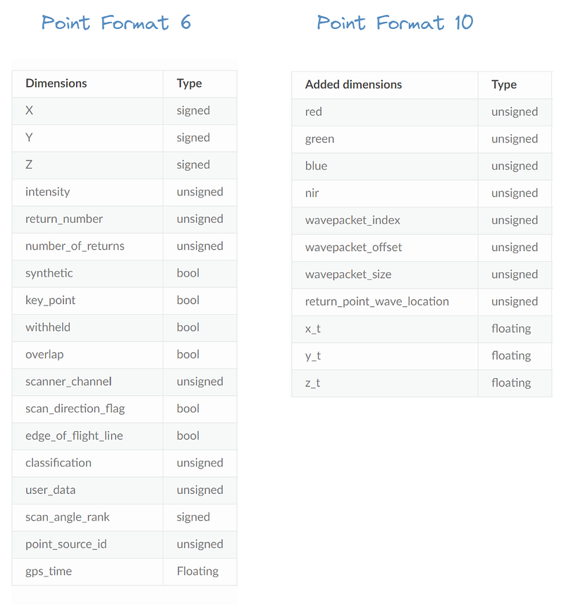
The .LAS Point Format 10, for example, Adds RGB, Nir (near-infrared), waveform data to point format 6, which is the base for the new version, LAS 1.4.
Where Can I Get LiDAR Data for Free?
LiDAR data is freely available from different sources. Government agencies, cities and other international organisations provide free accessible Lidar Data worldwide.
There are several articles listing out the top Free LiDAR data sources. I use OpenTopography, USGS, and other sources for specific cities and countries.
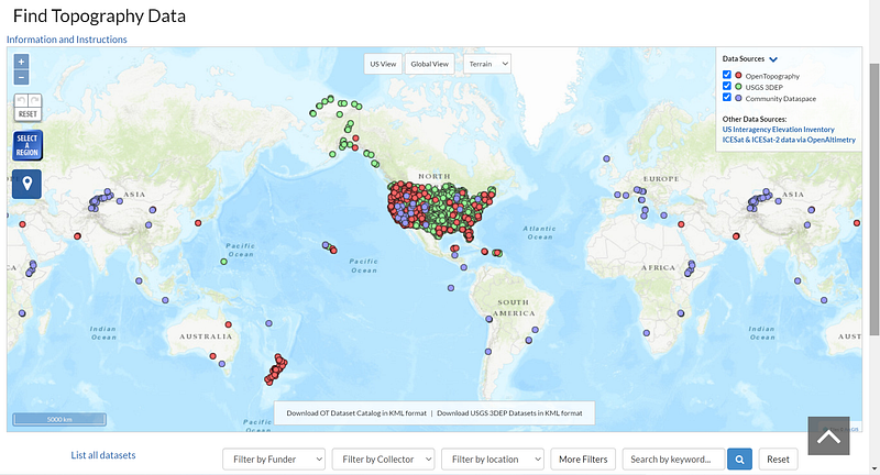
There is still no worldwide coverage of free accessible LiDAR data; however, OpenTopography has free community-contributed LiDAR data available to use. You might be lucky to have data available in your region if you are not based in the west.
LiDAR Tools
There is plenty of tools and software to work with LiDAR point cloud data. Some are desktop-based and Web-based, while others can be used in your favourite programming language. I will cover some of these free tools and software in this list.
- QGIS/GRASS (Desktop): Now, it is possible to directly use the .las or .laz file in QGIS from version 3.14. It is one of my favourite tools when working with Point Cloud data.
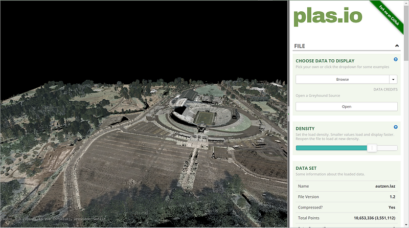
- Plas.io (Web): Plas.io offers basic functionality and visualisation for point cloud data through the web browser. You can upload the file and visualise it right away in your browser.
3. Laspy (Python): Laspy is a python library for lidar LAS/LAZ IO library. You can ingest point cloud data, manipulate it and store it. However, there is no native visualisation functionality in Laspy.
4. Open3D (C++ & Python): Open3D is an open-source library supporting 3D data. It offers 3D visualisations.
The list is not extensive but rather opinionated. It should help you get started on the right track working with point cloud data.
Conclusion
LiDAR data is widespread and is used widely in many domains and applications. This introductory article covered what Lidar is, where to access it freely, and some of the tools you can use to work with point cloud data.
The following article covers how to process point cloud data in Python. Stay tuned.


