
Architecture, Photography and Tools
Tools and Methods to Plan Architectural Photography Projects
Research and preparation can lead to better results

The technologies and sophistication of modern digital cameras and photo editing tools dwarf those of the film cameras and darkroom equipment of the recent past. Likewise, the number and capabilities of resources and tools available to help photographers identify and prepare to photograph subjects have exploded in the past decade.
This article describes the tools and resources I use to identify potential architectural photography subjects and to help me plan for successful photo shoots.
It’s a big world out there. Also, time is limited to pursue photographic passions. So, why not adopt more and better technology to bolster our ability to create better images?
TripAdvisor
While Google Maps may have supplanted TripAdvisor as the top travel website, the site still offers value to savvy travelers. Having used TripAdvisor for more than a decade, I discovered the ability to search for buildings on the site only recently.

In the screenshot below, for example, after searching for “Minneapolis,” selecting “Architectural Buildings” narrowed the list.

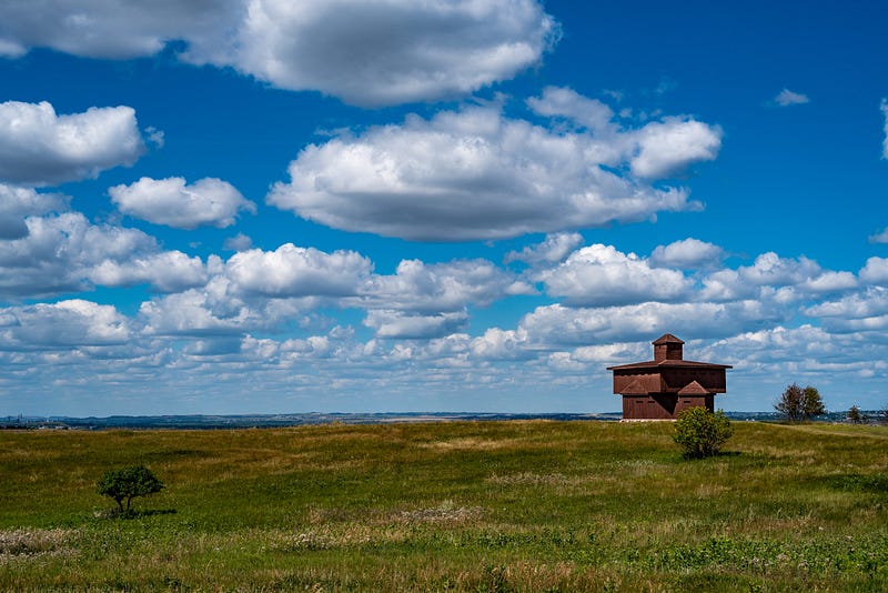
TripAdvisor listed eleven places in the category of Architectural Buildings. While it’s a small number, it offers a good start.

Local, Regional, and National Tourism Websites
Many cities, states, provinces, and countries promote themselves to attract tourist dollars. For example, the state of Minnesota in the US promotes its events and locations with its Explore Minnesota website.
I regularly visit tourism websites to help plan trips and identify places of interest. Occasionally, they feature prominent or historic architecture, too.
Regional and National Travel Guidebooks
Printed guidebooks are still popular, although they have lost prominence in the Internet age. While preparing for a trip, I sometimes visit the local public library and check out guidebooks that cover the areas I plan to visit. They often show pictures of photogenic cityscapes and historic or otherwise photographic buildings.
Unlike TripAdvisor, whose information is produced by everyday travelers, professional writers create guidebooks. The writers immerse themselves in the places they photograph and write about, offering details, tips, photographs, and insights that other resources might not cover.
Here are prominent publishers of travel guidebooks available in the United States:
- Fodor’s
- Frommer’s Travel Guides
- Lonely Planet
- Moon Travel Guides
- National Geographic Books
- Rick Steves’ Europe
Architectural Websites, Magazines, and Books
Architectural websites, magazines, and books are valuable sources for subject ideas.
The following are some examples of online architecture magazines. Some produce printed magazines as well.

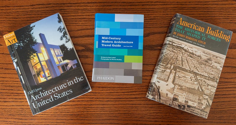
While travel guidebooks provide helpful information about places, books on architecture also have a place in planning. Recently, I checked out several books about architecture in the US to help me learn more about its history and architectural styles. They will also help me identify and pinpoint buildings I might want to visit and photograph.
National Register of Historic Places
The National Register of Historic Places, operated by the U.S. National Park Services, is the official list of the nation’s historic places worthy of preservation. At the end of 2023, the list contained more than 98,000 properties.
Most counties within the United States have one or more properties listed in the National Register. To find properties that may interest you, see the resources on the National Register Database and Research page.
While some National Register search tools offer limited functionality, the web-based map with address search is easy to use and powerful. I used it to find the Pill Hill Residential Historic District in Rochester, Minnesota, where I live. I walk and cycle regularly through the beautiful Pill Hill neighborhood, but I was surprised to learn that 130 of its buildings are listed in the National Register.
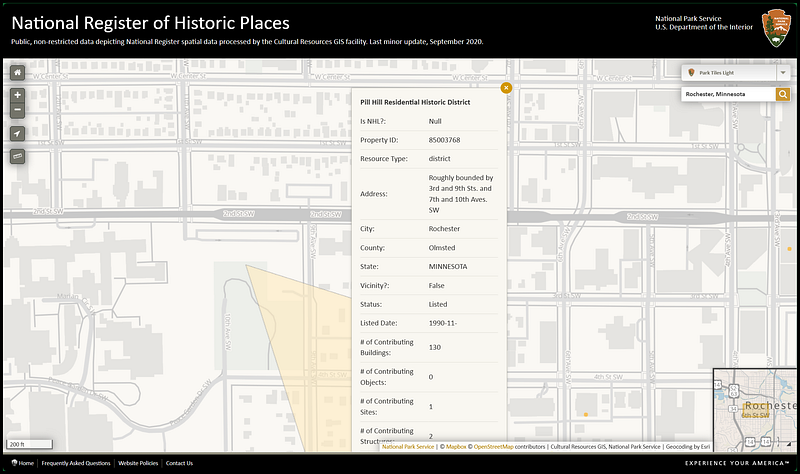
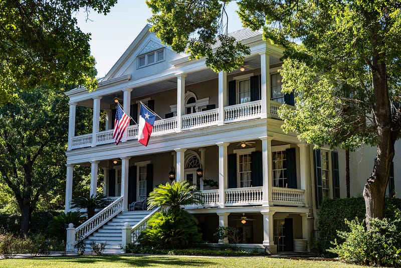
The Pill Hill neighborhood is named for the hundreds of physicians who have built houses and mansions there since the early twentieth century. It is located behind Saint Mary (yes, the spelling without an apostrophe is correct in this case) Hospital, one of the country’s largest hospitals, and a Mayo Clinic facility.
Google Search
You may have heard about Google’s recent generative AI debacle. However, the company offers many free and powerful tools that could benefit anyone, including architectural photographers.
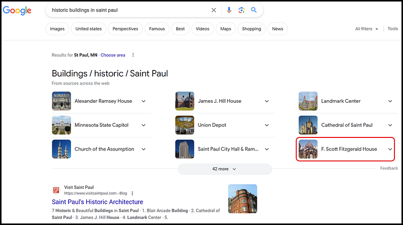
The example above shows a Google search for “historic buildings in Saint Paul.” It returned a list of hundreds of web pages. But the “F. Scott Fitzgerald House,” the home of a prominent novelist from Minnesota, piqued my interest.

YouTube
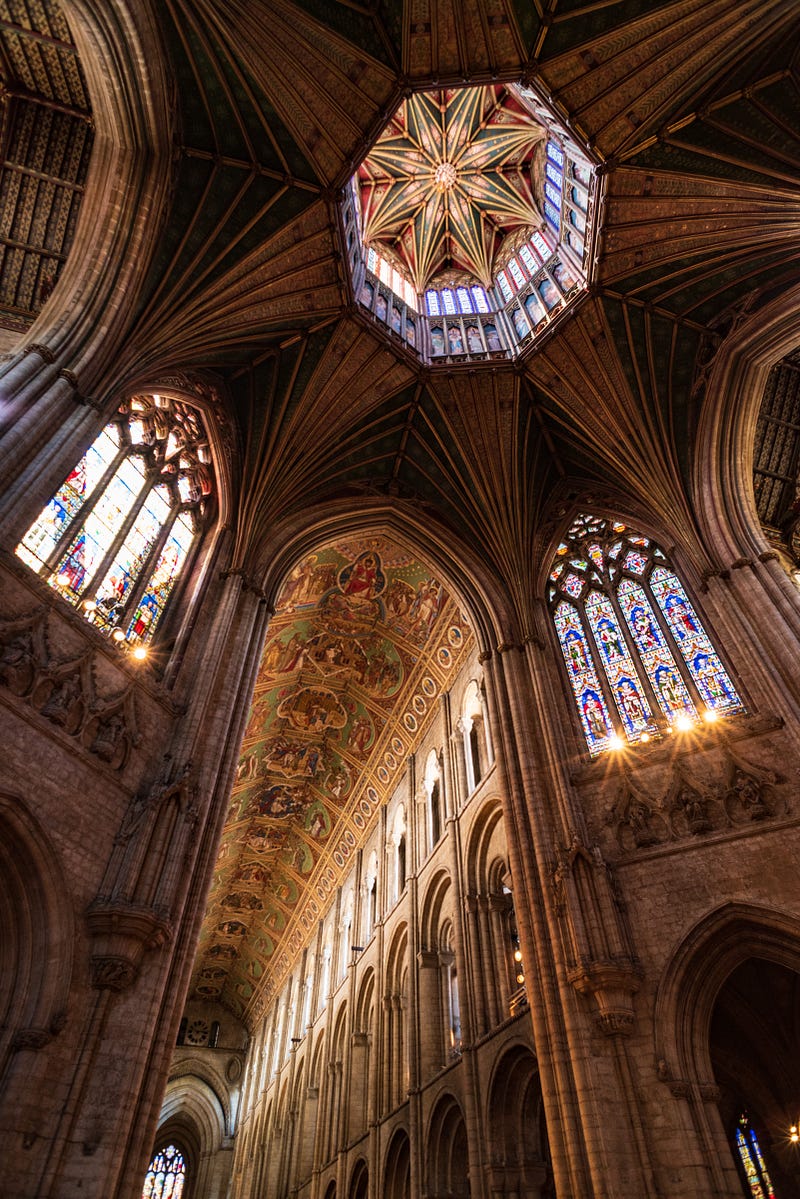
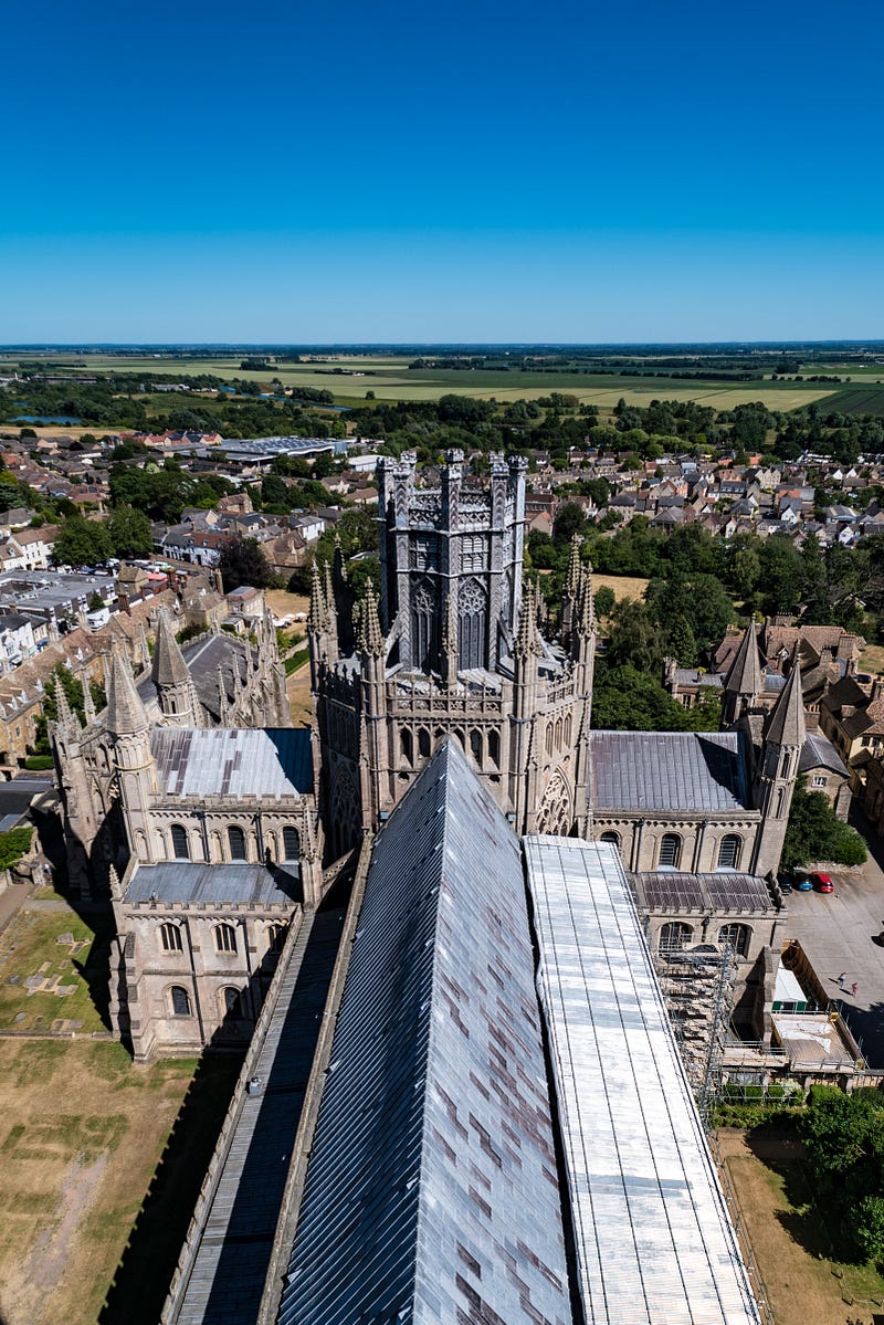
Owned by Google, YouTube offers millions or billions of videos to learn about and experience about anything and any place on the planet. For example, I could have experienced a virtual tour of Ely Cathedral’s Octagon Tower with David before experiencing the actual tour with him. Our group even walked on the cathedral’s roof.
Local, Regional, and National Park Websites
Some local, regional, and national park units feature historic buildings and other structures on their grounds. Information and maps on their websites may help you locate landmark buildings and other structures.
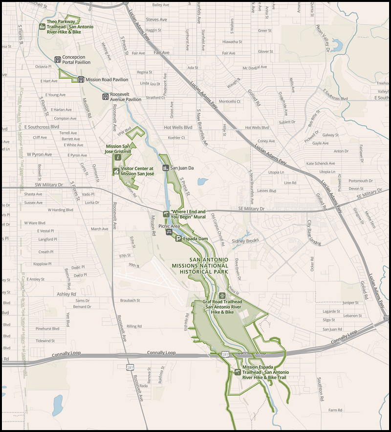
The United States National Park Service (NPS) website provides information and maps for all 429 national park units in the country. For example, my wife and I used its map of the San Antonio Missions unit to locate the many Spanish mission sites in San Antonio, Texas.

Historical Society Websites
In the US, historical societies at the county and state levels provide numerous services. For example, the Minnesota Historical Society (MHS) owns, maintains, preserves, and operates historic buildings.

The MHS website lists more than two dozen historic sites in Minnesota that it operates. I have the information to plan trips to several sites.
Google Maps
Sometimes I wonder how people navigated in their cars before the invention of GPS and tools like Google Maps and Apple Maps. These tools have become indispensable and can be used to find architectural subjects.
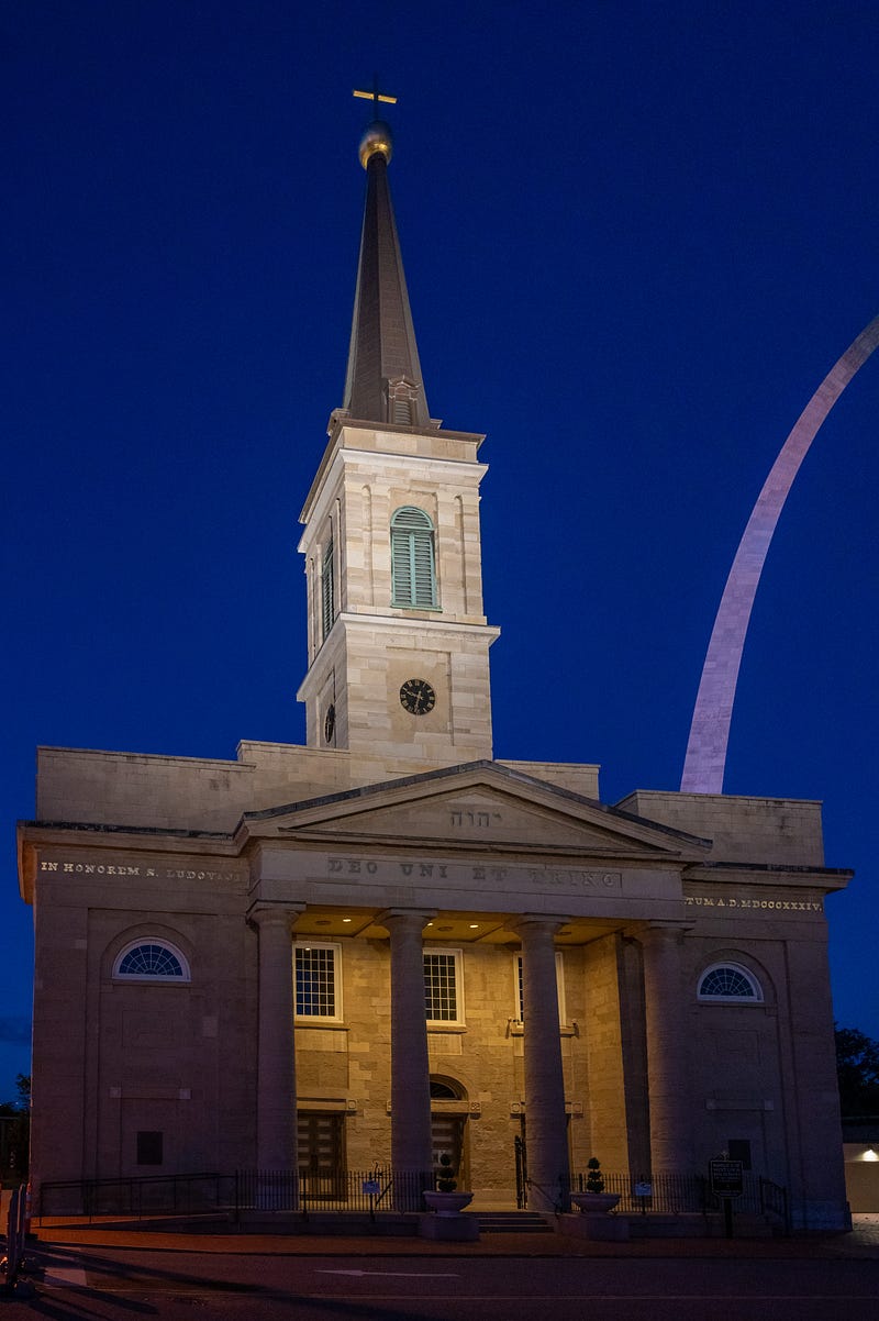
For example, I searched Google Maps for “old churches in St. Louis” and found the Basilica of St. Louis, King of France, near the Gateway Arch. My wife and I planned to tour the arch’s grounds while in St. Louis, so we decided to swing by the basilica during our visit.
While visiting San Antonio, Texas, I used Google Maps to search for “historic neighborhoods near me.” The King William neighborhood topped the list, so my wife and I enjoyed walking through the historic area near downtown.
The Street View function adds visual power to Google Maps. For many locations, it allows the photographer to view the subject from many angles and imagine where the best light might fall on it during any time of day.
The Photographer’s Ephemeris
The Photographer’s Ephemeris (TPE) is an incredible desktop and iOS app photography tool. Photographers can use this map-based sun, moon, and Milky Way calculator at present or to help them prepare for future outings.
In combination with the Street View feature of Google Maps, photographers could use TPE to understand when and where light will fall on a particular building or any other photographic subject.
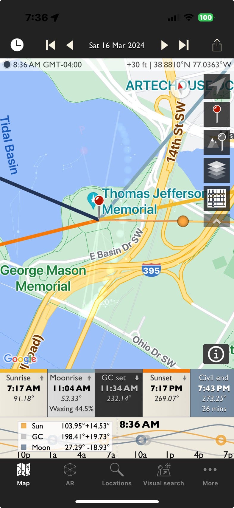
In the screenshot above, TPE shows the azimuth of the sun and moon in relation to the Jefferson Memorial in Washington, D.C., at 8:36 AM on 16 Mar 2024. By dragging the timeline near the bottom of the screen left or right, the user will see the azimuth lines for the selected time.

Spreadsheet Lists
A spreadsheet can prove valuable for tracking photographic subjects of interest, including buildings. When searching for potential subjects, I record them in a “Photo Sites” spreadsheet in Google Sheets.
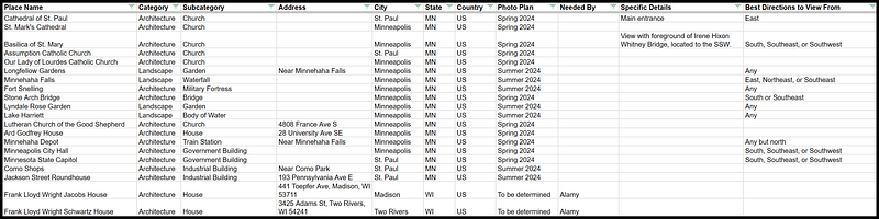
Data points that I capture include the following:
- Place Name
- Category
- Subcategory
- Address
- City
- State (or province)
- Country
- Needed By (For example, whether a stock photo agency requested a photo of this subject.)
- Specific Details
- Best Directions to View From (I enter this value after reviewing the site in Google Maps Street View or TPE.)

Any spreadsheet software, such as Microsoft Excel or Google Sheets can be used to track photography ideas. I prefer Google Sheets because it is free, easy to use, and available on any device (desktop PC, tablet PC, smartphone, or tablet PC) anywhere a Wi-Fi or cellular signal is available.
Memories
Sometimes, memories play a role in identifying fascinating buildings and places to visit and photograph.
As a high school student in Architectural Drafting I and II classes, teacher Mr. Hompe shared snippets of the works of prominent American architects. The only two I remember are Frank Lloyd Wright and a man who mentored him, Louis Sullivan. They and Henry Hobson Richardson form “the recognized trinity of American Architecture.”
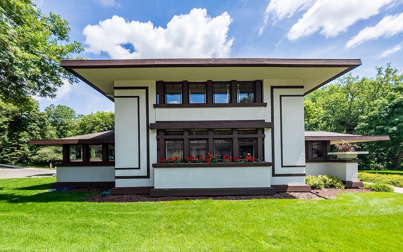
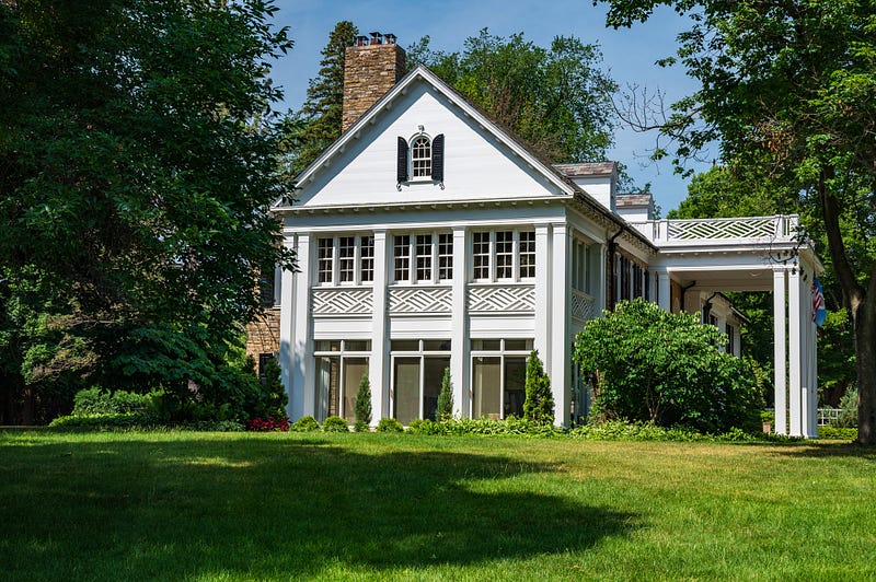
I often use Google Search or Google Maps to find Wright’s and Sullivan’s buildings. My wife and I recently toured Wright’s modest Stockman House in Mason City, Iowa, because of a search result. Smaller than most Wrightian structures, we considered it quite livable, except for the four-season porch with its six-foot ceiling, shown on the left side (facing north) of the picture of the above house.
A Word or Two on Photographic Equipment
I travel light. Recently, I have carried a Nikon Z6 II full-frame body and a Nikon Z 24–70mm f/4 S lens on architectural photography outings. The lens’s focal length range meets most needs. I also carry a circular polarizer filter.
I typically leave the tripod at home or in the car. However, I use it for night photography and time exposures to smooth-moving water, for example.
“I learned this, at least, by my experiment: that if one advances confidently in the direction of his dreams, and endeavors to live the life which he has imagined, he will meet with a success unexpected in common hours.” ― Henry David Thoreau, Walden: Or, Life in the Woods
Conclusion
Sometimes, wandering and stopping to photograph an exciting building works well. However, research and planning can help us achieve our desires and reach our goals.
I use the tools, resources, and methods presented here for architectural photography. But they can be applied to many photographic subject categories, such as landscapes, cityscapes, and travel.
In the modern world of technology, the range and abilities of resources and tools for planning and executing photography projects seem endless. The resources, tools, and methods presented here have helped me to reach my goals. But there is much more to explore.
How about you? What tools and techniques help you achieve your photographic goals? I would love to hear from you.
As always, thank you to the Full Frame editorial team of Rodrigo S-C, Lauri Novak, and Kasey Sparks. They, along with the publication’s writers and readers, make it an enjoyable and rewarding destination.
“You don’t make a photograph just with a camera. You bring to the act of photography all the pictures you have seen, the books you have read, the music you have heard, the people you have loved.” ― Ansel Adams