
The Longmynd Hike
Shropshire’s 24-hour, 8-hill, 8,000-feet ascent challenge
Clomp. Clomp. Clomp.
The sound of heavy, weary walking boots struggling to find the energy of putting one foot in front of the other, is what wakes me from six o’clock in the morning onwards on the second Sunday in October.
These intrepid hikers have got barely a mile to go to their journey’s end. These are the successful hikers, who will complete their trek before seven o’clock, having set off at one o’clock the day before.
The last mile is always the killer. The previous forty-nine are just the warm-up.
Endurance
To the uninitiated, the Longmynd Hike cleverly conveys a sense of ease. Perhaps, even, an air of nonchalance. I mean, a hike is simply a walk in the park, isn’t it?
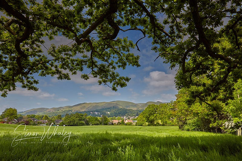
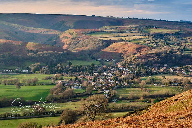
It takes place around the town of Church Stretton, in Shropshire. Is this one of the UK’s national parks, packed with mountains? Nope.
Perhaps the SAS train their recruits here, before sending them off to foreign lands to invade besieged embassies. Nope.
So, how difficult is the Longmynd Hike? Here are the vital statistics:
- One walk.
- Eight hills.
- Fifty miles.
- Eight thousand feet of climbing (and descending!).
- Time limit: 24 hours.
Gulp! As someone who lives here, I’ve never been inspired to have a go. I mean, when I climb a hill, I want my efforts rewarded with a glorious view from the top. How’s that work at two o’clock in the morning?
Route map
It’s at this point in an article where I might include an illustration of a route map. But I can’t. Because there isn’t one. This isn’t a waymarked trek. Entrants have to find their own way using official rights of way and the appropriate maps.
Here, though, is a rough illustration of the placement of the hills and the route.
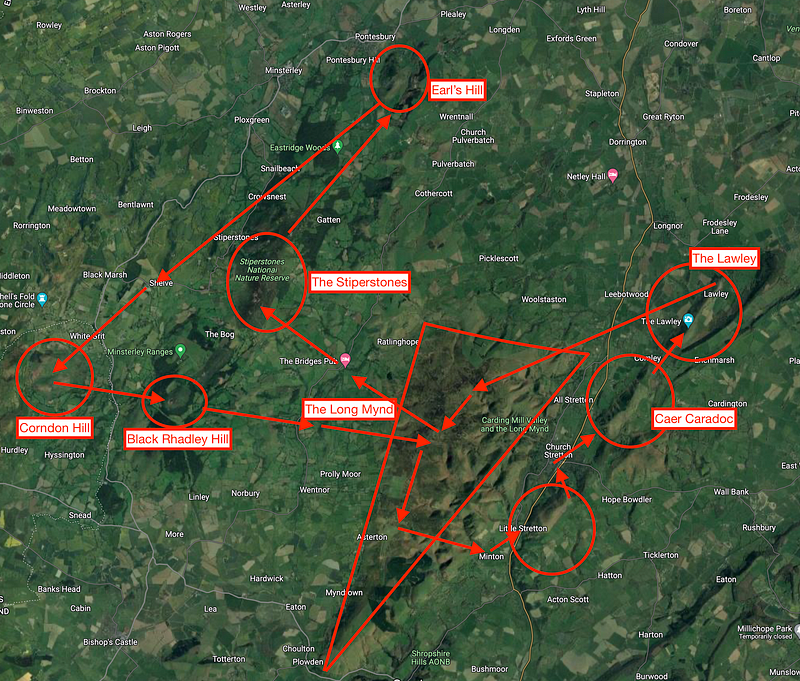
1: Caer Caradoc
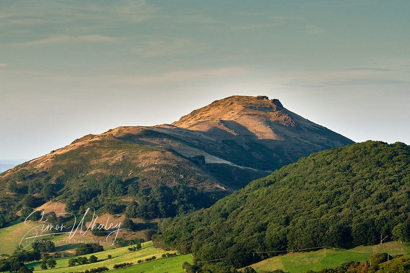
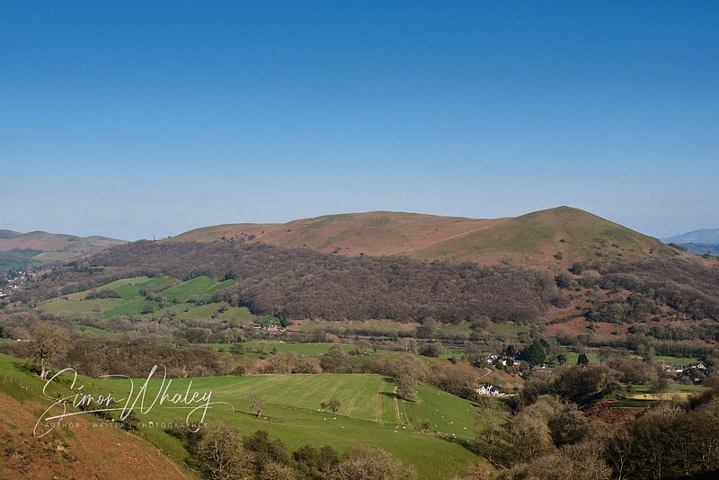
It all kicks off at one o’clock on the first Saturday of October. Entrants start from Church Stretton’s school, and head across to the first hill — Caer Caradoc (1,506 feet).
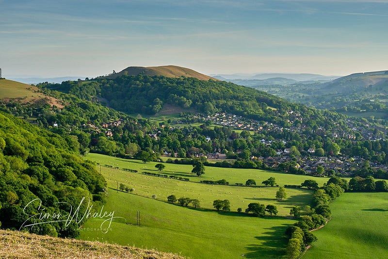
Church Stretton lies in a valley surrounded by hills, and Caer Caradoc has a rugged look about it. Of all the town’s hills, this is the one that taunts people. “Climb me!” it screams whenever your eyes lock onto the rocky outcrops that pierce its undulating ridgeback.
Actually, I climbed it on Sunday when the event was all over. Much quieter then, you see. For me, it’s a great two-hour stroll, up and down, and back home again.
But, these Long Mynd hikers. . . Well, they carry on.
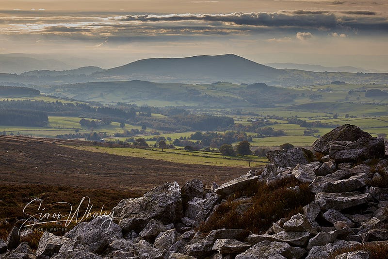
From Caer Caradoc’s summit, which is two miles from the start) there are marvellous views across most of North Shropshire, towards the Cheshire Plain. On a clear day, you can even catch glimpses of the Peak District, the UK’s first national park.
Long Mynd Hikers don’t look that far. Instead, their next peak is The Lawley, which is directly ahead. All they have to do is drop the other side of Caer Caradoc and begin the long, slow climb up this whale-backed ridge.
The Lawley
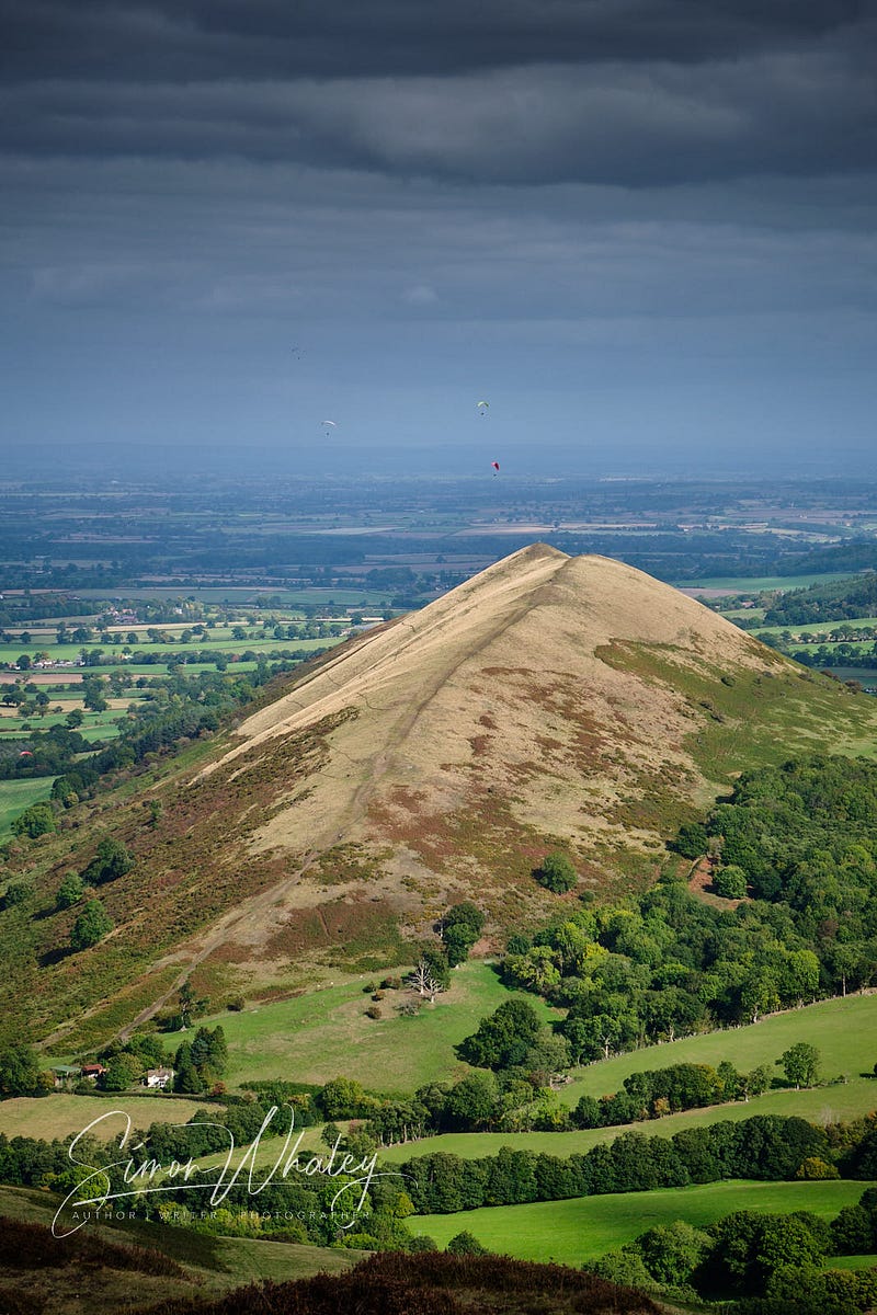
The Lawley (1,260 feet) is tall, slender, and getting on a bit. . . And another two miles away. Standing on top of Caer Caradoc, The Lawley is directly ahead, and then about 20 miles further north-east stands The Wrekin. Get out a map and place a ruler along these three summit points, and you’ll soon realise you’re standing on top of a geological fault line.
(Yes, Church Stretton does get earthquakes, but this is the UK, so the tremors are so small we don’t usually notice them. Usually.) Still, if the earth’s crust hadn’t erupted with volcanic rock 570 million years ago, then the Long Mynd Hike would be less challenging and these hills wouldn’t exist!
High Park — The Long Mynd
Once The Lawley has been conquered, the route heads west, across the main A49 road. Another three miles away stands the higher ground of High Park. This lies on the broad northern end of the Long Mynd.
The Long Mynd is an area of heath and moorland covering 21 square miles. Think of it as an inverted isosceles triangle, with its broad end facing north-east, and its sharp end pointing south-west.
It can be quite deceptive because from the north, it seemingly climbs gently from the surrounding land. Unless you happen to be climbing it, when it becomes a long, slow, drawn-out climb. But to do so means following in the steps of history, for this route becomes the Port Way, an old droving route used over 5,000 years ago.
Pole Bank — The Long Mynd
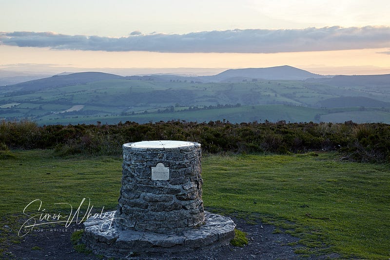
Three miles from High Park (1,230 feet), deviating slightly off the Port Way track, brings entrants to the Long Mynd’s summit, called Pole Bank, which stands at 1,693 feet.
Those that make it in daylight hours are rewarded with fine views, stretching westwards across most of Wales. On a clear day, Cadair Idris, one of Wales’ higher peaks (2,930 feet) can be spotted seventy miles away.
Even if you can’t spot it, one of the most amazing things about the Long Mynd’s summit is that you can’t see any large urban conurbations, power lines or manmade monstrosities. (And, to be quite honest, there are few dwellings visible from here). Not bad when you consider we’re only 45 miles as the crow flies from Birmingham City Centre.
Still, there’s no rest for the hikers, but at least the next two miles are downhill into the River East Onny valley and the quiet village of Bridges.
Stiperstones
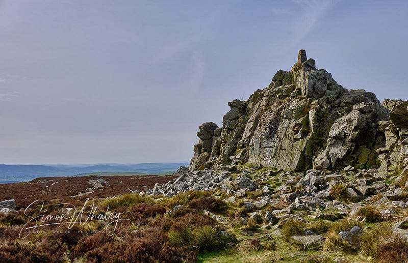
Of course, what goes down, then has to go up again, and from here, the Long Mynd Hike travels three miles up to the summit of The Stiperstones.
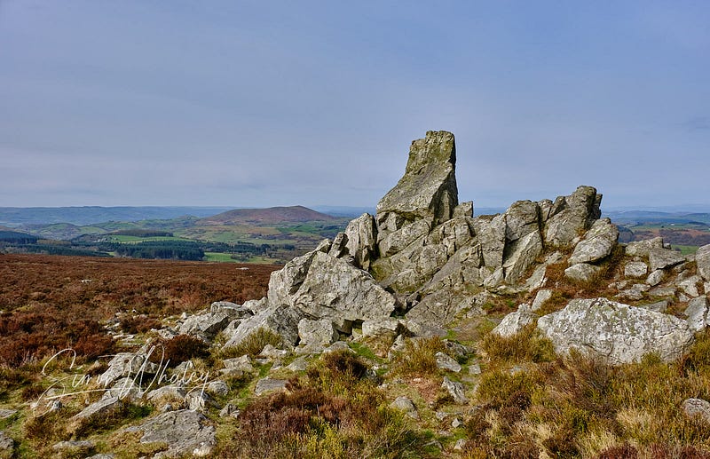
At 1,759 feet, this is ankle-breaking country, for the Stiperstones are a series of quartzite outcrops bursting through this ridge, much of which shattered during the last ice age creating the most unsafe paths in Britain (in my opinion). Feet-friendly flat surfaces here are as rare as passing wooly mammoths. (Having said that, there is a wheelchair-friendly path stretching for nearly a mile from a car park here, but it doesn’t go anywhere near the summit ridge.)
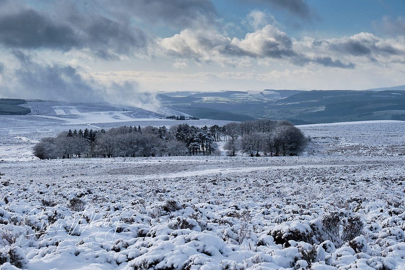
Again, though, the height does offer some great views back across to the Long Mynd. If anyone is interested in tackling the Long Mynd Hike I would offer the following advice: get past the Stiperstones before dark (remember, this happens on the first weekend in October, so here in the Northern Hemisphere the nights are drawing in — it’s dark by 7pm now). I’ve walked the Stiperstones many times, but only in daylight where I can see where I’m putting my feet.
Earl’s Hill
Five miles away lies the rounded mound of Earl’s Hill. Nudging into the atmosphere at an altitude of 1,049 feet, this elevation of the earth’s crust sometimes looks like the curled up body of a sleeping dragon. Whatever you do, don’t wake it.
It might not be an impressive looking hill, but it has some claims to fame. In 600BC, there was an Iron Age hill fort crowning its summit, which makes it a scheduled ancient monument now. It was also the first patch of land the Shropshire Wildlife Trust acquired as a nature reserve in 1964.
From here the route switches back, negotiating the surrounding countryside, heading west of the Stiperstones, passing through the hamlet of Shelve from where it crosses the border into Wales.
Corndon Hill
Ten miles since Earl’s Hill, hikers reach the summit of Corndon Hill at 1,683 feet. Surrounded on three sides by England (clearly the Welsh really wanted this hill to be inside their land), its summit is crowned by a rocky Bronze Age cairn.
Black Rhadley Hill
The route then heads east again, for five miles, crossing back into England to reach Black Rhadley Hill (1,315 feet). For the hike, permission is granted by a local landowner to access the hill summit through the wooded Pellrhadley Hill. Anyone wanting to climb Black Rhadley at any other time of year can do so via legal rights of way. . . But if you’re not doing the Long Mynd Hike, you can probably manage the extra distance required to reach the summit via legal routes. (If Long Mynd Hikers couldn’t use the private land, then the Long Mynd Hike would be longer than the nice round 50 miles 😁.)
Stiperstones
I may have mentioned that this challenge climbs eight hills, which it does. However, I may have forgotten to mention that it climbs some of them twice, and so three miles after Black Rhadley, hikers find themselves on the slopes of the Stiperstones again, before veering south-east towards. . .
Pole Cottage, on the Long Mynd
Yes, the hikers are back onto the Long Mynd, barely half a mile from the Long Mynd’s summit that they saw many, many hours earlier. But at least they’ve only had to climb to 1,575 feet, which is 184 feet lower than the Long Mynd’s summit.
From here, the hikers head south for about a mile, towards the ‘point’ of Long Mynd, then they turn east, for another three miles as they drop towards the hamlet of Minton (where the actor Pete Postlethwaite once lived).
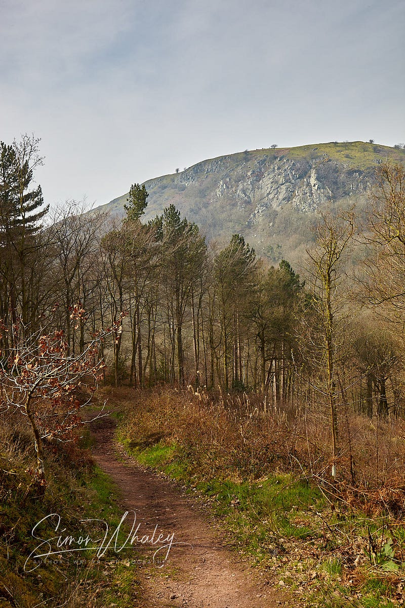
Ragleth Hill
From here, the hikers cross over the main A49 road again, and begin the ascent of the final hill: Ragleth Hill. Now, this is my hill. Well, when I say my hill, I don’t mean that own it, but that this is the hill I climb a couple of times a week because I live halfway up it. I never approach it from the angle the hikers have to.
The south face of Ragleth Hill kills calf muscles. . . particularly calf muscles that have already climbed seven different hills and covered over 47 miles. It climbs over 600 feet in half a mile. Admittedly, it’s not the North face of the Eiger, but when you’ve got this far, really all you want is an escalator 😁.
Make it to Ragleth’s long summit ridge (highest point 1,305 feet) just as the sun is rising, and hikers are bathed in a golden hue as the rays reach over Brown Clee Hill, Shropshire’s highest point (1,770 feet).
From the Ragleth’s highest point, there are just two miles to complete the circuit back to the school, where the hikers set off the previous day.
Fastest Hikers
The challenge of the Long Mynd Hike is not the 50 miles (although for many that is a challenge in itself) but that you have to complete it within 24 hours.
Some people don’t need that long.
The first person across the finish line in the 2022 Long Mynd Hike completed the challenge in nine hours 17 minutes 😱.
As for me. Well, I prefer travelling by foot at a slower pace. . . one that allows me to admire the view and appreciate it. I love travelling on foot. I love getting temporarily misplaced (not lost) because it’s often at those times when you stumble across something truly magical.
But I have a huge admiration for these hikers tramping the Shropshire Hills in all weathers with a goal of achieving it within 24 hours (some doing it for charity).
At least, when their heavy-footed walking boots wake me up on the first Sunday in October as they pound the pavement outside my house, I can turn over and go back to sleep again.
Further Information
If you’re inspired to do the Long Mynd Hike, check out their website. A full list of the rules can be found here.


