
The Groundwater of Mexico’s Yucatan Peninsula
Paradise under threat
∘ The Yucatan Peninsula Aquifer ∘ Regional Conservation Issues ∘ Better Planning for Water Management and Tourist Development
The Yucatan Peninsula Aquifer
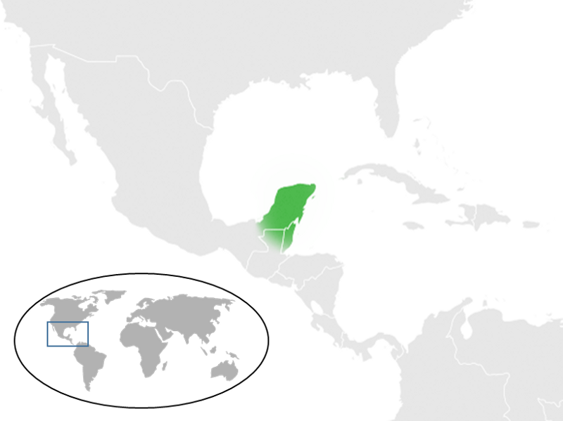
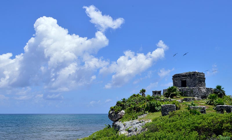
The Yucatan Peninsula (YP) encompasses the Mexican federal states of Campeche, Yucatan, and Quintana Roo and adjacent parts of Belize and Guatemala. It is located between the Gulf of Mexico to the west and north and the Caribbean Sea to the east.
The YP platform is mainly formed by sedimentary rocks called limestone. This type of rock has high permeability and is mainly composed of carbonate minerals. Because limestone is soluble in rainwater, it forms a particular landscape known as karst, characterized by the presence of underground drainage systems and many erosional landforms such as sinkholes and caves.
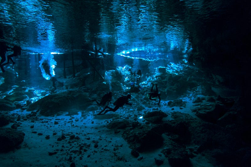
Since the limestone platform of YP is huge, it forms one of the largest underground water reservoirs in the world, and shelters the world’s longest underwater cave system [1, 2].
Due to the absence of surface runoff, the only access to fresh water is through underground passages that leave the aquifer exposed. At YP, these karst features are locally known as “cenotes”. The word “cenote” is a Spanish conversion of the Yucatec Maya word “d’zonot” or “ts’onot” which means “water hole” or “water pound”.
Although this type of karst structure also usually occurs in Australia, Cuba, Turkey, Europe, and the Urals region, it is usually rare, while in YP it can be found in high numbers [3].
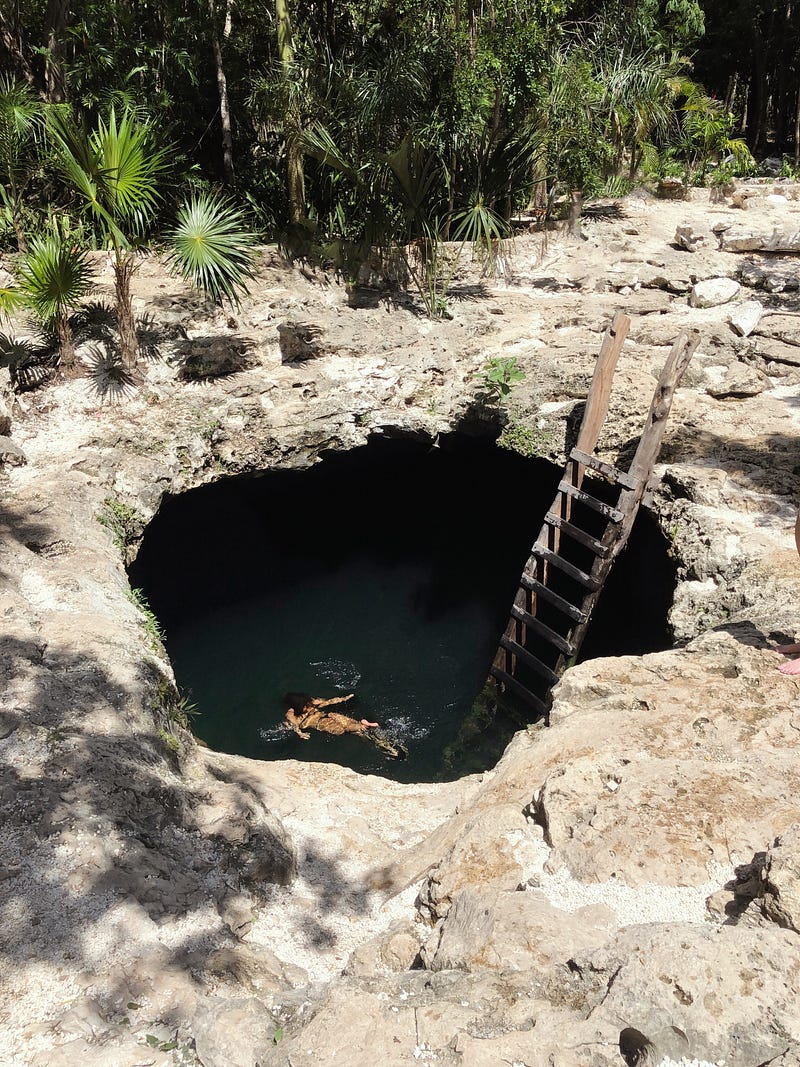
There are different types of cenotes, but the term usually refers to any water-filled sinkhole formed from the collapse of limestone bedrock that has groundwater [4].
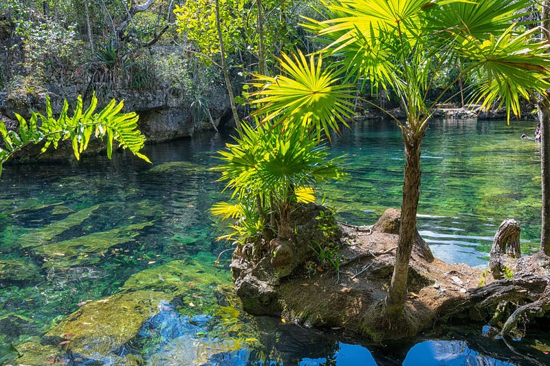
Cenotes are extremely important locally because they are the main source of fresh water for humans and wildlife.
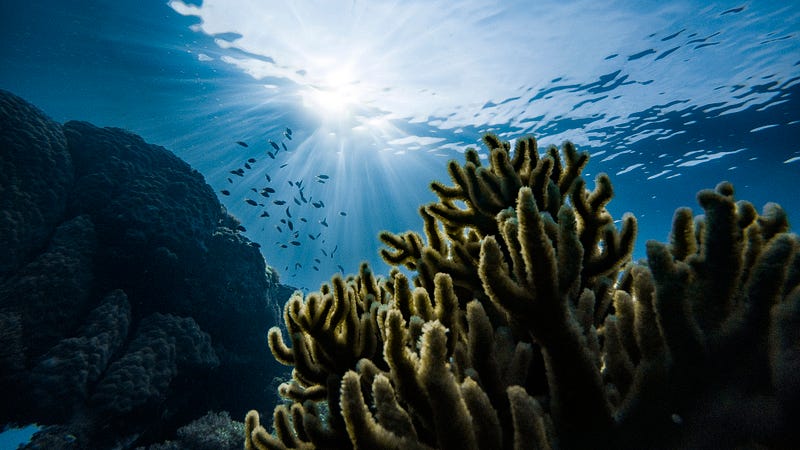
Since they have distinctive aquatic biodiversity and vegetation, cenotes can be seen as islands of life that provide the water needed for lots of different terrestrial species (like jaguars, ocelots, tapirs, and birds) [4, 5, 6].
Nowadays, cenotes and their associated natural areas have gained global popularity because of their aesthetic and cultural value. Consequently, the YP is visited by millions of tourists who want to swim, dive and explore the different local attractions including archaeological sites, touristic beaches, and ecosystems such as the jungle, the seagrass meadows, and the coral reef.
Regional Conservation Issues
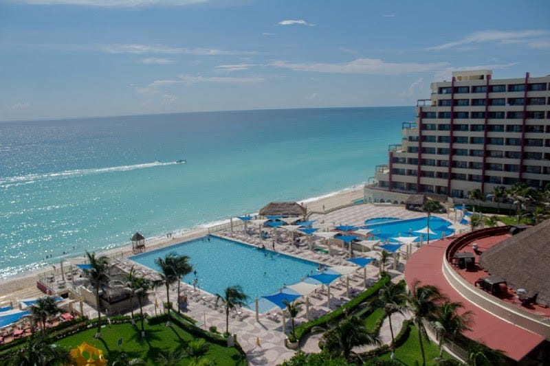
As a very popular tourist destination, the YP has been subjected to intensive economic development that threatens its ecosystems and groundwater. Especially at the coast, the tourism industry has had a great impact on ecosystems like mangrove and coral reefs.
The three main ecological problems in the regions are: 1) increasing population growth and waste production, 2) poor water management, and 3) deforestation and land-use change associated with tourism development [1, 7].
Some of the most popular tourist locations of the Riviera Maya (a tourist corridor along the coast of the east side of the YP) like Cancun are considered to be near ecological collapse because the economic development and the associated population growth have decreased the availability and quality of fresh water for human use and other ecosystem services (benefits that humans obtain from ecosystems) [8, 9].
Groundwater-management problems on the YP are mainly related to bad water quality that arises predominantly from wastewater discharge [1]. Since limestone is highly permeable, the soil has no filter effect and, therefore, the region is inherently susceptible to groundwater contamination.
Wastewater is mostly re-injected into the aquifer or discharged into cenotes, and approximately, only one-third of it is treated before disposal [1,7]. Furthermore, land and water management is spatially fragmented and often ineffective to face the pressure of the tourism industry and related urban development [7].
Better Planning for Water Management and Tourist Development
Underground passages provide a pathway for contamination that directly connects water originating in inland areas with discharge areas along the Caribbean Sea [1, 4].
Since almost all cenotes are connected, they cannot be seen as isolated entities and, therefore, it is necessary to have a regional conservation plan for groundwater protection [1].
Prevention and mitigation measures are needed to ensure that the expansion of development does not harm the marine environment and human health and, in turn, the tourism-based economy of the region [7, 9].
To face contamination from the domestic sewage produced by cities, towns, and resorts, it is essential to develop and maintain adequate wastewater treatment infrastructure, and the practice of injection of sewage into the aquifer should be discontinued [7]. Besides, it is necessary to avoid contamination of runoff from highways, roads, parking lots, and the tarmac at airports [7].
Integrated approaches to water management are required that are built upon participation by all stakeholders, including the private sector, government, and communities. These include coordinated protection through better planning of land use, zoning of remaining terrestrial ecosystems, and vegetation cover (especially mangroves) to provide an additional buffer against coastal pollution [1, 7].
Without these integrated approaches, the tourism-based economy of the Riviera Maya will not be sustainable over the medium to long term [7].
If you want to learn more about contaminants in the YP aquifer, you can check out this article [7]. More about the YP karst and groundwater conservation measures can be found in this article [1].
Let me know your opinion in the comments.
If you enjoy reading stories like these and want to support me as a writer, consider signing up to become a Medium member. It’s $5 a month, giving you unlimited access to stories on Medium. If you sign up using my link, I’ll earn a small commission.


