
Photography, Travel
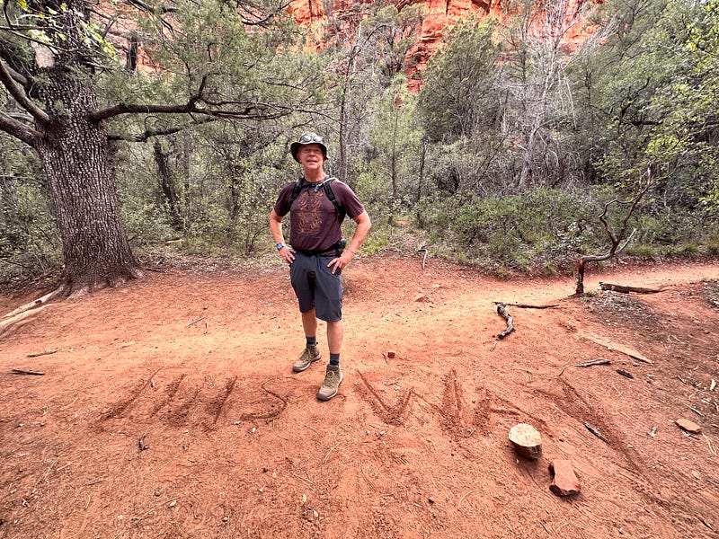
Subway Cave in Boynton Canyon, Sedona Arizona
It’s a scramble, but the view is more than worth the effort
When my husband and I first started exploring Sedona, Arizona, in the mid 1990’s, it was not uncommon to find miniature desiccated cobs of corn, left behind by the Sinaguan Indians, amongst the tumbled ruins of ancient cave dwellings. The locals all knew not to take anything from these ancient homes, but, sadly, those relics have long since vanished. Evidence of their life here can still be found though amongst barely-visible caves high up in the canyon walls.
From around 500–1425 C.E. the Sinaguans (the name is derived from the Spanish “sin agua” — or “without water”) eked out an existence in this harsh, but beautiful land. They were hunter-gatherers but also learned to grow corn and squash. They had trade routes as far south as Mesoamerica. The explosion of nearby Sunset Crater in 1064 covered the region in a layer of ash, which enriched the area for farming.
And then they vanished.
It’s likely that they were driven out by drought and morphed into other puebloan tribes further east. The Hopi and the Zuni both consider the Sinaguas to be ancestral.
Traces of their existence can be found all over the Verde Valley and the Mogollon rim. Nearby Montezuma’s Castle, a twenty-room “high-rise apartment” is likely the last (and probably the largest) of their abandoned homes.
But my husband and I always took greater delight in stumbling across lesser-known ruins which were off the beaten path. We’d remembered one such dwelling at the back end of Boynton Canyon. When we’d last explored this trail we’d been the only people to scramble up the canyon to peer into these remnants of the past.
On a recent trip to Sedona, we decided to try to find those ruins again.
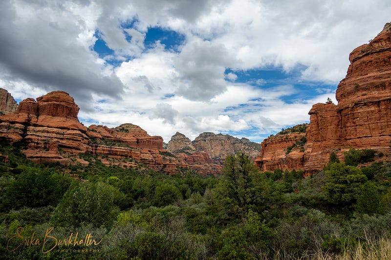
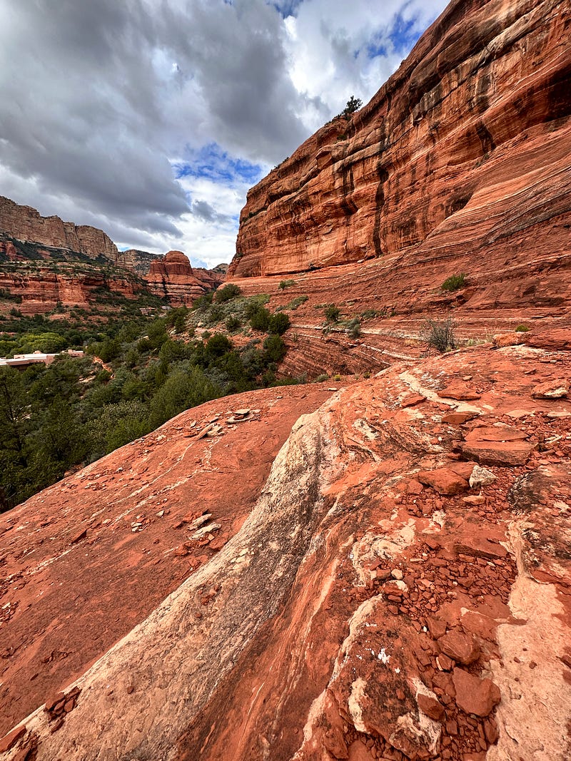
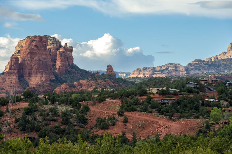
We set off from the Boynton Canyon trailhead and wound our way back behind Enchantment Resort. The panoramic red rock vistas embraced us in all directions.
We couldn’t remember exactly where the ruins were but our very-old guidebook mentioned that there was one dwelling, high up on the canyon wall, about quarter mile in. We recalled that there were two sets of caves on this trail — one early on and another quite a ways back.
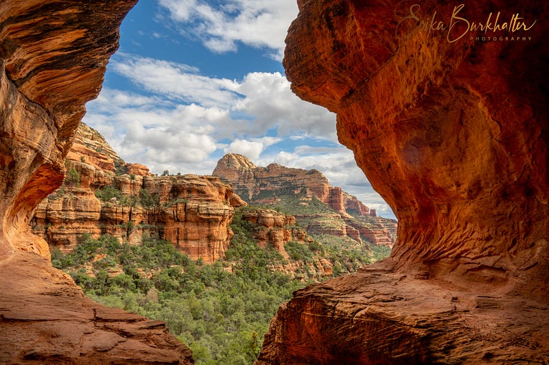
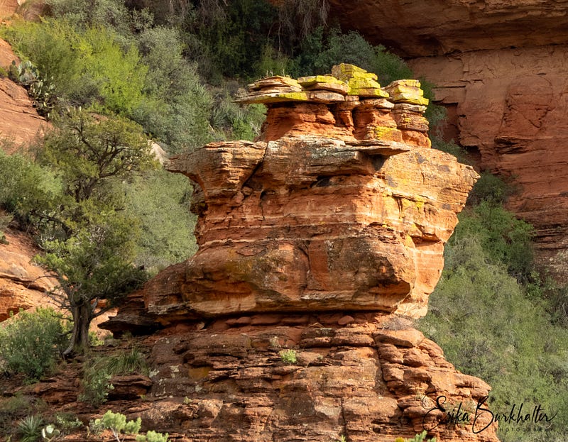
We looked up to our right at the quarter mile mark and spied them. Can you see them in the photo below?
I did remember that it was a bit of a scramble, but that we had successfully gotten up there.
Can you imagine if this was your daily commute?
Well, one of us decided to try to make our way up there to take some photographs. But, at a certain point, this was the view back down and let’s just say that my palms were getting a bit sweaty.
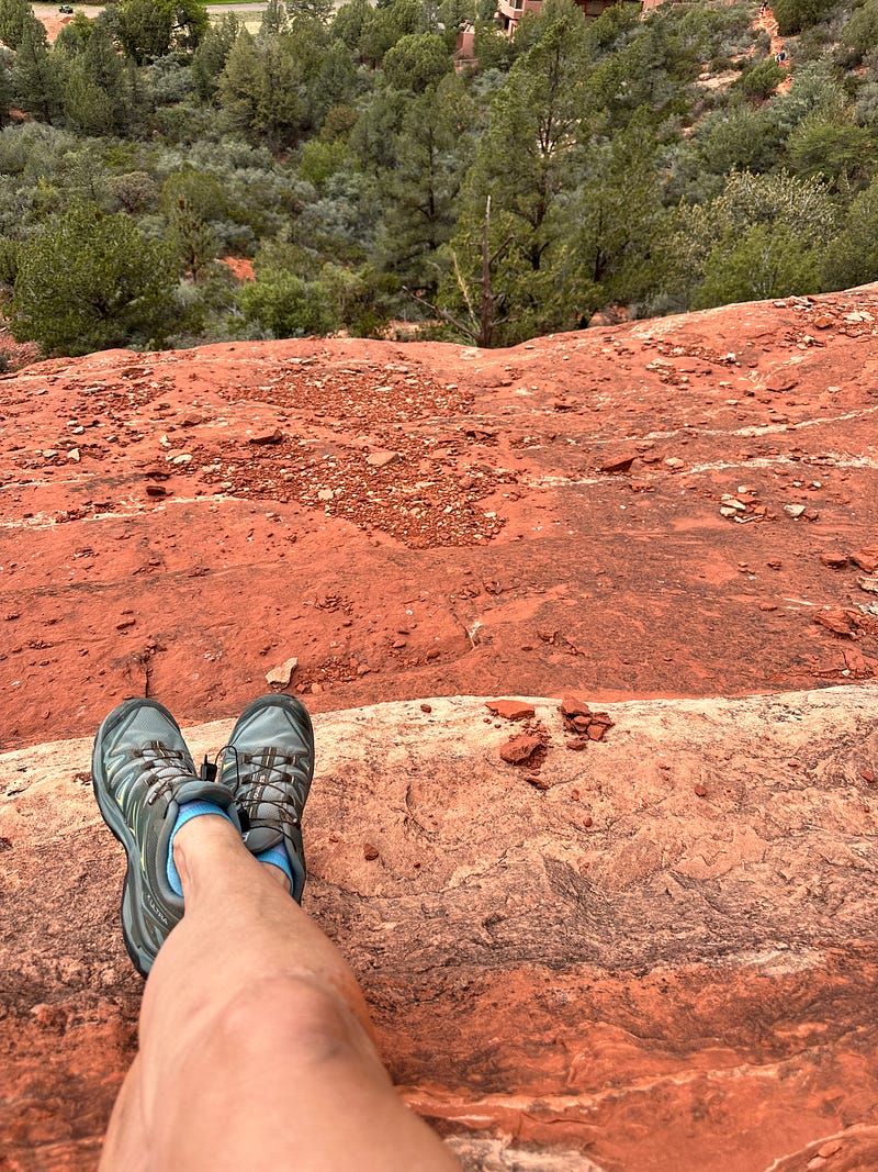
This was the view off to my right.
I decided that, while the view from up there was pretty spectacular, it was probably not worth the risk. I’d been promised a margarita at one of my favorite restaurants after the hike and I wanted to live long enough to drink it!
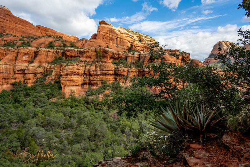
Once I was back down to trail level, we set off again, winding our way through a forested area rimmed all around with red rocks.
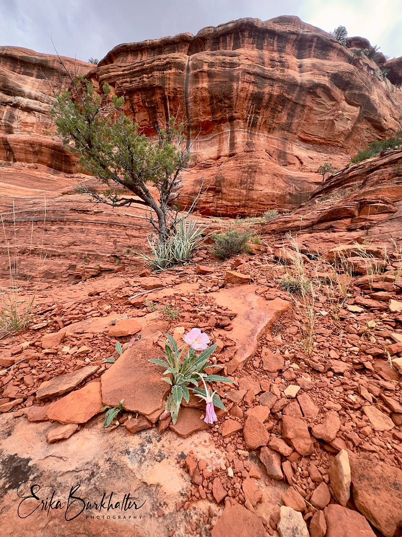
It always amazes me how trees and cacti can thrive by hanging on by their very toes to rocky crevices and craggy plateaus.
I have to confess that we did not even know about the allure of “Subway Cave” until we asked a couple hiking in the other direction if they had been to the ruins. She pulled out her phone to show me a picture and proclaimed that the cave was “Instagram worthy!” Apparently the cave was right next to ruins, which may or may not have been the same ones we had visited so many years ago.
It wasn't hard to find the turn-off.
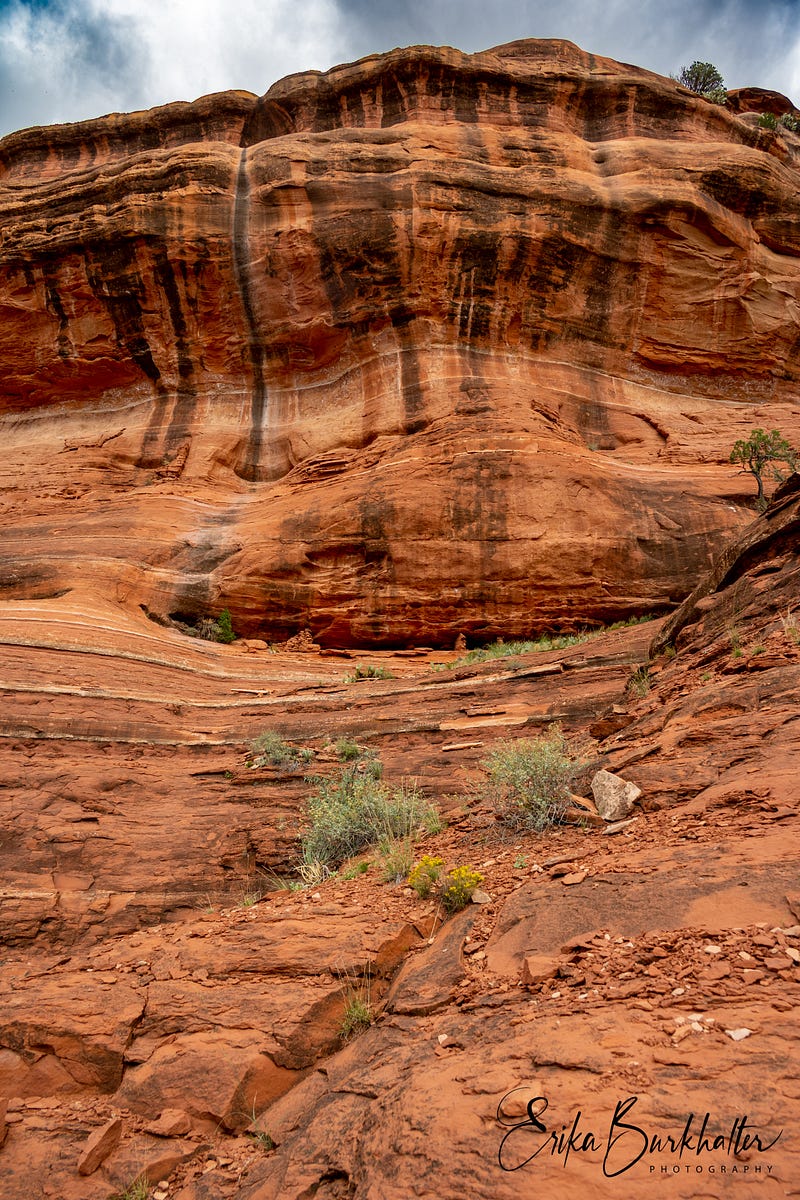
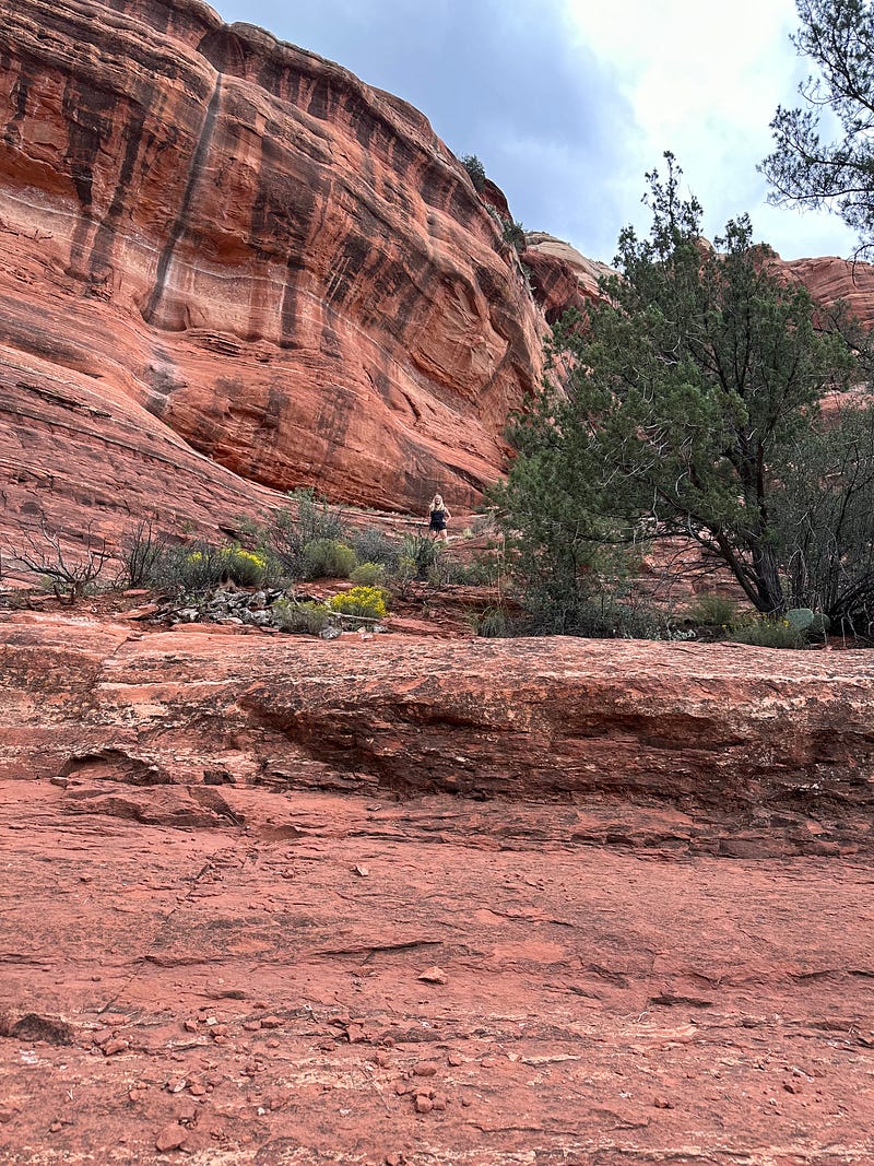
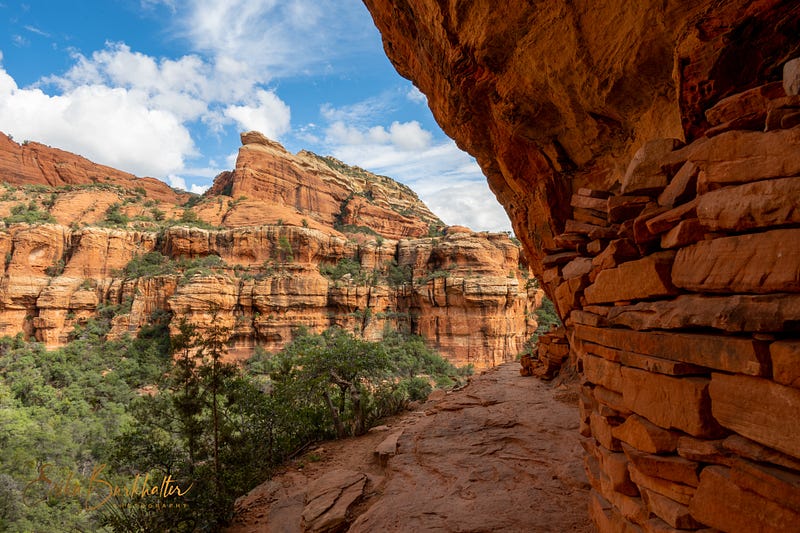
After scooting backwards with both hands and feet searching for niches to give us enough leverage to hoist ourselves up the rocky staircase, we made it to the cave.
You can see the way “up” to my right in the photo below.
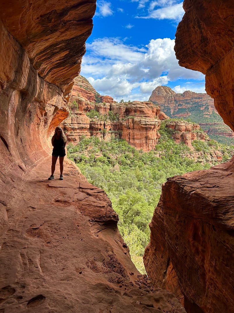
Unlike our experience of this trail many years ago, we were not alone. It’s become quite a popular destination. I had to wait a while for people taking “selfies” to clear out of the way in order to take these photos.
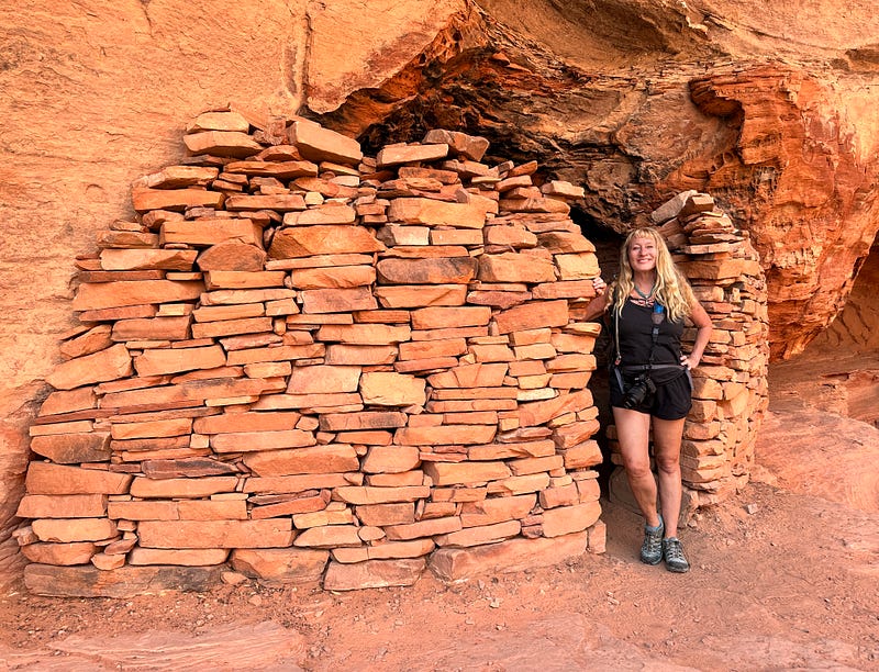
For the very brave of heart, you can walk out onto that ledge to the right and around the corner, then the ruins are right there.
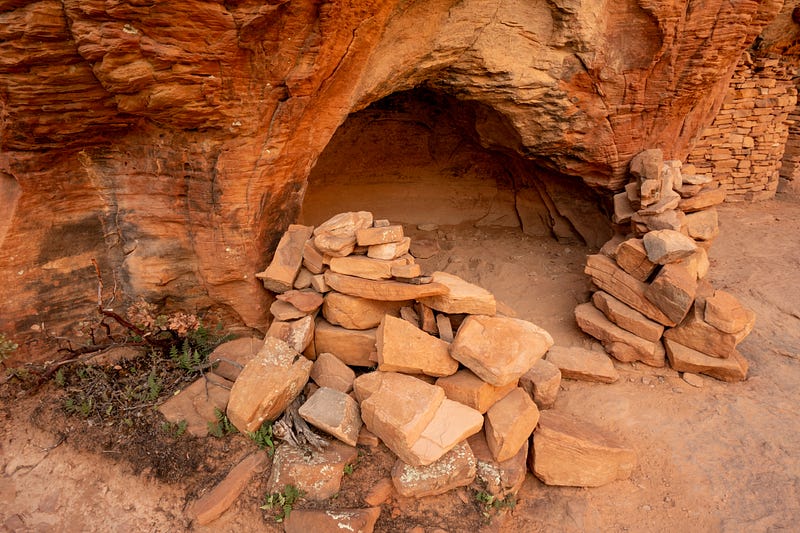
Or, like me, you can climb back down and then take an (easier) scramble up to the Sinaguan site. We’re still not sure if these were the same dwellings we saw so many years ago, but they were really interesting to see, nonetheless.
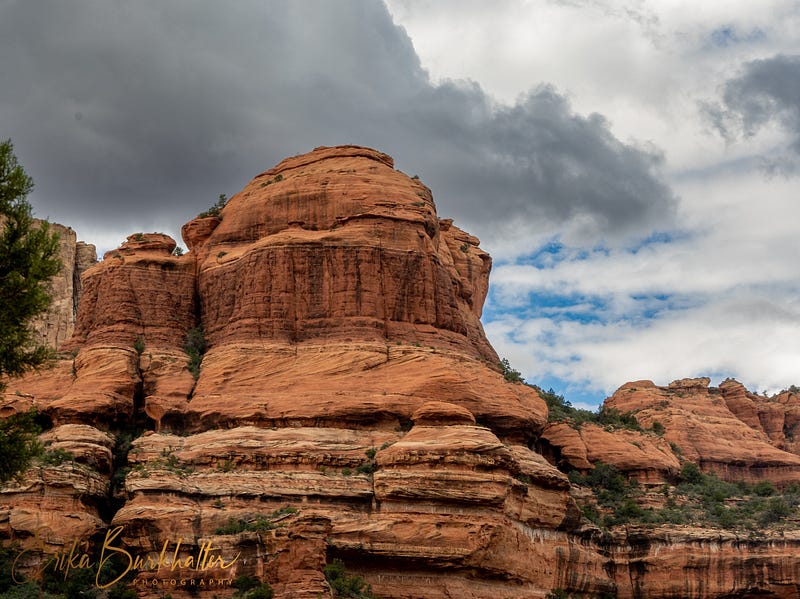
It’s a pretty epic place for a home, don’t you think?
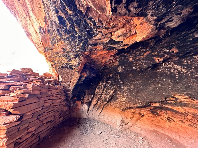
My imagination goes wild thinking about what it was like to live here.
You can still see the smoke from their fires on the walls.
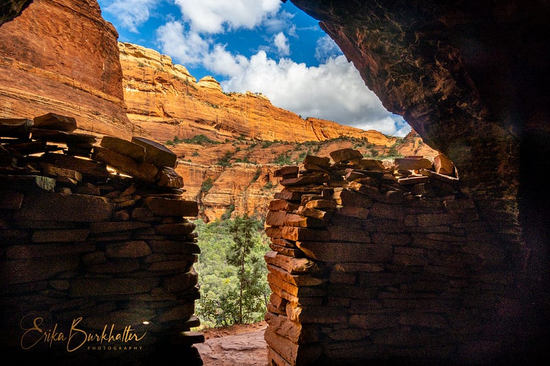
This dwelling has been a bit “reconstructed.”
What a view they had! I’d sure love waking up to that each morning.
After getting slightly lost on our way back down, we made it into town and to Hillside Restaurant, where I had my promised margarita — and french fries and a glass of wine! We felt like we deserved it.
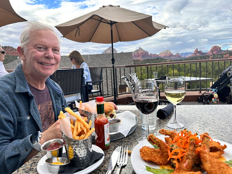
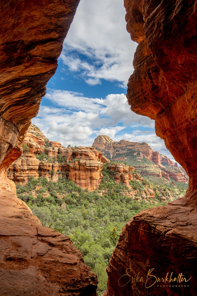
And the view from here wasn’t too shabby either.
Erika Burkhalter is a yogi, neurophilosopher, cat-mom, photographer, and lover of travel and nature, spreading her love and amazement for Mother Earth’s glories, one photo, poem or story at a time. (MS Neuropsychology, MA Yoga Studies).
You might also enjoy these:
If you enjoyed this piece, you might consider subscribing to my stories. You’ll get an alert whenever a story gets published. While I do normally post my stories with free “friends” links on social media, if you enjoy reading on medium, you can help the many talented writers here by joining. It helps to support the arts and to keep us writing!
And, because I’ve had a few people asking lately, if you’re ever interested in purchasing a photo, just leave me a note.
Photos and story ©Erika Burkhalter. All rights reserved.