
Randolph’s Leap
A scenic walk in Moray’s countryside, with a historic backstory
In an attempt to motivate me to move more, I recently bought a book of 40 coast and country walks in my local area. Randolph’s Leap is quite close to my home, so I decided to ease myself in gently. Also, there is a cafe at one end of the walk! I promised myself a hot chocolate at the end, as a reward.
The Legend
In the 14th Century, two feuding families lived on opposite sides on the River Findhorn; the Cummings on the Dunphail side, and the Randolphs on the Darnaway side. Historically, the Cummings held the position of Ranger of the forest of Darnaway, a position which brought with it wealth and social standing. Unfortunately for Sir Alexander Cumming and his six sons, he was out of favour with the King, Robert the Bruce, whose nephew was Thomas Randolph, Earl of Moray.
Having been warned by Randolph to stay out of Darnaway, Alexander’s eldest son, Alistair, hatched a plan to attack Randolph’s castle. Alistair and his men were ambushed at Darnaway and retreated to the river, where Alistair and three of his men desperately leapt across the narrowest point of the gorge to safety. (Though not for long – Randolph’s men found them hiding in a cave and killed them anyway).
You would think that the narrow part of the gorge would be called Alistair’s Leap, given he was the one doing the leaping. Well, it was originally – but the land was later granted to Randolph by the king, and gradually the name was changed.
The Walk
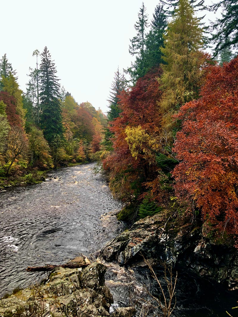
The woodland path along the River Findhorn from Logie to Randolph’s Leap is a popular and scenic walk all year round. The area has been designated an SSSI (Site of Special Scientific Interest) by NatureScot.
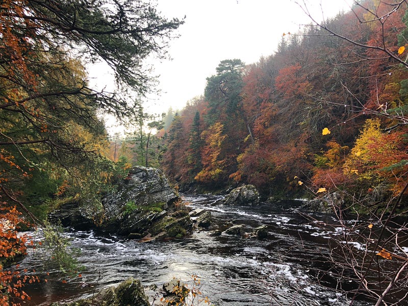
Randolph’s Leap is the narrowest part of the gorge, so it is perhaps the least impressive part of the walk. The views are more dramatic further down the river, where the River Findhorn and River Divie converge.
There are two flood stones to be seen along the path, marking the high-water mark of the “Muckle Flood” of 1829. These are both set quite some distance above the riverbank – the river rose 16 metres above its normal level.
At places, the path is very narrow and close to the edge, with steep, unprotected drops down to the river. I therefore cannot recommend it for children or dogs. The ground can be wet and slippy underfoot, so waterproof sturdy footwear is a must.
It is possible for a small number of vehicles to park on the roadside near Randolph’s Leap, in case you would like a much shorter walk.
Alternatively, if you are in the mood for a 4 km walk, parking is available at Logie Steading, a visitors centre in Dunphail with shops, a children’s play area, and the aforementioned cafe!

One walk down, 39 to go….