
My A-Z Favorite Travel Destinations — Mariposa
On the road again heading for my favorite M spot 140 miles away.
We did something different last week: a three-day road trip! Hooray! Where did we go? Mariposa. Where? How? And why on earth Mariposa?
Where we went and how we got there.
Mariposa is about a hundred and forty miles east of our home in Castro Valley. We drove on I-580, I-205, I-5, and CA-120 to Manteca. Then it was south on US 99 to Merced and east on CA-140 to Mariposa.
Now, what exactly is Mariposa?
Well, first of all it’s a county. One of the original 27 counties in California. In fact, it once was the largest county. But then the state legislature began carving out other counties, mostly from Mariposa. Mariposa is now the 53rd largest county in California by population. Only Trinity, Mono, Modoc, Sierra and Alpine are smaller.
Oh, and there is not one city in the entire county!
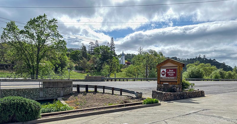
Mariposa is also a town. The town of Mariposa is the largest in the county with a population of 1,725 and is the county seat. Technically, it’s not even a town. According to our federal government, it’s merely a census-designated place! And it’s where we stayed two nights.
And why on earth did we go there?
Well, if you are a history buff… or to be more specific a California History buff… or to be even more specific, if you are interested at all in the California Gold Rush era, then you go to Gold Rush places like Mariposa County.
But if you are not a history buff, you probably wouldn’t understand.
There are very few history buffs poking around these days and no one seems to be bothering the grazing cattle. So, the cattle are happy (except those that end up on the menu of Happy Burgers, a popular spot in the middle of town).
I’m a history buff. I’m also writing a book. Most of the action in the book takes place in Mariposa.
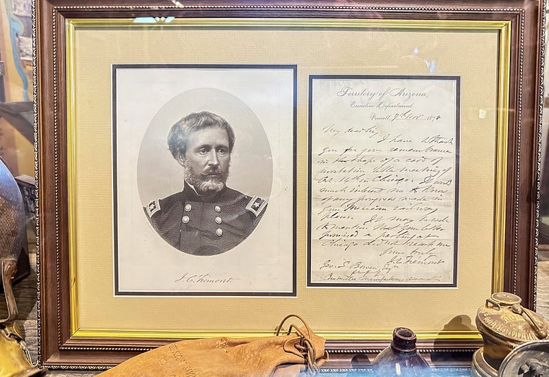
I started researching the expeditions of John Charles Fremont 50 years ago when we were living in Fremont, CA. Then 26 years ago I began to focus on the 17 year period when Fremont was involved in California gold mining. My story begins in 1847 when Fremont bought a parcel of land called Rancho las Mariposas from Juan Alvarado, an ex-governor of California when it was still part of Mexico.
I made many trips to Mariposa in 1997 and 1998 when I was researching for my book but then 25 years went by in a flash and I recently realized that I need to make at least one more trip to finish the research.
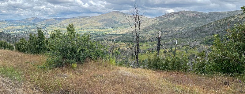
Mariposa County has 17,225 residents. Most of them live in the western two-thirds of the county. The eastern third of the county is all mountains — very few people live there. That is a lot of land for just a handful of people — mostly grass and trees and those grazing cattle.
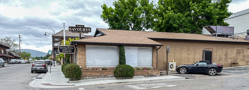
On day 1 of our road trip we drove to Mariposa the town and had dinner at a very nice restaurant right on CA-140 called Frederick’s of Savourys.
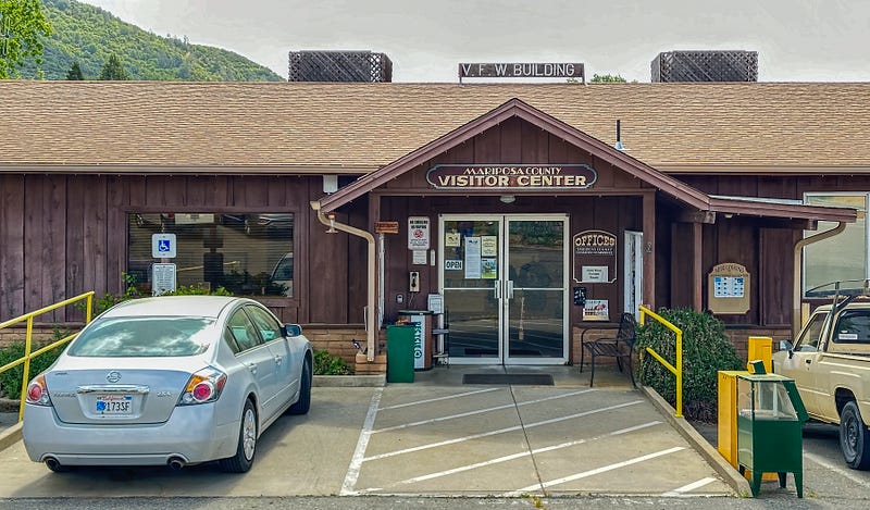
On Day 2 we visited the Mariposa Visitor Center because we were visitors and that’s what visitors should do. We asked if there were any flood dangers we should worry about. They assured us that there weren’t.
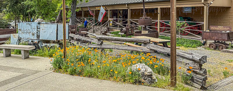
Then we spent late morning and early afternoon at the museum. That’s what history buffs do.
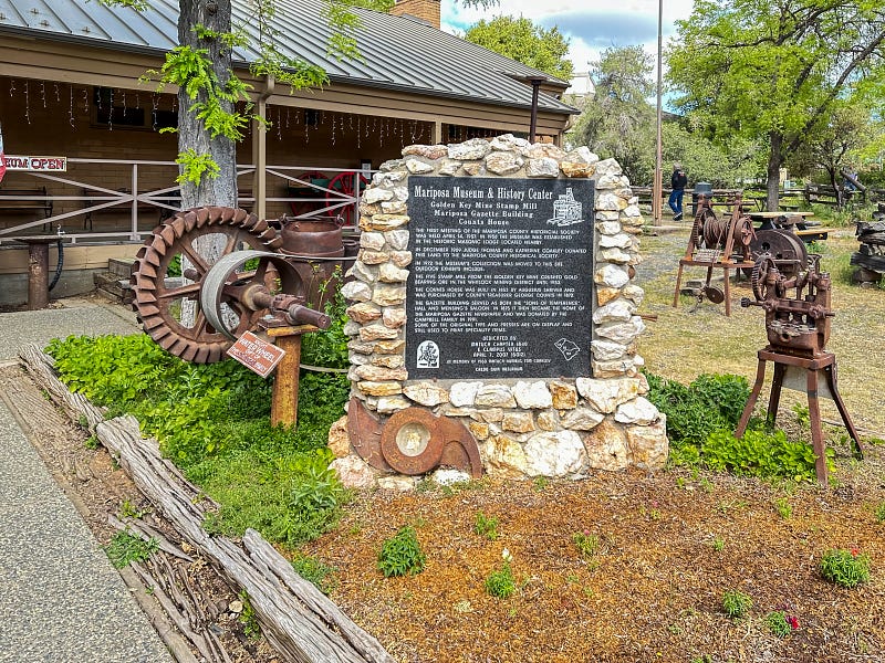
According to the Smithsonian Institute, the Mariposa Museum is “the best little museum of its size west of the Mississippi!”
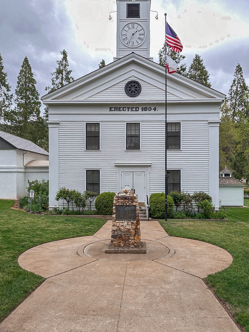
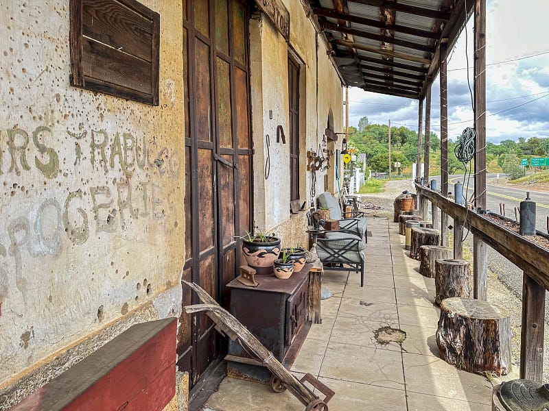
After lunch (Happy Burgers) we drove down Bullion street (named after Fremont’s father-in-law, Senator Thomas Hart Benton who acquired the nickname of “Old Bullion” because of his stand for using gold and other metals instead of paper currency) and visited: - the county library (for a little research); - the county courthouse (built in 1854); - the old stone jail (built in 1858); - St Joseph’s Catholic church (built in 1863).
In 1850 Fremont built an adobe hotel for Palmer and Cook, San Francisco bankers who leased the Mariposa Mine from him. It’s the oldest building in town and once housed the Gold Coin Sports Bar and Grill but is now a Japanese ramen restaurant called Little Shop of Ramen.
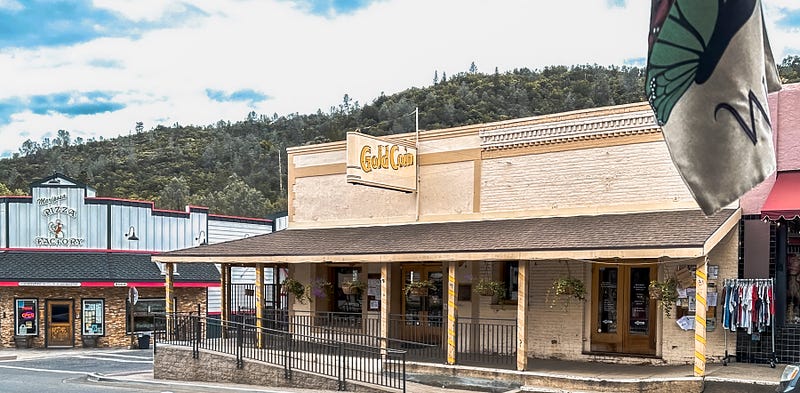
After our Bullion Street excursion we walked around Old Town Mariposa a bit (it only takes up a block of CA-140, Mariposa’s main street, which also goes by the name of Charles Street, named after John Charles Fremont himself) and then we drove to the mountains.
But why did we drive to the mountains?
Well, about 4 million people a year visit the eastern third of Mariposa County, which is better known as Yosemite National Park.
John Muir thought Yosemite was the most beautiful place on earth. He once walked all the way from San Francisco to Yosemite, following the stage coach roads that CA-120 now parallels. And he lived there as a shepherd for many years. Muir founded the Sierra Club to preserve his beloved land. His ultimate achievements were in 1890 when he helped form Yosemite National Park and in 1903 when he convinced Teddy Roosevelt that Yosemite National Park should include Yosemite Valley and the Mariposa Grove.
Lincoln had already signed a bill back in 1864 giving the valley and the grove to the state of California. In 1906 California gave them back to the federal government so that all Yosemite would be united in one National Park.
The heart of Yosemite lies in Mariposa County. The park also extends to Tuolumne County north of Mariposa and Madera County south of Mariposa.
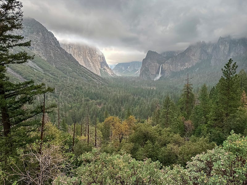
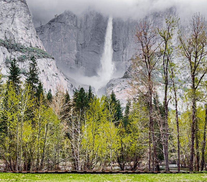
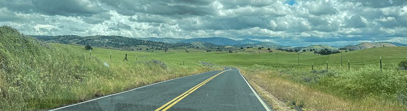
Yosemite Valley is about 40 miles from our motel in Mariposa. We thought it would take us about an hour. Wrong. No one told us about the two detours requiring waits of 20 minutes each on the way to the West entrance. So, our drive from Mariposa took more than two hours.
The valley was closed the day before our trip because of flood danger but reopened when the Merced River failed to reach flood stage.
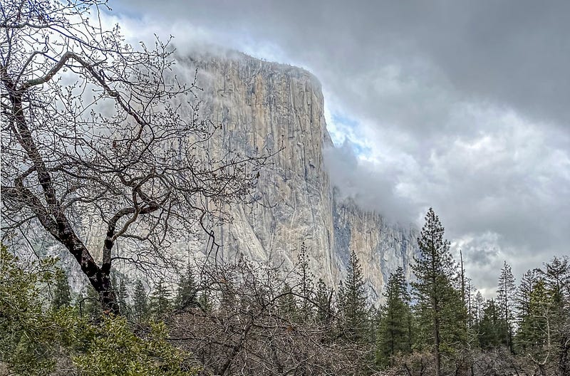
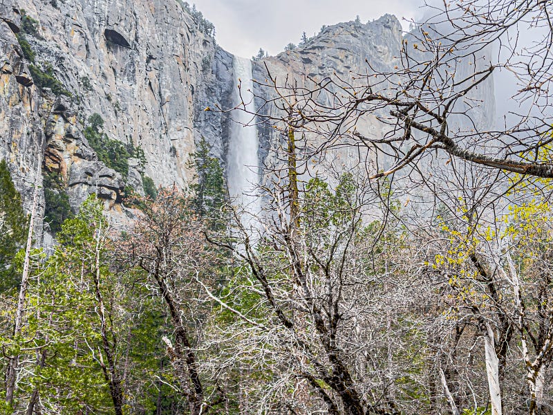
It was cold and it was wet when we got to the tunnel view on highway 41. It was colder and wetter when we got to the valley floor and we noticed that many of the meadows near the Merced River looked like swamps. Here’s what we saw:
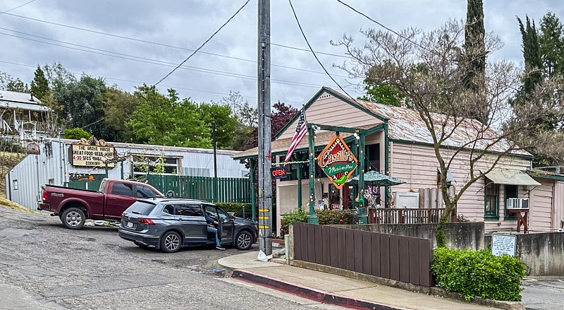
I took my pictures and we returned to Mariposa (the town) where we had dinner at Castillo’s Mexican restaurant, one of the few restaurants open on Monday nights.
On day 3 we visited the Catholic church, surmised where the Mariposa Mine probably was (up the hill past the church cemetery), and then took the long way home.
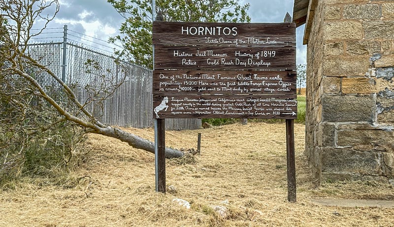
We drove up CA-49 to Bear Valley where the Fremonts lived for a couple of years in the 1850s and then down Bear Valley Road to Hornitos, the home of Joaquin Murietta, a famous stage coach robber during the gold rush era. Hornitos once had a population of 15,000 but it’s practically a ghost town now.
Then we drove east on Hornitos Road to Cathey’s Valley and back to CA-140 and on to Merced and US99 and back home.
It rained almost all the way from Turlock (where we stopped at Olive Garden for lunch) to Castro Valley. But we didn’t care. It was so nice to be on the road again!
Now on to the letter N — unless I decide to write about my favorite ruins (the Globetrotters May Challenge) first.
Sam Millichap started the A to Z challenge last year and wrote her Z story many moons ago. Adrienne Beaumont was next to complete her Z story. I have my Z picked out already, but I have no idea what I’m going to do about X!
In case you missed it, I wrote my L story in January about our 2012 adventures on the London Underground.
I have been waiting since then for fairly good weather to get to my M story. I think I’m last in line. Anne Bonfert wrote her O story a couple of weeks ago. So, there are at least two of us still involved in these challenges!
Thanks for reading!


