
Heading West: Road-tripping through the Desert
Desolate lands are sometimes the most beautiful
Writing this article is hard…
Just typing this story’s title makes me want to take three weeks of vacation, fill up the gas tank, and stock up on snacks for the road. And, as we all know, shopping for road trip snacks should look like a ten-year-old was given $100 and was left unsupervised.
When my wife and I take road trips, we TAKE ROAD TRIPS. We’re talking a lot of miles. My favorite route to Las Vegas is about three thousand miles, round trip when you add in some side attractions and adventures. That route is mostly what I’ll be writing about here.
Let’s get the hell out of Dodge!
When we have done this trek, we usually tend to leave after work on our specified date so we can avoid burning an extra day of vacation time. We head west out of Topeka and make the approximately four-hour drive to Dodge City, Kansas. Yes, that Dodge City. Boot Hill, Wyatt Earp, and lots of cattle. We stock up on my dad’s homemade beef jerky, eat whatever delicious meal my mom wants to cook us, and then take advantage of a free night of lodging with them. Usually, we are also dropping off the biggest of our fur babies, Maisie. An early start the next morning, preferably a Saturday, and we continue west (and south…).
Is there anything better than an early morning, coffee in hand, heading out on the open road with little or no traffic in sight? I don’t think so. An hour or so into the trip, I’m sure Coye (my wife) had handed me at least one sparkling water, most likely a Perrier. If it was convenient, we probably got a sausage biscuit at McDonald’s, because that’s just what we do. They just hit a little different on a road trip.
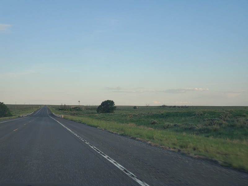
From Dodge City, we head Southwest through the Oklahoma panhandle and continue on into New Mexico. On this particular venture, we stayed in Clayton, NM. After arriving late the night before we grabbed some gas station breakfast and headed west on Highway 412. That drive was absolutely gorgeous on a Sunday morning. I don’t think we saw another vehicle for at least two hours. Countless times we pulled to the side of the road and took pictures from the roadway or even stood between the yellow lines on the pavement.
We made our way to Interstate 25 and went south, down through Santa Fe and Albuquerque. From Albuquerque, we went west on Interstate 40, and that highway is definitely not my favorite. Lots of trucks, trucks, and more trucks. But, you take what you get when it comes to traffic and I just had Coye hand me another Perrier, or maybe a Red Bull, and we kept trucking…
Traveling into Arizona we had one place marked on our map, and since it was an outdoor activity (during the peak of Covid), we decided to stop at the Meteor Crater Natural Landmark. It was quite the attraction to see this massive hole in the ground that was created by a massive rock from outer space. If you’d like to check it out click here. After the crater, we rolled into one of our favorite cities, and a possible retirement location, Flagstaff, Arizona.
Settled into our hotel and decided to find some local breweries that might have some outdoor seating. We found Mother Road Brewing and it was so good that I’ve recommended it to several people who have traveled to Flagstaff since. Check them out here. We did a little bit of wandering around but several places were closed due to Covid and also the time of day. We were exhausted so we called it a night.
The Grand Canyon
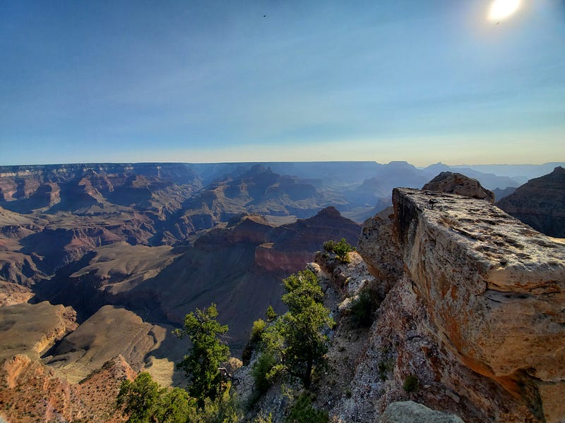
Waking up as early as we possibly could the next morning we filled our water packs and prepared to do some hiking in Grand Canyon National Park. We left Flagstaff and took Highway 180 north out of the city and then went north on Highway 64. This will lead you right to the South Rim entrance. If you pull into the park between 6 a.m. and 6:30 a.m. you will find that the parking lots are empty and you won’t have any tourists photo-bombing your Instagram pics.
If you’ve never been to the Grand Canyon, I can’t even begin to explain the massive expanse that you will see. The sheer depth of the canyon and the river at the bottom plays tricks on your eyes. Looking at the layers of rock that were cut through during millions and millions of years of erosion is fascinating. One can find themselves just staring at certain parts of the canyon forever.
We decided to do the South Rim Trail and it was a long, but fairly moderate hike. The entire trail is paved and there are plenty of places to rest and take pictures along the way. I think our round-trip hike took approximately 3.5 hours, maybe 4 hours at the most. By the time we got back to our vehicle, the parking lot that had three cars in it when we arrived, was now full. We did a quick change of clothes and continued our journey.
We dropped back south on Highway 64 and got back on Interstate 40 westbound. More trucks…
Our furthest west destination was Las Vegas, but I’m not going to go into much detail about Vegas on this trip for multiple reasons. It was the height of Covid and Vegas had just reopened. It was like the Wild West, but not in a good way. It was the most uncomfortable we had ever felt in that city. The crowds were different, there were a lot of mentally ill vagrants just wandering around (including inside the casinos, which are usually regulated by security), and it was just not what we’ve grown to love about Sin City. Luckily we only spent two nights there and moved on to our next stop.
Leaving Las Vegas
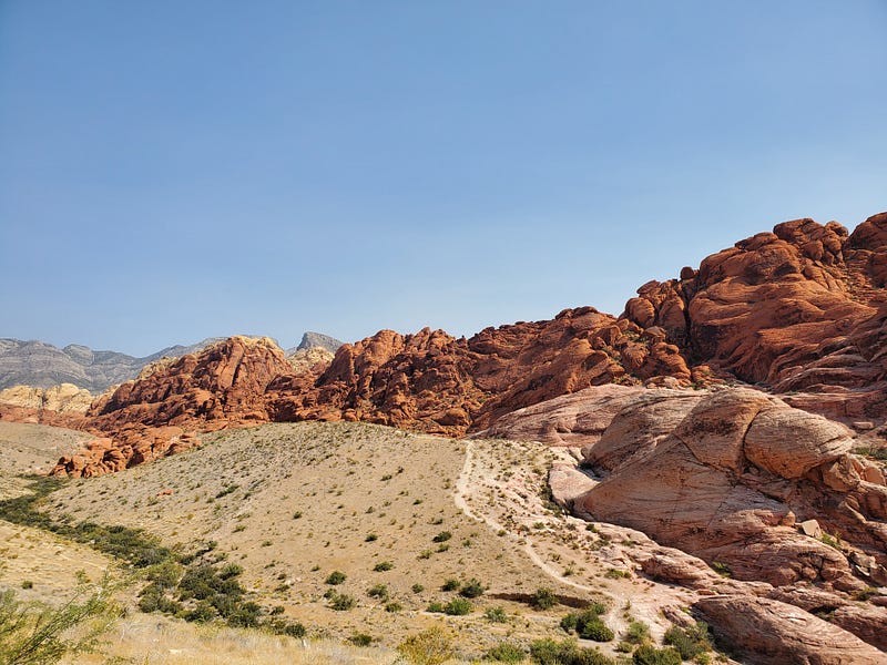
Because we couldn’t wait to get out of Vegas we were up early on our next travel day. We want to visit Red Rock Canyon which is directly west of Las Vegas and only about a 20 to 30-minute drive from The Strip. We were lucky enough to drive up to the admission gates and be informed that the day we were there, there was no admission. Hey, our luck is turning around!!
We spent about an hour or so driving the loop and exploring some short trails. Red Rock has some amazing rock formations and color contrasts. It’s a photographer’s dream during the right time of day.
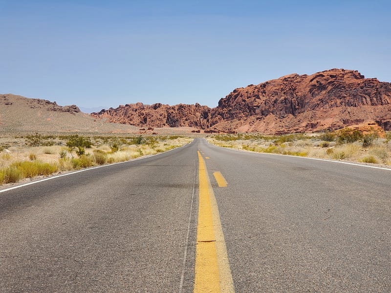
We left Red Rock and made our way North out of the city. We took Interstate 15 about 45 minutes north and then went back east on Valley of Fire “Highway”. This road can get a little desolate and the movie “The Hills Have Eyes” came to mind several times. But, this lead us to Valley of Fire State Park and it did not disappoint. The drive through the park is fantastic and the colors, rock formations, and landscape is gorgeous. I would highly recommend it when near Las Vegas.
Taking Highway 169 north out of the park, we made our way back to Interstate 15, and then continued northeast into the Northwest corner of Arizona, and then into Utah. That drive is great for scenery but doesn’t have a lot of places that you’d want to pull off.
Zion
Still traveling North, we went through St. George, and continued until we turned east on Highway 9. We stopped in Hurricane for fuel and then continued to stay on Highway 9 into Zion National Park. We had reservations at a hotel right outside of the main entrance, in the town of Springdale.
Springdale is a magnificent little town. It’s at the base of the Zion monuments and everywhere you look there is nothing but awe-inspiring scenery.
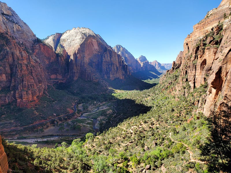
Zion National Park is, quite possibly, my favorite. Plenty of hiking trails for a multitude of skill levels and the crowds when we went, weren’t awful. Again, if you can get up as early as possible you can beat the crowds to the best trails.
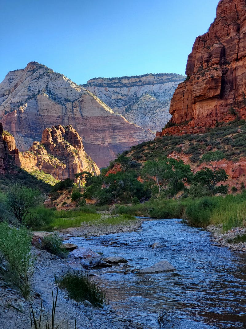
We spent three nights in Springdale, and had two full days of hiking. We would hike early in the morning to avoid the heat and crowds. Those afternoon naps after a long morning of climbing and hiking are beautiful.
After our stay in Zion and Springdale our journey resumed with us heading east on Highway 9 until we met up with Highway 89 and went north. We kept that heading until we got to Highway 12 and turned east. Our next National Park was just south of Highway 12.
Bryce Canyon National Park
Bryce Canyon National Park is stunning. The natural weather phenomenon that has caused some of the geologic structures is fascinating.
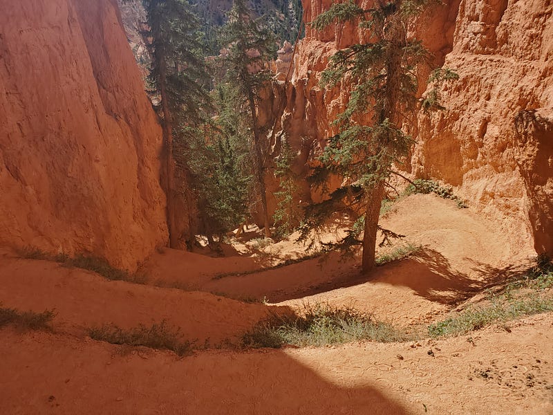
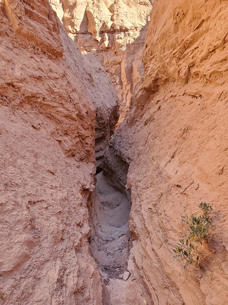
If I am remembering correctly, we started near the north end of the park and took the Queen’s Garden Trail. It started near Sunrise Point, and took a wide loop around, with it ending at “Wall Street”. Professional tip: Do NOT end your hike at Wall Street. See picture below.
At the end of the hike, we washed off a little dust. OK, a LOT of dust and then decided what to do next. We had booked a hotel in Bryce, which is right outside of the National Park entrance, but we try and stay flexible and we just weren’t feeling like we were spending our time wisely by staying there a full night. So, we decided to pivot and cancel our night in Bryce and make a stop near Capitol Reef National Park. We quickly got out the Google machine and found a cool little place in Torrey, Utah. A few clicks and a credit card number typed out, and we had altered our plans!
We stayed in Torrey, Utah that night and had an amazing hamburger at a local food truck called Capitol Burger. There is a reason this place has a five-star rating on Google.
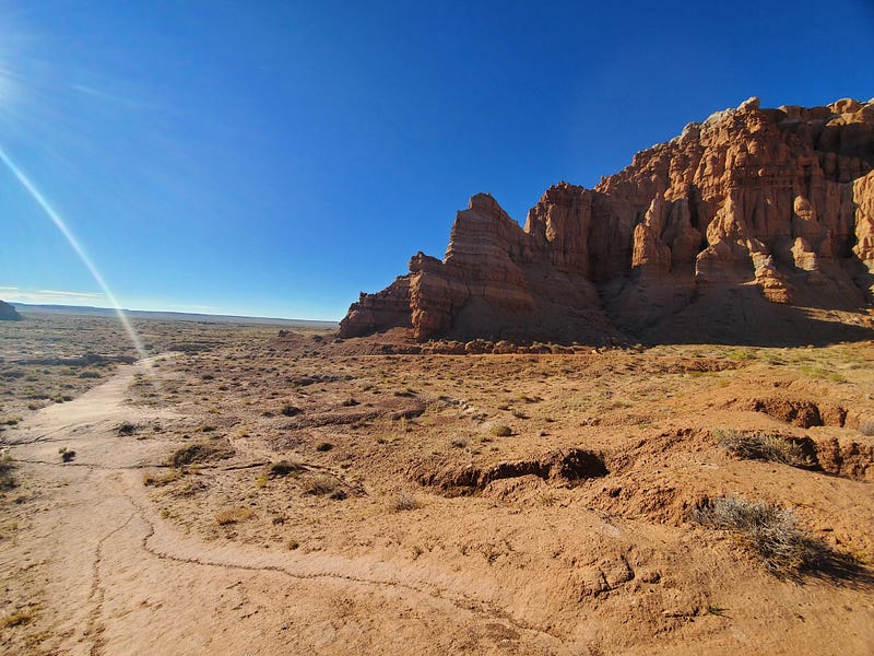
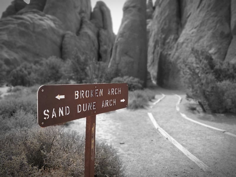
The next day we continued our travels and went east on Highway 24. We turned north on Highway 24 where it meets Highway 95. As we were traveling North we noticed some signs for another state park. We had seen this park before but we didn’t have time to stop. This time we decided to check it out, and with a name like Goblin Valley State Park, how could we resist?
Goblin Valley
Goblin Valley was quite the little random find. We paid our entrance fee and decided to do a quick hike that might take a couple of hours. We decided to do the Carmel Canyon Trail and to also check out the Goblin’s Lair. Yes, it was as cool as it sounds.
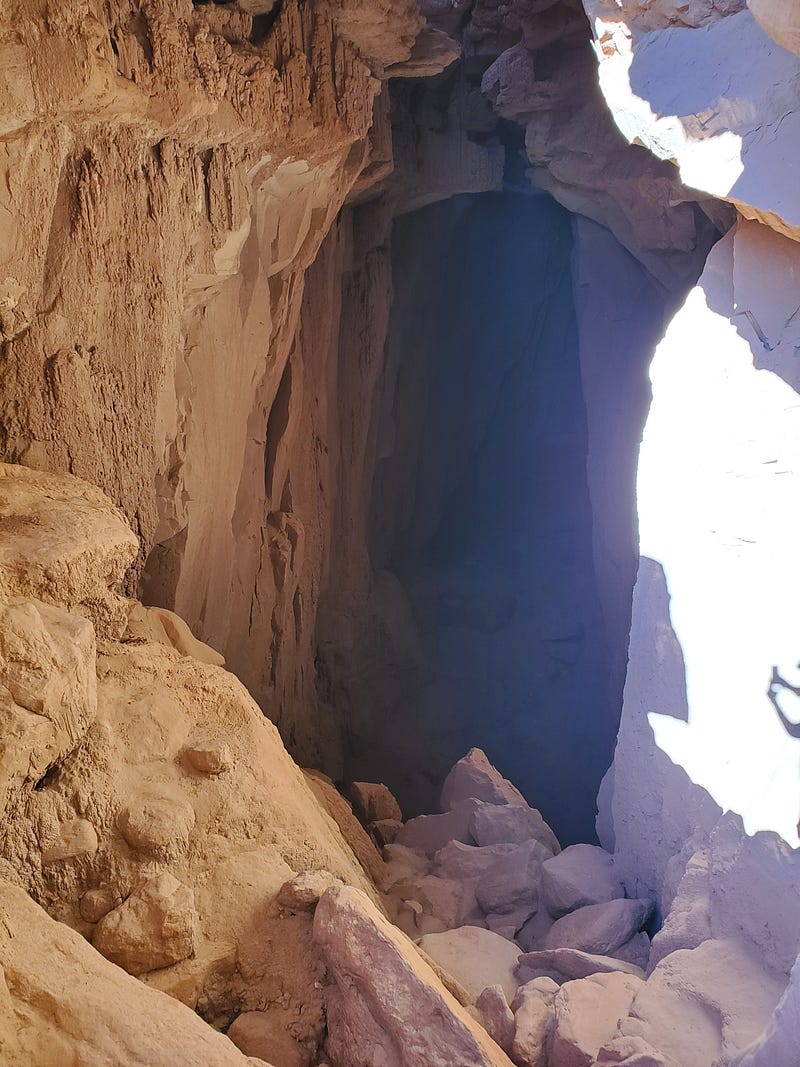
We did find ourselves in a little bit of a precarious situation at one point on the trail when we discovered that we needed to do a little bit of climbing and had to use each other as stepping stones…We also had to navigate this:
We made it out unscathed and continued…
Moab, Utah
With our mini adventure behind us we continued on to Moab, Utah.
Moab is a fun little city that caters to those that like to climb rocks, but with Jeeps and other motorized vehicles. Everywhere you look you’ll see side by side utility-type vehicles driving up and down the streets, parked in parking spots, and being carted around on trailers. If you’re a Jeep fan, you’d be in heaven. Every type of four-wheel drive vehicle you can imagine can be seen up and down the main drag. It’s not really our cup of tea, but it was fun to marvel at the sheer number of All Terrain Vehicles (ATV) that were zooming about.
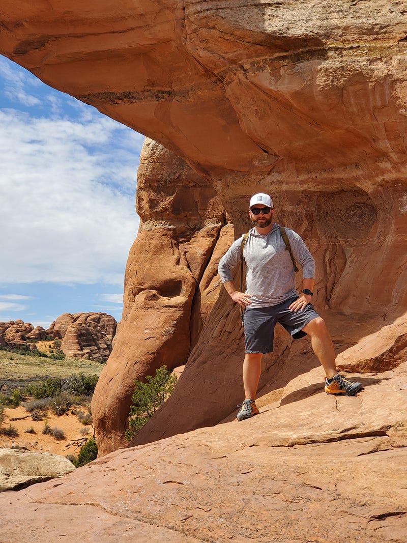
The main focus of our stay in Moab was to explore the several National and State parks that are in the area. Arches National Park was at the top of our list, followed by Canyonlands, and then Dead Horse Point State Park. Unfortunately, by the time we hit Moab, we were exhausted. We really only had time and energy for one park, so we went with our first choice and explored Arches. We loved it.
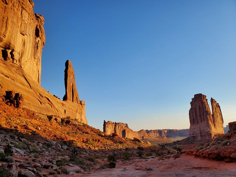
I think we both would go back to Arches given the chance. We started the morning doing a fairly quick hike on the Park Avenue Trail (pictured above). It was stunning to see the morning sun hit the giant pillars of rock. The crowds of tourists were non-existent and it felt like you were on another planet.
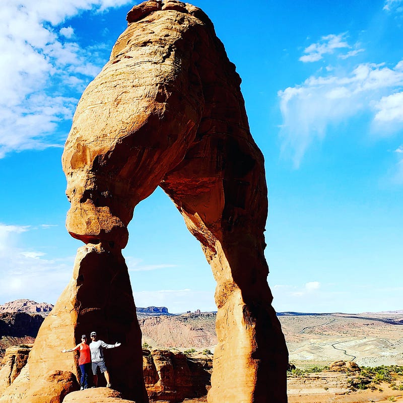
After Park Avenue, we made our way to the Delicate Arch trailhead. This was a bit of a hike with some elevation. Fortunately, we had packed our water packs and were prepared to sweat a little. The sweat was worth it.
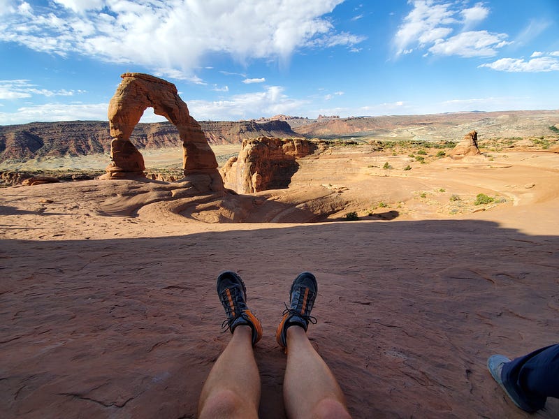
We sat and admired The Delicate Arch for a while. There was something about it that just drew you in. Imagining the amount of time that the earth took to create such a work of art was hard to come to terms with. This is one of the more popular arches, so get here early to avoid the crowds if you can.
After we pulled ourselves away from the Delicate Arch, we stopped at several other places along the Arches Highway loop.
As the day got hotter, we decided to shelve our hiking shoes for the trip and made our way back to the hotel where a nice and cold swimming pool was waiting for us. Not to mention the variety pack of local beers that I had picked up the day before…
The LONG way home
Due to our timing, we had one full day to get from Moab, Utah all the way back to Dodge City, KS. A little over 681 miles in one day.
We grabbed coffee at a really cool little drive-thru coffee stand on the south end of Moab. It was called Wicked Brew Coffee and it was exactly what two weary travelers needed to make the trek home.
We shot down Highway 191 and then went east on Highway 491 through Colorado until we got to Highway 184. We took that east until we hit Highway 160 which we took all the way across Colorado until we got to the desolate Highway 10. We took that east across a prairie of nothingness and arrived in La Junta, Colorado. After La Junta, we took Highway 50 until it turned into Highway 400, and lead us right into good old Dodge City. We pulled into my parent’s driveway and peeled our rear ends from the seats. To say that was a long drive would be an understatement.
We stayed the night and made the rest of the four-hour drive home the next morning.
Thank you for sticking with me during this full road trip recap. Now please excuse me while I go start packing some road trip snacks.
Thanks for reading and following along! As always, if you have any questions or comments, please leave a note or send an email. I’d be happy to answer any travel questions you may have!