Mature Flâneur
Climbing Madeira’s Highest Mountain
The many ups and downs of climbing Pico Ruivo
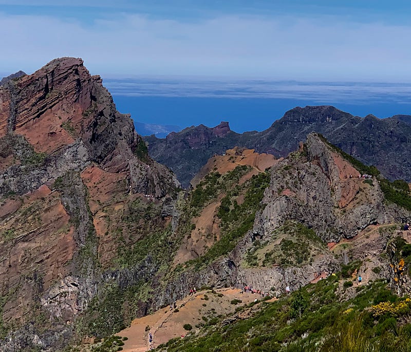
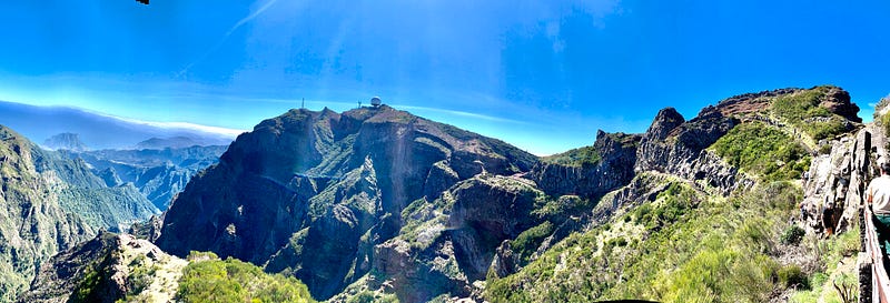
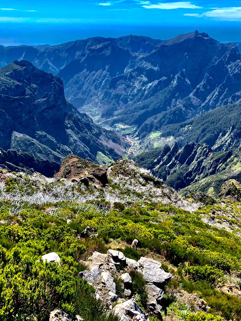
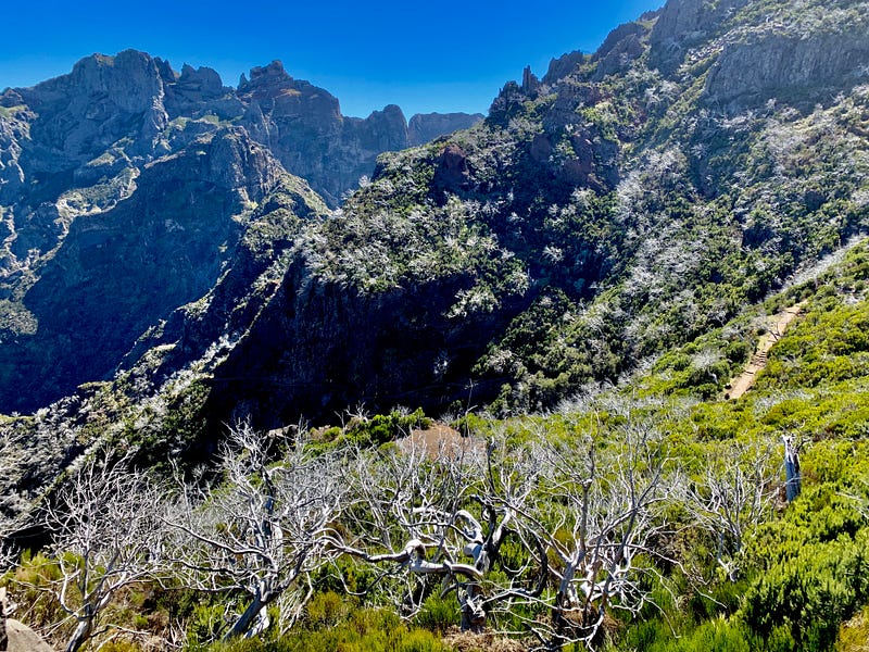
The Island of Madeira is a vertical place. No surprise, as it is the remnant of a volcano. But from the shore, one has the illusion that outside of the capital, Funchal, the island is simply a series of green cliffs and river valleys, with little fishing villages at the bottom, tiered farms, vineyards and banana plantations all the way up to the top. All very orderly and civilized, which one would naturally expect after 603 years of civilization (The Portuguese claimed the island in 1420). That illusion got shattered for me the first time I glimpsed the interior—a wild, raw land of steep gorges and impossible peaks. I gaped.
If Funchal is Lisbon, the interior is Lofoten. It looks far more like the mountainous Norwegian islands than a subtropical paradise off the coast of Africa.
Teresa had signed me up for a hike across the center of the island, to the peak of Pico Ruivo, a distance of 9.8 kilometers. Six miles? No sweat, I thought. I had walked this far on several Norwegian treks last summer and certainly climbed far higher (Pico Ruivo tops out at 1,861 meters above sea level). It was thoughtful of my beloved spouse to book with a tour company because with a rental car I would have had to walk in and out from the same starting point. The tour company drops hikers off in the morning at the trailhead of Pico do Arieiro near the south coast and then picks them up in the afternoon at Achada do Texeira, a viewpoint on the north coast not far from Pico Ruivo.
Luis, our designated driver, sent us a digital map in advance and explained the route to the eight of us hikers as we left the city. He told us we would have four hours and forty minutes until pick up on the far side of the island. That would give us a pace of two-and-a-bit klicks per hour for the hike, which seemed pretty slow, even for a mature flâneur. I had not counted on how much vertical distance I would actually be covering over those horizontal 9.8 kilometres, as measured on the map.
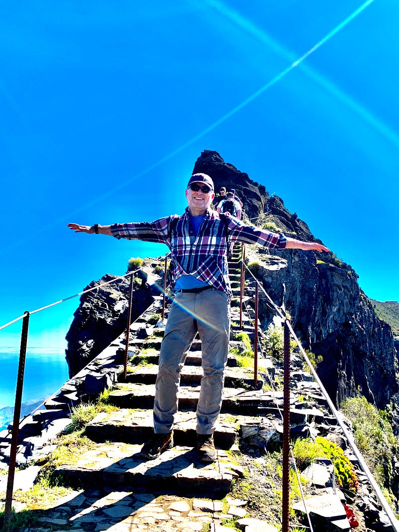
I was the oldest person in the van. The rest of the hikers were in their thirties. They all seemed massively fit, especially the only other solo hiker, Mattais a Swede who looked like a young Thor, except for his shaven head and aviator sunglasses. Not to worry, Luis assured me. Anyone in reasonably good shape could do this hike, so long as they were not afraid of heights.
The weather, Luis told us, was perfect. Normally, clouds can roll in across the Atlantic and cover the island at any time. But today the sky was utterly clear, as blue as a swimming pool. “You’re all lucky! It’s like a day in August,” said Luis with a grin.
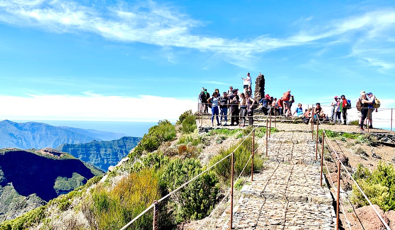
However, because of the fine weather, there was a traffic jam at the starting point. A Madeiran woman was shooing tourist drivers in their rental cars away from the roadside, back down the hill, yelling at them that parking was only for tour buses. “Don’t worry,” Luis assured us all, “more than half of these people aren’t here for the hike, they go up to the viewpoint by the radar station, 100 meters away, then come right back down.”
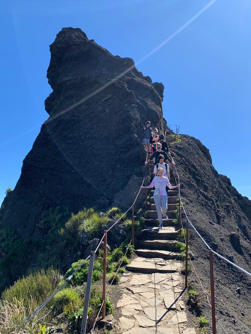
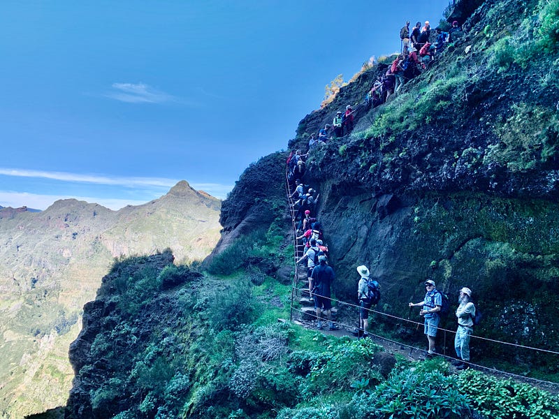
Even so, that meant we were far from alone on our perfect day. I could see several dozens of people on the trail ahead. But, on the other hand, to me all this company was comforting, given the precarious path. If I got into trouble — I do have a wonky knee — there would be plenty of help.
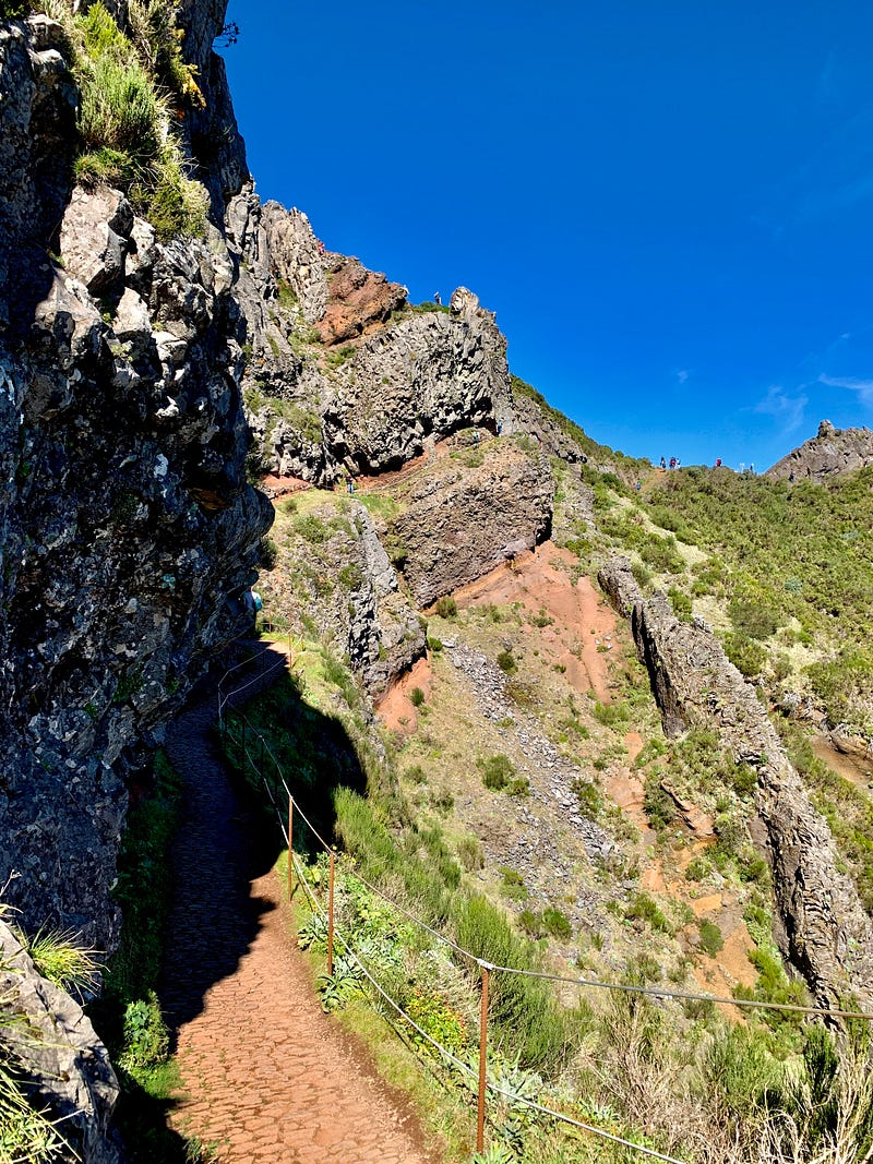
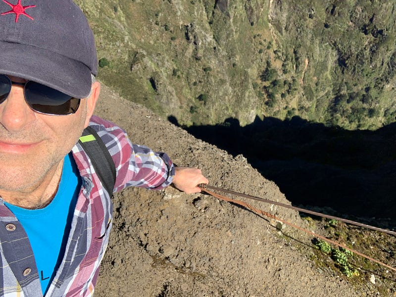
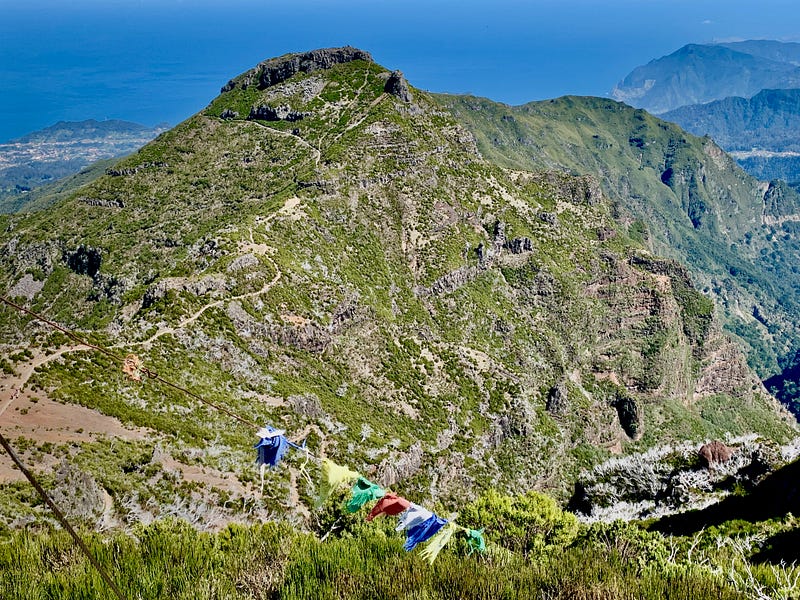
Leaving the lookout at the trailhead, the route took a series of ups and downs over some of the steepest territory I have ever passed through, even in Norway. But unlike the Northland, these trails had plenty of wire guardrails, with stone stairs cut into the most vertical parts. So yes, it was a precipitous climb, but with no real danger of falling.
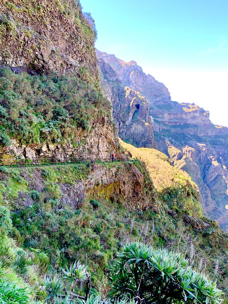
In some places the path had been hacked out of sheer rock wall; in others, it narrowed to a knife edge, with vertigo-inducing drops on both sides of the trail. In those stretches, I clung to the wire guardrails at first, until I came across a wire line that had simply snapped and was lying slack on the ground. Okay, so not a good plan to trust these wires with one’s life.
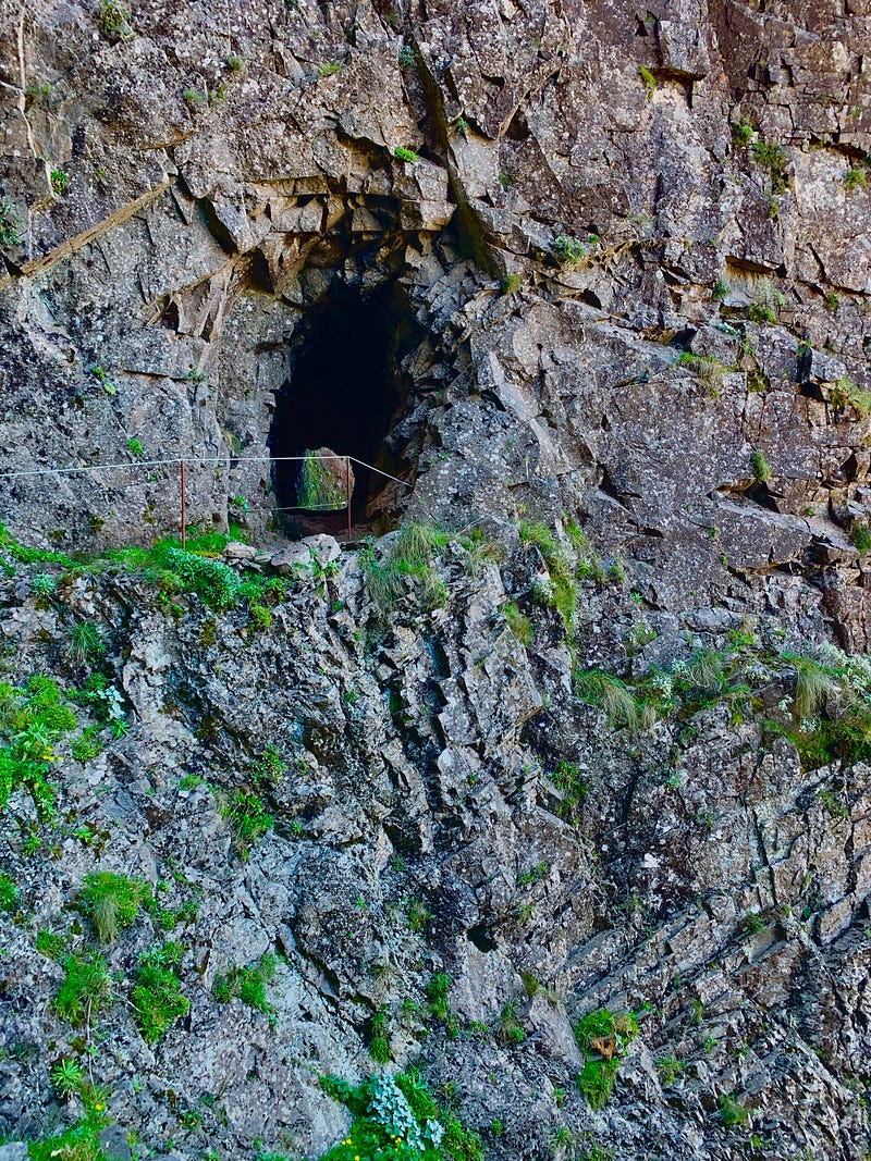
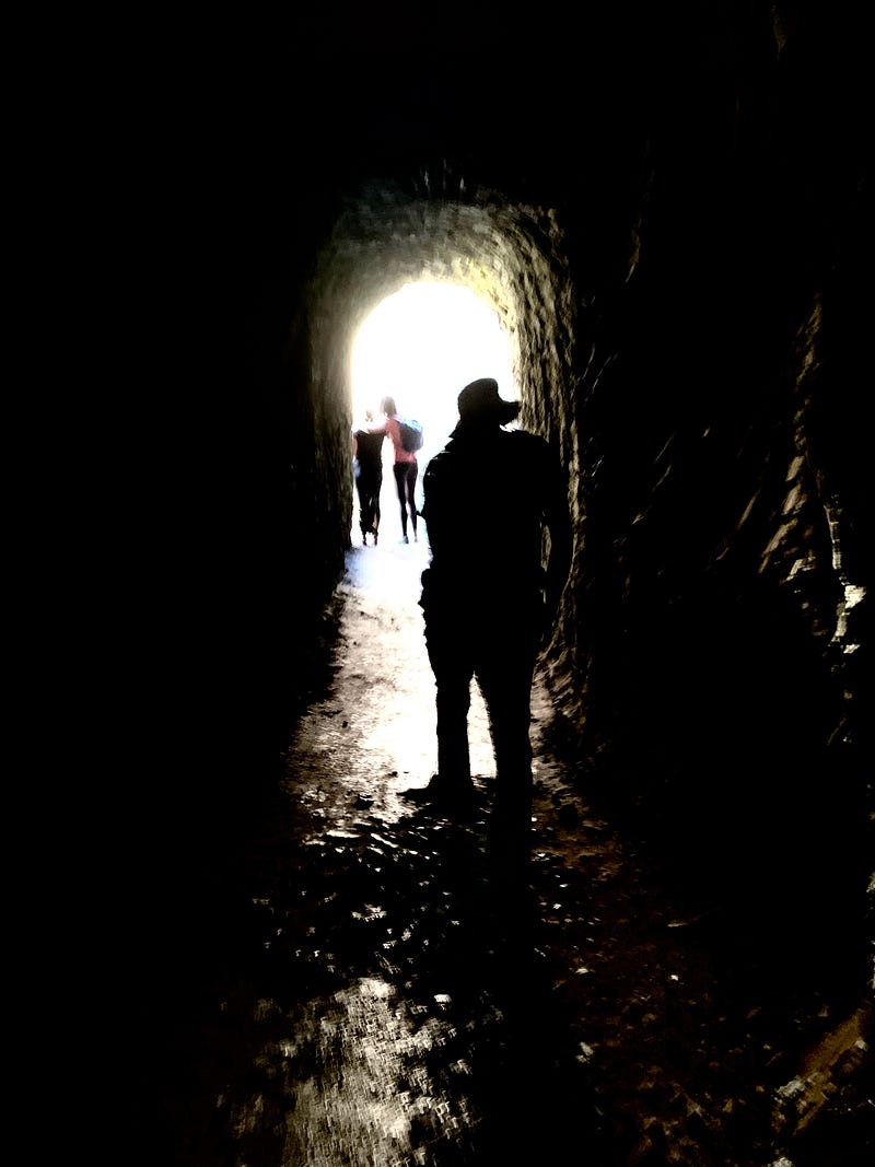
In several places where it was impossible to create a path around a cliff, tunnels had been dug right through the stone. These tunnels were invariably damp and dripping inside, with puddles a few inches deep. These were difficult to avoid in the darkness, even with the help of my smartphone flashlight. Fortunately, my boots were waterproof, but I saw plenty of hikers in running shoes. Frequently I heard curses or cries of dismay in the tunnels as someone soaked a foot.
The middle part of the trail ran level for a while, and then abruptly shot up in a series of stairways, some so narrow that hikers could only move in one direction at a time. This created traffic jams requiring patience and politeness all around. I was heartened at the civility. A little bit of shoving could have ended in tragedy.
After climbing what seemed an endless stairway to heaven, at last I crested the pass and could finally see Pico Ruivo. My chest heaved. My lungs had not worked this hard since Norway. Thankfully, Teresa had recently shared with me a new technique for climbing stairs she had learned on a Tik Tok video, called “hinge walking” that takes the stress of climbing off the knees and allows the big muscles of the quadriceps to do most of the work. I may be an old dog, but thankfully I’m always ready to learn a new trick.
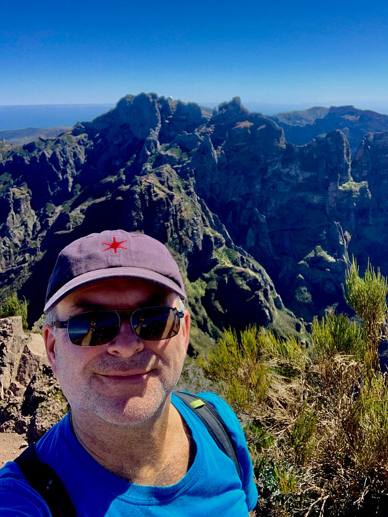
An hour later, I was at the top of Pico Riuvo. From the peak, I could look around the island and see ocean for 360 degrees. I could not fathom how an island that seems so small could contain mountains so big.
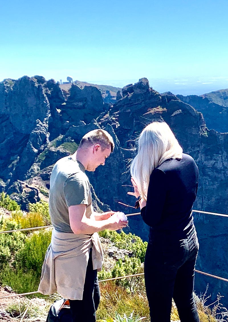
Near me at the lookout, a woman screamed. Oh my god, had someone fallen? No, there was a man next to her on one knee. He held a little white box open in his outstretched hands. She wiped tears of joy from her eyes and drew him to his feet, and they embraced. The people around them clapped. Now, that’s a classy engagement, I thought to myself. But what if she—or he—had not made it to the top?
I ran into Mattais again, a.k.a. Thor, at the peak’s lookout. He was now wearing nothing but shorts, a hat and aviators.
“Why are people still wearing coats?” the big Swede asked me. It must have been about 67 degrees. Of course, back in his homeland, 67 is summertime.
He confessed that for him, this had been a strenuous hike, which made me feel great.
“Just imagine it on these 65-year-old pins!’ said the mature flâneur, tapping a thigh.
It was an easy, hour-long, downhill stroll from the peak to the parking lot where Luis was waiting for us in his van. I would gladly pay once more to do this walk all over again, I thought to myself on the ride back to Funchal, but not for a few days! As I finish writing the story, two days later, my thighs are still painfully sore from all the hinge walking. But my old knees are just fine.
Want more Madeira? You can find all six of my Madeira stories at the top of this list: