
Chickasaw National Recreation Area Day 1
Sulphur, Oklahoma
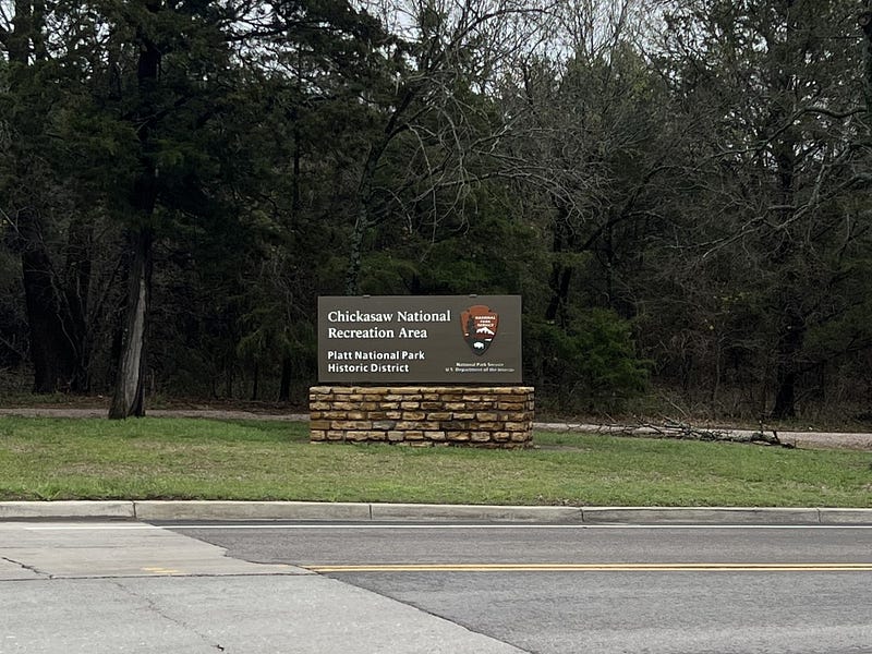
We left Carlsbad, New Mexico on Thursday, March 23 and headed to Chickasaw National Recreation Area in southern Oklahoma. We arrived on Friday, March 24 and camped at The Point Campground for two nights.
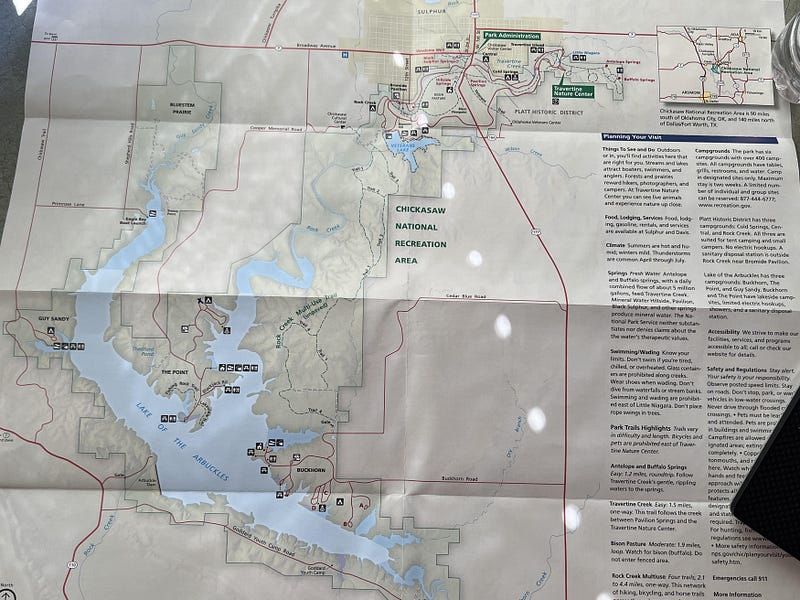
Chickasaw National Recreation Area is located on the Lake of the Arbuckles and includes all the area surrounding the lake. It is 90 miles south of Oklahoma City and 140 miles north of Dallas, Texas.
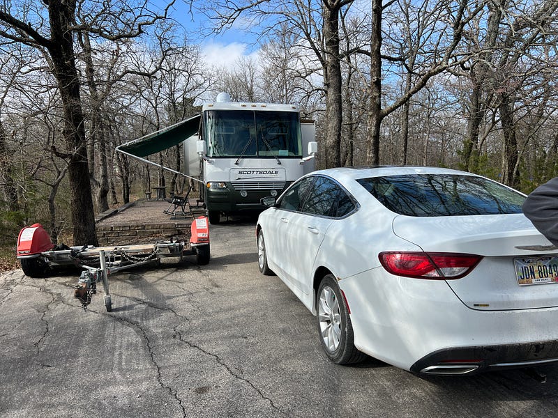
It was a beautiful camp spot at The Point with a lot of room and privacy. We love camping in spots like this where it is secluded in the woods and surrounded by trees. We were able to sit outside under the awning for the first time in 3 months.
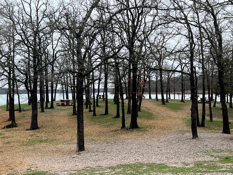
Since we arrived early in the day on Friday, we decided to do some sightseeing for the afternoon. First thing we did was explore the campground and the immediate area of The Point.
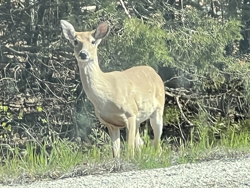
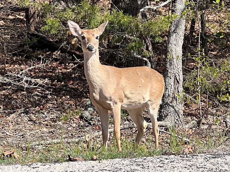
We saw a lot of deer in the area. I am never sure if they are Whitetail Deer or Mule Deer. Most of them looked like Whitetail Deer.
The differences in the tails of these deer is the best and easiest way to differentiate between the two species. Mule deer have a white rump and a tail with a black tip at the end of it. Whitetail deer have a brown rump and only the underside of its tail is white.
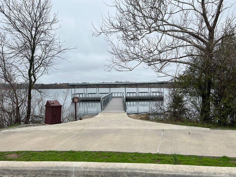
There are several nice picnic areas with access to the lake, a boat ramp, and restroom facilities.
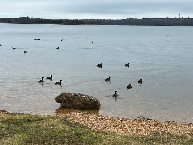
There were large flocks of American Coots in the water. This is the most Coots I have seen at one time.
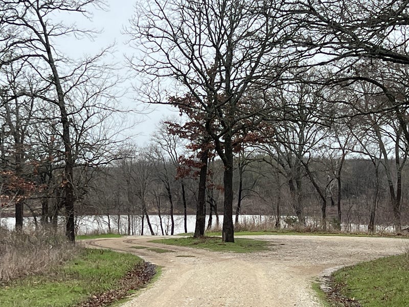
The next area we explored was Breezy Point and Post Oak.
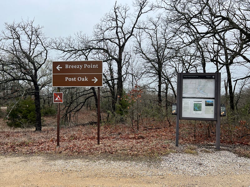
Post Oak Road is a gravel road that ends at the lake with a circle turnaround.
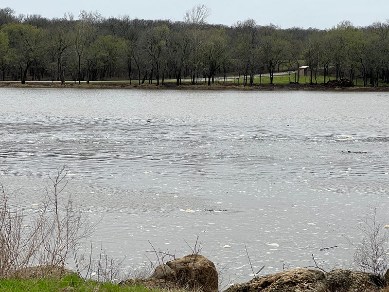
Breezy Point has a beautiful view of the lake from the shore and lots of picnic tables.
The next place we drove to was the Vendome Well at Flower Park in downtown Sulphur. Now I know why the town was called Sulphur.
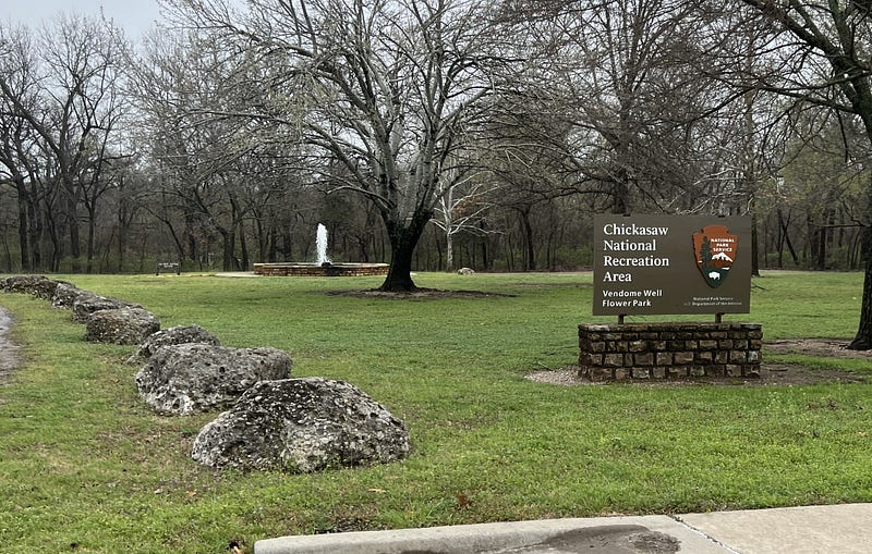
As soon as we turned into the drive we could smell the sulphur. If you have never smelled sulphur water, it smells a lot like rotten eggs. The fountain is beautiful from a distance.
Hydrogen sulfide gas gives the water the rotten egg smell. It occurs in wells as a result of decay and chemical reactions with the soil and the rocks.
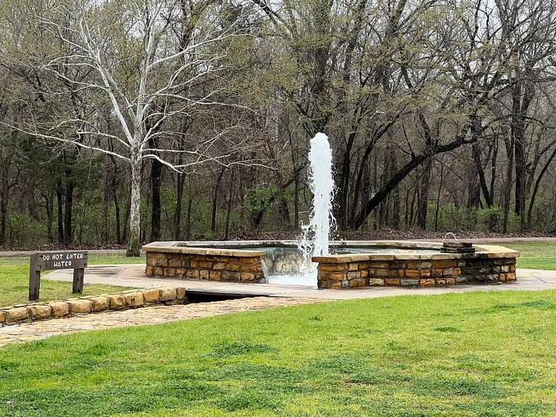
Rich asked if I wanted him to park so we could walk up closer. Nope. This picture is close enough.
This well flows under natural pressure with no pump. The water you see before you is nearly 10,000 years old. No wonder it stinks. The well was first drilled in 1922 and pumped out around 2,500 gallons of water per minute. It was called the largest flowing mineral well in the world.
By 1979 it was only producing 300 gallons per minute. It has been upgraded with modern plumbing and still produces about that same amount today.
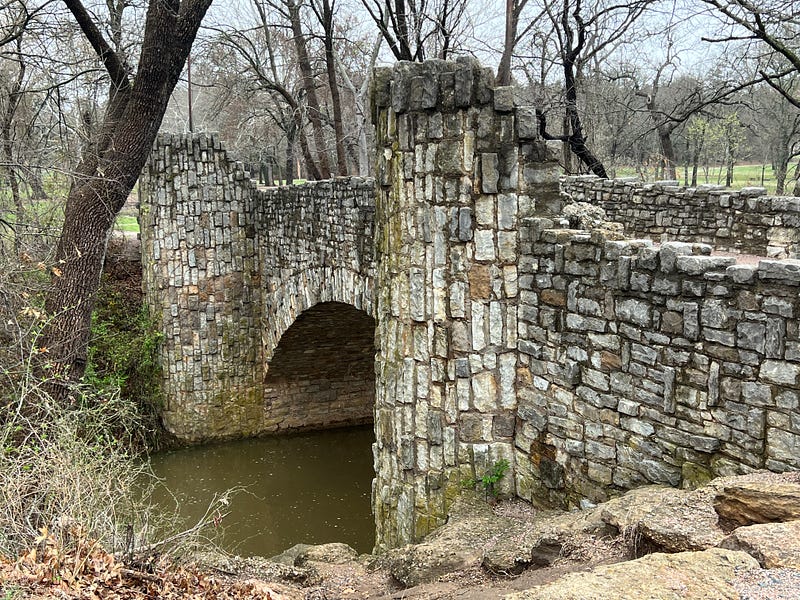
The Lincoln Bridge was built in 1909 after a small wooden bridge across the Travertine Creek collapsed. It connects the Vendome Well and Flower Park in the town of Sulphur to the mineral springs south of the creek.
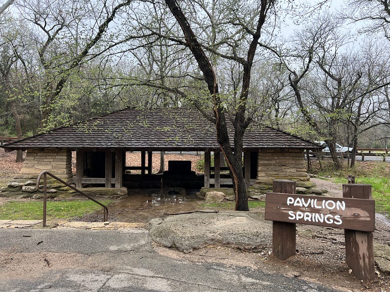
Pavilion Springs is the next stopping point on the east side of the road, while Hillside Springs is on the west side.
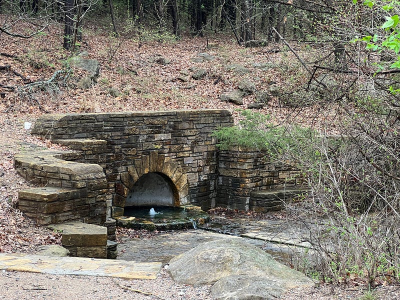
Knowledge of the medicinal powers of these springs existed long before the settlement of the town, during Native American habitation of the area.
We drove by the Bison Viewpoint at the Bison Pasture but didn’t see any bison nearby. It was a two-mile walk around the entire pasture and I was not feeling up to the walk.
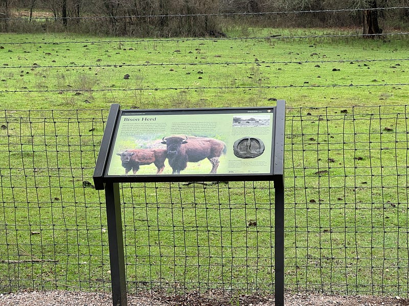
Do you know how to tell the difference between bison and buffalo? Bison have large humps at their shoulders and bigger heads. They also have beards and their horns are different.
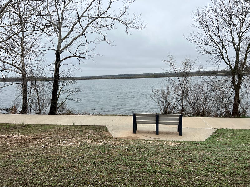
The next place we visited on Day 1 was Veteran’s Lake.
This is a man-made lake that was built in 1933 and became part of the National Recreation Area in 1983. A nice paved trail circles the entire lake at a distance of 3 miles.
What a beautiful tribute this place is to all veterans.
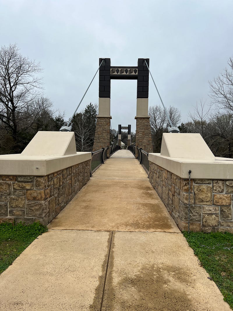
And finally, we came to the Bridge of Friendship.
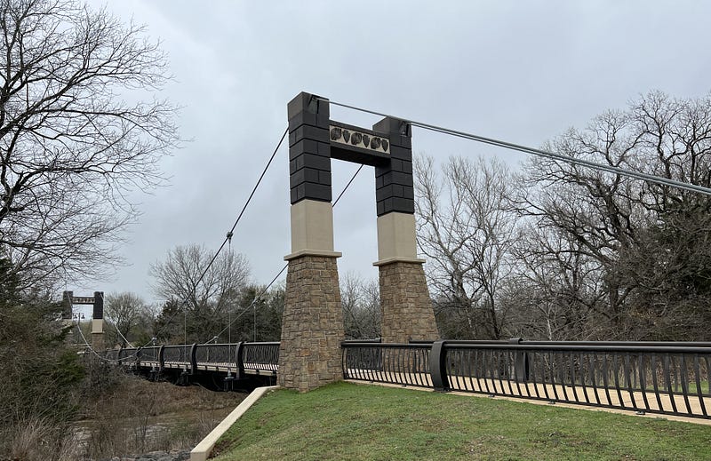
On the other side is the Chickasaw Cultural Center, which we did not go to. The bridge was built to symbolize the friendship between the Chickasaw Nation and the National Park Service.
Stay tuned for Day 2 of exploring Chickasaw National Recreation Area. It is absolutely gorgeous here and I can’t wait to share it with all of you.