
A Road Trip To Ground Zero Of Climate Change, Part 2
How climate change has affected the Southwest
While man’s intervention since the Industrial Revolution may have hastened its start, we now focus on the results of our effect on planet earth. Climate change is primarily about water: too much or too little, and the warming of the polar areas.
If you live in the West, you may think how much rain they get in the East is not fair. However, in the East, they may say back to you, “yeah, deal with another flooded basement, then tell me how you feel.”
So I took a drive through five western states. This is the seventh story I’ve written on the megadrought in the Southwest. My previous reports about the drought have been primarily factual. This one is a firsthand look.
Albuquerque>Window Rock>Page, AZ
Occurring from about mid-June to mid-September, Arizona and New Mexico rely on monsoonal rains, primarily for agriculture and livestock grazing. However, depending on how the wind blows, the monsoons can also affect Southern California, Nevada, Utah, and southwestern Colorado.
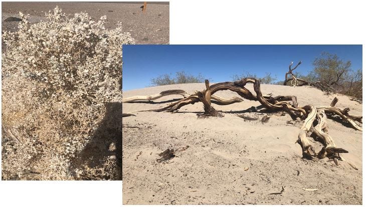
The last three years have seen weak, if non-existent, monsoonal rainfall. However, 2021 has been a bit better. Taken in the latter part of August, this trip showed some positive signs. Driving through the heart of the Navajo Nation, wide prairies are punctuated by mountain ranges, mesas, and buttes. I was pleasantly surprised to see these vast expanses being green as far as the eye could see, punctuated with clusters of yellow wildflowers. Don’t get me wrong; there was still plenty of brown! But there was grass for the livestock on which to feed.
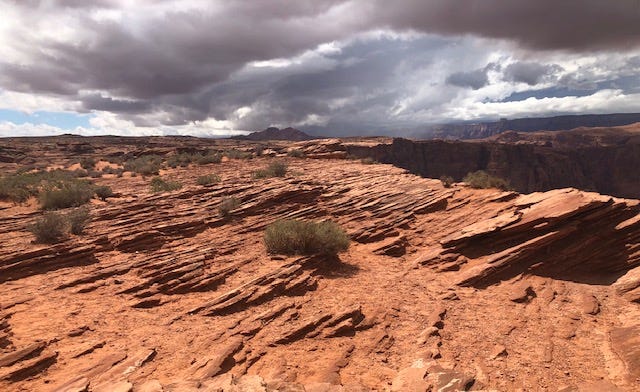
One of the highlights of the trip was to be Antelope Canyon near Page. It features swirls of different colors of sandstone amidst several slot canyons. Guess what? Rained out! Good thing and bad thing.
The area around Page and Lake Powell is mainly red sandstone. As a result, few plants can take hold unless they find a tiny crack or crevice, which they do.
Page>St. George, UT>Death Valley
Heading west from Page, you enter “The Arizona Strip.” It is a large piece of land bordered on the south by the Colorado River and the Utah border to the north. Interestingly, there is only one entryway into The Strip from Arizona. It’s like an island. When I say it appeared lush, I don’t mean Hawaii lush, but by Arizona standards. But, of course, we can attribute that to the monsoons.
Climatic zones and altitudes change quickly around here, going from desert to alpine forest back to desert about 30 miles east of St. George, one of the fastest-growing metropolitan areas in the country. But, aside from the cottonwood trees growing along the Virgin River, I see nothing but artificial green.
St. George gets all of its water from the Virgin. It looks more like a stream, at least when I saw it. The city wants to build a $1.8 billion water pipeline from Lake Powell. The terrain over which the pipeline would travel is very rough with many ups and downs, requiring massive pumps. Maybe St. George was just a bad idea to begin with.
Descending several hundred feet through a very narrow canyon (with tractors pulling three trailers going 75 mph!), you arrive in the valley which includes Las Vegas and the beginning of the Mojave Desert. The road skirts the north side of the city, so The Strip didn’t tempt me. Unfortunately, this area received no monsoonal moisture. They had zero rainfall in July and August. As a result, the ground was scorched, and the vegetation was sparse.
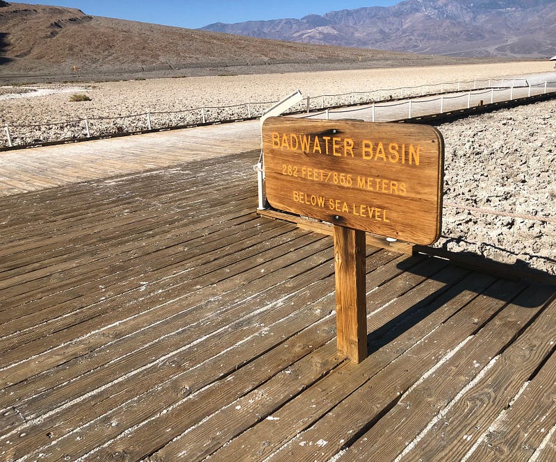
It was 105° when I arrived in Death Valley at about 9:00 pm. I set out to tour the following morning, which is the only time to tour Death Valley in the summer! Earlier in July, the temperature reached 134°, arguably the highest temperature ever seen anywhere in the world. But they had received enough rain just a week before my arrival to cause flash flooding, still visible on some roads.
This is one of the most fascinating national parks I’ve ever seen. It’s like being on another planet. Salt beds were going “snap, crackle, and pop,” an after-rain phenomenon amidst the otherwise utter silence.
Death Valley>Ventura, CA
The ultimate destination was Ventura for my 45th high school reunion. This trek went through the Mojave Desert to the Coastal Mountains and finally to the Coast itself. For the most part, it looked like it hadn’t rained in years. As one might expect, vegetation is sparse. With more than 500,000 residents, the Palmdale/Lancaster area is another where one questions “why?” due to no visible water. Groundwater from natural aquifers is their primary source, with wells drilled as deep as 550 feet. I’m sure they’ll have to dig much deeper in the coming years.
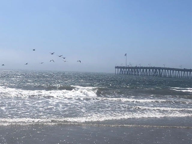
Within 30 miles of the Coast, the land surrounding the highway returns to green due to irrigation. Many varieties of vegetables are grown year-round, as well as citrus fruits in the area. The Oxnard Plain is known to have some of the richest soil for agriculture in the world. The problem is urban development! Ventura’s cool sea breezes were a welcome relief after driving through hundreds of miles of desert. The ocean makes you forget about drought, although it exists just steps away.
Ventura>Long Beach>Palm Springs>Phoenix
There is nothing remarkable about driving miles and miles on Los Angeles area freeways. But, heading back inland, I noticed how parched the hills were because of the many fires that have burned them over the years. Still, there were many homes in remote canyons, highly susceptible to brush fires. When the brush grows back. Or maybe they’ll be engulfed in mudslides. If it rains.
What was that definition of insanity?
The Colorado River ambers through the East side of the town of Blythe, CA. It’s not much of a river by the time it reaches here. It has been exhausted by the dams near and far upstream. What’s left will mostly go to the All-American Canal, which begins near the border with Mexico, transporting water to the agricultural areas of the Imperial Valley.
Mexico is entitled to 1.5 million acre-feet of water per year from the Colorado. It’s stored at the Morelos Dam, just 1.1 miles south of the U.S./Mexican border. This water feeds the thirsty cities of Mexicali with a population near one million, and Tijuana, a city of 2.1 million. The remainder goes to agriculture. As a result, there is often no water left at the river’s terminus at the Gulf of California.
The weather seems to have drawn a line between California and Arizona. As I entered Arizona, things became a bit more green, thanks to the monsoons. As you drive east, you begin to see big patches of green on the horizon — those are irrigated fields with water coming from the Central Arizona Project. This canal crisscrosses I-10 on its way to quench the thirst of Phoenix and Tucson. Uncovered, it loses about 4.5% of water annually to evaporation. The Bureau of Reclamation studied covering the canal, but it was deemed cost-prohibitive at a cost that was quadruple what the original canal price tag was.
Phoenix>Albuquerque
Heading north out of Phoenix on SR 87, vegetation was nice and green, but many areas had burned. Have you ever seen a burned-out saguaro forest? It’s a sad thing. North of Payson, the land looked much as it should this time of year. Perhaps a little greener, but it is still in a state of exceptional drought.
The effects of the monsoon won’t last long. Soon things will return to their natural state of brown unless we have fall rain events. Which is unlikely.
Conclusion
California seems to be covered with a waterproof raincoat. It just won’t rain there. The prognosis by meteorologists is that a La Niña is developing in the Pacific, which will keep the Southwest on the warm and dry side this winter. But, of course, this is the exact opposite of what is needed.
Through the end of the year, drought is expected to keep hold in the already stricken areas. The situation improves in the Pacific Northwest but is likely to worsen in the Western two-thirds of Texas and extending northward to Nebraska. The East? Business as usual.
(Sigh.)
With that sort of projection, it’s time to move on to some happier subjects. Ponies and rainbows and unicorns, like my daughter might have said come to mind. In other words, I’m going to bury my head in the sand and give you an update in January. Until then, let it snow, let it snow, let it snow!
Sources for this article include weatherunderground.com, The Washington Post 7/27/2021, Water Education Foundation, and the Central Arizona Project.
Head to my profile page, where you’ll find my other six stories on the megadrought in the Southwest:
- The American West: Long on People, Short on Water
- How the West Went Dry
- 6 Of The Most Unsustainable Cities, Analyzed
- The East Gets Wetter and the West Gets Drier
- Water Crisis in the West, v5.0-The Colorado River Story
- A Road Trip To Ground Zero of Climate Change, Part 1
Click below to subscribe to Medium and read all of my stories, along with thousands of other writers. It’s like creating your own magazine! (Note: this is an affiliate link, and I will receive a portion of your membership fees.)


