
Travel and History
A Night at the D-Day Beaches
How many ghosts surrounded us, anchored inside the remains of the Mulberry harbour at Arromanches?
Tours of the D-day beaches are popular, but ours was a bit different.
It was the summer of 2011, 77 years after D-Day. We sailed across on our 27' boat from the Solent in England. We didn’t quite follow in the wakes of all those ships and brave soldiers, sailors and airmen. Our route was simpler.
And we were lucky with the weather.
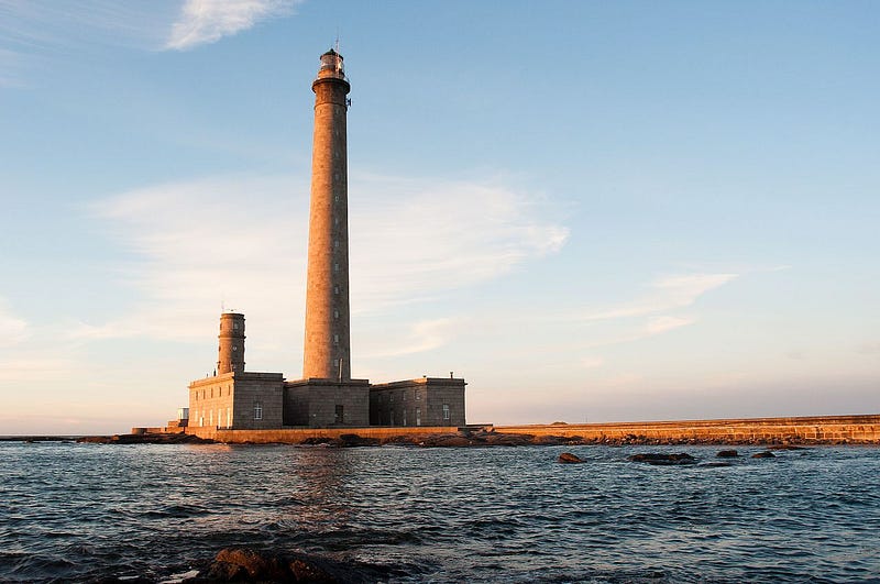
Firstly we made the 66 mile crossing to the marina in Cherbourg in daylight. Next day we sailed eastwards around the Pointe de Barfleur, past the huge Barfleur (Gatteville) lighthouse. Then we were in the Baie de Seine. We anchored of St Vaast (famous for its oysters) for a night and then the next day sailed on past Utah beach. We found our way through the extensive sandbanks, onward and up the Carentan canal.
Then we were stuck, moored in the Carentan canal for a few days while the heavens emptied on us. But it was rain, not the 82nd and 101st Airborne forces which had rained down in the early morning of June 6, 1944.
However we did get to visit Sainte-Mère-Église, which was one of the first towns in France to be liberated. We stood in the town square and saw the parachute memorial, consumed by the history and touched by emotion.
When the rains finally ceased we went back to the open sea and continued eastward past Omaha beach, thinking of ‘Saving Private Ryan’ and its realistic depiction of that landing by the US Rangers on that beach. And of course for historical accuracy I should include the US 1st and 29th Infantry Divisions who also played their part.
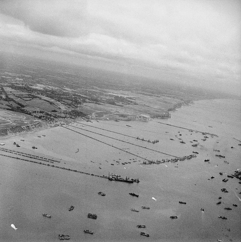
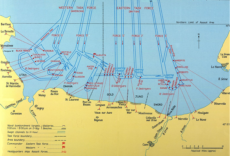
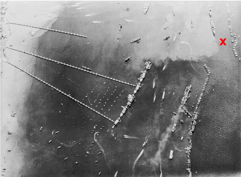
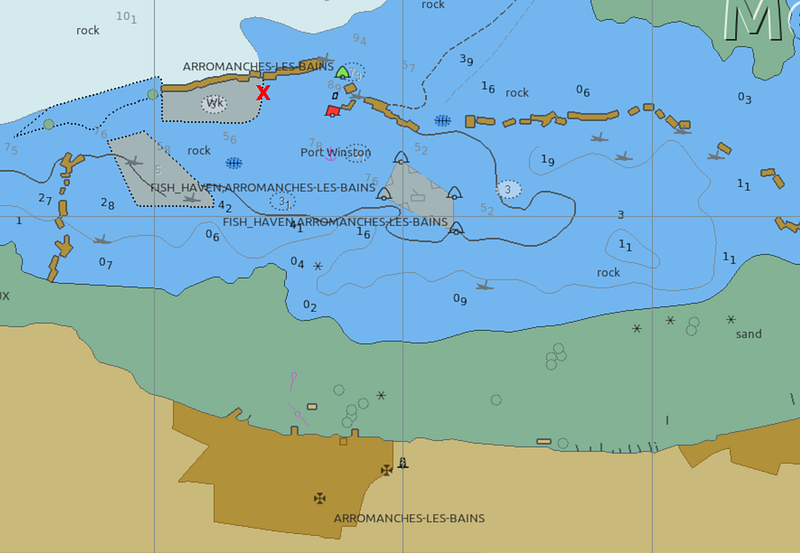
That day ended with good weather as we reached Gold Beach and a rare chance to anchor inside the remains of Port Winston, one of the two Mulberry harbours which ensured the success of the Allied invasion.
The area is wreck-strewn.
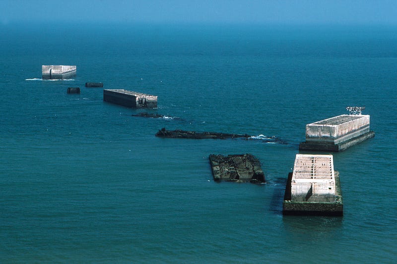
As it now is
From our electronic chart:
The Mulberry harbours were an ingenious idea and used a novel concept to enable around the clock all-tide operation, landing 12,000 tons a day of matériel. Two were constructed in secret, towed in sections across the English Channel and assembled off the D-day beaches. Harbour ‘A’ off Omaha beach was irreparably damaged by bad weather within 2 weeks of construction, but Harbour ‘B’ — Port Winston — survived.
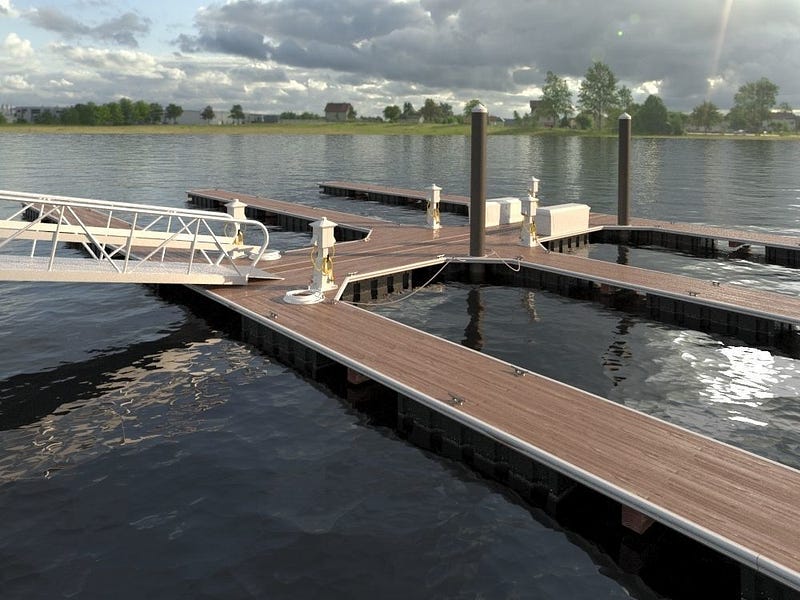
The tides at the D-Day beaches can range over 7 metres, and that posed design problems. The solution was first developed for the Mulberry harbours by a Scottish engineering consultancy. Also, long floating roadways were required to move the cargo ashore and these were .conceived by Major Allan Becket.
Today we see marinas all around the world which use the principle of floating pontoons and piles.
Old ships were towed across the English Channel and sunk along with huge concrete barges to provide an outer breakwater and protect the floating docks and roadways. The concrete is all that remains today.
We’d been careful with our anchoring as there was a wreck nearby, but all was well and we enjoyed a peaceful night with the ghosts who did not disturb us.
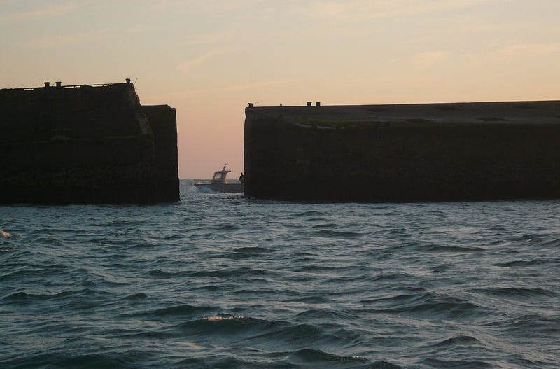
A beautiful dawn
The next morning was beautiful and the skipper (now my First Mate) snapped a Frenchman out trying to catch his breakfast.
Onwards
After breakfast we moved on to Courseuilles-sur-Mer (Sword Beach) where we could safely leave the boat at a mooring on the Orne River and catch a bus back (in the rain) to visit the superb D-Day museum at Arromanches. The museum has a large, intricate and fascinating model of the Mulberry harbour at Gold Beach.
And backwards
By then it was time to return to England. That turned out to be a tough sail in a twenty seven footer but all went well.
And now, every time I tie up at a floating dock, I think of the Mulberry harbours and how they ensured a successful liberation of Europe.
There’s much more about this fascinating piece of history at Wikipedia.
About me: If you follow me I guarantee variety in your inbox with some unusual perspectives! I write on a wide range of topics including humor, tech, space, geopolitics and travel, together with daily news events and the minutiae of my daily life living on a boat. Yes, I really do live on a boat (some readers don’t believe that). I also write about…
…tying up my boat and where the idea came from
If you appreciate stories like these and want to support other writers and me, consider signing up to become a Medium member. It’s only $5 a month, giving you unlimited access to incredible stories on Medium. If you sign up using my link below, I’ll earn a small commission at no extra cost to you.
Or maybe just buy me a coffee? and tell me what you liked reading (or not)!
